The best walks and hikes around Comunanza Cadenazzo/Monteceneri
4.6
(1761)
12,827
hikers
331
hikes
Hiking around Comunanza Cadenazzo/Monteceneri offers a diverse landscape characterized by agricultural plains, riverine environments, and prominent mountainous terrain. The region, part of Switzerland's Insubric area, features varied ecosystems including chestnut groves and dense vegetation. This blend provides a range of hiking trails suitable for different skill levels, from easy paths along rivers to challenging mountain ascents.
Best hiking trails around Comunanza Cadenazzo/Monteceneri
- The most popular hiking route is Giubiasco to Prada Abandoned Village Loop, a 5.4 miles (8.6 km)…
Last updated: June 29, 2026
4.5
(8)
24
hikers
8.64km
02:46
350m
360m
Moderate hike. Good fitness required. Easily-accessible paths. Suitable for all skill levels.
4.3
(10)
23
hikers
4.62km
01:37
270m
270m
Easy hike. Great for any fitness level. Easily-accessible paths. Suitable for all skill levels.

Sign up for free
4.0
(1)
8
hikers
2.66km
00:56
160m
150m
Easy hike. Great for any fitness level. Easily-accessible paths. Suitable for all skill levels.
1
hikers
11.5km
04:38
890m
890m
Moderate hike. Good fitness required. Easily-accessible paths. Suitable for all skill levels.
5.50km
02:05
370m
370m
Moderate hike. Good fitness required. Easily-accessible paths. Suitable for all skill levels.
Get access to more routes and recommendations from other explorers.
Sign up for free
Already have an account?
Our route recommendations are based on thousands of hikes, rides, and runs completed by other people on komoot.
Start today with a free account
Your next adventure awaits.
Login or Signup
Popular around Comunanza Cadenazzo/Monteceneri
Tips from the Community

An interesting medieval village on the hill—at least in its remnants. Currently under renovation... and surely picturesque afterward.
0
0

The "Fortini della Fame" – Hunger Fortresses or Hunger Towers – are historical monuments closely linked to the turbulent history of the 19th century. These cylindrical structures are the remaining remnants of a fortification system consisting of 36 towers. Five towers still stand today above Camorino. This is tower no. 5: "Al Pian di Bur." The tower has been renovated and serves as an energy museum.
1
0
The "Fortini della Fame" – Hunger Fortresses or Hunger Towers – are historical monuments closely linked to the turbulent history of the 19th century. These cylindrical structures are the remaining remnants of a fortification system consisting of 36 towers. Five towers still stand today above Camorino. This is tower number 4: "Al Sass del Camósc."
1
0
The "Fortini della Fame" – Hunger Fortresses or Hunger Towers – are historical monuments closely linked to the turbulent history of the 19th century. These cylindrical structures are the remaining remnants of a fortification system consisting of 36 towers. Five towers still stand today above Camorino. This is Tower No. 3: "Ala Pélera"
1
0
The "Fortini della Fame" – Hunger Fortresses or Hunger Towers – are historical monuments closely linked to the turbulent history of the 19th century. These cylindrical structures are the remaining remnants of a fortification system consisting of 36 towers. Five towers still stand today above Camorino. This is Tower No. 2, "Ai Munt."
1
0
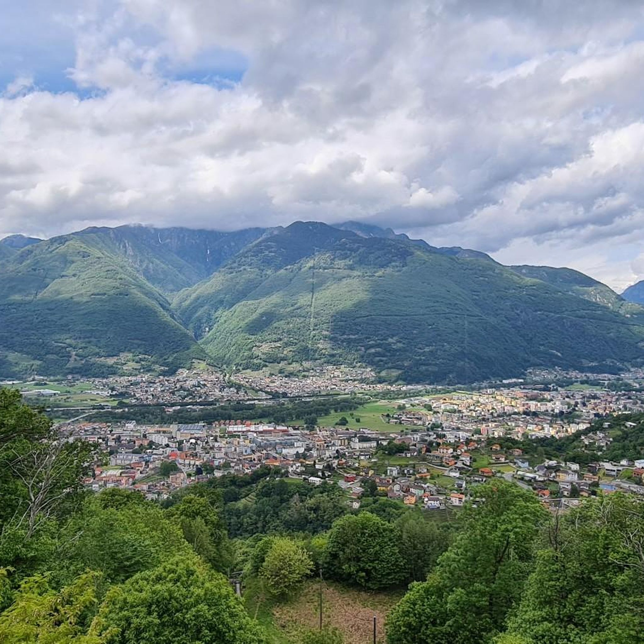
Beautiful view of the Magadino, Locarno and Bellinzonese plains
1
0

Possible parking and starting point for round
1
0

Frequently Asked Questions
What kind of terrain can I expect on hikes in Comunanza Cadenazzo/Monteceneri?
The region offers a diverse landscape, from agricultural plains and riverine environments to prominent mountainous terrain. You'll find paths winding through chestnut groves, dense vegetation, and ascents leading to panoramic mountain peaks.
Are there challenging hikes available in the Monteceneri area?
Yes, for experienced hikers, there are challenging routes. For example, the ascent to Cima di Medeglia offers routes from moderate to difficult, providing extensive views. Another demanding option is the Ascent to Camoghè via Corte di Mezzo, which involves significant elevation gain.
What scenic viewpoints or natural features can I discover on hikes in Comunanza Cadenazzo/Monteceneri?
Hikers can enjoy breathtaking 360-degree panoramic views from peaks like Cima di Medeglia and Monte Tamaro, where you can often see both Lake Maggiore and distant high peaks. The region also features riverine environments, such as those along the Ticino River, and diverse ecosystems with chestnut groves.
Are there any notable landmarks or attractions accessible from the hiking trails?
Yes, the area is rich in attractions. You can visit the Carasc Tibetan Bridge for a unique experience, explore the Curzútt Historic Village, or reach the Cima di Medeglia Summit Cross for incredible views.
Is public transport a good option for reaching hiking trails in Comunanza Cadenazzo/Monteceneri?
The region is generally well-connected, and public transport can be a viable option for accessing various trailheads. Many routes are designed to be accessible, allowing hikers to reach starting points without a car.
Are there family-friendly hiking trails in Comunanza Cadenazzo/Monteceneri?
Yes, the region offers easy, accessible paths suitable for families and all fitness levels. The Piano di Magadino Park, for instance, features nature trails like the 'Percorso Sonoro Parco del Piano di Magadino', which is engaging for all ages. Easy circular hikes along the Ticino River are also great for families.
Can I find circular hiking routes in this area?
Yes, there are several circular routes available. A popular option is the Giubiasco to Prada Abandoned Village Loop, which offers a moderate hike through varied terrain. Another example is the Pizzo di Corgella and Cucchetto Loop.
What is the best time of year to go hiking in Comunanza Cadenazzo/Monteceneri?
The region is suitable for hiking across multiple seasons. Spring and autumn offer pleasant temperatures and vibrant scenery, while summer is ideal for higher altitude trails. Even winter can offer options, though conditions on mountain paths may require specific gear and caution.
What do other hikers enjoy the most about hiking in Comunanza Cadenazzo/Monteceneri?
The area is highly rated by the komoot community, with an average score of 4.6 stars from over 1600 reviews. Hikers often praise the diverse landscape, ranging from riverine paths to challenging mountain ascents, and the variety of trails suitable for different ability levels.
How many hiking trails are there in Comunanza Cadenazzo/Monteceneri?
There are over 330 hiking routes available in Comunanza Cadenazzo/Monteceneri, catering to a wide range of preferences and skill levels. This includes over 100 easy routes, 150 moderate, and more than 80 difficult trails.
Are there any historical trails or educational paths in the region?
Yes, the region features historical and educational routes. The 'Historical Montecenerino Trail' is an ancient path significant for trade and communication, characterized by chestnut trees. Additionally, the 'educational path Between mountains and lake' offers insights into forests, meadows, villages, and local agriculture.
Are there any easy hikes suitable for beginners in Comunanza Cadenazzo/Monteceneri?
Absolutely. The region has over 100 easy routes. A great option for beginners is the Fortini della Fame Trail, an easy 2.9-mile path that takes about 1 hour 35 minutes and offers historical points of interest. The Trail to the Dam is another easy option through a riverine environment.
Most popular routes around Comunanza Cadenazzo/Monteceneri
Most popular attractions around Comunanza Cadenazzo/Monteceneri

Get inspired with the komoot mobile app


Explore more
Browse the best Hikes in other regions.
