The best running trails around Comunanza Cadenazzo/Monteceneri
4.0
(15)
3,067
runners
163
runs
Jogging routes around Comunanza Cadenazzo/Monteceneri traverse a varied landscape in the canton of Ticino, Switzerland. The region features the flat plains of the Magadino Valley, suitable for easier runs, alongside mountainous terrain offering more challenging trails. Runners can find routes through shaded groves, along valley floors, and ascending hills that provide panoramic views. The area's topography includes both agricultural lowlands and higher elevations, creating diverse running environments.
Best jogging routes around Comunanza Cadenazzo/Monteceneri
- The most popular jogging route is From…
Last updated: May 23, 2026
4.74km
00:40
270m
270m
Moderate run. Good fitness required. Mostly paved surfaces. Suitable for all skill levels.
2.46km
00:24
150m
160m
Moderate run. Good fitness required. Mostly paved surfaces. Suitable for all skill levels.

Sign up for free
98
runners
6.63km
00:54
290m
290m
Moderate run. Good fitness required. Mostly paved surfaces. Suitable for all skill levels.
48
runners
14.8km
02:41
1,160m
1,160m
Hard run. Very good fitness required. Sure-footedness, sturdy shoes and alpine experience required.
17
runners
6.04km
00:41
160m
160m
Moderate run. Good fitness required. Mostly paved surfaces. Suitable for all skill levels.
Get access to more routes and recommendations from other explorers.
Sign up for free
Already have an account?
Our route recommendations are based on thousands of hikes, rides, and runs completed by other people on komoot.
Start today with a free account
Your next adventure awaits.
Login or Signup

Tips from the Community

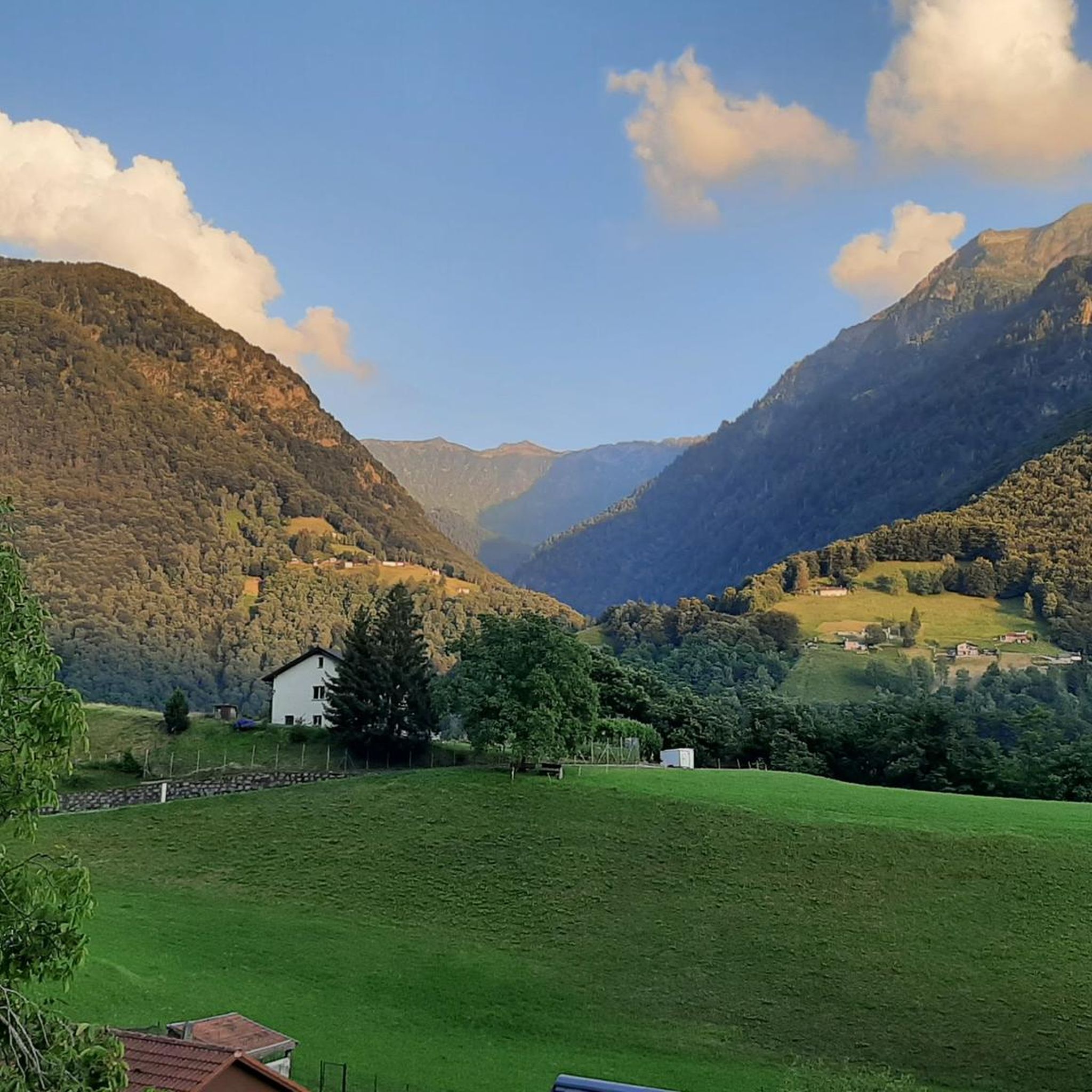
An interesting medieval village on the hill—at least in its remnants. Currently under renovation... and surely picturesque afterward.
0
0

The "Fortini della Fame" – Hunger Fortresses or Hunger Towers – are historical monuments closely linked to the turbulent history of the 19th century. These cylindrical structures are the remaining remnants of a fortification system consisting of 36 towers. Five towers still stand today above Camorino. This is tower no. 5: "Al Pian di Bur." The tower has been renovated and serves as an energy museum.
1
0
The "Fortini della Fame" – Hunger Fortresses or Hunger Towers – are historical monuments closely linked to the turbulent history of the 19th century. These cylindrical structures are the remaining remnants of a fortification system consisting of 36 towers. Five towers still stand today above Camorino. This is tower number 4: "Al Sass del Camósc."
1
0
The "Fortini della Fame" – Hunger Fortresses or Hunger Towers – are historical monuments closely linked to the turbulent history of the 19th century. These cylindrical structures are the remaining remnants of a fortification system consisting of 36 towers. Five towers still stand today above Camorino. This is Tower No. 3: "Ala Pélera"
1
0
The "Fortini della Fame" – Hunger Fortresses or Hunger Towers – are historical monuments closely linked to the turbulent history of the 19th century. These cylindrical structures are the remaining remnants of a fortification system consisting of 36 towers. Five towers still stand today above Camorino. This is Tower No. 2, "Ai Munt."
1
0

Very large rest area with tables, benches and grill. Beautiful viewpoint.
0
0

Possible parking and starting point for round
1
0

The first evidence of inhabited areas in Prada dates back to 1381 and it was certainly inhabited until the second half of the 1500s. It was then abandoned in the first half of the 17th century, the reasons are still unknown.
1
0
Frequently Asked Questions
How many running routes are available in Comunanza Cadenazzo/Monteceneri?
The Comunanza Cadenazzo/Monteceneri region offers a wide selection of running routes, with over 170 trails mapped on komoot. These range from easy strolls to challenging alpine runs, catering to all fitness levels.
What kind of terrain can I expect on the jogging paths in this region?
The terrain in Comunanza Cadenazzo/Monteceneri is incredibly varied. You'll find everything from accessible cycle routes with fine asphalt, like sections of the Tenero–Bellinzona Cycle Path, to challenging alpine trails with significant elevation changes. Many routes traverse valley plains, hills, and forested paths, offering a diverse running experience.
Are there any easy or beginner-friendly jogging routes?
Yes, the region provides several easy running options. For instance, the flat plains of the Magadino Valley offer suitable terrain for less strenuous runs. While specific easy routes are not highlighted in the top recommendations, komoot lists 7 easy tours out of the total, ensuring options for beginners.
Can I find circular running routes in Comunanza Cadenazzo/Monteceneri?
Absolutely. Many of the running trails in the area are designed as loops. A popular example is the From Camorino to the fortini della Fame – loop run, which offers a moderate 4.7 km experience. Another great option is the Cima di Dentro loop from Circolo di Sant’Antonino, a moderate 6.6 km path.
What are some scenic running trails with good viewpoints?
For breathtaking vistas, consider routes that ascend to higher elevations. The Cima di Medeglia Summit Cross, at 1,260 meters, rewards runners with an "overwhelming panoramic view." Similarly, the Alpe Caneggio, bordered by peaks like Pizzo di Corgella and Camoghè, provides an alpine environment with stunning scenery for more challenging runs.
Are there any dog-friendly running routes in the area?
While specific dog-friendly routes aren't explicitly listed, the region's extensive network of natural trails through forests and valleys generally welcomes dogs, especially in less populated areas. The municipality of Cadenazzo is also developing a new recreational area that will include dog parks, indicating a dog-friendly approach in the region.
What is the best time of year for jogging in Comunanza Cadenazzo/Monteceneri?
The diverse altitudes mean running conditions vary. Lower valley routes can be pleasant year-round, with shaded groves offering respite in warmer months. For higher alpine trails and panoramic views, late spring through early autumn is generally ideal, avoiding snow and ice. Always check local weather conditions before heading out.
Are there any historical or cultural points of interest along the running routes?
Yes, the region blends natural beauty with cultural heritage. The "Via del Ceneri" and "Le Terre del Ceneri" routes, for example, are being developed as national routes and feature ancient chestnut groves and historical military posts. You might also encounter the historic San Bernardo Church, dating back to the 11th or 12th century, along certain paths.
What do other runners say about the trails in Comunanza Cadenazzo/Monteceneri?
The running routes in Comunanza Cadenazzo/Monteceneri are highly regarded by the komoot community, with an average rating of 3.8 stars from 12 reviews. Runners often praise the varied terrain, from valley plains to forested paths, and the extensive network that offers options for all ability levels.
Are there any challenging trail running options for experienced runners?
Absolutely. For those seeking a more strenuous effort, the region offers true trail running routes, particularly around Monte Generoso, which features scenic trails involving both climbing and descending. The Capanna Genzianella – Abandoned Village of Prada loop from Pianezzo is a difficult 14.8 km route with over 1100 meters of elevation gain, perfect for experienced trail runners.
What are some notable natural features or landmarks to look out for while running?
Beyond the panoramic mountain views, you can encounter several interesting natural features. The region is home to various mountain passes like San Lucio Pass and Monte Ceneri Pass. You might also pass by mountain huts such as Rifugio Giovo or Monte Bar Hut, offering potential rest stops or scenic points.
Is public transport available to access the running trails?
While specific public transport details for every trailhead are not provided, the region is generally accessible. For instance, the availability of a rack railway for Monte Generoso offers an option for ascending or descending, allowing runners to focus on specific sections of the trail. It's advisable to check local bus or train schedules for access to specific starting points like Camorino or Sant’Antonino.
Most popular routes around Comunanza Cadenazzo/Monteceneri
Most popular attractions around Comunanza Cadenazzo/Monteceneri

Get inspired with the komoot mobile app


Explore more
Browse the best Running Trails & Routes in other regions.
