The best road cycling routes in Lexington city
4.5
(2)
85
riders
21
rides
Road cycling routes in Lexington city traverse a landscape characterized by rolling hills, river valleys, and natural rock formations. The region offers varied terrain suitable for road cyclists, from parkland loops to more challenging climbs. Elevations can reach over 1,300 meters on some routes, providing significant ascents and descents. The area features a mix of open roads and routes passing through natural attractions like the Natural Bridge of Virginia.
Best road cycling routes in Lexington city
- The most popular road…
Last updated: August 18, 2026
15
riders
74.6km
03:26
760m
760m
Moderate road ride. Good fitness required. Mostly well-paved surfaces and easy to ride.
5.0
(1)
7
riders
50.8km
02:24
540m
550m
Moderate road ride. Good fitness required. Some segments of this route may be unpaved and difficult to ride.

Sign up for free
6
riders
107km
05:47
1,290m
1,290m
Hard road ride. Very good fitness required. Some segments of this route may be unpaved and difficult to ride.
4.0
(1)
3
riders
Moderate road ride. Good fitness required. Mostly well-paved surfaces and easy to ride.
4
riders
Moderate road ride. Good fitness required. Some segments of this route may be unpaved and difficult to ride.
5
riders
Moderate road ride. Good fitness required. Some segments of this route may be unpaved and difficult to ride.
2
riders
86.6km
04:36
1,620m
1,620m
Hard road ride. Very good fitness required. Mostly well-paved surfaces and easy to ride.
8
riders
88.1km
04:24
1,070m
1,070m
Hard road ride. Very good fitness required. Some segments of this route may be unpaved and difficult to ride.
3
riders
22.4km
01:04
270m
270m
Easy road ride. Great for any fitness level. Mostly well-paved surfaces and easy to ride.
Get access to more routes and recommendations from other explorers.
Sign up for free
Already have an account?
Our route recommendations are based on thousands of hikes, rides, and runs completed by other people on komoot.
Start today with a free account
Your next adventure awaits.
Login or Signup
Popular around Lexington


Tips from the Community

The Visitor Center and Bridge Entrance at Natural Bridge State Park serve as the starting point for exploring the park's main attractions, including the Natural Bridge along the Cedar Creek Trail. The Visitor Center offers amenities such as restrooms, a gift shop, and informative displays about the park's geology, history, and natural features. It's also where visitors can purchase admissions tickets and receive maps and guides for their visit. It is open from 10 am – 6 pm and the fee is $9 per persons 13 years and older, and $6 per person ages 6-12. Children younger than six are free.
0
0
The Natural Bridge in Virginia's Natural Bridge State Park is a stunning geological formation located along the Cedar Creek Trail. Standing 215 feet high and 90 feet wide, this natural limestone arch was carved by Cedar Creek over millions of years. The bridge has a rich history; once considered sacred by the Monacan people and later surveyed by a young George Washington, it is a National Historic Landmark, drawing visitors to marvel at it and explore the surrounding trails. The Cedar Creek Trail beneath the bridge offers a scenic 1.6-mile walk, passing by the bridge, a waterfall, and the Monacan Indian Living History Exhibit, making it a popular destination for locals and visitors alike.
2
1
At this spot where the Blue Ridge Trail and the Thistle Ridge Disc Golf Course Trail meet is a rather curious sight: a scale mode of the famous Stonehenge! This model is made out of foam, so it is best not to touch or climb on it, but feel free to take photos and explore this quirky spot.
0
0
Woods Creek Park is a lovely local park on the western side of Lexington, Virginia. There is a playground, open green spaces, and a picnic pavilion. The Woods Creek Trail also runs through and ends at this park, making it a great place to begin or end your hike along it.
0
0
The Woods Creek Trail is a gravel multi-use trail that links the historic Jordan's Point with Woods Creek Park through the Washington and Lee University and the Virginia Military Institute's (VMI) campuses. This is a great urban trail on the northwestern side of Lexington.
0
0
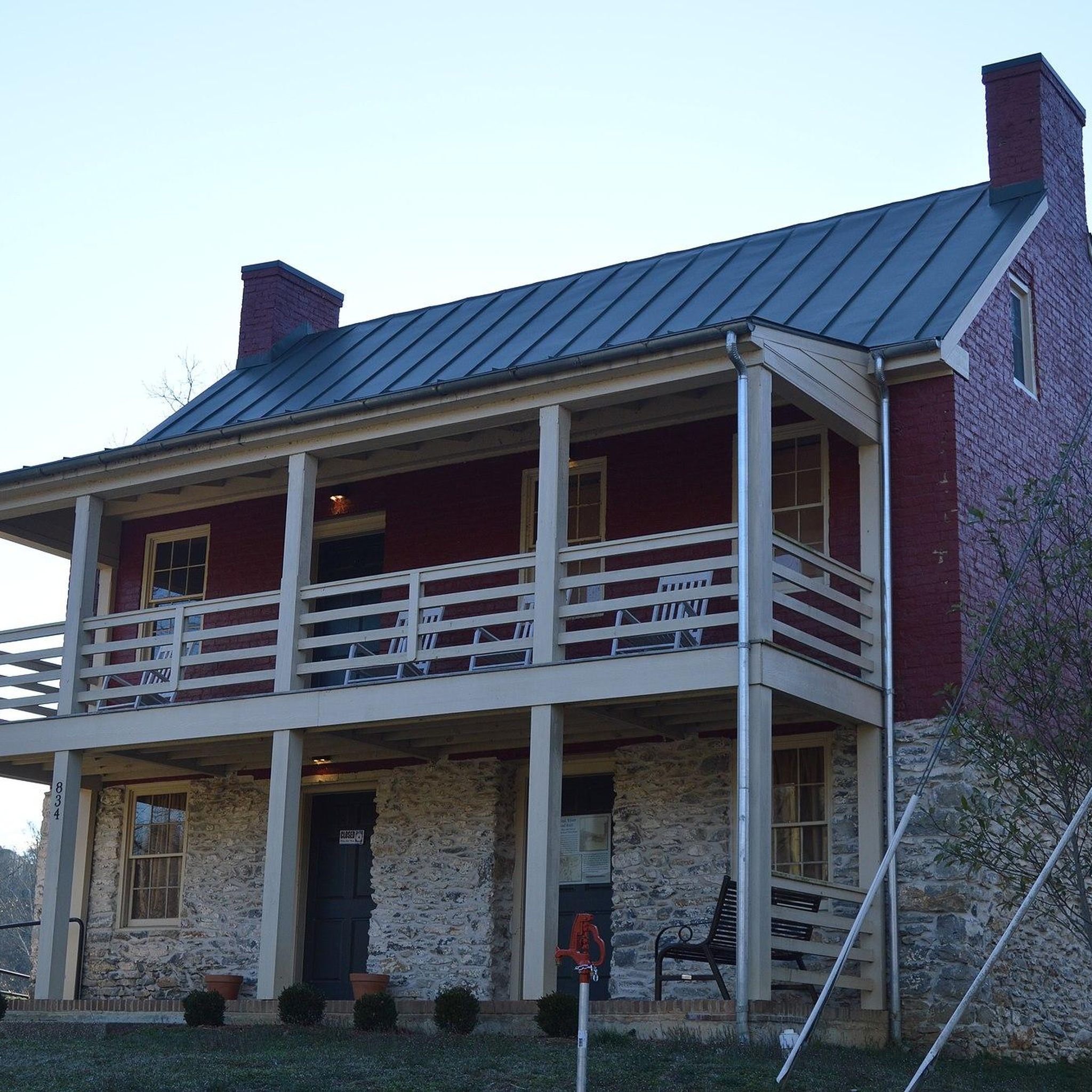
The Jordan's Point Historic District is located in Jordan's Point Park in Lexington, Virginia. Developed around 1800 by John Jordan and John Moorhead, the site originally housed a sawmill. In 1806, they dammed the Maury River and constructed a cotton mill in 1808. Although only foundations and the millrace remain from these early industrial activities, notable surviving structures include the miller's house, built around 1815, which is now a local museum, and a chapel built in 1874. The district's historical significance was recognized in 2016 when it was listed on the National Register of Historic Places.
0
0
Glen Maury Park, a 315-acre park in Buena Vista, offers miles of hiking and biking trails, an Olympic-sized pool, and two campgrounds. The park features several pavilions that can be rented out. Annually, the park hosts music events for music lovers of all genres, from rock n' roll to classical. Rentals for kayaks, inner tubes, and bikes are available at the park office if you want to cool off in the river after a nice hike around the trails. Additionally, the Glen Maury House is located here. Also known as Paxton Place or Elisha Paxton's house, this historic home was built between 1829 and 1832 and was listed on the National Register of Historic Places in 1979.
0
0

The Irish Creek Valley Overlook is located at Milepost 42.2 on the Blue Ridge Parkway and offers views of the valley that Irish Creek carves into. It's a cool overlook between two mountainsides that you can see from the parking area without ever having to get off of your bike.
0
0
Frequently Asked Questions
What kind of terrain can I expect on road cycling routes in Lexington?
Lexington's road cycling routes are characterized by rolling hills, picturesque river valleys, and unique natural rock formations. You'll find a varied landscape, from parkland loops to more challenging climbs, with some routes featuring elevations over 1,300 meters.
Are there road cycling routes suitable for beginners in Lexington?
While Lexington's routes are generally moderate to difficult, offering significant elevation gains, there are options that can be approached by those looking for a less strenuous ride. For example, the shorter Woods Creek Park loop from Lexington is a moderate route that covers 27.8 km with around 450 meters of elevation gain, making it a good starting point.
Are there challenging road cycling routes for experienced riders in Lexington?
Yes, experienced riders will find challenging routes in Lexington. The region offers paths with significant elevation gains, such as the View of Irish Creek Valley – Boston Knob Overlook loop from Buena Vista, which is classified as difficult and features over 1,300 meters of ascent over 70 km.
What are some popular loop routes for road cycling in Lexington?
Many of Lexington's road cycling routes are designed as loops, allowing you to start and end in the same location. Popular options include the Woods Creek Park loop from Lexington, a 50.8 km moderate ride, and the longer Natural Bridge of Virginia – Caverns at Natural Bridge loop from Lexington, which covers 64.6 km.
What natural attractions can I see along road cycling routes in Lexington?
Lexington's routes often pass by prominent natural landmarks. The Natural Bridge of Virginia – Caverns at Natural Bridge loop from Lexington, for instance, takes you past the iconic Natural Bridge of Virginia and its caverns, offering stunning views of natural rock formations and valleys.
How many road cycling routes are available in the Lexington area?
There are over a dozen road cycling routes available in the Lexington area, catering to various skill levels. These include 10 moderate routes and 2 more difficult options, providing a good selection for different preferences.
What do other road cyclists say about the routes in Lexington?
The road cycling routes in Lexington are highly rated by the komoot community, with an average score of 4.5 stars. Cyclists often praise the varied terrain, the scenic beauty of the rolling hills and river valleys, and the challenging climbs that make for a rewarding ride.
Are there any road cycling routes that start from specific points like Food Lion or Buffalo Bend?
Yes, some routes are conveniently accessible from specific starting points. For example, you can begin the Natural Bridge of Virginia – Caverns at Natural Bridge loop from Food Lion, a 66.6 km ride, or the Natural Bridge of Virginia – Caverns at Natural Bridge loop from Buffalo Bend, which is a longer 78 km route.
What is the best time of year for road biking in Lexington, KY?
The spring and fall months generally offer the most pleasant conditions for road biking in Lexington, with milder temperatures and beautiful scenery. Summer can be warm and humid, while winter may present colder temperatures and potential for icy conditions, especially on higher elevations.
Are there any routes near Buena Vista that offer scenic views?
Absolutely. The View of Irish Creek Valley – Boston Knob Overlook loop from Buena Vista is a difficult 70 km route that provides stunning vistas of the Irish Creek Valley and includes the Boston Knob Overlook, making it ideal for those seeking panoramic views.
Can I find shorter road cycling routes in the Lexington area?
While many routes are moderate to long, there are shorter options available. The Poplar Hill loop from Buena Vista is a moderate 35.5 km route with around 487 meters of elevation gain, offering a more compact cycling experience.

Get inspired with the komoot mobile app


Explore more
Browse the best Road cycling routes in other regions.
