The best cycling routes in Fresno County
4.7
(61)
810
riders
46
rides
If you've ever tried to plan touring cycling in Fresno County, you know how many options pop up. It's tough to tell which routes are genuinely worth your time and effort, and which are just filler. That's where komoot comes in. Our community has ridden, mapped, and reviewed these routes, so we've done the legwork for you. This guide cuts through the noise, offering a curated shortlist of the best touring cycling routes that are truly worth your legs.
Fresno County offers a unique blend for touring cyclists, transitioning from the flat, agricultural valley floor to rolling foothills and eventually the towering Sierra Nevada mountains. You'll find everything from gentle riverside paths to challenging mountain ascents, often under nearly 300 days of sunshine a year, making it a great year-round destination. Expect diverse terrain, from urban parks to scenic road routes through orchards and bluffs.
If you only do one route, we'd start with the Lewis S. Eaton Bike Trail, an easy 9.3 miles (15.0 km) ride that winds through Woodward Park and along the San Joaquin River bluffs, offering great views without too much effort. For a more substantial day out, the Fresno to Millerton Lake loop via Old Town Trail is a moderate 44.5 miles (71.7 km) that blends natural scenery with urban sections. Dive in and discover why over 300 touring cyclists have already explored Fresno County with komoot.
Last updated: May 10, 2026
5.0
(15)
30
riders
15.0km
00:51
60m
60m
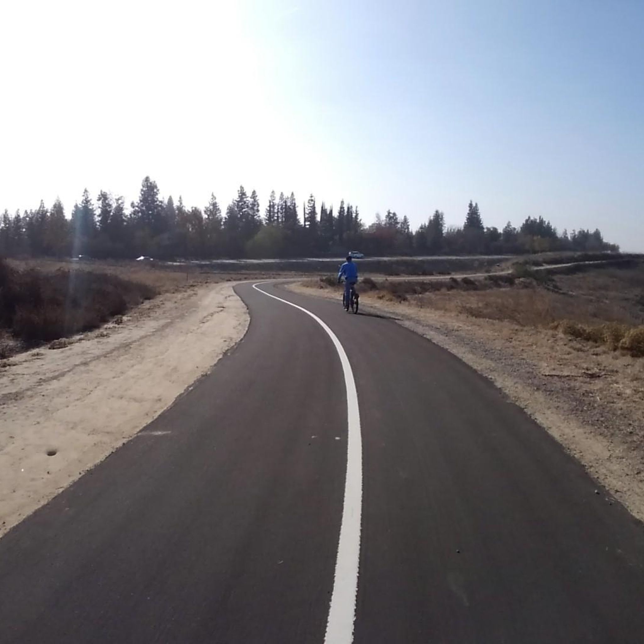
The Lewis S. Eaton Bike Trail offers a delightful touring cycling experience on a wide, paved surface, winding through varied scenery. You'll pedal through the cool, shaded forests of California Redwoods and Lodgepole Pines within Woodward Park, then emerge to enjoy beautiful overlooks of the San Joaquin River and distant views of the Sierra Nevada mountains. This easy 9.3-mile (15.0 km) route, with only 191 feet (58 metres) of elevation gain, is perfect for a relaxed ride that takes about 51 minutes.
Accessing the trail is straightforward, with multiple entry points along Friant Road at intersections like Audubon, Fort Washington, Champlain, and Copper. Parking is available inside Woodward Park for a fee, or you can find free parking at the Coke Hallowell Center for River Studies at the trail's northern end. Be aware that this is a popular multi-use path, so you'll share it with walkers, especially on busy days.
This trail is a key part of the developing San Joaquin River Parkway network, envisioned to be a 22-mile path when fully completed, offering exciting future Lewis S. Eaton Bike Trail touring routes. It also connects to other local paths like the Thomas MacMichael Sr. Loop Trail, allowing you to extend your ride. Keep an eye out for local wildlife, including foxes, red-tail hawks, and various waterfowl around the river and park lakes.
5
riders
71.7km
04:12
330m
330m
The Fresno to Millerton Lake loop via Old Town Trail offers a rewarding touring cycling experience, guiding you through varied landscapes from agricultural fields to riverine paths, culminating in scenic views of Millerton Lake and the Friant Dam. This moderate 44.5-mile (71.7 km) route features 1069 feet (326 metres) of elevation gain and typically takes around 4 hours and 11 minutes to complete, making it a solid day trip for cyclists with good fitness.
When planning your ride, be aware of the road conditions Fresno to Millerton Lake cycling Old Town Trail presents, especially the stretch of Millerton Road between Friant and Auberry. This section is known for narrow shoulders, sharp curves, and fast-moving traffic, which some cyclists consider dangerous. There are no specific permits required for cycling this route.
Millerton Lake State Recreation Area is a significant feature along the route, boasting over 40 miles of shoreline and a multi-use trail system that makes it a hub for various outdoor activities. The lake itself was created by the Friant Dam in the 1940s, adding a historical and engineering landmark to your ride.

Sign up for free
5.0
(1)
3
riders
12.4km
00:51
50m
60m
The Lewis S. Eaton Bike Trail Loop offers a wonderfully accessible touring cycling experience, winding through the diverse landscapes of Woodward Park. You'll glide along a well-maintained paved path, enjoying views of cool forests, including California Redwoods, and expansive vistas overlooking the San Joaquin River. This easy 7.7-mile (12.4 km) loop, with a gentle 180 feet (55 metres) of elevation gain, is perfect for a relaxed ride that takes around 50 minutes, making it ideal for families or a casual outing.
For your visit, parking is available at Woodward Park (with an entrance fee) or free of charge at the Coke Hallowell Center for River Studies at the trail's northern end. The route is well-equipped with amenities like drinking fountains, benches, and restrooms, especially around the River Center, ensuring a comfortable journey. It's a great option for a morning or afternoon ride when you want to enjoy nature without a strenuous effort.
This trail is more than just a loop; it's a foundational segment of the ambitious 22-mile San Joaquin River Parkway network, connecting to other routes like the Clovis Old Town Trail. Beyond the cycling, the area is rich in wildlife, offering chances to spot foxes, red-tail hawks, and various waterfowl, adding an extra layer of enjoyment to your ride through this scenic part of Fresno.
3
riders
21.2km
01:14
20m
20m
The Old Town Trail in Clovis, California, offers a pleasant urban cycling experience, perfect for a relaxed outing. This easy 13.2-mile (21.2 km) touring cycling route, with a minimal 60 feet (18 metres) of elevation gain, can be completed in about 1 hour and 14 minutes. You'll pedal on mostly paved surfaces, enjoying parks and the shade of beautiful evergreen trees, making it a family-friendly Old Town Trail cycling option.
As part of a larger rail-trail network, access to the Old Town Trail is generally straightforward. The route features community-oriented amenities like an active counter for cyclists and a book exchange, suggesting a welcoming atmosphere. For the best experience, consider riding in the morning or late afternoon, especially if you're looking for cafes and pubs near Old Town Trail cycling route, as the trail's urban setting often provides such options nearby.
This trail is notable for its integration into the broader Fresno Clovis trail system, offering potential for longer rides and future development of amenities. Its flat, accessible terrain and community features make it an excellent choice for beginners or those seeking a gentle ride rather than a strenuous workout. The focus on parks and green spaces provides a refreshing contrast to the surrounding urban environment.
5.0
(1)
2
riders
32.5km
02:02
350m
350m
The Grizzly Falls to Road's End touring cycling route offers an unparalleled journey through Kings Canyon's stunning glacial valley. You'll pedal along the Kings Canyon Scenic Byway, surrounded by towering granite walls and mixed conifers, with the Kings River as your constant companion. The highlight is undoubtedly Grizzly Falls, an 80-foot cascade that provides a picturesque break from the saddle, showcasing the park's dramatic natural features.
This moderate 20.2-mile (32.5 km) bike ride, with 1158 feet (353 metres) of elevation gain, typically takes around 2 hours and 1 minute. The route is on paved surfaces, making it accessible for most touring cyclists. Remember that the Kings Canyon Scenic Byway is subject to seasonal closures, usually from late spring through fall, so always check conditions before heading out. Road's End offers convenient parking and serves as a popular trailhead.
This cycling route provides a unique way to experience the grandeur of Kings Canyon, offering a different perspective than the park's hiking trails. It's an excellent option for those who want to explore the deep canyon by bike, immersing themselves in the landscape carved by ancient glaciers. The continuous scenic viewpoints along the way make it one of the best bike trails in Kings Canyon, especially for those interested in the Grizzly Falls to Road's End cycling profile.
73.3km
05:46
1,930m
1,930m
The Hume Lake to Grizzly Falls via Kings Canyon Scenic Byway offers an immersive touring bicycle experience through the rugged beauty of the Sierra Nevada. You'll traverse diverse landscapes, from oak chaparral to dense pine and fir forests, with continuous stunning scenery along the Kings Canyon Scenic Byway. The route offers breathtaking views, including the Kings River Canyon overlook and magnificent groves of Giant Sequoia Trees, culminating at the picturesque Grizzly Falls.
This is a difficult 45.5-mile (73.3 km) ride with a significant 6334 feet (1931 metres) of elevation gain, taking approximately 5 hours and 46 minutes. It's best suited for experienced touring cyclists with a very good fitness level. Be prepared for substantial elevation changes, climbing from around 1,800-2,000 feet near Hume Lake to 6,400-6,500 feet within Kings Canyon National Park. While mostly paved, some segments may be unpaved.
This route is lauded as one of the most beautiful roads in the United States, providing an unparalleled natural grandeur. You'll pass by the historic Hume Lake, home to the world's first concrete-reinforced multiple arch dam, and have the option to explore Boyden Cavern along the way. It's a journey that combines physical challenge with the awe-inspiring natural features of Kings Canyon.
1
riders
62.1km
03:46
400m
400m
This touring cycling route from Sanger, California, to Pine Flat Lake offers a fantastic journey through the Sierra Nevada foothills, culminating in stunning lake views. You'll cycle through oak-covered landscapes, with the scenery gradually opening up to reveal the expansive Pine Flat Lake and the rugged Kings River Canyon. The route is approximately 38.6 miles (62.1 km) long, with a manageable 1311 feet (399 metres) of elevation gain, making it a moderate ride that takes about 3 hours and 46 minutes to complete.
Planning your ride is straightforward, as the route is generally accessible and primarily on paved surfaces. While most of the journey is smooth, be aware that some segments, particularly closer to Pine Flat Lake, might be rougher or even unpaved. The best time to cycle Sanger to Pine Flat Lake is typically during the spring or fall to avoid the extremes of summer heat or potential winter chill. Parking is usually available at the start in Sanger, and facilities are well-maintained at Pine Flat Lake.
Pine Flat Lake itself is a significant feature, nestled in the Sierra Nevada foothills and known for its natural beauty, rolling hills, and lush greenery. It's a popular spot for various water-based activities like boating and fishing, and the area is home to diverse wildlife, including deer, hawks, and bald eagles in winter. This route provides a unique opportunity to experience the transition from agricultural lands to the serene natural beauty of the foothills and a major recreational lake.
1
riders
78.4km
06:03
1,840m
1,840m
The Kaiser Peak loop offers a dramatic touring cycling journey through the Sierra Nevada, transitioning from dense pine forests to rugged bouldery sections and high-alpine grasses. You'll be treated to expansive views of surrounding mountains and pristine lakes like Huntington Lake, showcasing the diverse landscapes of the Kaiser Wilderness. It's a challenging ride that rewards with a true wilderness experience.
This difficult 48.7-mile (78.4 km) route demands significant endurance, featuring 6029 feet (1837 metres) of elevation gain and typically requiring around 6 hours and 3 minutes to complete. Be prepared for varied terrain, as Kaiser Pass Road can be narrow and bumpy, and sections within the Kaiser Wilderness become unpaved and rough, potentially requiring you to push your touring bicycle. This route is best suited for experienced cyclists with very good fitness levels.
What makes the Kaiser Peak loop truly stand out is its unique opportunity to explore the diverse and pristine landscapes of the Sierra National Forest, venturing into areas known primarily to locals and outdoor enthusiasts. The dramatic granite formations and high-altitude lakes provide a distinct character, offering views and experiences that many travelers might miss on more conventional routes.
1
riders
50.5km
04:19
1,570m
1,570m
The Shaver Lake to Huntington Lake touring cycling route offers a truly epic ride through the Sierra National Forest, challenging you with significant elevation changes while rewarding you with expansive mountain vistas. You'll climb past dense pine forests and prominent granite domes, with stunning views of both Shaver Lake and the higher-elevation Huntington Lake. This difficult route is a hard road ride, best suited for experienced cyclists who crave a demanding alpine adventure.
Planning your visit means preparing for a substantial physical effort; this 31.4 miles (50.5 km) route includes 5139 feet (1566 metres) of climbing, taking around 4 hours and 18 minutes. Be aware that while mostly paved, some sections can be unpaved and tough. The best time to cycle is during the warmer seasons, as winter conditions can close mountain roads, making this route inaccessible.
This area is a premier cycling destination, known for its challenging terrain and high-elevation landscapes, including the famous Kaiser Pass. Shaver Lake, at 5,500 feet, serves as a gateway to the High Sierra, and the region is also a starting point for major backpacking trails like the John Muir Trail. The route's difficulty and the stunning natural features make it a significant undertaking for those seeking advanced cycling routes in the Sierra Nevada.
1
riders
70.8km
04:50
1,250m
1,250m
If you're looking for a truly immersive touring cycling experience through the Sierra National Forest, the Shaver Lake to McKinley Grove of Giant Sequoias route delivers. You'll traverse varied terrain, from the shores of Shaver Lake through extensive pine forests, culminating in the awe-inspiring presence of ancient giant sequoias. This difficult 44.0-mile (70.8 km) ride, with its 4114 feet (1254 metres) of elevation gain, is a serious undertaking, but the reward of seeing these majestic trees makes every pedal stroke worth it. Expect a journey that feels both challenging and deeply connected to nature, taking around 4 hours and 49 minutes.
Before you set out, remember that access to McKinley Grove is typically from May through September. It's crucial to check road conditions, especially in spring, as winter weather can affect accessibility. The grove itself offers free access, along with picnic areas and restrooms, providing a perfect spot to rest and explore before your return. Starting your ride from Shaver Lake means you'll have options for cafes and other amenities nearby, which is helpful for fueling up before or after this demanding route.
The McKinley Grove of Giant Sequoias is the undisputed highlight of this cycling trip, offering a more secluded and serene experience compared to more crowded national parks. Here, you can encounter giant sequoias reaching up to 230 feet tall and thousands of years old, providing a powerful sense of history and scale. The route offers dramatic shifts in scenery, from lush landscapes to prominent granite domes, making it a memorable journey for those seeking both a physical challenge and profound natural beauty.
Get access to more routes and recommendations from other explorers.
Sign up for free
Already have an account?
Our route recommendations are based on thousands of hikes, rides, and runs completed by other people on komoot.
Start today with a free account
Your next adventure awaits.
Login or Signup
Popular around Fresno County
Other adventures in Fresno County


Tips from the Community

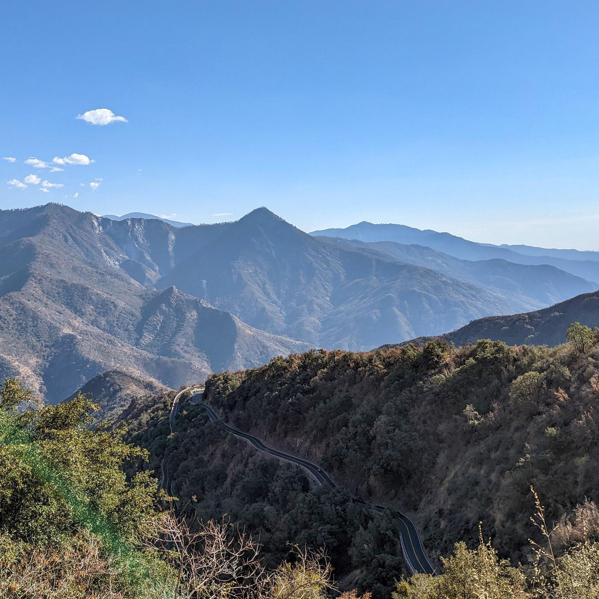
Kaiser Pass Road is one of the highest roads in California. It is a narrow, bumpy but fully paved road. There are wonderful views of the Sierra Nevada Mountain Range.
0
0
The Kaiser Wilderness is a beautiful, protected wilderness which is part of the Sierra Nevada Mountain Range. There are several lakes and trails of varying difficulty that weave through the area. There are also some paved and gravel roads with easier gradients that you can opt for to view the amazing wilderness.
0
0

Right next to Sentinel Campground, this visitor center provides backcountry permits, which are best reserved long in advance. Unfortunately, bikes are not permitted in the backcountry.
1
0

Just 1 hour from Fresno and nestled amongst the pines of the Sierra National Forest, Shaver Lake is a popular year-round destination. The area draws outdoor enthusiasts of all stripes, including, but not limited to, boaters, swimmers, anglers, cyclists, and hikers. The lake got its start in 1893 when lumberjack C.B. Shave created a small mill pond by building a rock-fill dam.
0
0
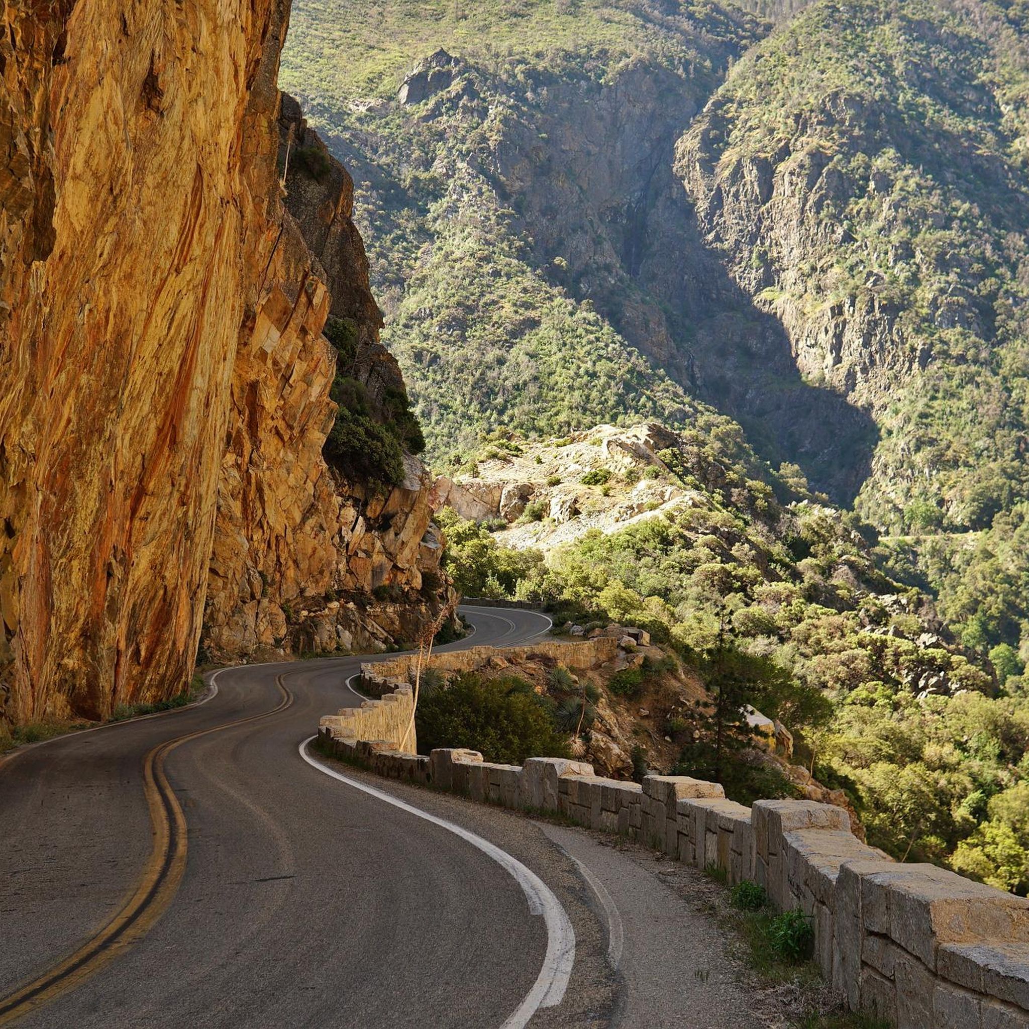
The Kings Canyon Scenic Byway is one of the most beautiful roads in the country. Along its 50 miles you'll pass towering groves of Giant Sequoia Trees and even higher cliffs of the canyon walls. The road was heavily damaged in the winter of 2023 so as things open up in Spring 2024 check ahead that everything has been repaired before making plans to ride this epic stretch of road.
0
0
Located along the Kings Canyon Scenic Byway, Boyden Cavern offers a 50 minute tour of the marble cave with a longer more in depth option available as well. If you plan on making this a stop on your journey be sure to book ahead by visiting this website: https://boydencavern.com/
0
0
Sweeping views from the edge of the deep Canyon cut by the Kings River.
0
0
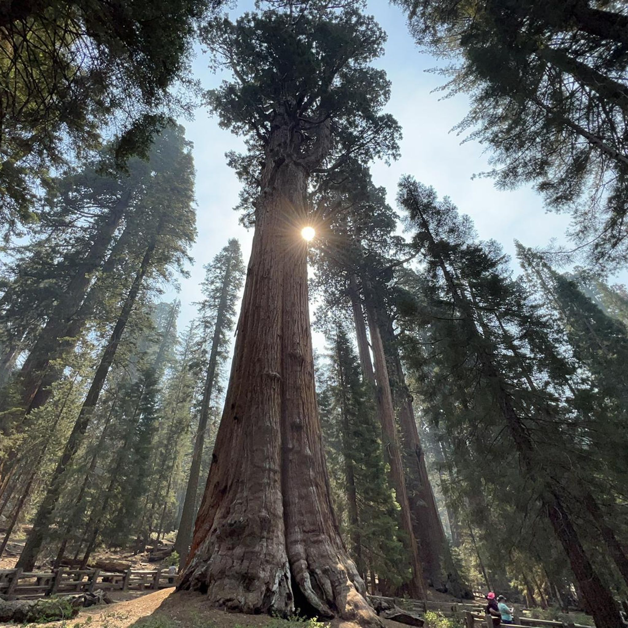
This isolated grove is home to 150-200 Giant Sequoia trees. There's a short trail that weaves its way around the grove, so you can immerse yourself under the canopy of the giants. You'll find parking and restrooms here as well.
0
0
Frequently Asked Questions
What types of touring cycling routes can I find in Fresno County?
Fresno County offers a diverse range of touring cycling routes, transitioning from the flat agricultural valley floor to rolling foothills and the towering Sierra Nevada mountains. You'll find everything from gentle riverside paths to challenging mountain ascents. The region is known for its proximity to national parks, extensive forest lands, and a network of rivers and lakes, providing varied scenery for every ride.
Are there easy touring cycling routes suitable for families or beginners in Fresno County?
Yes, Fresno County has several easy touring cycling routes perfect for families and beginners. For instance, the Lewis S. Eaton Bike Trail is an easy 9.3-mile path that winds through Woodward Park and along the bluffs of the San Joaquin River, offering pleasant views. Another great option is the Old Town Trail, which provides a straightforward ride through natural settings and connects to charming Old Town Clovis.
What are some scenic highlights or natural attractions I can see along touring cycling routes in Fresno County?
Fresno County's routes offer access to stunning natural beauty. You can encounter majestic waterfalls like Grizzly Falls or Mist Falls. Many routes also feature picturesque river views, such as the Middle Fork Kings River or the Foot bridge over San Joaquin River. The region is also a gateway to national parks, offering glimpses of ancient giant sequoia groves and colossal granite canyons.
Are there any circular touring cycling routes in Fresno County?
Yes, there are several circular touring cycling routes available. A popular choice is the Fresno to Millerton Lake loop via Old Town Trail, a moderate 44.5-mile path that blends natural settings with urban areas. For a shorter, easy option, consider the Lewis S. Eaton Bike Trail Loop.
What is the best time of year for touring cycling in Fresno County?
Fresno County enjoys over 300 days of sunshine annually, making it suitable for touring cycling much of the year. Spring is particularly beautiful, especially for experiencing the Fresno County Blossom Trail with its vibrant orchards. Fall offers pleasant temperatures and changing foliage. While summer can be hot in the valley, higher elevation routes in the Sierra Nevada provide cooler conditions. Winters are generally mild, allowing for cycling on lower elevation trails.
What do other touring cyclists say about the routes in Fresno County?
The touring cycling routes in Fresno County are highly rated by the komoot community, with an average score of 4.9 stars from over 40 reviews. Cyclists often praise the diverse terrain, from agricultural landscapes and river bluffs to scenic mountain foothills, and appreciate the variety of options for different ability levels.
Are there any challenging touring cycling routes for experienced riders?
Absolutely. For experienced touring cyclists seeking a challenge, Fresno County offers routes with significant elevation gains and technical descents, particularly in the Sierra Nevada foothills and mountains. Examples include the difficult Hume Lake to Grizzly Falls via Kings Canyon Scenic Byway or the Shaver Lake to Huntington Lake route, which features substantial climbs and stunning mountain vistas.
Can I find routes that take me through the famous giant sequoia groves?
Yes, some touring cycling routes in Fresno County provide access to the majestic giant sequoia groves. For instance, the difficult Shaver Lake to McKinley Grove of Giant Sequoias route allows you to cycle towards these ancient wonders, offering a truly unique experience amidst the towering trees.
Are there touring cycling routes that offer views of lakes or rivers?
Many touring cycling routes in Fresno County feature beautiful lake and river views. The Lewis S. Eaton Bike Trail follows the San Joaquin River. Routes like Sanger, California to Pine Flat Lake lead to scenic Pine Flat Lake, while others explore areas around Shaver Lake and Hume Lake, providing picturesque waterside cycling opportunities.
What should I consider regarding parking when planning a touring cycling trip in Fresno County?
Parking availability varies by route. For urban and park trails like the Lewis S. Eaton Bike Trail or those near Old Town Clovis, designated parking lots are generally available. For routes venturing into more remote areas or national forests, check specific trailhead information or local regulations. It's always advisable to research parking options for your chosen starting point in advance.
Are there any specific rules or permits required for touring cycling on certain trails in Fresno County?
Most local and urban bike paths in Fresno County do not require special permits for cycling. However, if your touring route takes you into national parks (like Yosemite, Sequoia, or Kings Canyon) or national forests, entry fees may apply, and specific regulations regarding cycling on certain roads or trails might be in place. Always check the official websites of these parks or forests for the most current information before your ride.
Can I find touring cycling routes that are less crowded or considered 'hidden gems'?
While popular routes like the Lewis S. Eaton Bike Trail can see more traffic, many of Fresno County's 46 touring cycling routes offer a sense of tranquility, especially those venturing into the foothills and mountains. Exploring routes like Kaiser Peak loop or those around the less-trafficked parts of the Sierra National Forest can provide a more secluded touring experience away from the crowds.
Most popular routes in Fresno County
Most popular attractions in Fresno County

Get inspired with the komoot mobile app


Didn’t find what you were looking for?
Check out more Cycling routes throughout Fresno County below and find the perfect route in your destination.
Explore more
Browse the best Cycling routes in other regions.
