The best cycling routes in Vega Baja Municipio
4.3
(10)
157
riders
14
rides
Touring cycling in Vega Baja Municipio offers a diverse landscape for exploration. The region features a mix of coastal areas with ocean vistas and an interior characterized by lush countryside and karst formations. Cycling routes traverse varied terrain, from paved surfaces to unpaved segments, catering to different skill levels. This allows touring cyclists to experience both the municipality's beaches and its green spaces.
Best touring cycling routes in Vega Baja Municipio
- The most popular touring cycling route is Bike loop from Vega Baja, a 29.5 miles (47.5 km) trail that takes 3 hours 29 minutes to complete. This route offers a moderate challenge through diverse landscapes.
- Another top favourite among local touring cyclists is Bike loop from Las Palmas, an easy 12.9 miles (20.8 km) path. This route leads through the lush countryside, suitable for a more relaxed ride.
- Local touring cyclists also love the Bike loop from Algarrobo, a 14.0 miles (22.5 km) trail leading through varied landscapes and green spaces, often completed in about 1 hour 43 minutes.
- Touring cycling in Vega Baja Municipio is defined by coastal paths, lush countryside, and karst hills. The network offers options for different ability levels, from easy rides to more challenging routes.
- The routes in Vega Baja Municipio are highly rated by the komoot community with an average score of 5.0 stars from over 5 reviews. More than 150 touring cyclists have used komoot to explore Vega Baja Municipio's varied terrain.
Last updated: July 2, 2026
20
riders
47.5km
03:29
270m
280m
Moderate bike ride. Good fitness required. Mostly paved surfaces. Suitable for all skill levels.
16
riders
20.8km
01:39
120m
120m
If you're looking for an accessible and scenic ride right from the city, the Bike loop from Las Palmas is a great option. This touring cycling route sticks to urban coastal paths, offering continuous Atlantic Ocean views and a chance to see the city from a different perspective. With only 404 feet (123 metres) of elevation gain over 12.9 miles (20.8 km), it's an easy ride that takes about 1 hour and 39 minutes, perfect for a leisurely outing.
Planning your ride is straightforward, as the loop starts directly in Las Palmas, a city known for its good cycling infrastructure and bike rental options. Gran Canaria's mild, year-round climate means you can enjoy this route almost any day, though early mornings or late afternoons are often best to avoid the warmest part of the day. No special permits are needed, and the paved surfaces make for a smooth experience.
This particular loop stands out as an easy touring bike route Las Palmas offers, contrasting with the island's more famous, challenging mountain climbs. It provides a taste of Gran Canaria's coastal beauty without the strenuous effort, making it a good choice for those seeking a relaxed ride or a family-friendly cycling route Las Palmas provides, rather than an advanced cycling loop Gran Canaria is known for.

Sign up for free
18
riders
22.5km
01:44
150m
150m
The Bike loop from Algarrobo is an easy touring cycling route in Vega Baja, Puerto Rico, perfect for a relaxed ride. This 14.0-mile (22.5 km) loop features a gentle 482 feet (147 metres) of elevation gain, making it a comfortable journey that takes approximately 1 hour and 43 minutes. It's an excellent choice for cyclists who prefer a less strenuous experience, allowing you to soak in the local scenery at a leisurely pace.
For planning your visit, this easy route is best enjoyed during cooler parts of the day, such as early mornings or late afternoons, to avoid the midday heat. While specific parking details are not available, arriving early is always a good strategy for any trailhead. Remember to bring plenty of water to stay hydrated throughout your ride.
This route stands out as a community-rated option for touring cyclists, offering a pleasant and accessible way to explore the area. It's particularly well-suited for those new to touring cycling or families looking for a straightforward and enjoyable outing, providing a positive experience for many who have ridden it.
5.0
(1)
13
riders
19.5km
01:26
90m
90m
The Los Tobos Beach loop from Algarrobo offers a delightful and accessible touring cycling experience along Puerto Rico's scenic coastline. You'll pedal past lush tropical vegetation, enjoy panoramic views of the ocean, and discover the unique karst topography with its limestone formations. The route is mostly on paved surfaces, making it a smooth ride for all skill levels, and provides access to the stunning Los Tubos Beach, known for its natural beauty.
This easy 12.1-mile (19.5 km) loop, with a gentle 292 feet (89 metres) of elevation gain, typically takes around 1 hour and 25 minutes to complete. It's a fantastic option for families or anyone looking for a relaxed ride. While specific parking information isn't detailed, starting from Algarrobo is convenient, and the trail is well-maintained, ensuring a pleasant outing.
What makes this route stand out is its blend of easy cycling with breathtaking coastal scenery, offering a refreshing escape with constant sea breezes. The area is also known for its Taíno heritage, adding a layer of cultural significance to the natural splendor. It's a perfect choice for those seeking scenic cycling loops near Algarrobo without demanding technical skills.
5
riders
19.5km
01:11
90m
90m
The Los Tobos Beach loop from Coto Norte offers a relaxed touring cycling experience, perfect for a quick and easy outing. This route covers 12.1 miles (19.5 km) with a gentle 301 feet (92 metres) of elevation gain, making it an easy ride that most cyclists can complete in about 1 hour and 11 minutes. You can expect a pleasant journey through the local area, likely with views of the coastline or the Manatí Municipio landscape, ideal for a casual pedal.
Planning your visit is straightforward for this easy route. While specific parking details aren't provided, you'll likely find convenient spots in or around Coto Norte. Consider cycling during the cooler parts of the day, like mornings or late afternoons, and always bring sufficient water. This loop is well-suited for beginners or anyone looking for a low-effort ride.
This route stands out as a great option for those seeking beginner touring cycling routes near Coto Norte and Los Tobos Beach. Its minimal elevation and manageable distance make it accessible for families or individuals new to cycling. It provides a simple way to explore the area without committing to a long or challenging adventure.
6
riders
47.0km
02:46
160m
160m
Moderate bike ride. Good fitness required. Mostly paved surfaces. Suitable for all skill levels.
6
riders
87.4km
05:12
600m
600m
Embark on a challenging touring cycling adventure with the Cerro Gozos – Los Tobos Beach loop, a difficult 54.3-mile (87.4 km) route that winds through Dorado's varied landscapes. You'll encounter a mix of paved roads and potentially unpaved sections, all while gaining 1972 feet (601 metres) in elevation over an estimated 5 hours and 11 minutes. The journey offers glimpses of the unique Pterocarpus Forest ecosystem and stunning coastal vistas, especially around the famous Los Tobos Beach, known for its powerful surf.
This demanding ride requires a very good level of fitness, so come prepared for a significant workout. While the Bosque de Pterocarpus de Dorado itself has restrictions on biking, the loop starts from its vicinity, offering a gateway to the region's diverse terrain. Plan your visit during cooler parts of the day or year, and ensure you carry enough hydration for the duration of this extensive loop.
The Dorado region is a gem for cyclists, blending scenic coastal paths with areas of lush mangroves and significant elevation changes. This particular loop stands out for its length and challenging profile, making it a prime choice for experienced touring cyclists. Keep an eye out for the natural beauty and perhaps even the ancient Taino petroglyphs sometimes exposed by the waves at Los Tobos Beach, adding a touch of historical intrigue to your ride.
Get access to more routes and recommendations from other explorers.
Sign up for free
Already have an account?
Our route recommendations are based on thousands of hikes, rides, and runs completed by other people on komoot.
Start today with a free account
Your next adventure awaits.
Login or Signup



Tips from the Community

There are miles of scenic bike trails in the reserve, many of which are grassy doubletrack. The hacienda is also an important historic site with an old sugar mill, steam engine, and tours. You can explore some of the ruins and old plantation lands on your own terms via bike.
0
0

Perfect to start practicing the sport of MTB
0
0

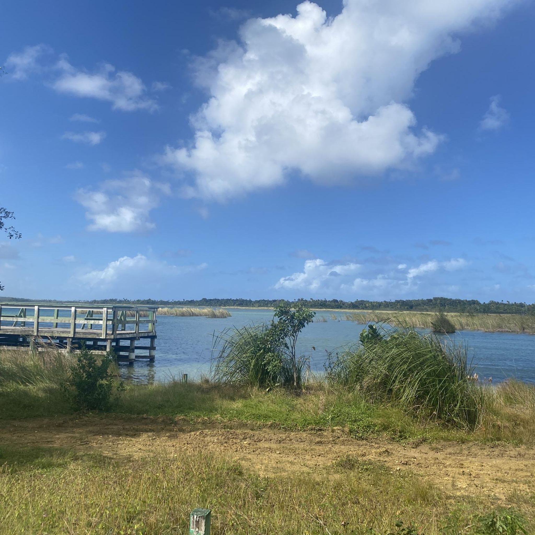
Area to practice recreational fishing, kayaking or MTB. It has gazebos for lunch, but they are pretty unworthy so use them at your own risk.
0
0

The lagoon covers an area of approximately 2.43 km2 and contains a total volume of water of 708 million gallons. It is made up of two segments: Laguna Tortuguero, which includes the northeastern swamp known as Cabo Caribe, and Laguna Rica. Its prevailing depth is between four to five feet. The most important hydrological consideration is the relationship between the Lagoon and its main water sources; groundwater from aquifers and water that runs through surface river discharges during rains.
0
0
Frequently Asked Questions
How many touring cycling routes are available in Vega Baja Municipio?
Vega Baja Municipio offers a variety of touring cycling routes, with over 10 options available for exploration. These routes cater to different skill levels, from easy rides to more challenging paths.
What kind of terrain can I expect on touring cycling routes in Vega Baja Municipio?
The terrain in Vega Baja Municipio is quite diverse. You'll find a mix of coastal paths offering stunning ocean views, lush countryside, and areas characterized by unique karst formations and 'mogotes' (karst hills). Routes can range from mostly paved surfaces to segments with unpaved sections, providing varied experiences for touring cyclists.
Are there any easy touring cycling routes suitable for beginners or a relaxed ride?
Yes, Vega Baja Municipio has several easy touring cycling routes perfect for beginners or those seeking a relaxed ride. For instance, the Bike loop from Las Palmas is an easy 12.9-mile (20.8 km) path that takes you through the lush countryside. Another great option is the Bike loop from Algarrobo, a 14.0-mile (22.5 km) trail through varied landscapes and green spaces.
Are there more challenging touring cycling routes for experienced riders?
For more experienced touring cyclists looking for a challenge, Vega Baja Municipio offers routes with moderate difficulty. The Bike loop from Vega Baja is a moderate 29.5-mile (47.5 km) trail that provides a diverse landscape experience. Another option is the Barceloneta Beach – Rincón Grande loop from Vega Baja, which is a longer, moderate 52.2-mile (84.1 km) route.
Can I find circular touring cycling routes in the area?
Yes, many of the touring cycling routes in Vega Baja Municipio are designed as loops, allowing you to start and end at the same point. Examples include the Bike loop from Vega Baja, the Bike loop from Las Palmas, and the Los Tobos Beach loop from Coto Norte.
What are some scenic highlights or natural features I can see while cycling in Vega Baja Municipio?
Vega Baja Municipio is rich in natural beauty. You can cycle past stunning beaches like Playa Puerto Nuevo, known for its natural rock barrier, or Playa Los Tubos with its crystal-clear waters. The region also features unique geological formations, including impressive caves like La Cueva del Indio with ancient petroglyphs, and lush green spaces such as Parque Ecológico Ceiba Pentandra, ideal for birding. Don't miss natural springs like Manantial Tortuguero or Ojo de Agua for exceptionally clear waters.
Are there family-friendly touring cycling options in Vega Baja Municipio?
Absolutely. The municipality offers easy, mostly paved routes that are suitable for families. Beaches like Playa Puerto Nuevo are known for being family-friendly, and some of the easier loops, such as the Los Tobos Beach loop from Coto Norte, provide a pleasant experience for all ages.
What is the best time of year to go touring cycling in Vega Baja Municipio?
Vega Baja Municipio, like much of Puerto Rico, enjoys a tropical climate, making it suitable for touring cycling year-round. However, the cooler, drier months from December to April are often preferred for outdoor activities, offering more comfortable temperatures and less humidity. It's generally advisable to avoid the peak hurricane season, which typically runs from June to November.
What do other touring cyclists enjoy the most about touring cycling in Vega Baja Municipio?
The touring cycling routes in Vega Baja Municipio are highly rated by the komoot community, with an average score of 5.0 stars. Reviewers often praise the diverse landscapes, from picturesque coastal views to the tranquil lush countryside and unique karst hills. The variety of routes catering to different ability levels is also frequently highlighted as a major draw.
Are there any touring cycling routes that specifically feature beaches?
Yes, several routes incorporate the beautiful coastline of Vega Baja. The Los Tobos Beach loop from Coto Norte is a great example, offering scenic views of Playa Los Tubos. Another option is the Vega Baja Beach loop from Plantation Water Park, which allows you to experience the coastal charm of the area.
Is parking available near the touring cycling routes?
While specific parking details for every route are not provided, popular areas and beaches in Vega Baja Municipio generally offer parking facilities. For routes starting from towns or well-known attractions, you can often find designated parking areas. It's always a good idea to check local signage or online maps for parking options near your chosen starting point.
Are there opportunities to explore unique natural springs or water features while cycling?
Yes, Vega Baja Municipio is home to several beautiful natural springs. The Manantial Tortuguero is known for its exceptionally clear waters, and the 'Ojo de Agua' spring is another popular spot, often accessible after a short ride through natural scenery. These offer refreshing stops and a chance to experience the region's pristine water sources.

Get inspired with the komoot mobile app


Explore more
Browse the best Cycling routes in other regions.
