The best cycling routes in South Central Connecticut Planning Region
4.7
(226)
1,107
riders
122
rides
Touring cycling in South Central Connecticut Planning Region offers diverse terrain, from coastal areas along the Long Island Sound to river valleys and forested uplands. The region features extensive multi-use trails and greenways, including sections of the East Coast Greenway and the Farmington Canal Heritage Trail. Cyclists can explore varied landscapes, including state parks like Sleeping Giant and West Rock Ridge, which provide elevated views. The area's network of dedicated cycling routes caters to different skill levels across its natural features.
Best touring cycling routes in South Central Connecticut Planning Region
- The most popular touring cycling route is Farmington Canal Heritage Trail — New Haven, Connecticut, a 31.2 miles (50.1 km) trail that takes 2 hours 51 minutes to complete. This route is a central part of the East Coast Greenway, offering a mostly paved surface.
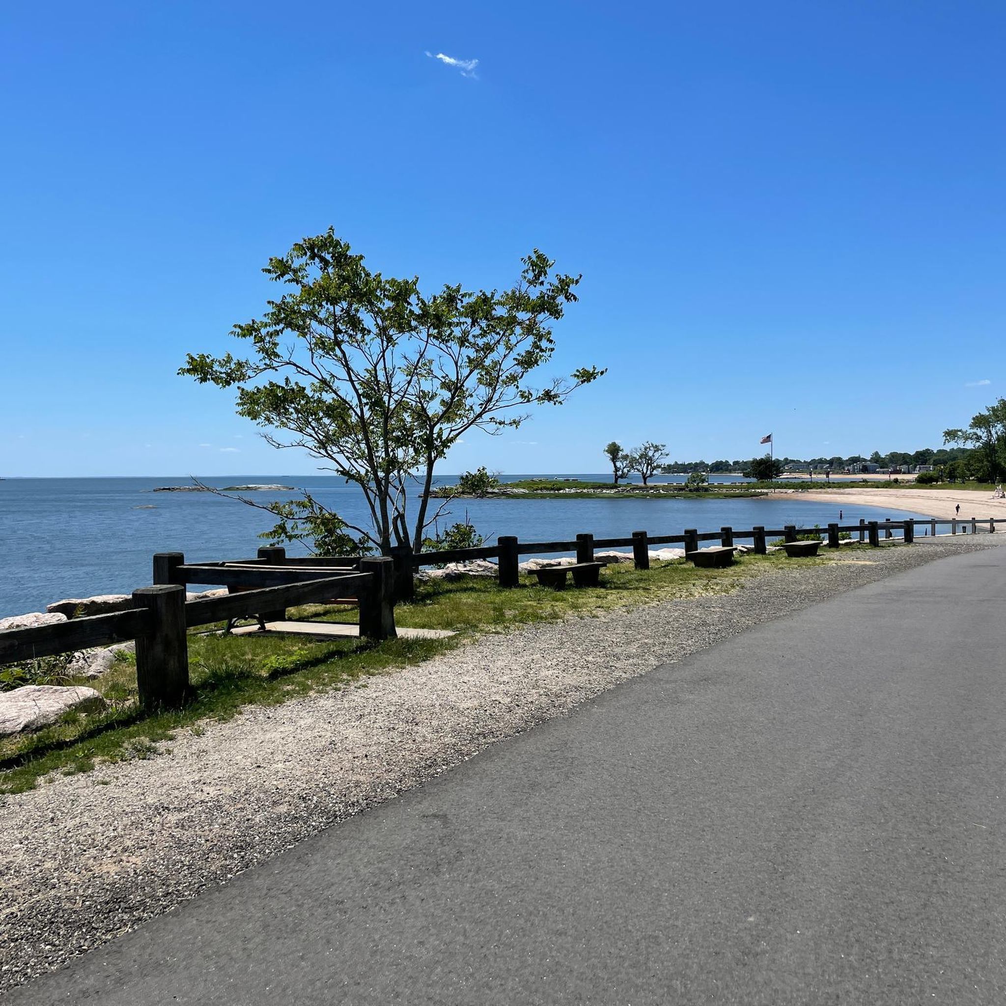
- Another top favourite among local touring cyclists is Silver Sands State Park via the East Coast Greenway — New Haven, Connecticut, a moderate 31.3 miles (50.3 km) path. This route provides coastal views and access to Silver Sands State Park.
- Local touring cyclists also love the East Rock Park loop — New Haven, Connecticut, a 5.7 miles (9.1 km) trail leading through East Rock Park, often completed in about 36 minutes.
- Touring cycling in South Central Connecticut Planning Region is defined by coastal paths, river valleys, and forested uplands. The network offers options for different ability levels, from easy greenways to more challenging routes through state parks.
- The routes in South Central Connecticut Planning Region are highly rated by the komoot community with an average score of 4.8 stars from over 190 reviews. More than 1100 touring cyclists have used komoot to explore South Central Connecticut Planning Region's varied terrain.
Last updated: August 31, 2026
4.8
(10)
59
riders
50.2km
02:51
140m
140m
The Farmington Canal Heritage Trail offers a delightful touring bicycle experience, winding through a dynamic tapestry of urban, suburban, and rural New England scenery. You'll glide along mostly paved surfaces, tracing old rail lines and canal towpaths, passing through quaint towns and alongside natural features like Lake Whitney. The route is dotted with historical elements, including old rail line structures and murals, providing a rich cultural backdrop to your ride.
Planning your trip is straightforward for this accessible path, which is suitable for all skill levels. While the trail is predominantly flat, be mindful of a few short on-road detours in towns like Avon and Southington where the trail isn't yet continuous. E-bikes are permitted, further enhancing accessibility, and the trail's connectivity to the Farmington River Trail allows for a scenic 28-mile loop option.
This trail is a notable component of the monumental East Coast Greenway, stretching from Florida to Maine, and offers a unique journey through New England's transportation history, following the path of the historic Farmington Canal. It's a moderate 31.2-mile (50.2 km) ride with a gentle 459 feet (140 metres) of elevation gain, typically taking around 2 hours and 51 minutes to complete. The trail's integration with local communities means you'll find plenty of services, including restaurants and lodging, making it convenient for longer excursions.
4.9
(17)
24
riders
50.4km
02:55
170m
170m
The East Coast Greenway from New Haven to Milford offers a delightful touring bicycle experience, blending urban stretches with serene coastal views. You'll pedal along the Long Island Sound, passing through charming areas like Silver Sands State Park Beach and the scenic Beach Street Trail, where the water views are particularly rewarding. The route features a mixed surface, predominantly paved, but with some segments that benefit from wider tires, creating a varied and engaging ride.
Planning your trip is straightforward, though it's good to know that while much of the 31.3-mile (50.4 km) journey is on dedicated paths, some sections share the road with traffic. This moderate route, with a gentle 551 feet (168 metres) of elevation gain, typically takes around 2 hours and 55 minutes to complete. It's best enjoyed during milder seasons to fully appreciate the coastal atmosphere and avoid extreme weather.
This segment is a key part of the ambitious 3,000-mile East Coast Greenway, connecting urban centers with natural beauty. It's notable for its direct access to several coastal attractions and offers a unique perspective on Connecticut's shoreline. The ongoing development of dedicated bike infrastructure in areas like New Haven continues to enhance the cycling experience, making this a great option for a rewarding day out.

Sign up for free
4.0
(2)
16
riders
37.8km
02:11
140m
140m
The East Coast Greenway: Milford and West Haven Coastal Loop offers a delightful touring cycling experience along the Connecticut shoreline. You'll pedal through diverse scenery, from serene marshlands to expansive views of the Long Island Sound, with notable stops like the sandy Oyster River Beach and the picturesque Silver Sands State Park Beach. This moderate 23.5-mile (37.8 km) route, featuring 443 feet (135 metres) of elevation gain, blends dedicated multi-use paths with shared road sections, taking about 2 hours and 10 minutes to complete.
To make the most of your ride, consider starting early, especially on weekends, to enjoy the coastal stretches with less traffic. The loop offers multiple access points as it's integrated into the larger East Coast Greenway network. While much of the terrain is flat, the varied surfaces, including paved, gravel, and some natural dirt, mean it's best for cyclists comfortable with different conditions.
This loop is a key segment of the ambitious 3,000-mile East Coast Greenway, connecting Maine to Florida, making it a significant route for both local rides and longer tours. The opportunity to potentially walk out to Charles Island from Silver Sands State Park Beach at low tide adds a unique natural feature to this scenic coastal journey.
4.5
(2)
9
riders
68.2km
04:06
480m
480m
Embark on the Branford Trolley Trail loop, a challenging 42.4-mile (68.2 km) touring bicycle route that immerses you in coastal Connecticut's natural beauty. You'll pedal through serene tidal wetlands and marsh habitats, crossing a historic iron trestle bridge that offers panoramic views of salt marshes and the distant Thimble Islands. The trail features a mix of surfaces, from paved sections to gravel and a wooden boardwalk, providing a varied and engaging ride for its 1560 feet (475 metres) of elevation gain.
This difficult loop typically takes around 4 hours and 6 minutes, making it an ideal choice for experienced cyclists looking for a substantial day trip. The route is part of the broader Shoreline Greenway Trail, so you'll find various access points and parking options along its course. Spring and fall offer the best conditions for cycling, with pleasant weather and vibrant scenery, ensuring a comfortable and enjoyable journey.
The Branford Trolley Trail segment itself follows the historic path of an early 20th-century electric trolley line, connecting modern users to Branford's transportation past. Beyond its historical significance, the trail is a crucial component of the larger Shoreline Greenway Trail, an ongoing project to create a continuous path along Connecticut's southern coast. It's also known for its ecological value, providing an intimate view of the tidal wetlands and serving as a habitat for various wildlife, including numerous shorebirds and osprey.
4.2
(5)
10
riders
30.9km
01:59
330m
330m
Cycle the Farmington Canal Trail and West Rock Ridge Loop, a challenging 19.2-mile route with panoramic views and diverse terrain.
3
riders
59.4km
03:39
490m
490m
Cycle the difficult 36.9-mile Sleeping Giant State Park loop via Farmington Canal Heritage Trail, featuring diverse scenery and 1616 feet of
4
riders
6.41km
00:23
50m
50m
The Naugatuck River Greenway Loop offers a delightful, easy touring cycling experience, tracing the revitalized Naugatuck River. You'll find yourself on mostly paved or firmly packed surfaces, enjoying scenic riverfront promenades and passing through pleasant wooded areas and parks. It's a short, accessible ride, perfect for a quick escape into nature with picturesque views.
This 4.0-mile (6.4 km) loop is rated easy, with a minimal 159 feet (49 metres) of elevation gain, making it a comfortable 23-minute ride for most. It's an excellent choice for beginner touring cyclists or families looking for a gentle outing. Parking is generally available at various access points along the Naugatuck River Greenway, and the trail is well-suited for a casual ride any time of day.
This specific loop is part of the larger Naugatuck River Greenway project, an ambitious effort to connect 11 communities along the river. It highlights a significant environmental success story, showcasing the river's revitalization and offering a mix of natural beauty and community access. The route provides a great introduction to the Naugatuck River Valley scenic views without demanding much effort.
2
riders
39.4km
02:22
250m
250m
Cycle the moderate Branford to Guilford loop, a 24.5-mile route offering scenic coastal views and a mix of paved and gravel paths.
1
riders
9.19km
00:37
130m
130m
Cycle the easy 5.7-mile East Rock Park loop in New Haven, Connecticut, for panoramic views of the city and harbor.
5.0
(1)
1
riders
73.1km
04:42
870m
870m
This difficult 45.4-mile touring bicycle loop combines the paved Farmington Canal Heritage Trail with rugged sections of Naugatuck State For
Get access to more routes and recommendations from other explorers.
Sign up for free
Already have an account?
Our route recommendations are based on thousands of hikes, rides, and runs completed by other people on komoot.
Start today with a free account
Your next adventure awaits.
Login or Signup
Popular around South Central Connecticut Planning Region




Other adventures in South Central Connecticut Planning Region

Tips from the Community

A smooth and fast road that's perfect for getting your head down and the pace up. Keep your eye out for walkers on the roadside.
0
0

Interesting stone arrangement created as a memorial to Captain Rick Ludwig.
0
0
Great view of Mount Carmel. The peak, also known as the Sleeping Giant, has a high point of 739 feet. From a distance, it looks like a man laying down.
0
0

A memorial site for Captain Rick Ludwig. The stones arranged in a circle are fascinating to look at and the children used them to reach infinity. The monument appears to have been created in 2023.
1
0

All told, this converted rail trail runs more than 47 miles through Connecticut, and is also part of the much longer East Coast Greenway. The paved surfaces makes for nice, easy riding through lots of pretty greenbelt areas.
0
0

The Ansonia Riverwalk Trailhead is just across the street from the Derby Greenway Trailhead. This is a paved extension of the bike path that offers more scenic views of the Naugatuck River with some park amenities along the side of the trail.
0
0
Naugatuck State Forest covers almost 5,000 acres. The forest has many different things to offer visitors including interesting trails, swimming, fishing holes and cliffs with amazing views. The park is usually quiet, so you can enjoy the beautiful scenery in solitude.
0
0
The A. Frederick Oberlin Bridge is a 1980 replica of the original Ithiel Town bridge that was commissioned by Eli Whitney. From this point, there is a great view of the bridge, which is only open to pedestrians. There are no cars allowed on the paths that lead to either side of the bridge, so you can stop to take a closer look at the bridge without worrying about traffic.
0
0
Frequently Asked Questions
How many touring cycling routes are available in the South Central Connecticut Planning Region?
There are over 130 touring cycling routes available in the South Central Connecticut Planning Region. These routes cater to various skill levels, with approximately 47 easy, 62 moderate, and 26 difficult options to explore.
What types of terrain can I expect on touring cycling routes in this region?
The South Central Connecticut Planning Region offers a diverse landscape for touring cyclists. You'll find scenic coastal areas along the Long Island Sound, picturesque river valleys like the Quinnipiac and Naugatuck Rivers, and forested uplands with rolling hills. Many routes utilize dedicated greenways, providing mostly paved and flat surfaces, while others venture into state parks with more challenging climbs and panoramic views.
What is the best time of year for touring cycling in South Central Connecticut?
The spring and fall seasons generally offer the most pleasant conditions for touring cycling in South Central Connecticut, with mild temperatures and beautiful foliage. Summer can also be enjoyable, especially along coastal routes, though it can be warmer. Winter cycling is possible on cleared paths, but some trails may be less accessible due to snow or ice.
Are there easy touring cycling routes suitable for beginners or families?
Yes, the region has numerous easy touring cycling routes perfect for beginners and families. The Naugatuck River Greenway loop is an excellent example of an easy, paved option. Many sections of the Farmington Canal Heritage Trail and the Shoreline Greenway Trail also provide gentle, accessible rides. For more options, you can explore the 47 easy routes listed in the region.
Are there challenging touring cycling routes for experienced cyclists?
Experienced cyclists looking for a challenge will find several difficult routes in the region. For instance, the Branford Trolley Trail loop offers significant elevation changes. Other challenging options include routes that traverse state parks like Sleeping Giant and West Rock Ridge, providing more demanding climbs and descents. There are 26 difficult routes available for those seeking a more strenuous ride.
Are there any circular touring cycling routes in the area?
Yes, many touring cycling routes in the South Central Connecticut Planning Region are designed as loops, offering varied scenery without retracing your steps. Examples include the East Rock Park loop, the Stewart B. McKinney National Wildlife Refuge loop, and the Branford to Guilford loop. These circular routes allow you to experience different aspects of the region's diverse landscape.
What natural features or landmarks can I see along the touring cycling routes?
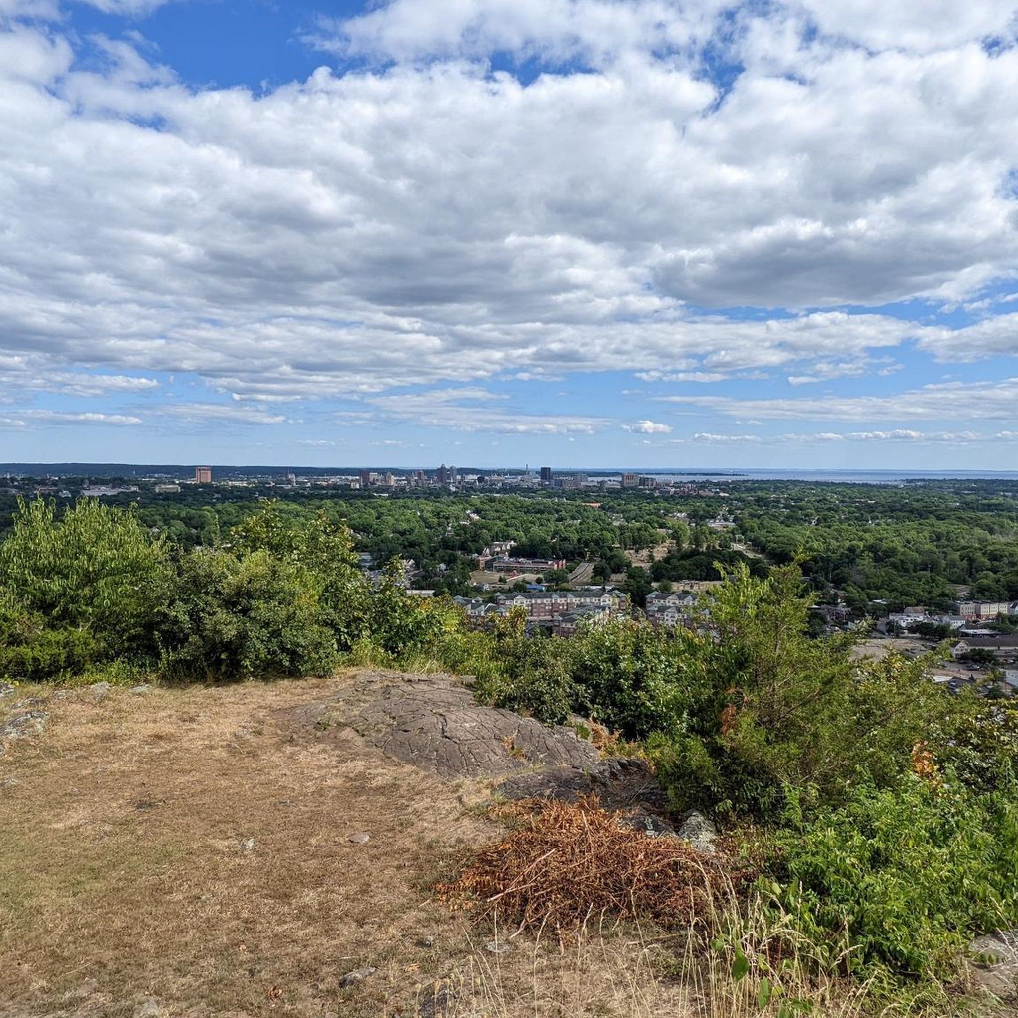
Cycling in the South Central Connecticut Planning Region offers access to numerous natural features and landmarks. You can ride along the scenic Long Island Sound coastline, explore river valleys, and pass through forested uplands. Notable natural attractions include East Rock and various viewpoints like Granite Hill view and View from West Peak. State parks like Sleeping Giant and West Rock Ridge also offer distinctive ridgelines and panoramic vistas.
Are there any historical sites or cultural attractions accessible by bike?
Yes, several historical and cultural attractions are accessible via the region's cycling routes. For example, the Farmington Canal Heritage Trail itself is a historic pathway. In New Haven, you can cycle near Yale University Old Campus. The region also features landmarks like Castle Craig, which can be reached or viewed from certain routes.
Where can I find parking for touring cycling routes?
Parking is generally available at trailheads and state parks throughout the South Central Connecticut Planning Region. Many greenways, such as the Farmington Canal Heritage Trail, have designated parking areas. For specific routes, it's advisable to check the route details on komoot or local park websites for precise parking information.
Is public transport available to access touring cycling trails?
Public transport options, including bus services, are available in many parts of the South Central Connecticut Planning Region, particularly in urban centers like New Haven. Some public transport services may accommodate bicycles, but it's recommended to check with the specific transit provider for their bike policies and route accessibility to trailheads.
Are touring cycling routes in South Central Connecticut dog-friendly?
Many multi-use trails and state parks in the South Central Connecticut Planning Region are dog-friendly, typically requiring dogs to be on a leash. However, specific regulations can vary by park or trail section. It's always best to verify the rules for the particular route or park you plan to visit to ensure a pleasant experience for you and your dog.
What do other touring cyclists enjoy most about cycling in South Central Connecticut?
The South Central Connecticut Planning Region is highly rated by the komoot community, with an average score of 4.8 stars from over 190 reviews. Cyclists often praise the region's diverse scenery, from coastal views to forested paths, and the extensive network of well-maintained greenways. The variety of routes, catering to all skill levels, is also frequently highlighted as a major draw.
Which greenways are prominent for touring cyclists in the region?
The region is home to several prominent greenways ideal for touring cyclists. The Farmington Canal Heritage Trail is a major highlight, forming a central part of the East Coast Greenway. The Shoreline Greenway Trail offers coastal riding opportunities, and sections of the Naugatuck River Greenway provide scenic river views. These greenways offer mostly paved, multi-use paths suitable for various cycling abilities.
Most popular routes in South Central Connecticut Planning Region
Most popular attractions in South Central Connecticut Planning Region

Get inspired with the komoot mobile app


Didn’t find what you were looking for?
Check out more Cycling routes throughout South Central Connecticut Planning Region below and find the perfect route in your destination.
Explore more
Browse the best Cycling routes in other regions.
