The best walks and hikes in Carbon County
5.0
(6)
196
hikers
23
hikes
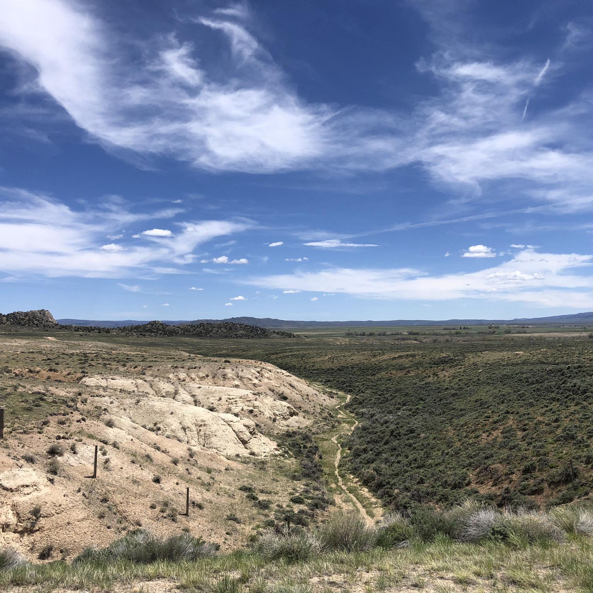
Hikes in Carbon County, Wyoming, cover a diverse landscape ranging from high-altitude desert to expansive national forests. The region is characterized by the mountain ranges of the Medicine Bow-Routt National Forest and designated wilderness areas like Huston Park. Trails navigate through conifer forests, past alpine lakes, and along sections of the Continental Divide.
Best hiking trails in Carbon County
- The most popular hiking route is Medicine Bow Peak loop via Lake Marie Trail — Medicine Bow-Routt National Forest, a 7.0 mile (11.3 km) trail that takes about 3 hours 35 minutes to complete. This route features significant elevation gain as it ascends toward the highest peak in the Snowy Range.
- Another top favourite among local hiking enthusiasts is Bridger Peak from Battle Pass via Continental Divide Trail — Carbon County, Wyoming, a moderate 9.3 mile (14.9 km) path. The trail follows a segment of the Continental Divide Trail, offering expansive views from the ridgeline.
- Local hiking enthusiasts also love the Green Mountain Falls Trail — Huston Park Wilderness Area, a 6.3 mile (10.1 km) trail leading through the Huston Park Wilderness, often completed in about 2 hours 48 minutes.
- Hiking in Carbon County is defined by alpine lakes, high-elevation peaks, and extensive national forest lands. The trail network provides options for different ability levels, from easy lakeside walks to more challenging mountain ascents.
- The routes in Carbon County are highly rated by the komoot community with an average score of 5.0 stars from a number of reviews. More than 140 hikers have used komoot to explore Carbon County's varied terrain.
Last updated: May 10, 2026
5.0
(2)
60
hikers
11.3km
03:36
450m
460m
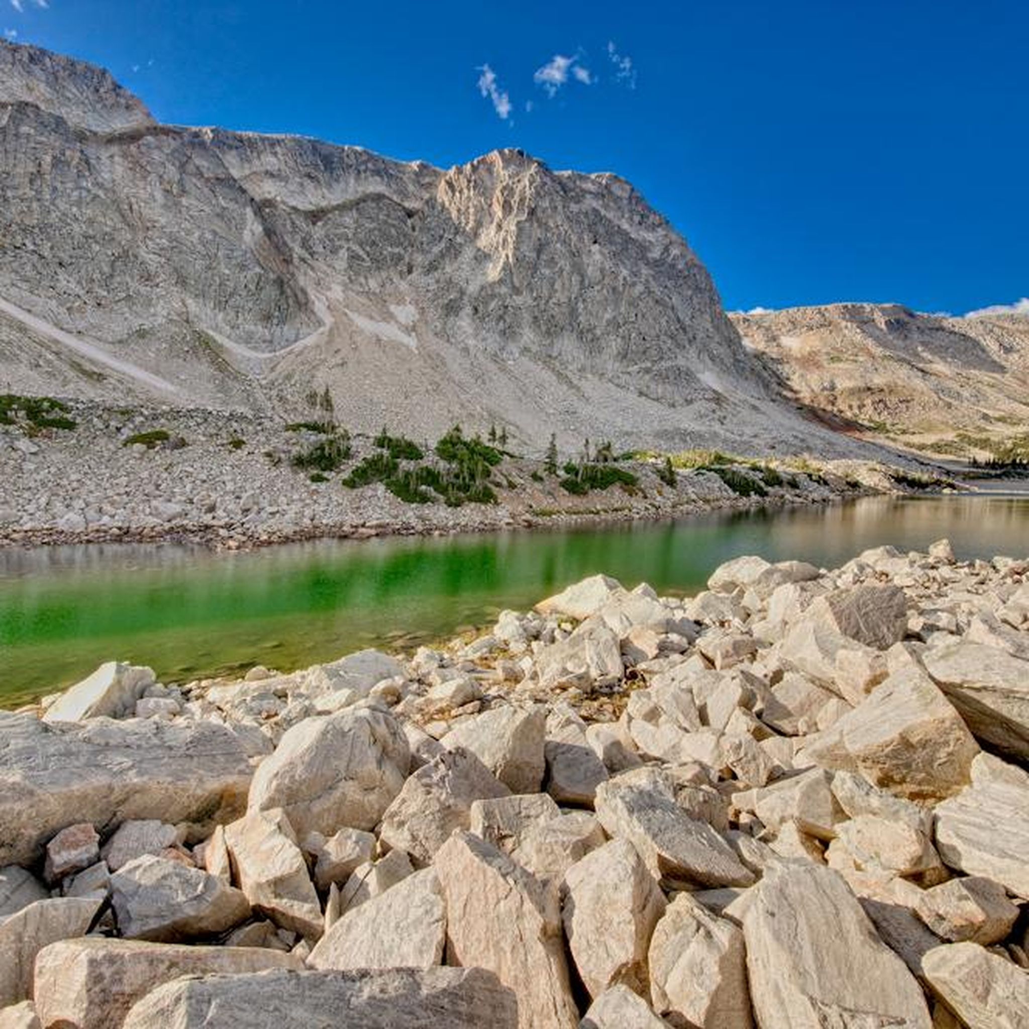
Embark on the Medicine Bow Peak and Lakes Trail Loop, a moderate 7.0 miles (11.3 km) hike that takes you through a truly diverse landscape. You will gain 1490 feet (454 metres) in elevation over approximately 3 hours and 35 minutes, experiencing everything from vibrant wildflower meadows to rugged, rocky terrain. As you ascend, the trail skirts several shimmering alpine lakes, including the picturesque Lake Marie, offering beautiful reflections of the surrounding peaks. The ultimate reward is reaching Medicine Bow Peak, the highest point in Southern Wyoming, where you are treated to expansive 360-degree panoramic views of the entire Snowy Range. This route provides a rewarding experience for hikers seeking both natural beauty and a physical challenge.
When planning your hike, be aware that conditions on the trail can vary significantly, even into late summer, with some sections potentially still covered in snow. Summer afternoons often bring thunderstorms, and since much of the route is above the tree line, it is wise to begin your hike early in the morning. This strategy helps you avoid potential lightning risks and allows ample time to complete the loop safely. Always check local weather forecasts and trail conditions before heading out to ensure a pleasant and secure adventure.
This trail is a highlight within the Medicine Bow-Routt National Forest, renowned for its unique high-altitude tundra environment. The ecosystem here supports a variety of alpine flora and fauna adapted to the harsh conditions, making it a fascinating area for nature observation. The geological formations leading up to Medicine Bow Peak tell a story of ancient glacial activity, shaping the dramatic landscape you see today. It is a prime example of the rugged beauty found in the Snowy Range, offering a distinct experience compared to lower elevation trails.
5
hikers
5.69km
01:39
150m
150m
The Lakes Trail offers an easy hiking experience through stunning alpine landscapes. As you hike, you will encounter crystal-clear alpine lakes, often framed by dramatic rock formations, providing expansive mountain vistas. This 3.5-mile (5.7 km) route involves a manageable 490 feet (149 metres) of elevation gain, typically taking about 1 hour and 39 minutes to complete. You will wind through diverse terrain, where wildflowers often add vibrant color in spring and summer.
When planning your visit, be aware that wet or snowy conditions can make parts of the trail challenging, especially during certain seasons. Always check local conditions before heading out to ensure a safe and enjoyable hike. You should also prepare for high altitudes, which can sometimes lead to dehydration or fatigue.
This trail is nestled within the Medicine Bow-Routt National Forest, known for its classic alpine scenery. Keep an eye out for unique geological formations and the possibility of waterfalls along the way, adding to the natural beauty of your journey. The route is a great way to immerse yourself in the region's natural environment.

Sign up for free
3
hikers
10.1km
02:49
180m
180m
Embark on the Green Mountain Falls Trail, a moderate hike spanning 6.3 miles (10.1 km) with an elevation gain of 607 feet (185 metres). This route offers diverse scenery, leading you past two scenic waterfalls and providing glimpses of majestic Pikes Peak. You will also discover the "Garden of Eden," a lush meadow vibrant with wildflowers during spring and summer. The trail culminates at the South Catamount Reservoir, where you can enjoy expansive water views after approximately 2 hours and 48 minutes of hiking.
Accessing the Green Mountain Falls Trail is straightforward, as the trailhead is located conveniently close to the charming town of Green Mountain Falls. You can typically find parking available within the town itself, making it easy to begin your hike. Consider starting your journey earlier in the day to fully enjoy the moderate 2 hours and 48 minutes it takes to complete the route. Always check local conditions before heading out, especially during shoulder seasons.
This trail is a highlight within the Huston Park Wilderness, offering a rewarding outdoor experience. The unique "Garden of Eden" section, with its rock outcroppings and seasonal wildflowers, provides a distinct natural feature. The journey to the South Catamount Reservoir offers a peaceful destination, making this route a notable choice for those seeking a blend of natural beauty and accessible hiking near Green Mountain Falls.
3
hikers
1.76km
00:30
40m
40m
Embark on an easy hike around Silver Lake, a peaceful natural setting perfect for a quick outdoor escape. This short loop covers 1.1 miles (1.8 km), offering pleasant views of the lake and the surrounding forest. You will gain a gentle 130 feet (40 metres) in elevation, making it a comfortable stroll that takes approximately 29 minutes to complete. It's an ideal route if you're looking for a refreshing nature walk without much effort.
Parking is generally available right at the trailhead, making access straightforward for your visit. This route is well-known for its accessibility, making it a great choice if you are hiking with family or prefer a less strenuous outing. Always remember to check local conditions before you head out, especially if you plan your trip during the shoulder seasons.
This trail provides a serene experience as you walk around Silver Lake, offering a quiet escape into nature. The nearby Silver Lake Campground also offers facilities, which can be convenient if you are planning to extend your stay in the area. It's a simple yet rewarding path within the Medicine Bow-Routt National Forest.
1
hikers
14.9km
04:22
420m
420m
Embark on the Bridger Peak via Continental Divide Trail, a rewarding hike that takes you through Wyoming's high country. This moderate route spans 9.3 miles (14.9 km) and involves a steady climb of 1380 feet (421 metres), leading you across ridgelines and past rocky outcrops. You can expect to complete the journey in about 4 hours and 22 minutes, enjoying expansive views of the surrounding hills and mountains as you ascend towards Bridger Peak.
To begin your adventure, access the trail from Battle Pass, a historically significant area. While the overall difficulty is moderate, be prepared for some short, steep sections that can test your endurance. Given the high-altitude environment, it is crucial to stay well-hydrated and ensure you are physically ready for the elevation changes before you set out.
This section of the Continental Divide Trail offers a true sense of remoteness and immersion in nature. If you visit in autumn, you will be treated to vibrant colors from the aspen trees, particularly around high-altitude passes like Battle Pass. The trail provides a unique opportunity to experience the rugged beauty of Medicine Bow-Routt National Forest, culminating in the impressive views from Bridger Peak itself.
8.58km
02:21
140m
140m
Embark on the Brush Creek Trails loop, a moderate hiking route that guides you through diverse landscapes. You will wander past stands of aspen and lodgepole pine, cross open meadows, and enjoy the shade of cottonwood groves, especially along the main Brush Creek Trail. This 5.3-mile (8.6 km) journey involves a gentle elevation gain of 448 feet (137 metres) and typically takes around 2 hours and 21 minutes to complete, offering a pleasant outdoor experience.
To begin your hike, head directly to the trailhead located behind the Brush Creek Visitor Center, which provides straightforward access. Be aware that a daily vehicle fee of $5 may be required for parking your car. While the trail is enjoyable year-round, planning your visit during summer allows you to witness the vibrant wildflowers and active insect life. In winter, the area transforms into a popular spot for cross-country skiing and snowshoeing.
This trail system is nestled within the expansive Medicine Bow-Routt National Forest, providing an accessible way to explore its natural beauty. Beyond its summer charm, the Brush Creek Trails are well-known for their winter activities, with weekly trail grooming often scheduled for snow sports. This makes the loop a versatile destination, offering different experiences depending on the season you choose to visit.
1
hikers
6.60km
01:51
130m
130m
Embark on an easy hike along the Quealy Lake Trail, a 4.1-mile (6.6 km) route that takes about 1 hour and 50 minutes to complete. You will gain 426 feet (130 metres) as you explore the high country of Medicine Bow-Routt National Forest. The path winds through beautiful alpine landscapes, featuring open meadows and pristine lakes. As you hike, you will reach the tranquil Reservoir Lake, where you can enjoy views of the iconic Medicine Bow Peak in the distance. This trail offers a peaceful and immersive experience in the Snowy Range.
Planning your trip to the Quealy Lake Trail requires a bit of preparation. The trailhead is accessed via Forest Road 103, and you will need a high-clearance 4WD vehicle to reach it. This route is typically open from June through October, making summer and early fall the best times to visit. Always check local conditions before heading out, especially for road accessibility.
This less-crowded path provides a quiet escape into the natural beauty of the Snowy Range. It is a great option if you are looking for a straightforward hike with rewarding alpine scenery without the hustle of more popular trails. The route allows you to connect with the pristine environment of the Medicine Bow-Routt National Forest.
1
hikers
10.1km
02:48
190m
190m
Embark on the Encampment River Trail, a moderate hike spanning 6.3 miles (10.1 km) with an elevation gain of 609 feet (186 metres). You can expect to complete this route in about 2 hours and 48 minutes. As you hike, you will follow the pristine Encampment River, where you can observe both turbulent rapids and calm stretches of water. The scenery shifts from lush river valleys to rugged mountain terrain, featuring deep canyon walls and dense evergreen forests of fir and spruce. Look for open hillsides adorned with sun, sage, alders, and wildflowers, adding vibrant color to the landscape.
The Encampment River Trail is a popular hiking destination, so plan for moderate use, especially during peak times. While this specific 6.3-mile route is considered moderate, be aware that other longer sections of the full trail system can include more challenging, rocky terrain and steeper climbs. Bikes are not permitted on this trail, ensuring a peaceful hiking experience. Always check local conditions before you head out, especially regarding weather and trail accessibility.
This trail offers a fantastic opportunity to explore the Encampment River Canyon Wilderness Study Area, a protected region in Carbon County, Wyoming. As you traverse the route, keep an eye out for diverse wildlife, including deer, elk, and various bird species that inhabit the area. The changing landscape, from riverine to mountainous, provides a rich natural experience, highlighting the unique ecosystem of the Encampment River Wilderness.
1
hikers
2.13km
00:35
30m
30m
Embark on an easy hike along the Platte River Trail, a serene route that follows the river's edge. You will wind through lush cottonwood forests, enjoying picturesque views looking down on the Platte River. This accessible trail covers 1.3 miles (2.1 km) with a gentle elevation gain of 113 feet (34 metres), making it perfect for a quick escape. Expect to complete the hike in about 35 minutes, immersing yourself in the tranquil natural setting.
Planning your visit to the Platte River Trail is straightforward, as it is generally accessible for hikers of all levels. You will find convenient parking available directly near the trailhead, allowing for an easy start to your adventure. This makes the route an excellent choice for a spontaneous outing whenever you need a quick dose of nature. Consider visiting during the morning or late afternoon for the most pleasant conditions and softer light along the river.
The Platte River Trail is nestled within the broader Platte River Wilderness, offering a glimpse into this unique natural environment. As you explore, keep an eye out for local wildlife that thrives along the riverbanks, such as various bird species, beavers, or muskrats. The trail provides a peaceful opportunity to connect with nature and observe the ecosystem of the Platte River.
5.58km
01:30
70m
70m
Embark on the Heart Lake Trail for an easy 3.5-mile (5.6 km) hike through the serene Medicine Bow-Routt National Forest. You will experience a gentle ascent, gaining 241 feet (73 metres) of elevation, making this a perfect route for a relaxed outing. The journey takes about 1 hour and 30 minutes, leading you through lush forest landscapes. Your destination is the tranquil Heart Lake, where you can enjoy the peaceful waters and surrounding natural beauty. This trail offers a refreshing escape into nature, ideal for a leisurely stroll.
When planning your visit, you will find parking generally available at the trailhead, providing easy access to begin your adventure. It is always wise to check local conditions before heading out, especially concerning weather forecasts and any potential seasonal changes that might affect the trail. Consider starting your hike in the morning to enjoy cooler temperatures and fewer crowds, enhancing your peaceful experience by the lake. This ensures you have ample time to complete the route comfortably.
The Heart Lake Trail stands out as a prime example of the natural beauty found within the Medicine Bow-Routt National Forest. It offers a unique opportunity to connect with the forest ecosystem and observe its diverse flora and fauna. The lake itself is a central feature, providing a calm focal point for your hike. This route is particularly notable for its accessibility and the rewarding views it offers without requiring extensive effort, making it a local favorite for a quick nature immersion.
Get access to more routes and recommendations from other explorers.
Sign up for free
Already have an account?
Our route recommendations are based on thousands of hikes, rides, and runs completed by other people on komoot.
Start today with a free account
Your next adventure awaits.
Login or Signup
Popular around Carbon County




Tips from the Community

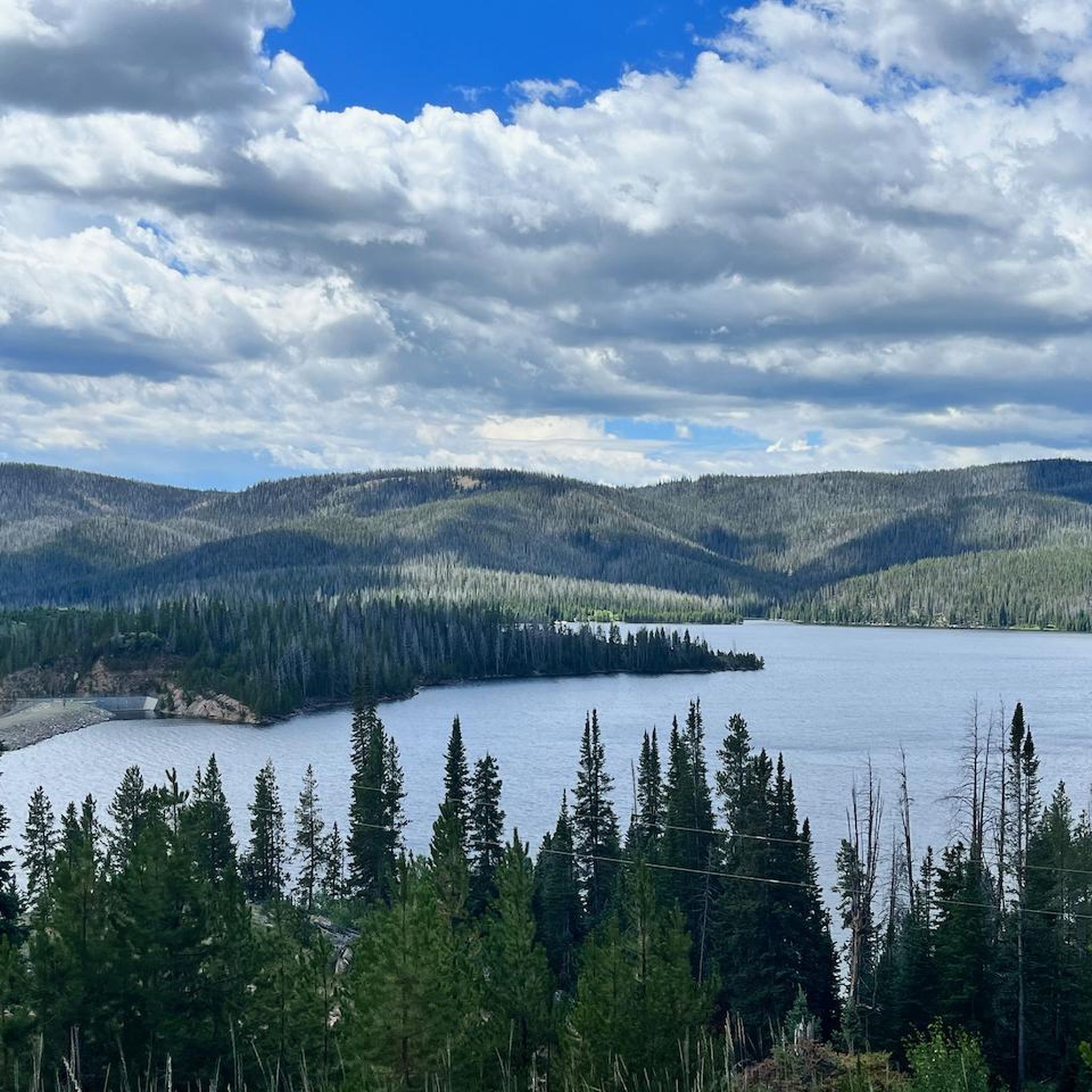
Of all the lakes you'll pass while riding Snowy Range Road, Lake Marie is the prettiest and most accessible from the road. This sort of scenery is exactly the reason for riding this road.
1
0
Although this challenging singletrack doesn't get a lot of traffic (probably because you need a 4-wheel-drive vehicle with high ground clearance to reach the trailhead), it's a fun one. You'll grind out some elevation gain on the way up, then gain it all back on the way down again. If you want a longer ride, this trail also links in with the Gap Lakes Trail and beyond.
1
0
If you set out from the Dipper Lake Trailhead, you'll put in a moderate climb on doubletrack to reach Heart Lake, which sits off a spur of the main trail. This is a quiet section of this trail network, but if you want to keep riding you can merge back into other nearby trails that access other lakes and the area around Medicine Bow Peak.
1
0
Heart Lake sits on a spur off the Dipper Lake Trail, which in turn connects in to the Medicine Bow Peak Trail. As long as your vehicle can make the rough approach to the trailhead, this is a great way to enjoy a quieter corner of an otherwise very popular section of Medicine Bow-Routt National Forest. It's also a good workout, with a moderate amount of elevation gain compared to the distance.
1
0
Heart Lake sits on a spur off the Dipper Lake Trail, which in turn connects in to the Medicine Bow Peak Trail. As long as your vehicle can make the rough approach to the trailhead, this is a great way to enjoy a quieter corner of an otherwise very popular section of Medicine Bow-Routt National Forest.
1
0
The easy trail loops near the Brush Creek Visitor Center are a great place for a first hike in Medicine Bow-Routt National Forest. During the summer keep an eye out for birds, flowers, and colorful insects including the dorcas copper butterfly. During winter, you might need to put on snowshoes or skis — the trails usually receive weekly grooming.
1
0
The easy trail loops near the Brush Creek Visitor Center — just inside the boundary of Medicine Bow-Routt National Forest — make a great place for a trail run. During the summer keep an eye out for birds, flowers, and colorful insects including the dorcas copper butterfly. During winter, you might need to put on snowshoes or skis — the trails usually receive weekly grooming.
1
0
This pleasant, narrow foothpath makes for a great run alongside the North Platte River.
1
0
Frequently Asked Questions
Are there any easy, family-friendly hikes in Carbon County?
Yes, there are several options suitable for families. The Silver Lake loop is a great choice, offering a short walk around a scenic lake in the Medicine Bow-Routt National Forest. Another gentle option is the Platte River Trail, which provides a relatively flat path along the beautiful North Platte River.
What are some challenging day hikes in the area?
For a strenuous but rewarding challenge, the Medicine Bow Peak loop is a top choice. This trail involves significant elevation gain as it ascends to the highest peak in the Snowy Range, offering incredible panoramic views.
Can I bring my dog on the trails in Carbon County?
Many trails in Carbon County are dog-friendly, especially within the Medicine Bow-Routt National Forest, but they must be kept on a leash. Always check specific regulations for wilderness areas, as rules can be stricter. Be mindful of wildlife and carry enough water for you and your pet, particularly at higher elevations.
Are there any hikes with waterfalls?
Yes, you can find waterfalls on some trails. The Green Mountain Falls Trail in the Huston Park Wilderness Area leads hikers through forests to a lovely waterfall, making for a scenic destination.
What kind of hiking should I expect in Carbon County?
The hiking here is incredibly diverse. You'll find everything from high-altitude desert landscapes in the Red Desert to alpine environments in the Medicine Bow-Routt National Forest. Expect trails that wind through conifer and aspen forests, pass pristine mountain lakes, and climb to exposed, rocky peaks with vast views.
Are there any circular or loop trails available?
Yes, there are several loop trails. For a moderate day out, the Brush Creek Trails loop offers a pleasant circuit through the national forest. Loop hikes are a great way to experience varied scenery without backtracking.
Where can I hike along the Continental Divide Trail?
Carbon County offers excellent access to the Continental Divide National Scenic Trail (CDT). A great option is the hike to Bridger Peak from Battle Pass, which follows a segment of the CDT and provides stunning views from the ridgeline. The town of Rawlins is also a designated CDT Gateway Community.
What are some good hikes for seeing alpine lakes?
The Snowy Range is famous for its beautiful alpine lakes. The Lakes Trail is specifically known for connecting several picturesque lakes. Another excellent choice is the Reservoir Lake via Quealy Lake Trail, which showcases the classic high-elevation lake scenery of the region.
How many hiking trails are in Carbon County?
There are over 20 hiking trails available in Carbon County, ranging from easy lakeside strolls to difficult mountain ascents. This includes 10 easy routes, 9 moderate ones, and 3 rated as difficult, ensuring there's a trail for every skill level.
What do other hikers think of the trails in Carbon County?
The trails in this region are very highly regarded by the komoot community, earning an average score of 5.0 stars. Hikers frequently praise the stunning alpine scenery, the well-maintained paths in the national forest, and the sense of solitude found in the wilderness areas.
What should I wear for hiking in the mountains here?
Layering is key. Weather in the mountains can change rapidly, even in summer. Start with a moisture-wicking base layer, add a fleece or insulating mid-layer, and always carry a waterproof and windproof outer shell.
Sturdy hiking boots with good ankle support are essential for the rocky and uneven terrain. Also, remember sun protection like a hat, sunglasses, and sunscreen, as the sun is much stronger at high altitudes.
Are there any good trails for longer, more remote hikes?
For a more remote experience, consider the Encampment River Trail. This out-and-back route follows the river, offering a sense of wilderness and solitude away from the more popular mountain peaks.
Most popular attractions in Carbon County

Get inspired with the komoot mobile app


Didn’t find what you were looking for?
Check out more Hikes throughout Carbon County below and find the perfect route in your destination.
Explore more
Browse the best Hikes in other regions.
