The best walks and hikes in Mariposa County
4.7
(6091)
59,621
hikers
300
hikes
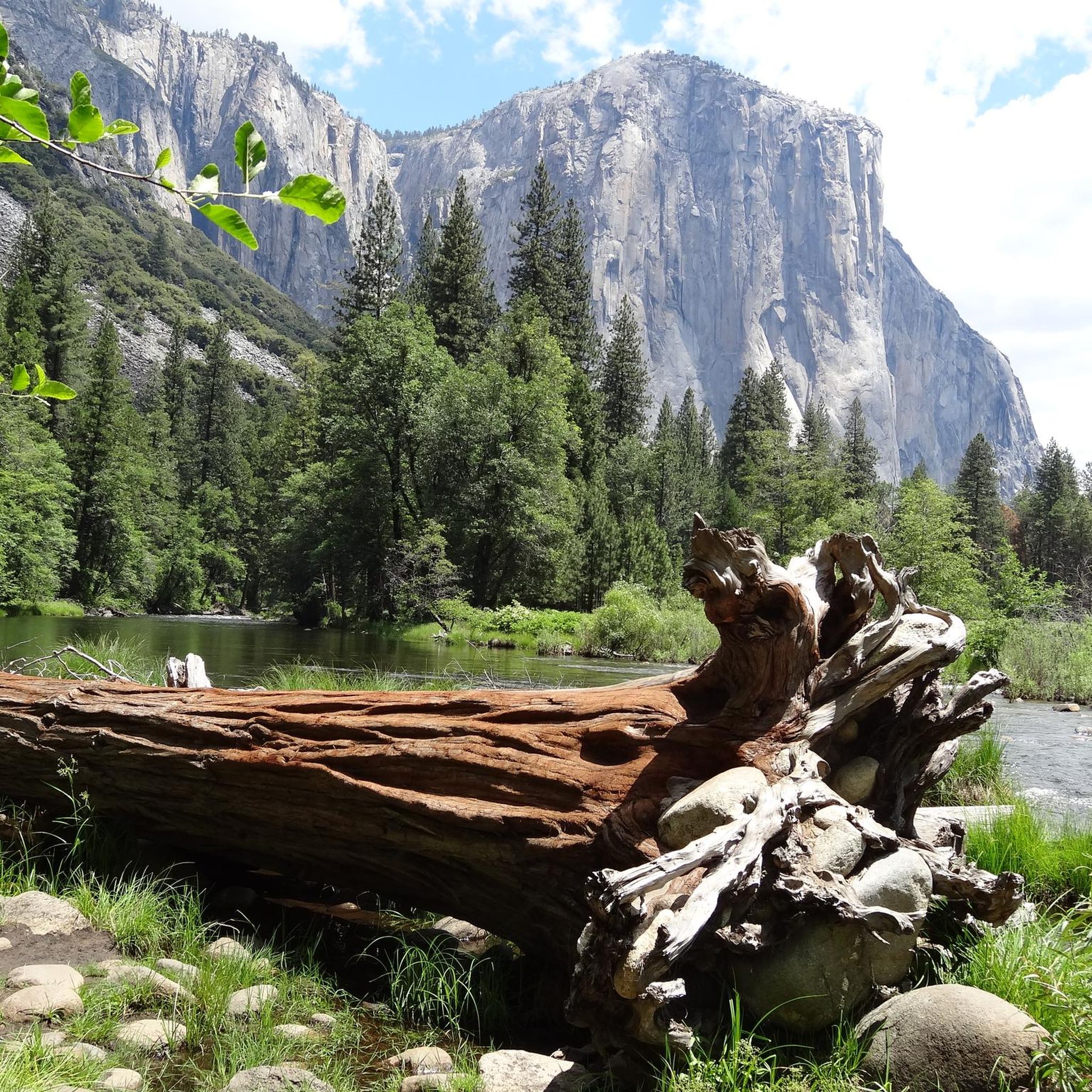
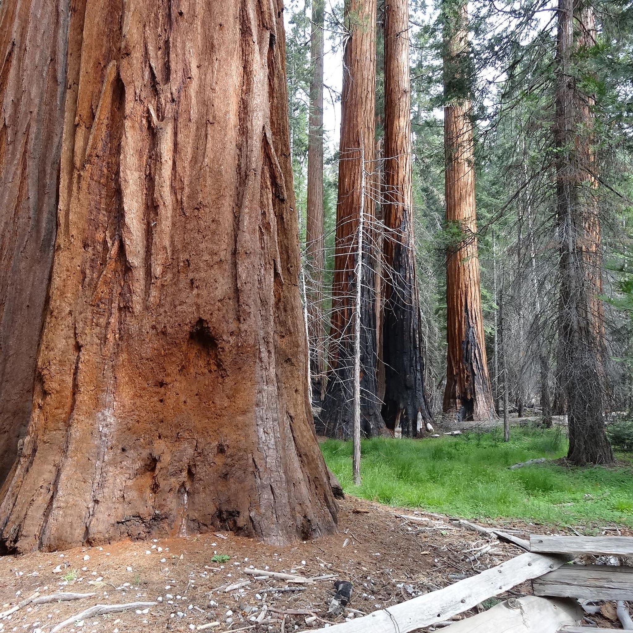
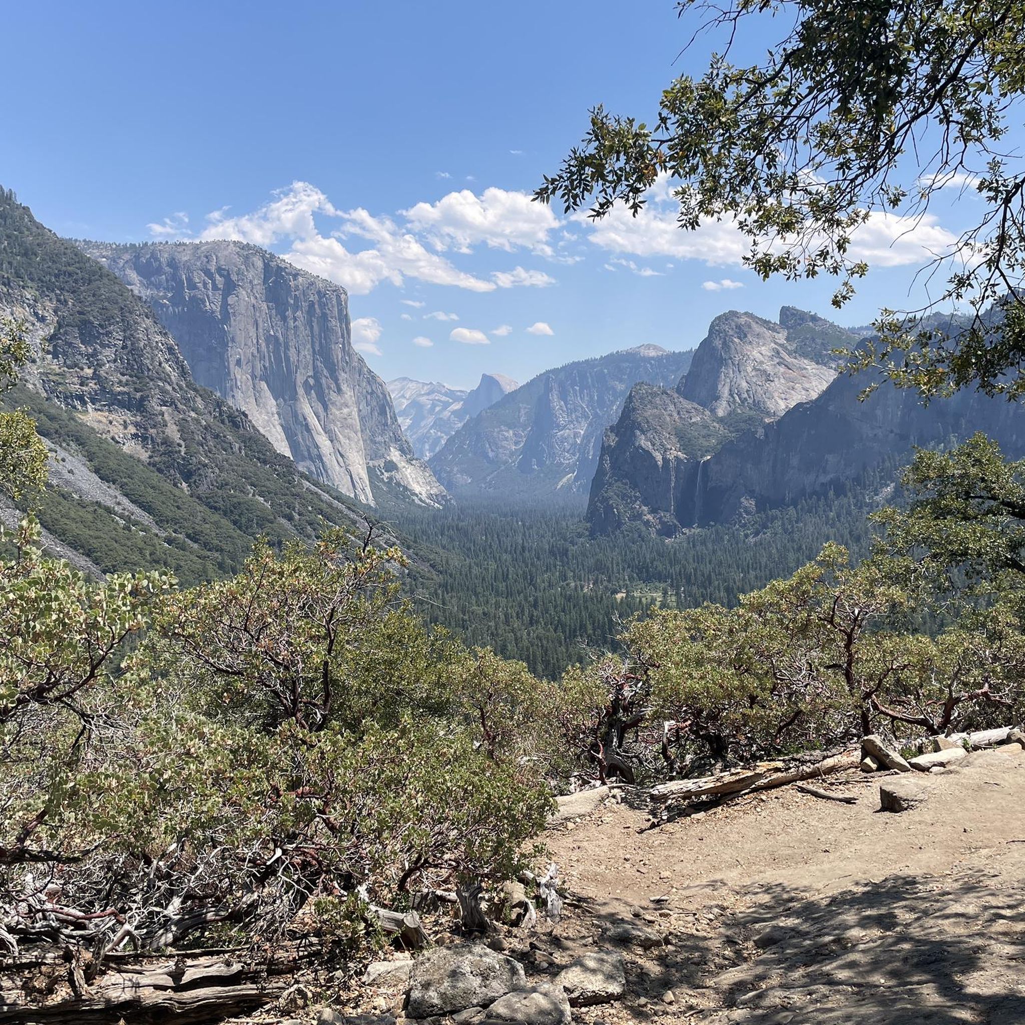
Hiking in Mariposa County offers diverse landscapes, from the alpine wilderness and granite formations of Yosemite National Park to the historic river valleys of the Merced River. The region features majestic peaks, thundering waterfalls, and ancient Giant Sequoia groves. Trails cater to various skill levels, providing access to both challenging climbs and gentle strolls through natural beauty.
Best hiking trails in Mariposa County
- The most popular hiking route is Vernal Falls and Nevada Falls loop from Curry Village — Yosemite National Park, a 8.3 miles (13.4 km) trail that takes about 5 hours 20 minutes to complete. This difficult route offers views of two major waterfalls within Yosemite Valley.
- Another top favourite among local hikers is Clark Point and Vernal Falls loop from Curry Village — Yosemite National Park, a moderate 6.4 miles (10.3 km) path. This trail provides varied perspectives of Vernal Falls and the surrounding granite landscape.
- Local hikers also love the Yosemite Falls Trail, a 7.5 miles (12.1 km) trail leading through forested areas and up to the top of Yosemite Falls, often completed in about 5 hours 20 minutes.
- Hiking in Mariposa County is defined by granite formations, thundering waterfalls, and Giant Sequoia groves. The extensive network of trails offers options for various ability levels, from easy walks to challenging ascents.
- The routes in Mariposa County are highly rated by the komoot community with an average score of 4.7 stars from over 5,200 reviews. More than 48,000 hikers have used komoot to explore Mariposa County's varied terrain.
Last updated: September 27, 2026
4.9
(712)
5,810
hikers
13.4km
05:19
680m
680m
The Vernal and Nevada Falls via Mist Trail is a challenging 8.3-mile (13.4 km) hike in Yosemite National Park, gaining 2221 feet (677 metres) over an estimated 5 hours and 18 minutes. This difficult route immerses you in the power of two major waterfalls, Vernal and Nevada Falls, as you ascend steep granite steps carved into the cliffside. The trail is renowned for its close-up views and the drenching mist from Vernal Fall, creating rainbows on sunny days.
To tackle this popular route, plan an early morning start to avoid the crowds, especially if you are aiming for the top of Nevada Fall. During spring and early summer, the mist from Vernal Fall is intense, so waterproof clothing is highly recommended. The trailhead is easily accessible, but parking can fill up quickly, making an early arrival essential for a smoother experience.
Considered one of Yosemite's most popular trails, the Mist Trail offers an unforgettable experience, particularly the unique granite staircase alongside Vernal Fall. While the initial section to Vernal Fall can be very busy, the crowds tend to thin out on the more strenuous climb to Nevada Fall. You can also opt to return via the John Muir Trail, which provides a different perspective and a less steep descent, making for a scenic loop.
4.9
(160)
1,360
hikers
8.51km
03:54
590m
590m
The Mist Trail is a truly immersive hiking experience, taking you right into the heart of Yosemite's powerful waterfalls. You'll navigate over 600 granite steps carved into the cliffside, feeling the refreshing spray from Vernal Fall as you ascend. The journey continues past the stunning Emerald Pool and Silver Apron, leading you to the majestic Nevada Fall, with continuous dramatic vistas of the Merced River and distant views of Liberty Cap and Half Dome.
This moderate 5.3-mile (8.5 km) hike involves a significant 1947 feet (593 metres) of elevation gain, typically taking around 3 hours and 54 minutes. Be prepared for a strenuous climb on often wet and slippery steps, especially during spring runoff. The trail is easily accessed by shuttle, but if you're driving, plan for early arrival as Mist Trail parking can be challenging. Good traction footwear is a must for this adventure.
Considered Yosemite's signature hike, the Mist Trail is renowned for its unparalleled access to two magnificent waterfalls, Vernal and Nevada Falls, which together drop over 900 feet. It's a must-do for anyone seeking a challenging climb combined with awe-inspiring natural beauty, making it one of the top rated hikes in Yosemite Valley.

4.9
(160)
1,360
hikers
8.51km
03:54
590m
590m
The Mist Trail plunges you into the heart of Yosemite's raw power, delivering a sensory overload of thundering waterfalls and drenching mist. This moderate 5.3-mile (8.5 km) hike, with its 1947 feet (593 metres) of elevation gain, leads you up steep granite steps to the base of Vernal Fall, where you'll feel the full force of the spray. Continuing on, the trail winds past the serene Emerald Pool and Silver Apron before reaching the impressive Nevada Fall, offering a truly unforgettable experience over roughly 3 hours and 54 minutes.
To tackle this popular route, you'll want to use the park shuttle to reach the trailhead, as parking can be scarce. Be prepared for crowds, especially during peak season, and know that the granite steps can be wet and slippery from the constant mist, particularly in spring and early summer. Good traction footwear is essential, and a waterproof layer will keep you comfortable as you get up close to the falls.
What makes the Mist Trail truly stand out is its unique
4.8
(403)
4,136
hikers
10.3km
03:50
460m
460m
The Vernal Fall and Clark Point Loop via Mist Trail and John Muir Trail offers an immersive Yosemite experience, taking you from the banks of the Merced River to the thundering spray of Vernal Fall. You'll navigate granite steps and forested paths, with the highlight being the powerful waterfall and the serene Emerald Pool. The trail culminates at Clark Point, where you're treated to expansive views of Nevada Fall and Half Dome, making the sustained climb well worth the effort.
To plan your visit, head to the Happy Isles Nature Center, the starting point for this adventure. Parking can be challenging, so an early start or utilizing Yosemite's shuttle service is highly recommended. This moderate 6.4-mile (10.3 km) loop, with its 1506 feet (459 metres) of elevation gain, typically takes around 3 hours and 49 minutes, so bring ample water and snacks. Spring offers the most dramatic waterfall flows, while fall provides cooler temperatures and clearer skies.
This loop is a quintessential Yosemite hike, combining the thrill of the Mist Trail's close encounter with Vernal Fall with the panoramic rewards of Clark Point. It's a fantastic way to experience two of Yosemite's most famous waterfalls and gain a unique perspective on the valley's grandeur, including distant views of Half Dome. The route provides a good challenge for those seeking a rewarding day hike in the heart of the park.
4.9
(278)
1,955
hikers
12.1km
05:21
1,160m
1,160m
Hard hike. Very good fitness required. Easily-accessible paths. Suitable for all skill levels.
4.9
(280)
1,896
hikers
10.8km
04:48
1,050m
1,050m
The Upper Yosemite Fall Trail is a demanding but incredibly rewarding journey that takes you to the top of North America's tallest waterfall. You'll navigate a consistently steep and rocky path, gaining 3435 feet (1047 metres) in elevation over 6.7 miles (10.8 km). The effort is paid back with continuous, expansive views of Yosemite Valley and Half Dome as you climb, culminating in an up-close encounter with the powerful Yosemite Falls. Expect a difficult hike that takes around 4 hours and 47 minutes, best suited for experienced hikers seeking a challenge.
To make the most of your hike, plan to go in spring or early summer when the waterfall is at its most impressive. The trail is largely exposed, so bring plenty of water, especially if you're hiking on a warm day. The trailhead is easily accessible in Yosemite Valley, but parking can fill up quickly, so an early start is always a good idea. Be prepared for a strenuous day and always stay on the marked path for safety.
This historic trail, built between 1873 and 1877, offers a unique perspective on Yosemite's iconic landscape that many visitors never get to see. Beyond the main falls, you can extend your hike to Yosemite Point for even more classic views of Half Dome and the Sierra Nevada Mountains. It's a high-effort, high-reward experience that showcases the raw power and beauty of Yosemite's natural features.
4.9
(220)
1,490
hikers
9.04km
03:41
740m
740m
Embark on the Upper Yosemite Fall Trail, a moderate hike that takes you on a rewarding ascent. This route covers 5.6 miles (9.0 km) with a significant elevation gain of 2414 feet (736 metres), typically completed in about 3 hours and 41 minutes. As you climb, you will pass through varied terrain, offering glimpses of the valley below and the powerful waterfall. The trail provides a direct experience of the park's grandeur, leading you closer to one of its most iconic features.
To make the most of your visit, plan to hike the Upper Yosemite Fall Trail during spring or early summer, generally from April to June. This period ensures you will see the waterfall at its most impressive flow. Be aware that by August, the falls can diminish significantly or even dry up completely, so check conditions before you go. Starting early in the day is always a good idea to avoid crowds and enjoy cooler temperatures on this exposed climb.
This trail is a direct path to the top of North America's tallest waterfall, offering a unique perspective on Yosemite Valley. From the summit, you can take in expansive views that stretch across the valley floor and encompass surrounding Sierra mountain peaks. It is a journey that connects you deeply with the natural forces that shaped this famous landscape, providing a memorable experience beyond just viewing the falls from below.
4.8
(143)
2,187
hikers
7.54km
02:40
320m
320m
Embark on the Mist Trail to Vernal Fall for a memorable hike through Yosemite National Park. This moderate route spans 4.7 miles (7.5 km) and involves a climb of 1038 feet (316 metres), typically taking about 2 hours and 40 minutes to complete. As you follow the Merced River, you will encounter the trail's iconic granite steps, where the mist from Vernal Fall can drench you, especially in spring and early summer, often creating rainbows. The experience culminates in spectacular, close-up views of the powerful 317-foot Vernal Fall.
Planning your visit carefully will enhance your experience on this popular trail. Expect crowds, particularly from April to June and during midday hours. To avoid the busiest times, consider starting your hike early in the morning or later in the afternoon. During periods of high water flow, especially in spring, the granite steps can become very slippery due to the waterfall's spray, so wearing hiking shoes with good traction is highly recommended. This trail is easily accessible within Yosemite National Park.
The Mist Trail is renowned for its unique natural features and historical significance within Yosemite. The trail's construction, featuring over 600 carved granite steps, is a testament to early park development, allowing visitors unparalleled access to the waterfall's base. Beyond Vernal Fall, you have the option to continue to the serene Emerald Pool, offering a different perspective of the park's stunning waterways. This route provides a quintessential Yosemite experience, blending challenging terrain with breathtaking natural beauty.
4.7
(41)
577
hikers
4.59km
01:11
30m
30m
The Lower Yosemite Fall Trail offers an incredibly accessible and scenic journey through Yosemite Valley, leading you right to the base of the iconic Lower Yosemite Fall. This easy, paved loop winds through a lush forested valley, providing dramatic views of the 320-foot (98-meter) cascade and the surrounding granite cliffs. You'll feel the refreshing mist from the falls, especially during peak flow, making it a truly immersive experience.
Planning your visit is straightforward, but be prepared for crowds, as this is one of Yosemite's most popular routes. The best time to go is during spring and early summer when the waterfall is at its most powerful due to snowmelt. By late summer, the falls can significantly diminish or even dry up, so time your trip accordingly for the best views.
What makes this trail particularly special is its exceptional accessibility; it's family-friendly and suitable for all abilities, including those using wheelchairs. It's a fantastic option for anyone looking for a high-reward, low-effort hike, covering 2.9 miles (4.6 km) with only 83 feet (25 metres) of elevation gain, typically taking just over an hour.
4.7
(41)
577
hikers
4.59km
01:11
30m
30m
The Lower Yosemite Fall Trail offers an incredibly accessible and rewarding experience, bringing you right to the base of one of North America's tallest waterfalls. This easy 2.9-mile (4.6 km) loop winds through the forested valley floor, crossing Yosemite Creek, and provides dramatic, up-close views of the 320-foot (98-meter) Lower Yosemite Fall. You'll feel the cooling mist and hear the roar of the water, especially from the Lower Yosemite Falls Viewpoint, making it a truly immersive encounter with nature.
This popular trail is paved and mostly flat, with only 83 feet (25 metres) of elevation gain, and takes about 1 hour and 11 minutes to complete. It's exceptionally family-friendly, with the eastern section of the loop being wheelchair and stroller accessible. To avoid the large crowds this trail often attracts, plan your visit for the early morning. Spring and early summer are ideal for experiencing the waterfall at its most powerful, as it can significantly reduce flow later in the year.
What makes this trail truly stand out is its exceptional accessibility combined with the proximity to such a magnificent natural feature. On clear, full-moon nights during spring, the mist from the falls can even create a rare and captivating "moonbow." Keep an eye out for wildlife like the Western Gray Squirrel as you explore this iconic Yosemite Valley path.
Get access to more routes and recommendations from other explorers.
Already have an account?
Our route recommendations are based on thousands of hikes, rides, and runs completed by other people on komoot.
Start today with a free account
Your next adventure awaits.


Other adventures in Mariposa County


Tips from the Community


The Mist Trail is much easier to hike uphill in early summer (snowmelt) than downhill because it becomes very slippery. Instead of returning the same way, it's recommended to head a little further upstream, turning right, onto the John Muir Trail—not only because of the slippery descent, but also because this leads to the best vantage point for Vernal Falls (marked on the map). Especially when the Merced River is full, the view is spectacular. The descent on the John Muir Trail is then much easier. Warning for photographers: During snowmelt, only take photos in the "splash zone" with a truly waterproof (submersible!) camera—and pack any other camera in a completely waterproof bag beforehand and only unpack it again at the top. Several careless camera owners have destroyed their equipment on this trail. I once heard a man at the top complaining about a broken Hasselblad – it was in his backpack, but obviously not completely waterproof. The fine mist penetrates everywhere, and even with a rain jacket, you end up wet like you've just taken a shower. On warm summer days, the trail is extremely crowded, with several thousand visitors on just a few kilometers of trail.
0
1
In summer, the most crowded trail in the entire park begins here. It's actually only bearable during the week in the off-season, but on summer weekends, several thousand people are spread out over just a few kilometers of trail.
0
0

You get really wet when you go up the steps at Verna Fall
0
0

Once you have left this section with its high steps behind you, you will know what an adventure you have embarked on 🙂
0
0

It is a 2,400-foot (739-meter) waterfall, the highest in North America and the fifth highest in the solar system. It is ten times higher than Niagara or Shoshone Falls, almost twice as high as the Empire State Building, and about as tall as a 200-story building if anyone ever built one. Best time to visit: In the spring, when the water roars off the falls and the breeze it creates on the bridge under the falls will blow your hat off your head. Worst time to visit: In early fall and late summer, when the falls are often completely dry at that time.
3
0
It is a 2,400-foot (739-meter) waterfall, the highest in North America and the fifth highest in the solar system. It is ten times higher than Niagara or Shoshone Falls, almost twice as high as the Empire State Building, and about as tall as a 200-story building if anyone ever built one. Best time to visit: In the spring, when the water roars off the falls and the breeze it creates on the bridge under the falls will blow your hat off your head. Worst time to visit: In early fall and late summer, when the falls are often completely dry at that time.
3
0

Very nice for cooling your legs and nice for a picnic
0
0
Frequently Asked Questions
How many hiking trails are available in Mariposa County?
Mariposa County offers a wide variety of hiking experiences, with over 230 trails recorded on komoot. These range from easy strolls to challenging ascents, catering to all skill levels.
Are there any easy hiking trails suitable for families or beginners?
Yes, Mariposa County has many accessible options. The Tuolumne Grove of Giant Sequoias offers an easy walk among ancient trees. Outside of Yosemite, the Wawona Meadow Loop and Tenaya Loop provide gentle strolls, often with beautiful wildflowers in spring and early summer. The Merced River Trail also has easy sections perfect for a relaxed outing.
Which trails feature waterfalls in Mariposa County?
Mariposa County is renowned for its waterfalls. Within Yosemite National Park, you can experience the iconic Vernal Falls and Yosemite Falls. Outside the park, the Lewis Creek Trail leads to Corlieu Falls and the more powerful Red Rock Falls, while Diana Falls along Bean Creek offers a relaxing hike to a seasonal swimming hole, best visited in spring and early summer.
Can I hike with my dog in Mariposa County?
While many trails within Yosemite National Park have restrictions on dogs, the historic Merced River Trail is a notable dog-friendly option, offering year-round hiking along the river. Other dog-friendly trails include the Tenaya Loop and the Wawona Meadow Loop, which are great for a gentle walk with your leashed pet.
What kind of natural attractions can I see along the hiking trails?
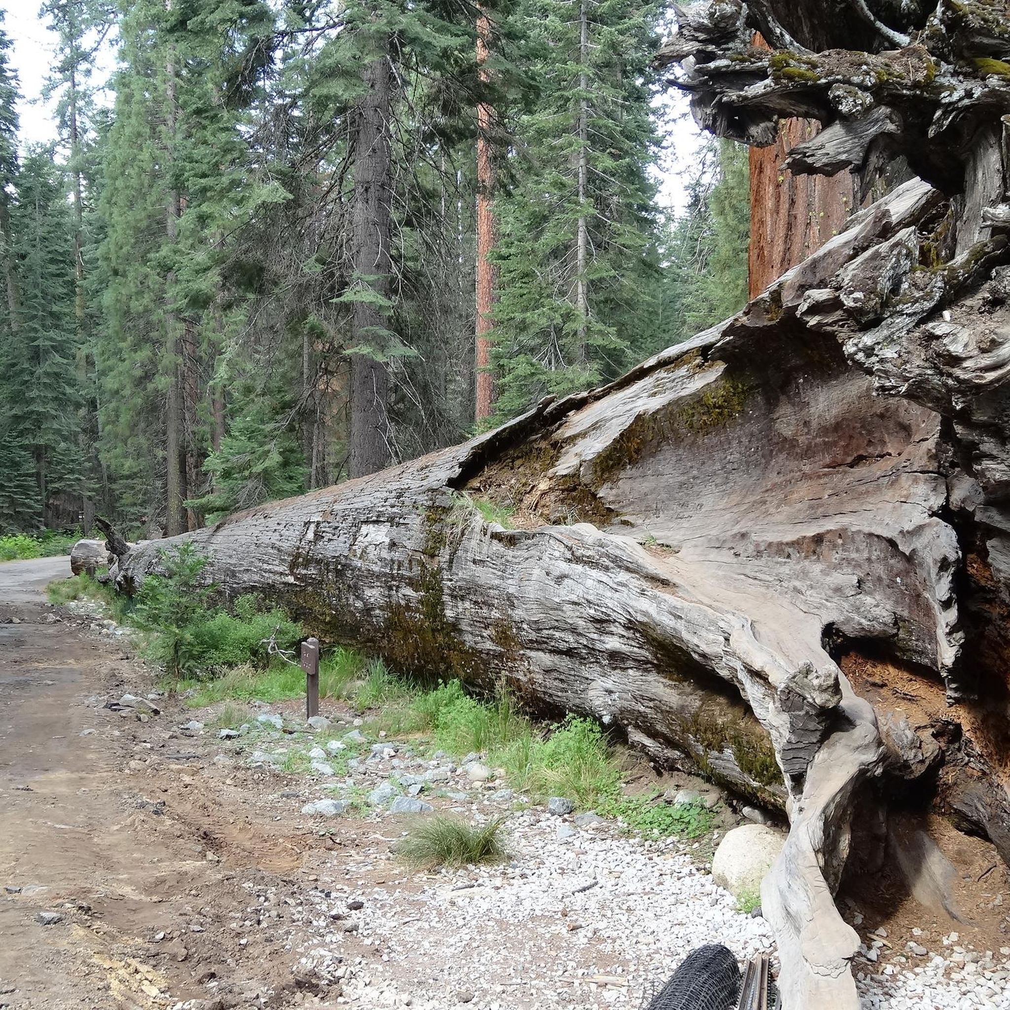
Mariposa County's trails offer diverse natural beauty. You can explore ancient Giant Sequoia groves, such as the Tuolumne Grove, or witness the majestic granite formations and thundering waterfalls of Yosemite National Park. Many trails, like the Merced River Trail and the Hite Cove Trail, are also known for vibrant wildflower displays in spring. You can also find stunning lakes like Mirror Lake and Tenaya Lake, and impressive peaks such as Sentinel Dome.
Are there any loop trails in Mariposa County?
Yes, several loop trails offer varied perspectives of the landscape. The Clark Point and Vernal Falls loop provides different views of Vernal Falls. The Wawona Meadow Loop and Tenaya Loop are also popular easy circular routes. For a longer option, consider the Lower and Upper Mirror Lakes loop.
What is the best time of year to go hiking in Mariposa County?
Spring is ideal for experiencing vibrant wildflowers and powerful waterfalls. Early summer also offers excellent conditions for waterfalls and opportunities for swimming in places like Diana Falls. The Merced River Trail is a great year-round option, while higher elevation trails are best enjoyed from late spring through fall when snow has melted.
What do other hikers enjoy most about hiking in Mariposa County?
The komoot community highly rates the hiking in Mariposa County, with an average score of 4.7 stars from over 5,200 reviews. Hikers frequently praise the breathtaking scenery, including the majestic granite formations and thundering waterfalls, as well as the diverse range of trails suitable for all abilities.
Are there any less crowded hiking options in Mariposa County?
While popular areas like Yosemite National Park can be busy, you can find quieter experiences. The Stockton Creek Preserve offers shorter trails and excellent birdwatching opportunities away from the main crowds. Diana Falls along Bean Creek also provides a more secluded and relaxing hike.
Do I need permits for hiking in Mariposa County?
Some areas, particularly within Yosemite National Park, may require permits for certain trails or during peak seasons. For example, day-use reservations or wilderness permits might be necessary for specific routes or overnight stays. It's always advisable to check the official National Park Service website for the most current permit requirements before your visit, especially for popular areas like Yosemite. You can find more information at nps.gov.
What are some challenging hikes in the region?
For experienced hikers seeking a challenge, Mariposa County offers demanding trails with significant elevation gains. The Four Mile Trail and the Top of Yosemite Falls Trail are known for their strenuous ascents and rewarding views. The Vernal Falls and Nevada Falls loop also presents a difficult but highly scenic option.
Most popular routes in Mariposa County
Most popular attractions in Mariposa County

Get inspired with the komoot mobile app


Didn’t find what you were looking for?
Check out more Hikes throughout Mariposa County below and find the perfect route in your destination.
Explore more
Browse the best Hikes in other regions.
