The 6 Most Amazing Peaks around Valle Bajo Alberche
Best mountain peaks around Valle Bajo Alberche are found in the eastern part of the province of Ávila, a region characterized by its mountainous terrain. This area lies between the Sierras de la Paramera and the foothills of the Sierra de Gredos, with the Alberche River flowing through a deep valley. The region offers diverse natural landscapes, including riverine vegetation and varied fauna. It provides opportunities for rural tourism and hiking across different difficulty levels.
Best mountain peaks around Valle…
Last updated: May 28, 2026
Entrance to Cueva Valiente
Highlight • Cave
A popular route starts from San Rafael and takes approximately 4 hours in total …
Translated by Google •
Tip by

Cabeza Líjar Summit
Highlight • Summit
Translated by Google •
Tip by
Sign up now to discover places like this
Get recommendations on the best single tracks, peaks, & plenty of other exciting outdoor places.
Sign up for free
Cueva Valiente Shelter
Highlight • Mountain Hut
Translated by Google •
Tip by
Peña del Águila Viewpoint
Highlight • Viewpoint
If it is not done in summer, you can see several streams along the way.
Translated by Google •
Tip by

Puerto de la Lancha
Highlight • Mountain Pass
Translated by Google •
Tip by

Alto del Mirlo (Pico Casillas)
Highlight • Summit
Translated by Google •
Tip by
Cabeza de la Parra
Highlight • Summit
Translated by Google •
Tip by

Views of Cebreros and Cerro Guisando
Highlight • Viewpoint
Translated by Google •
Tip by
Start today with a free account
Your next adventure awaits.
Login or Signup
Popular around Valle Bajo Alberche

The treasures of Guadarrama – on foot along the GR 10 in Madrid
A journey to the interior of the Iberian Peninsula – Levante Way (GR 239)
Hiking around Valle Bajo Alberche
Road Cycling Routes around Valle Bajo Alberche
MTB Trails around Valle Bajo Alberche
Running Trails around Valle Bajo Alberche
Cycling around Valle Bajo Alberche

Gravel biking around Valle Bajo Alberche


Tips from the Community

Spectacular viewpoint in the middle of the Sierra de Guadarrama above El Espinar. The Senda de la Peña del Águila trail begins on the outskirts of the town of San Rafael, in Segovia. It is about 6 km in which we will venture into the beautiful pine forests of the area until we reach the viewpoint.
0
0

Alto de Cueva Valiente is a place from which you can see wonderful views in every direction.
0
0

Cueva Valiente is a mountain located in the Sierra de Guadarrama, part of the Central System. A popular route starts from San Rafael and takes approximately 4 hours in total to reach Cueva Valiente and return. The trail follows a network of paths, some of which can be difficult to follow, so carrying a map or GPS is recommended. The total distance is 11.2 kilometers, with an ascent of 689 meters and an equal descent. The maximum altitude reached is 1903 meters. If you are interested in exploring this beautiful mountain, I encourage you to take the hike! 😊
2
0

Viewpoint of the Segovian part of the mountain range, surrounded by some of its best-known peaks.
0
0

An incredible viewpoint from the top of the summit of Cabeza Líjar, right next to the geodesic vertex. On a clear day we can easily recognize the La Jarosa reservoir.
1
1

Ascent from Puerto de Guadarrama (T2+) in just over an hour. For us northern types, it's best to climb before midday, although the route offers a lot of shade. The summit with its "stone pool" is not very pretty, but offers an incredible view of: - Madrid (in the distance) - Valley of the Caidos - Embalse de la Jarosa - Embalse de Valmayor - Plain of Castilia y Leon (in the north)
1
0

From this point there are very nice and wide views of the town of Cebreros and in the background, Cerro Guisando, one of the last mountains of the Sierra de Gredos on the east side.
1
0
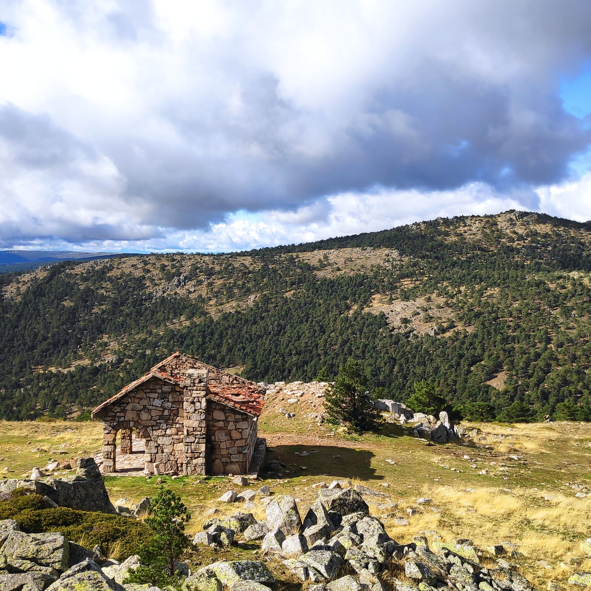
This is an access to Cueva del Valiente that is located away from the highest point of the Cave: It offers good views of the area since it is located in an elevated area.
1
0
Frequently Asked Questions
What are the most popular mountain peaks to visit in Valle Bajo Alberche?
Among the most popular mountain peaks in Valle Bajo Alberche, visitors highly appreciate Cabeza Líjar Summit for its incredible panoramic views. Another favorite is Cueva Valiente Shelter, located on a popular route in the Sierra de Guadarrama, offering extensive views in every direction. The Peña del Águila Viewpoint is also well-loved for its natural route and views of the Segovian mountain range.
Are there challenging mountain peaks for experienced hikers in Valle Bajo Alberche?
Yes, for experienced hikers, the route to Entrance to Cueva Valiente is considered challenging. This mountain, part of the Sierra de Guadarrama, involves a round trip of approximately 4 hours, covering 11.2 kilometers with an ascent of 689 meters to a maximum altitude of 1903 meters. Some trails can be difficult to follow, so good navigation skills are recommended.
What kind of views can I expect from the mountain peaks in Valle Bajo Alberche?
The mountain peaks in Valle Bajo Alberche offer diverse and impressive views. From Cabeza Líjar Summit, you can see the La Jarosa reservoir, the Valley of the Fallen, the Valmayor reservoir, and the Castilian-Leonese plain. Cueva Valiente Shelter provides wonderful views in every direction, while Alto del Mirlo (Pico Casillas) offers impressive vistas of the entire area, being the last highest mountain of the eastern end of the Sierra de Gredos.
Are there any historical sites or shelters on the mountain peaks?
Yes, the Cueva Valiente Shelter is a notable historical site located on a popular route in the Sierra de Guadarrama. It serves as a hut and offers a place to rest while enjoying the surrounding views.
What are some intermediate mountain peaks or viewpoints for a moderate hike?
For intermediate hikers, Cabeza Líjar Summit is an excellent choice, with an ascent from Puerto de Guadarrama achievable in just over an hour. The Peña del Águila Viewpoint also offers a natural route that can be completed in less than 2 hours at a leisurely pace. Other intermediate options include Alto del Mirlo (Pico Casillas) and Puerto de la Lancha.
What kind of outdoor activities can I do near the mountain peaks of Valle Bajo Alberche?
Beyond peak bagging, the Valle Bajo Alberche region offers a variety of outdoor activities. You can explore numerous hiking trails, from easy walks to more challenging treks. There are also dedicated MTB Trails and Gravel biking routes available for cyclists of different skill levels. The area's diverse natural landscapes make it ideal for rural tourism.
Are there easy hiking trails near the mountain peaks for all fitness levels?
Yes, the Valle Bajo Alberche region caters to all fitness levels. You can find easy paths suitable for a relaxed stroll. For specific easy hiking routes, you can explore the Easy hikes around Valle Bajo Alberche guide, which includes routes like the Navalperal de Pinares Reservoir Trail or a walk through the center of Las Navas del Marqués.
What natural features can I observe while exploring the mountain peaks?
The Valle Bajo Alberche region is rich in natural beauty. While exploring the mountain peaks, you'll encounter diverse riverine vegetation, and if you're lucky, you might spot varied fauna, including vultures and imperial eagles. The broader Valle del Alberche is known for ecological reserves like the Valle de Iruelas, a Special Protection Area for Birds, and the Pinar de Hoyocasero, which boasts unique botanical significance and endemic flora.
What do visitors enjoy most about the mountain peaks in Valle Bajo Alberche?
Visitors particularly enjoy the incredible panoramic views offered from summits like Cabeza Líjar Summit, where you can see vast landscapes stretching across Castilla y León and the Community of Madrid. The sense of accomplishment from reaching peaks like Alto del Mirlo (Pico Casillas) and the natural beauty of the trails, sometimes with streams, are also highly appreciated.
Can I find mountain passes with good views in the Valle Bajo Alberche area?
Yes, the region features several mountain passes that offer excellent viewpoints. Puerto de la Lancha is one such mountain pass that provides intermediate-level hiking opportunities and scenic views. Additionally, Alto del Mirlo (Pico Casillas) is also categorized as a mountain pass with impressive views.
Are there any viewpoints that offer a good perspective of the surrounding towns or landmarks?
Absolutely. From Cabeza Líjar Summit, you can clearly see the La Jarosa reservoir, the Valley of the Fallen, and the Valmayor reservoir. The Views of Cebreros and Cerro Guisando highlight offers specific vistas of these towns and landmarks, providing a unique perspective of the cultural landscape alongside the natural beauty.
Most popular routes around Valle Bajo Alberche
Most popular attractions around Valle Bajo Alberche

Get inspired with the komoot mobile app


Didn’t find what you were looking for?
Discover Valle Bajo Alberche’s best peaks and summits by region:
Explore more
See even more amazing summits around Valle Bajo Alberche with these guides:
