The best walks and hikes around Lacs De Vens 1Er
4.7
(457)
4,378
hikers
152
hikes
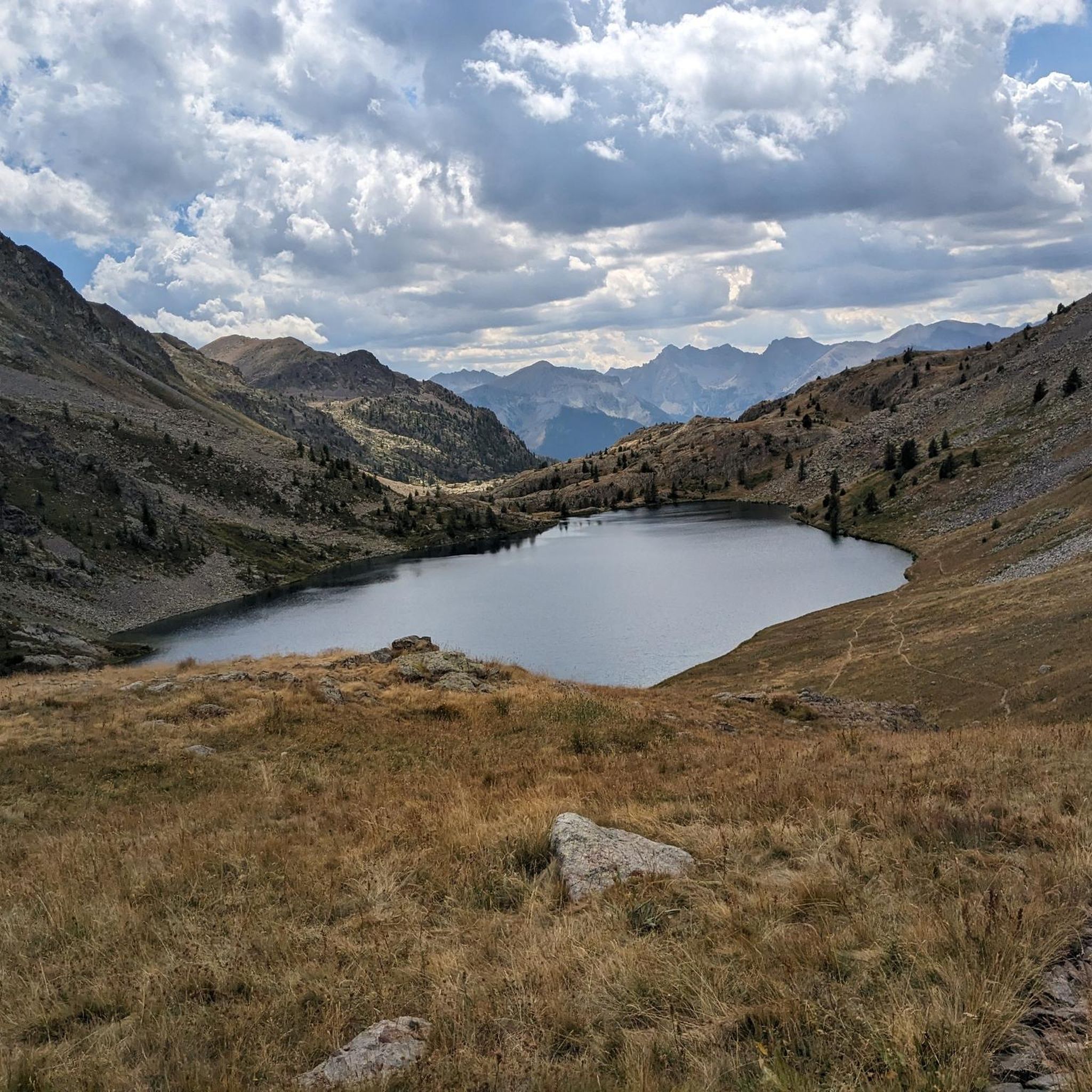
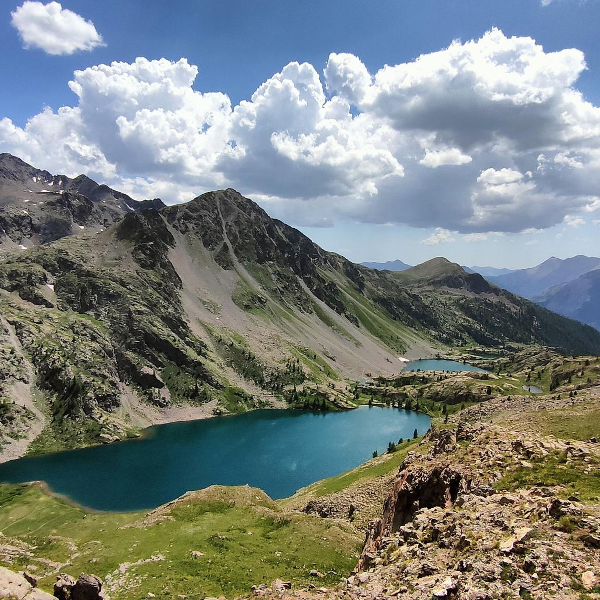
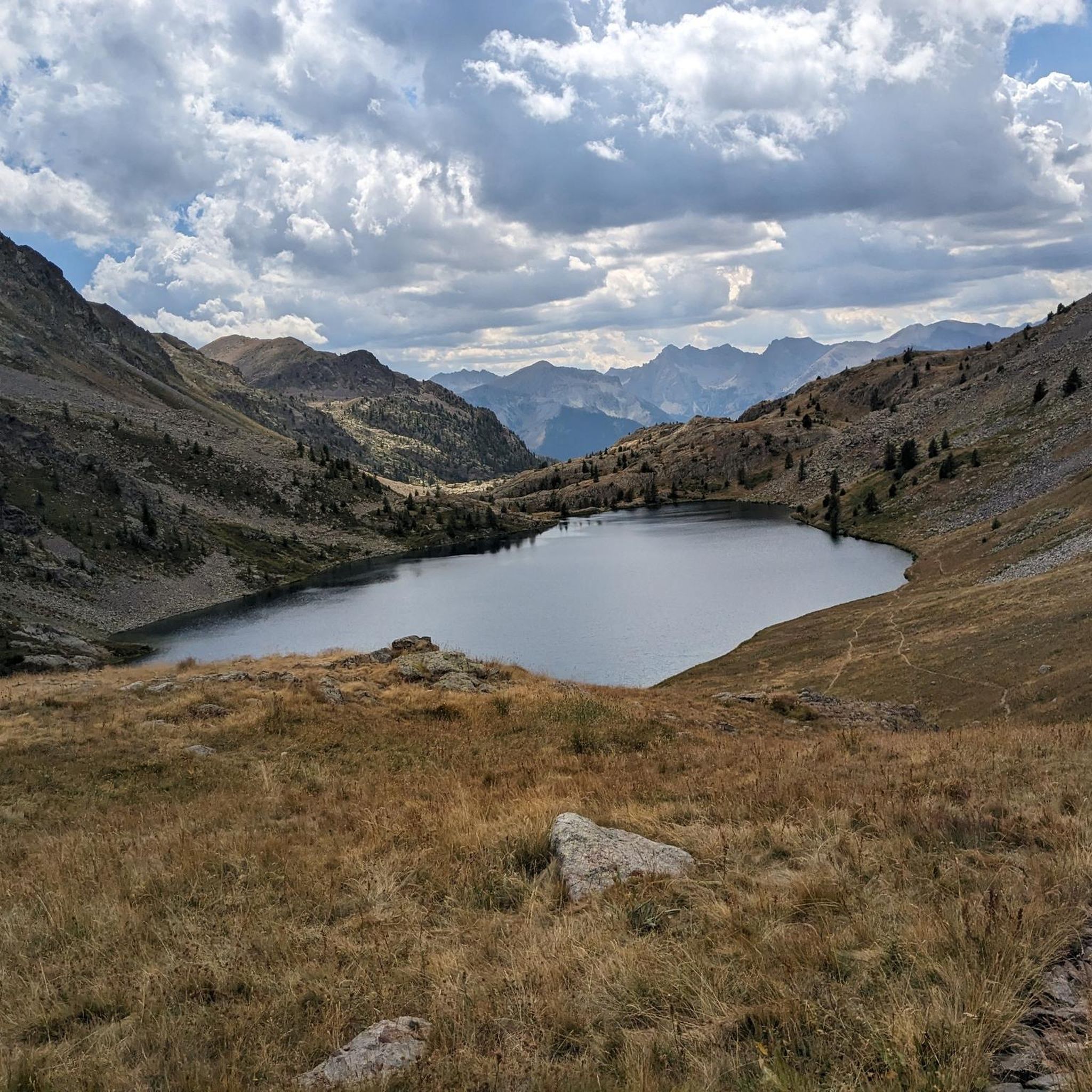
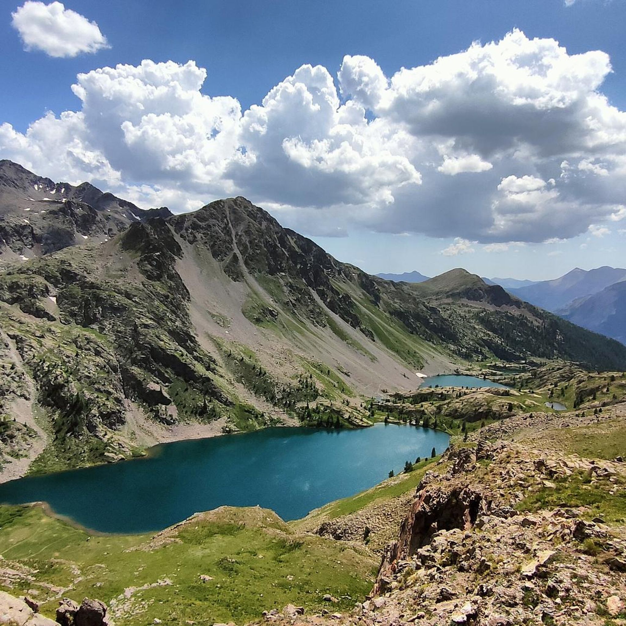
Hiking around Lacs De Vens 1Er, nestled within Mercantour National Park, offers diverse trails amidst alpine scenery. The region is characterized by emerald-colored lakes, larch forests, rocky terrains, and expansive prairies. Unique geological structures, such as a natural limestone bridge and the Aiguilles de Tortisse, contribute to a varied and dramatic environment, alongside steep slopes of grey schist and alpine pastures.
Best hiking trails around Lacs De Vens 1Er
- The most popular hiking route is Energy Trail: Stage 1 to Refuge de Vens, a 5.9 miles (9.5 km) trail that takes 4 hours 16 minutes to complete. This route offers alpine lake views.
- Another top favourite among local hikers is GR 52: Grande Traversée du Mercantour, a moderate 4.7 miles (7.6 km) path. This section features panoramic alpine views.
- Local hikers also love the Trail P32 to Col de Panieris, a 5.2 miles (8.4 km) trail leading through varied terrain, often completed in about 4 hours 41 minutes.
- Hiking around Lacs De Vens 1Er is defined by alpine lakes, larch forests, and unique geological structures. The network offers options for different ability levels, from moderate paths to difficult alpine treks.
- The routes in Lacs De Vens 1Er are highly rated by the komoot community with an average score of 4.7 stars from over 450 reviews. More than 4000 hikers have used komoot to explore Lacs De Vens 1Er's varied terrain.
Last updated: June 25, 2026
5.0
(3)
66
hikers
9.48km
04:17
580m
580m
Hike the moderate 5.9-mile Chemin de l'Énergie, Stage 1 to Refuge de Vens, gaining 1915 feet with stunning alpine lake views.
1
hikers
7.59km
03:52
630m
630m
Hike the moderate 4.7-mile Col du Fer Trail (via P45) in Mercantour National Park, gaining 2070 feet for panoramic alpine views.

Sign up for free
2
hikers
8.37km
04:42
800m
800m
Hike the difficult 5.2-mile Hidden valley trail to Col de Panieris (via Trail P32), gaining 2637 feet with panoramic views.
4.9
(15)
207
hikers
11.7km
05:22
790m
790m
Hard hike. Very good fitness required. Sure-footedness, sturdy shoes and alpine experience required.
5.0
(13)
151
hikers
16.8km
07:37
1,090m
1,090m
Hard hike. Very good fitness required. Sure-footedness, sturdy shoes and alpine experience required.
Get access to more routes and recommendations from other explorers.
Sign up for free
Already have an account?
Our route recommendations are based on thousands of hikes, rides, and runs completed by other people on komoot.
Start today with a free account
Your next adventure awaits.
Login or Signup
Tips from the Community

This Alpine pass is a true hidden gem in the Alta Val Stura! The climb will take you into an almost otherworldly landscape, with reddish and yellow rocks creating a unique atmosphere. It's a perfect place for those who enjoy challenging hikes and seek tranquility. The effort is well worth it: from the summit, at 2,675 meters above sea level, the view is nothing short of spectacular. On clear days, you can admire the Mercantour National Park and its Vens Lakes. An unmissable highlight for mountaineers, expert hikers, and lovers of 360° panoramas.
0
0
Amazing observation point, easy to access, overlooking the lakes and surrounding area.
0
0
Characteristic place, much visited, with a view of the Vens Lakes. Nature here wanted to create an amazing photographic point.
0
0

A magnificent hike in the Haute-Tinée offering varied panoramas and one of the most beautiful series of lakes on Mercantour!
0
0
The climb from Le Pra is gradual and easy, with the summit of Bonnette in the background. We then passed under the strange Aiguilles de Tortisse before reaching the Col du Fer (view of Mont Viso).
0
0
In the town of Saint-Etienne de Tinée, in the heart of the Mercantour National Park, the Vens Lakes refuge offers a mountain setting typical of the Maritime Alps. The Vens refuge is located in one of the most prestigious places in the Mercantour Park. It is located in an environment of natural lakes, waterfalls in an old glacial cirque, rich alpine meadows and varied fauna (mountain sheep, chamois, eagles, etc.).
0
0
Place with impressive views that is worth visiting.
0
0
Frequently Asked Questions
How many hiking trails are there in Lacs De Vens 1Er?
There are over 150 hiking routes around Lacs De Vens 1Er, offering a wide variety of options for different skill levels and preferences. The komoot community has explored more than 156 routes in the area.
What is the best time to visit Lacs De Vens 1Er for hiking?
The most picturesque time to visit Lacs De Vens 1Er is typically between July and November, when the chain of five main lakes exhibits striking emerald hues. The Refuge de Vens is also guarded from mid-June to mid-September, providing a convenient stopping point during this period.
What kind of terrain can I expect on hikes around Lacs De Vens 1Er?
The terrain around Lacs De Vens 1Er is incredibly varied, featuring a rich tapestry of larch forests, rocky sections, and expansive prairies. You'll also encounter unique geological structures like a natural limestone bridge and the Aiguilles de Tortisse, along with steep slopes of grey schist and alpine pastures.
Are there any easy hiking trails suitable for beginners around Lacs De Vens 1Er?
Yes, there are several easier options. For instance, the Energy Trail: Stage 1 to Refuge de Vens is a moderate hike offering stunning alpine lake views. The 'Col d'Anelle loop from Saint-Dalmas-le-Selvage' is also noted as an easy 6.20 km hike suitable for all fitness levels.
Are there challenging hikes for experienced trekkers in the area?
Absolutely. Lacs De Vens 1Er offers many challenging routes, with over 80 difficult trails. A notable option is the Trail P32 to Col de Panieris, a difficult 8.37 km trail with significant elevation gain, perfect for panoramic views. Another demanding route is the Refuge de Vens – Tortisse Arch loop from Saint-Dalmas-le-Selvage.
Are there any circular hiking routes in Lacs De Vens 1Er?
Yes, there are several excellent circular routes. The 'View of the lakes loop from Vens' is an 11.7 km loop offering extensive views of the lakes. Another popular choice is the 'Lacs de Vens Loop', which explores the Vens Lakes and the Collet de Tortisse, known for its unique geological structures.
Can I bring my dog on the trails in Lacs De Vens 1Er?
Lacs De Vens 1Er is located within the Mercantour National Park, which has specific regulations regarding dogs to protect wildlife. Generally, dogs are not permitted on trails within the central zone of the National Park, even on a leash. It's essential to check the current Mercantour National Park regulations before planning your hike with a dog.
Are there family-friendly hiking options in Lacs De Vens 1Er?
While many trails are challenging, there are options suitable for families. The 'Col d'Anelle loop from Saint-Dalmas-le-Selvage' is an easy 6.20 km hike that is suitable for all fitness levels, making it a good choice for families looking for a less strenuous outing.
What unique natural features can I see while hiking?
Hikers can marvel at the stunning chain of five main emerald-colored lakes, unique geological structures like a natural limestone bridge near the Tortisse Arch, and the impressive Aiguilles de Tortisse. Keep an eye out for local wildlife, as chamois can often be spotted in the Vallon de Vens.
Where can I find panoramic views of the lakes and mountains?
Many trails offer breathtaking panoramic views. The GR 52: Grande Traversée du Mercantour section near Lacs De Vens is known for its panoramic alpine vistas. The 'View of the lakes loop from Vens' also provides extensive views of the lakes, and the Trail P32 to Col de Panieris leads to excellent panoramic viewpoints.
Is there parking available for hikers at Lacs De Vens 1Er?
Yes, access to the lakes is primarily by hiking from designated parking areas. You can typically find parking at the Vens parking area or from the hamlet of Le Pra, which serve as common starting points for trails into the region.
What do other hikers enjoy most about hiking in Lacs De Vens 1Er?
The area is highly rated by the komoot community, with an average score of 4.7 stars from over 450 reviews. Reviewers often praise the stunning alpine lake views, the diverse terrain ranging from larch forests to rocky landscapes, and the unique geological formations that make each hike memorable.
Most popular routes around Lacs De Vens 1Er

Get inspired with the komoot mobile app


Explore more
Browse the best Hikes in other regions.
