The best road cycling routes around Totesee
4.8
(101)
5,188
riders
13
rides
Road cycling routes around Totesee navigate a high-alpine landscape characterized by challenging mountain passes, deep valleys, and views of reservoirs. The region, situated in the Goms, features significant elevation changes and winding roads suitable for experienced road cyclists. Routes often traverse historic pass roads and offer extended climbs and descents.
Best road cycling routes around Totesee
- The most popular road cycling route is Gletsch – Gletsch Chapel loop from Grimselpass, a 7.6 miles (12.2 km) trail that takes 49…
Last updated: May 27, 2026
36
riders
12.1km
00:49
410m
410m
Moderate road ride. Good fitness required. Mostly well-paved surfaces and easy to ride.
4.6
(16)
842
riders
64.8km
04:15
2,000m
2,000m
Hard road ride. Very good fitness required. Some segments of this route may be unpaved and difficult to ride.

Sign up for free
5.0
(2)
31
riders
26.1km
01:44
810m
810m
Moderate road ride. Good fitness required. Mostly well-paved surfaces and easy to ride.
4.5
(2)
199
riders
67.0km
03:16
920m
920m
Hard road ride. Very good fitness required. Some segments of this route may be unpaved and difficult to ride.
5.0
(28)
1,288
riders
76.2km
04:48
2,130m
2,130m
Hard road ride. Very good fitness required. Mostly well-paved surfaces and easy to ride.
Get access to more routes and recommendations from other explorers.
Sign up for free
Already have an account?
Our route recommendations are based on thousands of hikes, rides, and runs completed by other people on komoot.
Start today with a free account
Your next adventure awaits.
Login or Signup

Other adventures around Totesee

Tips from the Community

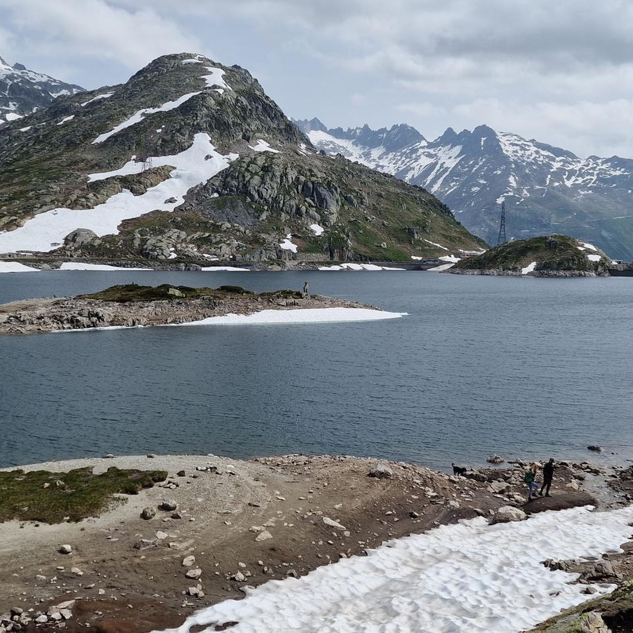
pretty here, very very pretty. It is worth a visit.
1
0

Well paved at least from Oberwald to Obergesteln. It allows you to bypass the tunnel safely (which is not forbidden to bikes AFAIK, but I got honked once by a Carpostal).
0
0
It was closed now, but there are restrooms nearby that will do the trick! No need to pay to use the restrooms at the Grimsel restaurant.
1
0
One of the most beautiful spots in Switzerland! No photo does it justice...
1
0

Since the tunnel on the Grimsel Pass road is only accessible by bike downhill, you'll have to take the old pass road. However, it's not a must, as the path, part of which is cobblestone, is much more beautiful and spectacular anyway.
2
0

In winter, you can hike comfortably and without traffic up to this famous curve. Scenes from the James Bond film with Sean Connery were shot here. Unfortunately, the memorial plaque is covered in winter. https://www.blick.ch/people-tv/kino/sean-connery-und-die-schweiz-der-furkapass-ging-mit-ihm-um-die-welt-id16172402.html
0
0


A very nice little place. About 90 minutes walk from Andermatt
0
0
Frequently Asked Questions
What kind of terrain can I expect on road cycling routes around Totesee?
Road cycling around Totesee primarily involves high-alpine landscapes, characterized by significant elevation changes and winding roads. You'll encounter challenging mountain passes, deep valleys, and scenic views of reservoirs, making it ideal for experienced road cyclists.
Are there road cycling routes suitable for beginners or families in Totesee?
While the Totesee region is known for its challenging high-alpine routes, there are some moderate options available. For instance, the Gletsch – Gletsch Chapel loop from Grimselpass is a moderate 7.6-mile route that offers beautiful views without extreme difficulty, which might be suitable for more experienced cycling families or beginners looking for a challenge.
How many road cycling routes are available in the Totesee area?
There are 13 road cycling routes available around Totesee. These include 5 moderate routes and 8 difficult routes, offering a range of challenges for different skill levels.
What are some notable landmarks or attractions I can see along the road cycling routes?
Many routes offer stunning views and pass by significant landmarks. You can expect to see the iconic Grimsel Pass, the serene Totensee (Grimsel Pass), and the Continental Divide Monument at Grimsel Pass. The Grimsel Hospiz and Lake Grimsel also offer picturesque stops.
Are there any circular road cycling routes around Totesee?
Yes, many of the routes around Totesee are designed as loops. Examples include the moderate Grimselsee – Grimsel Pass Reservoir loop from Gletsch, which takes you through high-alpine terrain with reservoir views, and the more challenging Old Grimsel Pass Road – Old Grimsel Pass Road Tunnel loop from Gletsch.
What is the typical elevation gain on road cycling routes in Totesee?
Given the high-alpine nature of the Totesee region, routes feature significant elevation gains. For example, the difficult Old Grimsel Pass Road – Old Grimsel Pass Road Tunnel loop from Gletsch involves nearly 2,000 meters of ascent, while the View of Grimsel Pass – James Bond Goldfinger Curve loop from Oberwald DFB climbs over 2,100 meters.
What do other road cyclists enjoy most about road cycling in Totesee?
The Totesee area is highly rated by the komoot community, with an average score of 4.7 stars from nearly 100 reviews. Cyclists often praise the challenging mountain passes, the breathtaking high-alpine scenery, and the well-maintained winding roads that offer a true test of endurance and reward with spectacular views.
What is the best time of year to go road cycling around Totesee?
Due to its high-alpine location, the best time for road cycling around Totesee is typically during the warmer months, from late spring to early autumn, when the mountain passes are clear of snow and weather conditions are more stable. Always check local weather and road conditions before planning your trip.
Are there any particularly long or challenging routes for advanced road cyclists?
Absolutely. Advanced road cyclists will find plenty of challenging options. The View of Grimsel Pass – James Bond Goldfinger Curve loop from Oberwald DFB is a difficult 76 km route with over 2,100 meters of elevation gain, offering a substantial challenge. Another demanding option is the Oberwald Village – Münster Airfield loop from Oberwald, covering nearly 67 km.
Is public transport available to access road cycling routes in Totesee?
The Totesee region, particularly areas like Gletsch and Oberwald, are generally accessible by public transport, often via post buses or trains depending on the specific starting point. These services can help you reach the beginning of many road cycling routes, especially those traversing the major passes. It's advisable to check local transport schedules for specific connections.
Where can I find parking for road cycling around Totesee?
Parking is typically available in the villages and at major pass crossings that serve as starting points for routes, such as Gletsch or Oberwald. Given the popularity of the area for outdoor activities, designated parking areas are usually provided, though they can fill up during peak season. Always look for official parking signs.
Most popular routes around Totesee
Most popular attractions around Totesee

Get inspired with the komoot mobile app


Explore more
Browse the best Road cycling routes in other regions.
