The best mountain hikes around Fälensee
4.8
(147)
1,260
hikers
66
hikes
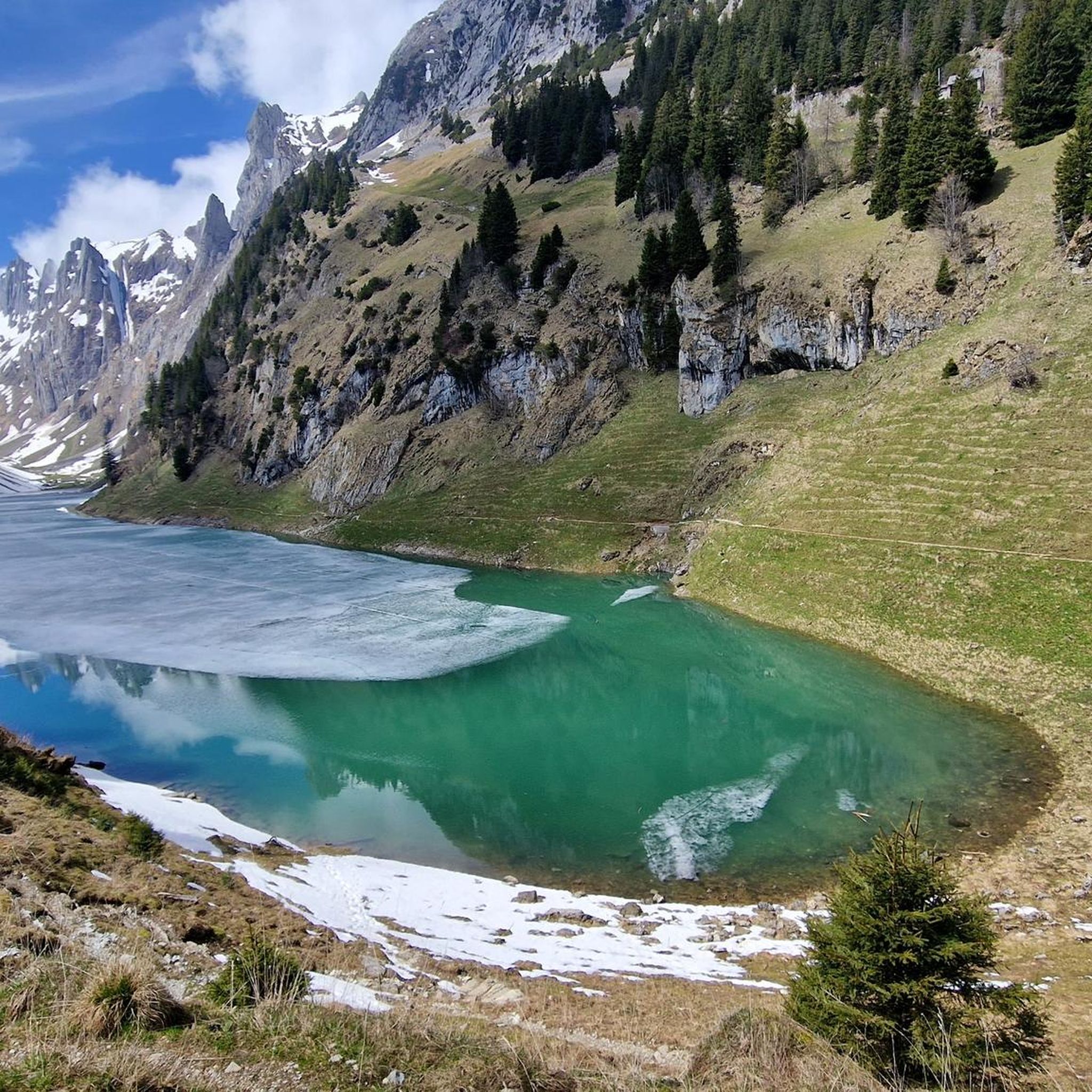
Mountaineering routes around Fälensee offer diverse terrain within the Appenzell Innerrhoden region. The area is characterized by alpine landscapes, including prominent peaks and deep valleys, with Fälensee itself being a notable mountain lake. The routes often feature significant elevation changes and rocky sections, typical of alpine environments. This region provides a range of challenges for mountaineers, from moderate ascents to difficult, sustained climbs.
Best mountaineering routes around Fälensee
- The most popular mountaineering route is Path to Saxerlücke – Saxer Lücke loop from Burgruine Hohensax, a 6.3 miles (10.1 km) trail that takes about 5 hours 16 minutes to complete. This difficult route features over 3,494 feet (1,065 m) of elevation gain.
- Another top favourite among local mountaineers is Saxer Lücke – Staubern Mountain Inn loop from Burgruine Hohensax, a difficult 9.5 miles (15.3 km) path. This route includes substantial climbs and offers expansive alpine views.
- Local mountaineers also love the Aescher Mountain Inn – Seealpsee loop from Wasserauen, a 9.3 miles (14.9 km) trail leading through varied mountain terrain, often completed in about 6 hours 18 minutes.
- Mountaineering around Fälensee is defined by alpine ascents, rocky ridges, and mountain lake views. The network offers options for different ability levels, with a majority of difficult routes.
- The routes in Fälensee are highly rated by the komoot community with an average score of 4.8 stars from over 170 reviews. More than 1,500 mountaineers have used komoot to explore Fälensee's varied terrain.
Last updated: October 10, 2026
5.0
(6)
50
hikers
8.68km
05:08
940m
940m
Hard mountaineering route. Very good fitness required. Sure-footedness, sturdy shoes and alpine experience required.
5.0
(1)
14
hikers
15.3km
07:35
1,220m
1,220m
Hard mountaineering route. Very good fitness required. Sure-footedness, sturdy shoes and alpine experience required.

5.0
(1)
11
hikers
11.9km
07:10
1,300m
1,300m
Hard mountaineering route. Very good fitness required. Sure-footedness, sturdy shoes and alpine experience required.
8
hikers
10.6km
06:28
1,040m
1,040m
Hard mountaineering route. Very good fitness required. Sure-footedness, sturdy shoes and alpine experience required.
5.0
(12)
61
hikers
16.3km
07:41
1,150m
1,150m
Hard mountaineering route. Very good fitness required. Sure-footedness, sturdy shoes and alpine experience required.
Get access to more routes and recommendations from other explorers.
Already have an account?
Our route recommendations are based on thousands of hikes, rides, and runs completed by other people on komoot.
Start today with a free account
Your next adventure awaits.
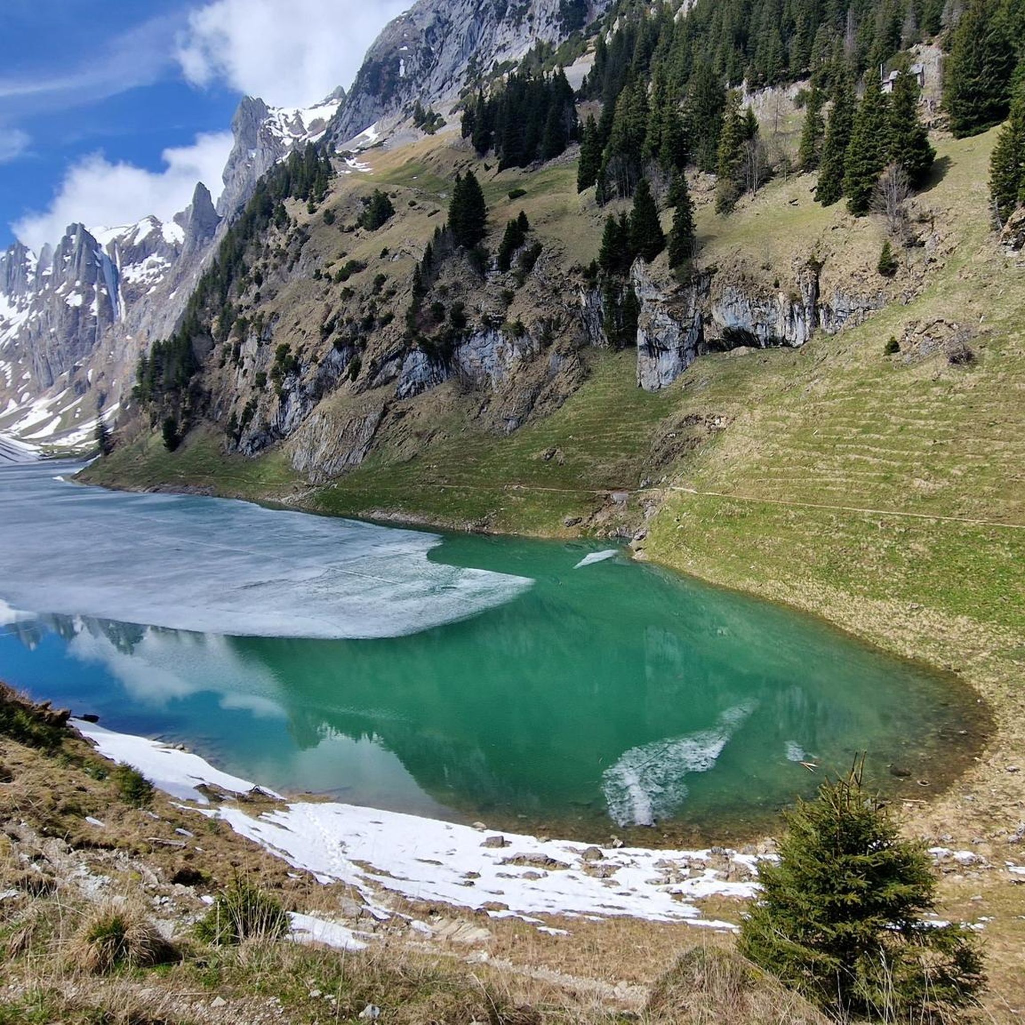
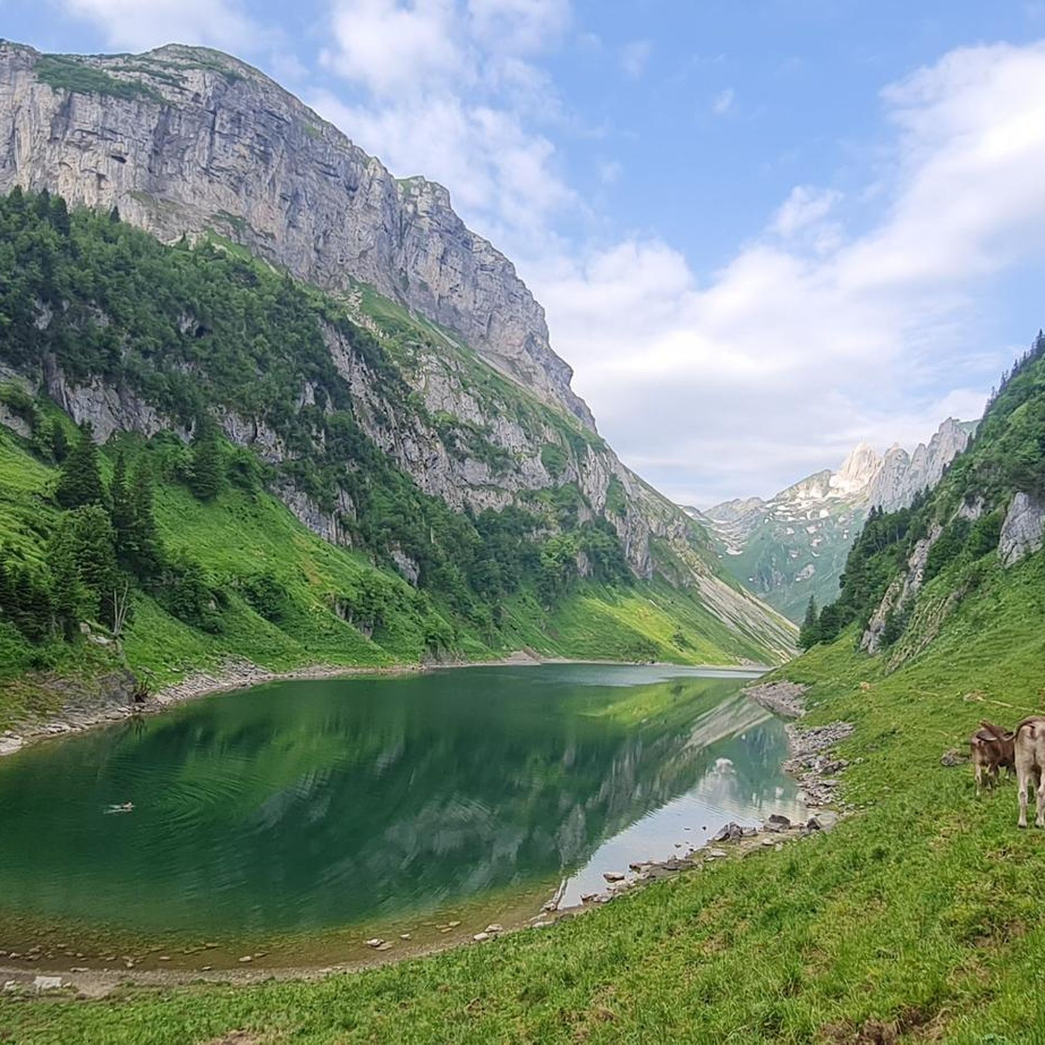
Tips from the Community

The Saxer Lücke (approx. 1,670 m above sea level) is a striking rocky notch in the Alpstein between the cantons of Appenzell Innerrhoden and St. Gallen. It is one of the best-known viewpoints in Eastern Switzerland and offers a spectacular view of the jagged rock peaks, the Rhine Valley, and the Vorarlberg Alps. The Saxer Lücke is accessible via well-maintained mountain hiking trails, including from the Staubern mountain inn or from Frümsel. The traverse between Staubern and Hohen Kasten is particularly popular. In summer, the impressive landscape and alpine flora are a draw, while in autumn, seas of fog in the Rhine Valley often create unforgettable panoramas.
6
1

The passage of the Roslen-Saxer First saddle is something very special. It resembles a high plateau more than anything. At an altitude of 2150 meters, you walk through an endless meadow of flowers and are almost overwhelmed by the mighty panorama of the karst neighbors. As gentle and peaceful as the walk on the saddle is, the descent through blueberry bushes and mountain pines down to the Saxer Lücke is all the steeper. For me, a secret tip where you are completely alone.
0
0

Beautiful imposing path with a magnificent view of the Saaxer Lücke and the Reitergrad and surrounding geology. Surefootedness required. Acrophobia is essential here.
0
0


Good view of the Saxerlücke...
6
0
The Roselnalp Hut is located at 1767 m. It is a sheep pasture.
7
0
Varied path, through the forest, over alpine meadows, a few steps at the end that lead steeply uphill.
7
0
The Roselnalphütte is located at 1767m.
5
0
Frequently Asked Questions
What is the general difficulty level of mountaineering routes around Fälensee?
The mountaineering routes around Fälensee are predominantly challenging. Out of 71 available routes, 54 are classified as difficult, with 16 moderate and only 1 easy option. This region is known for significant elevation changes and rocky sections, typical of alpine environments.
Are there any beginner-friendly mountaineering routes near Fälensee?
While most routes around Fälensee are difficult, there is at least one easy mountaineering route available. For beginners, it's advisable to seek out guided tours or stick to the less demanding paths to safely enjoy the alpine scenery.
How long do mountaineering routes around Fälensee typically take to complete?
The duration of mountaineering routes varies significantly. For example, the Path to Saxerlücke – Saxer Lücke loop from Burgruine Hohensax takes approximately 5 hours 16 minutes, while the Marwees Ridge Trail – Seealpsee loop from Wasserauen can take over 7 hours 30 minutes due to its length and elevation.
Are there family-friendly options for exploring the Fälensee area?
While the mountaineering routes themselves are largely difficult, families might find the surrounding Appenzell Innerrhoden region offers more accessible trails for hiking. For mountaineering specifically, it's crucial to assess the difficulty and duration carefully, as most routes involve significant climbs and rocky terrain. Look for the single easy route or shorter, less strenuous sections of moderate trails.
Can I bring my dog on the mountaineering trails around Fälensee?
Many trails in the Swiss Alps, including those around Fälensee, are generally dog-friendly, provided dogs are kept on a leash, especially in areas with livestock or wildlife. However, given the difficult and rocky nature of many mountaineering routes here, ensure your dog is fit and accustomed to such terrain. Always carry enough water for both yourself and your pet.
What is the best time of year for mountaineering in Fälensee?
The best time for mountaineering around Fälensee is typically from late spring (June) through early autumn (September/October). During these months, snow has usually melted from higher elevations, and weather conditions are more stable. Always check local weather forecasts and trail conditions before heading out, as alpine weather can change rapidly.
Are there any circular mountaineering routes in the Fälensee area?
Yes, there are several circular routes available. A popular option is the Saxer Lücke – Staubern Mountain Inn loop from Burgruine Hohensax, which offers expansive alpine views. Another is the Aescher Mountain Inn – Seealpsee loop from Wasserauen, leading through varied mountain terrain.
Where can I park when planning a mountaineering trip to Fälensee?
Parking availability depends on your chosen starting point. For routes originating from Burgruine Hohensax, you would typically look for parking in nearby villages or designated trailheads. For routes starting near Wasserauen, there are usually parking facilities available, often for a fee, serving the cable car and hiking routes in that area. Always plan your parking in advance.
What do other mountaineers enjoy most about the Fälensee region?
The Fälensee region is highly rated by the komoot community, with an average score of 4.8 stars from over 170 reviews. Mountaineers often praise the stunning alpine landscapes, the challenging yet rewarding ascents, and the picturesque views of Fälensee itself. The diverse terrain, from rocky ridges to mountain lake vistas, is frequently highlighted.
Are there opportunities for wild swimming near the mountaineering routes?
Fälensee itself is a beautiful mountain lake, and while specific wild swimming spots along mountaineering routes aren't always explicitly marked, the lake offers opportunities for a refreshing dip. Always be mindful of water temperatures, which can be very cold, and respect local regulations regarding swimming in natural bodies of water.
Are there any mountain inns or cafes along the mountaineering routes for refreshments?
Yes, some routes pass by or near mountain inns where you can find refreshments. For instance, the Seealpsee – Aescher Mountain Inn loop from Wasserauen suggests that the Aescher Mountain Inn is accessible, offering a chance to rest and refuel. It's always a good idea to check opening times, especially outside peak season.
What kind of weather conditions should I expect when mountaineering around Fälensee?
Fälensee is located in an alpine environment, meaning weather conditions can be highly variable and change rapidly. Expect cooler temperatures at higher elevations, even in summer, and be prepared for sudden shifts including rain, fog, or even snow. Always carry appropriate layers, waterproof gear, and check a reliable mountain weather forecast before and during your trip.
Most popular routes around Fälensee

Get inspired with the komoot mobile app


Explore more
Browse the best Mountain Hikes & Routes in other regions.
