The best road cycling routes around Lake del Sambuco
4.7
(132)
10,293
riders
24
rides
Road cycling around Lake del Sambuco, located in the Distretto di Vallemaggia, is characterized by alpine landscapes, challenging climbs, and scenic dam crossings. The region features varied terrain, from valley roads to mountain passes, offering diverse experiences for road cyclists. Routes often include significant elevation gains, winding through valleys and past natural features like gorges and waterfalls. The area provides a setting for road cycling with a focus on elevation and natural beauty.
Best road cycling routes around Lake del…
Last updated: May 23, 2026
4.5
(2)
7
riders
16.6km
01:04
500m
500m
Moderate road ride. Good fitness required. Mostly well-paved surfaces and easy to ride.
5.0
(1)
23
riders
33.7km
02:28
1,260m
1,260m
Hard road ride. Very good fitness required. Some segments of this route may be unpaved and difficult to ride.

Sign up for free
5.0
(1)
10
riders
40.0km
02:13
850m
860m
Moderate road ride. Good fitness required. Mostly well-paved surfaces and easy to ride.
4.0
(1)
7
riders
13.8km
00:37
110m
110m
Easy road ride. Great for any fitness level. Mostly well-paved surfaces and easy to ride.
4.9
(82)
7,114
riders
99.1km
06:46
3,050m
3,050m
Hard road ride. Very good fitness required. Mostly well-paved surfaces and easy to ride.
Get access to more routes and recommendations from other explorers.
Sign up for free
Already have an account?
Our route recommendations are based on thousands of hikes, rides, and runs completed by other people on komoot.
Start today with a free account
Your next adventure awaits.
Login or Signup

Tips from the Community

The Furka Pass is a 2,429 m high Swiss road pass in the Alps. It connects the Urseren Valley (the upper valley of the Reuss River) in the canton of Uri with the Goms district in the canton of Valais. It straddles the European watershed between the Mediterranean Sea and the North Sea. Source: Furka Pass – Wikipedia https://share.google/zJGI3KsPRtARfpYje
6
0

St. Gotthard Pass The Gotthard Pass divides waterways and connects various cultural and linguistic areas. Its significance as an "Alpine transversal" began at the beginning of the 13th century with the construction of the legendary Devil's Bridge in the Schöllenen Gorge. For many centuries, trade caravans (trading cattle and cheese for grain, wine, rice, and salt), mercenaries, messengers, and even entire armies crossed the pass. Between 1818 and 1836, the canton of Uri, with the help of other cantons, expanded the pass road, thus achieving its predominance among Swiss Alpine passes. The Gotthard Pass has significantly shaped the economy and culture of Central Switzerland for centuries. Until the opening of the Gotthard Railway in 1882, the Gotthard Pass was also used in winter. Dozens of roadmen and shovel workers were employed for this purpose. In 1922, the post bus replaced the stagecoach, and with the introduction of gasoline duties in 1923, the expansion of the pass roads began, continuing to this day. The old pass road on the south side, the Tremola between the top of the pass and Airolo, is still preserved and passable. This stretch of road recalls more tranquil journeys over the Gotthard that occurred not so long ago. In the 19th and 20th centuries, the Gotthard Pass was "condensed" into a myth, a symbol of Switzerland's independence, unity, and identity. Text / Source: Interest Group for Alpine Passes IAP, PO Box 11, 6491 Realp https://alpen-paesse.ch/de/alpenpaesse/gotthardpass
15
1

Absolutely heartbreaking to see the damage that had torn through the village here. I found an article that covers the event leading up to this ruin: https://www.theguardian.com/world/2025/aug/05/forest-gone-storm-that-moved-a-mountain-climate-crisis-environment
1
0


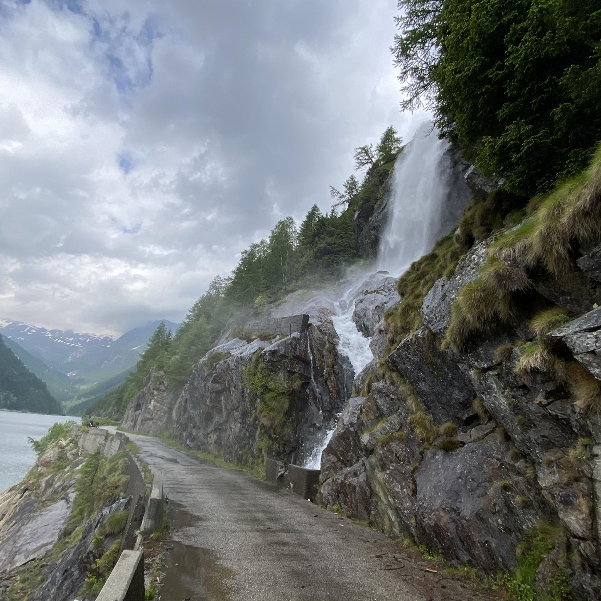
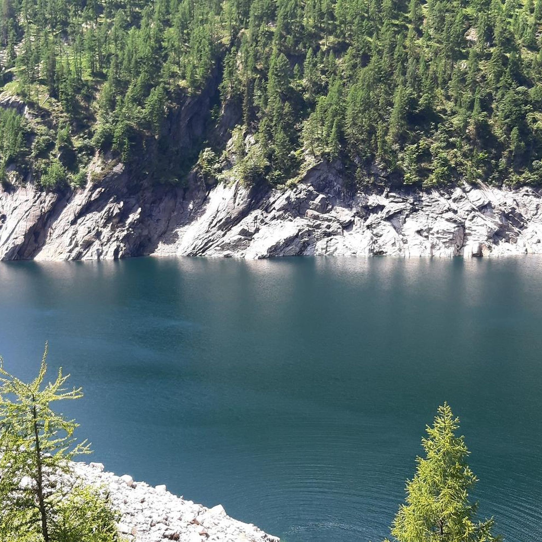
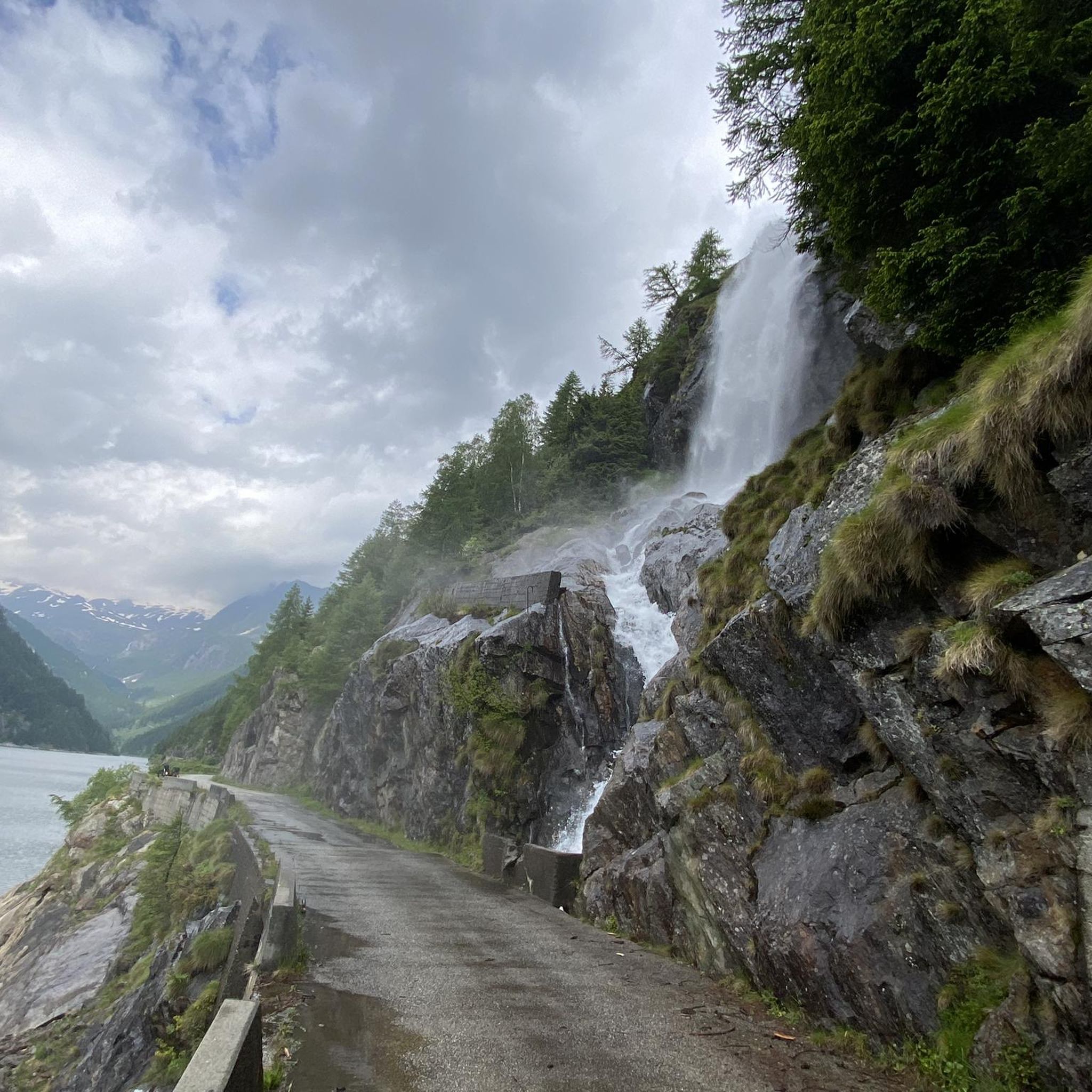
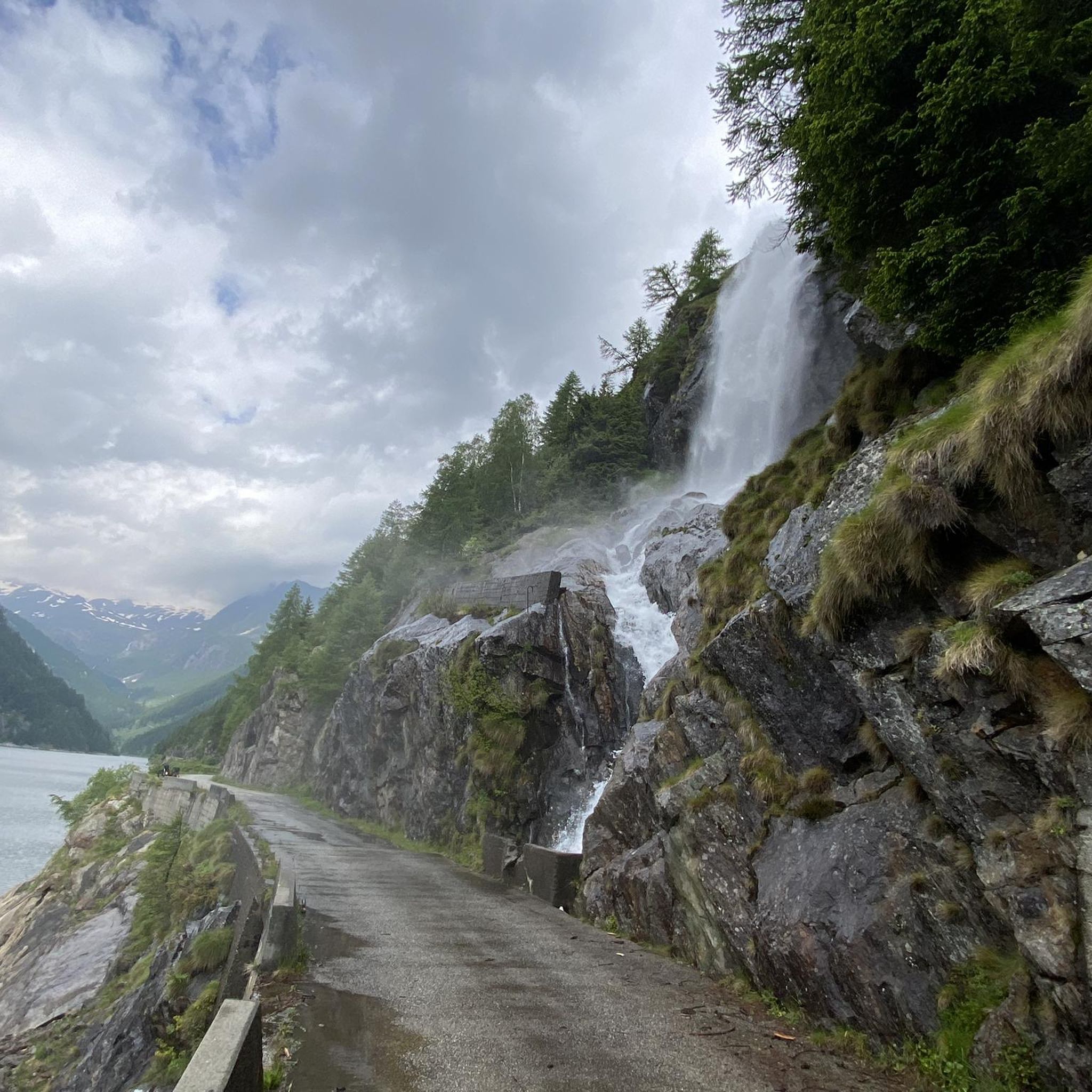
As others have already said: It's tough, steep, and beautiful here! It's best to split the climb into shorter stages, so the 2,000 meters of elevation gain over 30 kilometers from Bignasco aren't quite as terrifyingly daunting. From Bignasco to Prato Sornico, it's rarely very steep. There are a few flat sections where you can pick up a decent pace. After Mogno (visit the church in Botta) and up to Fusio, things really get going for the first time. Many hairpin bends soften the incredibly nasty ramps, but your legs will still be tested here! Up to the Sambucco reservoir, it becomes truly idyllic, green, and quiet. There are a few tough climbs, but even here, the difficulty is still manageable. There's a fountain at the summer restaurant: fill up your bidons again, because there are only streams and gullies here. After the relaxing flat section by the lake, the final and most strenuous part of the climb follows. The scenery is stunning, but it's steep all the way to the top! Wow!
1
0


very pretty here, very pretty
2
0
There are few places to stop for refreshments in Val Bavona, which is why La Froda in Foroglio is usually very busy. The view of the waterfall from the terrace is unique.
0
0
Frequently Asked Questions
What kind of terrain can I expect when road cycling around Lake del Sambuco?
The region around Lake del Sambuco offers varied terrain, from valley roads to challenging mountain passes. You'll encounter significant ascents and descents, with many roads being paved and experiencing little traffic. The landscape transitions from riverine gorges to alpine scenery as you gain elevation, providing a diverse and visually stunning backdrop for your ride.
How many road cycling routes are available in the Lake del Sambuco area?
There are over 20 road cycling routes available around Lake del Sambuco, catering to various skill levels. This includes 3 easy routes, 9 moderate routes, and 12 difficult routes, ensuring options for every road cyclist.
Are there any easy road cycling routes suitable for beginners or a more relaxed ride?
Yes, for an easier ride, consider the Supermarket – Piottino Gorge loop from Piotta. This 13.8 km route leads through the scenic Piottino Gorge and is often completed in about 37 minutes, offering a less strenuous option.
What are some challenging road cycling routes for experienced riders?
Experienced riders seeking a challenge will find several demanding routes. The Lago del Narèt Climb is a difficult 33.7 km path known for its substantial elevation gain. Another epic option is the multi-pass Gotthard, Furka and Nufenen passes route, covering nearly 100 km with over 3,000 meters of ascent.
What natural features or landmarks can I see along the road cycling routes?
The region is rich in natural beauty. You can expect to see impressive gorges carved by the Maggia River, such as at Ponte Brolla, and numerous waterfalls, including the dramatic Foroglio Waterfall. As you ascend, you'll be treated to spectacular alpine scenery, rugged peaks, and serene mountain lakes, especially around the Sambuco dam itself. Traditional villages like Fusio and Cevio also offer cultural points of interest.
When is the best time of year to go road cycling around Lake del Sambuco?
Thanks to the mild climate in the lower parts of the Vallemaggia, road cycling is often possible throughout the year. However, for routes involving higher alpine passes and Lake del Sambuco itself, the warmer months from late spring to early autumn generally offer the most favorable conditions, avoiding snow and ice.
Are there any circular road cycling routes in the area?
Yes, many routes are designed as loops. For example, the Fusio – Sambuco Dam loop from Fusio is a popular moderate route that takes you to the Sambuco Dam and back. Another option is the Broglio – Foroglio Waterfall loop from Lavizzara, a moderate 40 km ride.
What do other road cyclists think about the routes around Lake del Sambuco?
The road cycling routes around Lake del Sambuco are highly regarded by the komoot community, holding an average rating of 4.7 stars from over 130 reviews. Cyclists frequently praise the challenging climbs, breathtaking vistas, and the quiet, well-maintained paved roads that allow for an immersive experience in the stunning natural surroundings.
Are there places to eat or get refreshments along the routes?
Yes, the Vallemaggia valley is dotted with traditional 'grottos' – local rural restaurants – which provide excellent opportunities for refreshments and to sample local cuisine. Many charming villages along the routes, such as Fusio, Mogno, and Cevio, also offer amenities.
Is it possible to reach the cycling routes using public transport?
While specific public transport details for every starting point are not provided, the Vallemaggia region generally has public transport connections to its villages. It's advisable to check local bus schedules to plan your access to the desired starting points for the routes.
What kind of views can I expect on a road cycling tour to Lake del Sambuco?
The journey to Lake del Sambuco offers spectacular views. You'll experience dramatic landscapes, from the impressive gorges of the Maggia River in the lower valley to the serene, rugged alpine scenery as you ascend. The area around the Sambuco dam itself provides stunning panoramic vistas of the surrounding mountains and the tranquil lake.
Most popular routes around Lake del Sambuco

Get inspired with the komoot mobile app


Explore more
Browse the best Road cycling routes in other regions.
