The best walks and hikes around Göscheneralpsee
4.7
(1271)
11,356
hikers
115
hikes
Hiking around Göscheneralpsee offers a diverse alpine landscape centered around a prominent reservoir in the Uri canton. The region is characterized by high mountain peaks, glacial valleys, and the Göscheneralpsee itself, which is fed by meltwater. Trails often traverse rocky terrain, alpine meadows, and areas with distinct flora and fauna, providing varied elevation changes suitable for different hiking experiences.
Best hiking trails around Göscheneralpsee
- The most popular hiking route is Lake Göscheneralp – Circular Hike around Göscheneralpsee loop from Göscheneralpsee, a 7.0 miles (11.3 km) trail that takes about 5 hours to complete. This moderate route offers continuous views of the lake and surrounding peaks.
- Another top favourite among local hikers is Bergsee Hut – Alpine moorland biotope loop from Göscheneralpsee, a moderate 4.3 miles (7.0 km) path. This trail leads through unique alpine moorland biotopes towards the Bergsee Hut, providing a blend of natural beauty and a mountain refuge experience.
- Local hikers also love the Trail Around Göscheneralpsee – Circular Hike around Göscheneralpsee loop from Göscheneralpsee, a 9.3 miles (15.0 km) trail leading through varied alpine terrain, often completed in about 8 hours. This difficult route offers a more challenging and extensive exploration of the lake's perimeter.
- Hiking around Göscheneralpsee is defined by its high alpine environment, the clear waters of the reservoir, and the rugged mountain scenery. The network of trails provides options for easy walks along the lake shore, moderate ascents to alpine huts, and challenging routes over higher passes.
- The routes in Göscheneralpsee are highly rated by the komoot community with an average score of 4.8 stars from over 1,000 reviews. More than 9,000 hikers have used komoot to explore Göscheneralpsee's varied terrain.
Last updated: September 27, 2026
4.8
(155)
1,070
hikers
Moderate hike. Good fitness required. Mostly accessible paths. Sure-footedness required.
4.8
(35)
408
hikers
6.99km
03:31
550m
550m
Moderate hike. Good fitness required. Mostly accessible paths. Sure-footedness required.

4.6
(13)
81
hikers
15.7km
08:05
1,000m
1,000m
Hard hike. Very good fitness required. Sure-footedness, sturdy shoes and alpine experience required.
4.9
(7)
79
hikers
Moderate hike. Good fitness required. Mostly accessible paths. Sure-footedness required.
5.0
(5)
70
hikers
Hard hike. Good fitness required. Sure-footedness, sturdy shoes and alpine experience required.
Get access to more routes and recommendations from other explorers.
Already have an account?
Our route recommendations are based on thousands of hikes, rides, and runs completed by other people on komoot.
Start today with a free account
Your next adventure awaits.

Tips from the Community

The Chelenalphütte SAC is a traditional hut located at 2,350 meters above sea level on a rocky terrace above the Chelenreuss Valley, beyond the Göscheneralpsee. It offers uninterrupted views of the surrounding granite peaks and the valley's glaciers. It can be reached in about 3.5 hours on foot from the Göscheneralp. The hut is an ideal starting point for summer hikes, climbing and combined alpine tours, such as the Sustenhorn, Gwächtenhorn and Tierberge. It is also a stop on the challenging "Five Huts Panorama Trail". There are several climbing parks in the vicinity of the hut.
1
0

Very nice alternative route from the Chelenalp hut to the glacier moraine, then along the river until you reach the mountain hiking trail towards the reservoir again. About 4 streams have to be crossed, which can be a bit icy depending on the weather (spring/autumn). In any case, we were glad we had our spikes.
0
0

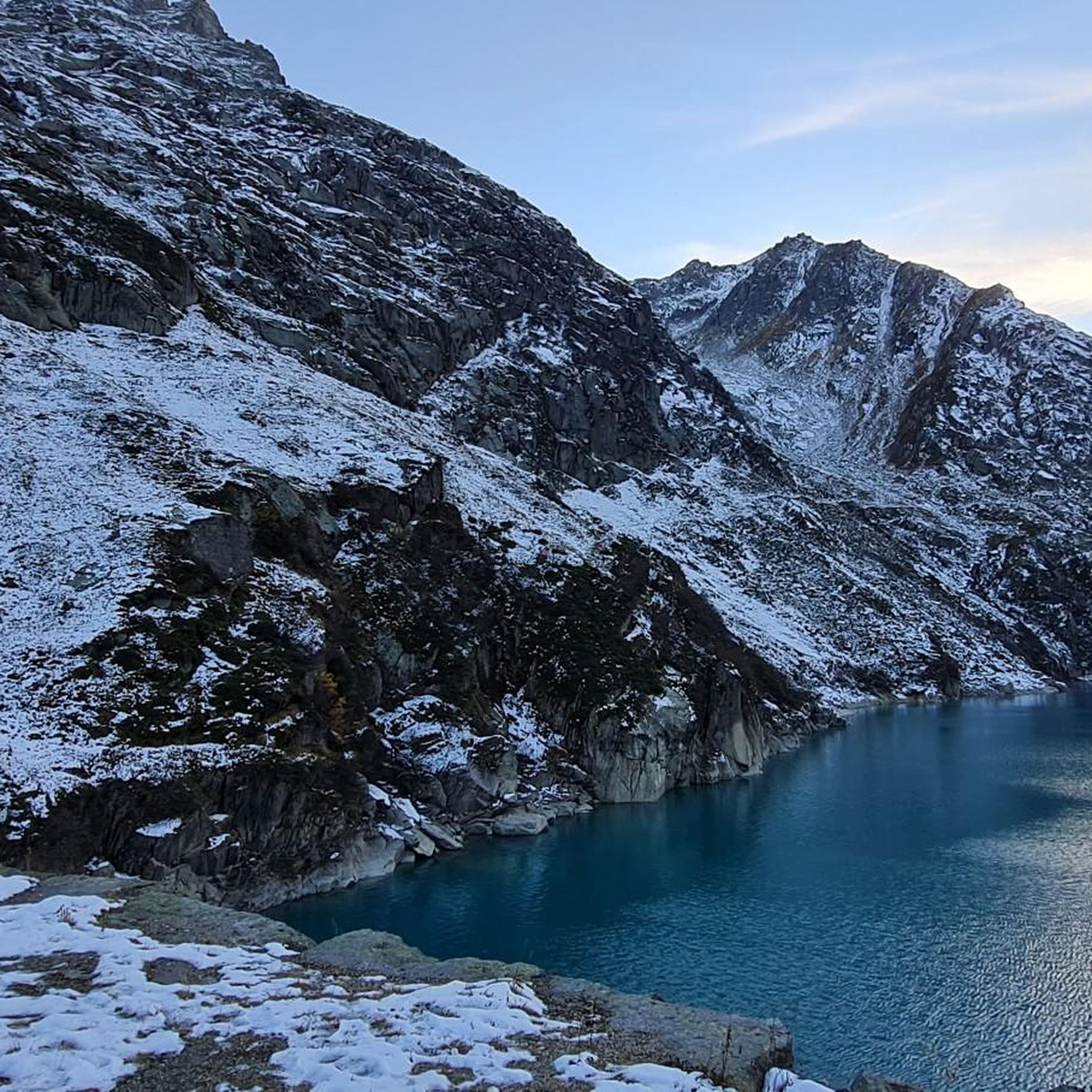
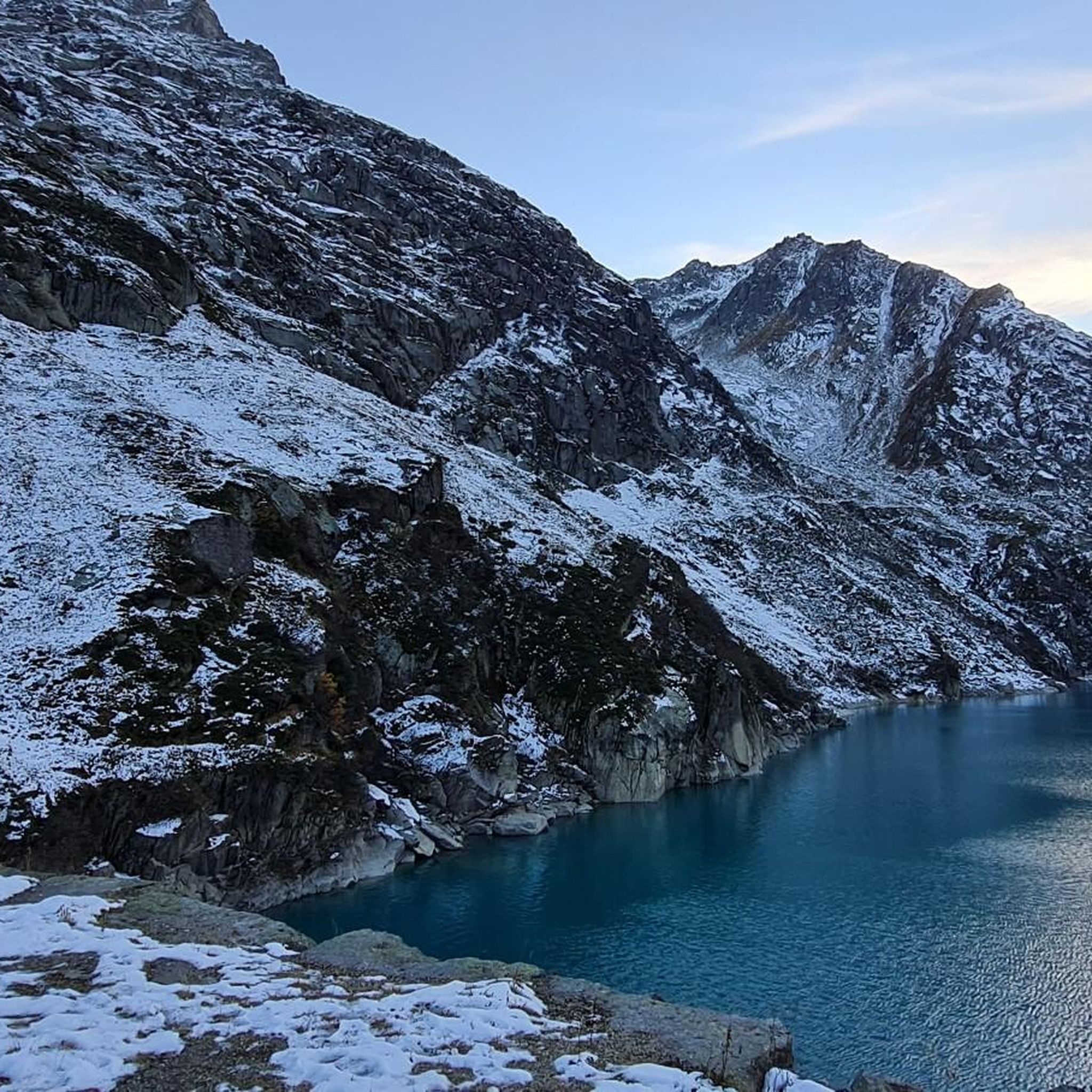
Very nice reservoir in the mountains with a great turquoise blue color🏞👍🐾Starting point for many hiking and mountain tours. It is very worthwhile to come here and enjoy!
0
0

The lake is dammed by a planted earth dam 155 meters high and 540 meters long. At its base the dam is 700 meters wide. A total of 9.3 million cubic meters of material was used. The dam can be visited. On this tour you take the funicular. The ride on the old winch railway is very adventurous and an experience.
1
0
The Göscheneralpsee lies at 1,792 meters and has a maximum depth of a good 100 meters. The lake's massive dam is considered the highest stone dam (a planted earth dam) in Switzerland. You can walk around the lake on a hike. While the front part is rather rocky, the back part is a moorland landscape.
2
0
Enjoy the impressive world of the Alps at the Dammagletscher mountain inn at 1,800 meters above sea level.
1
0

Good place for a reward after a tour.
1
0
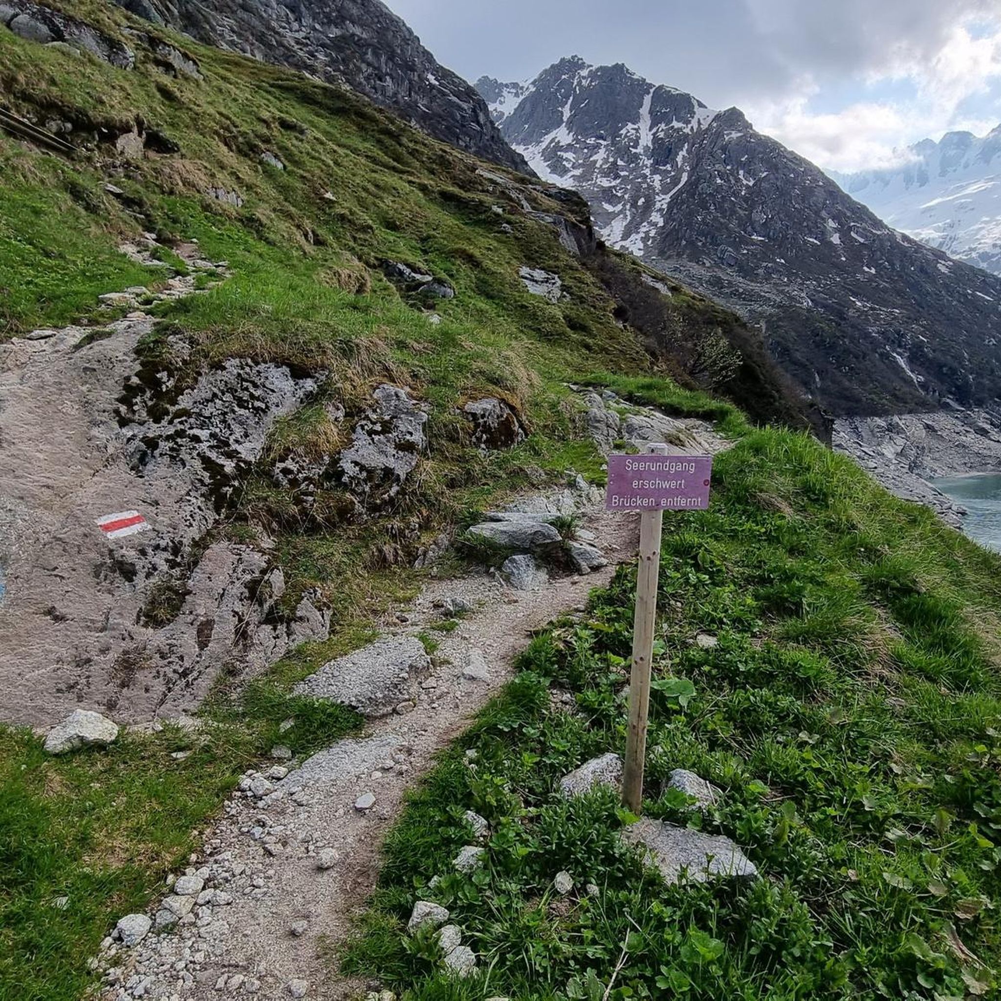
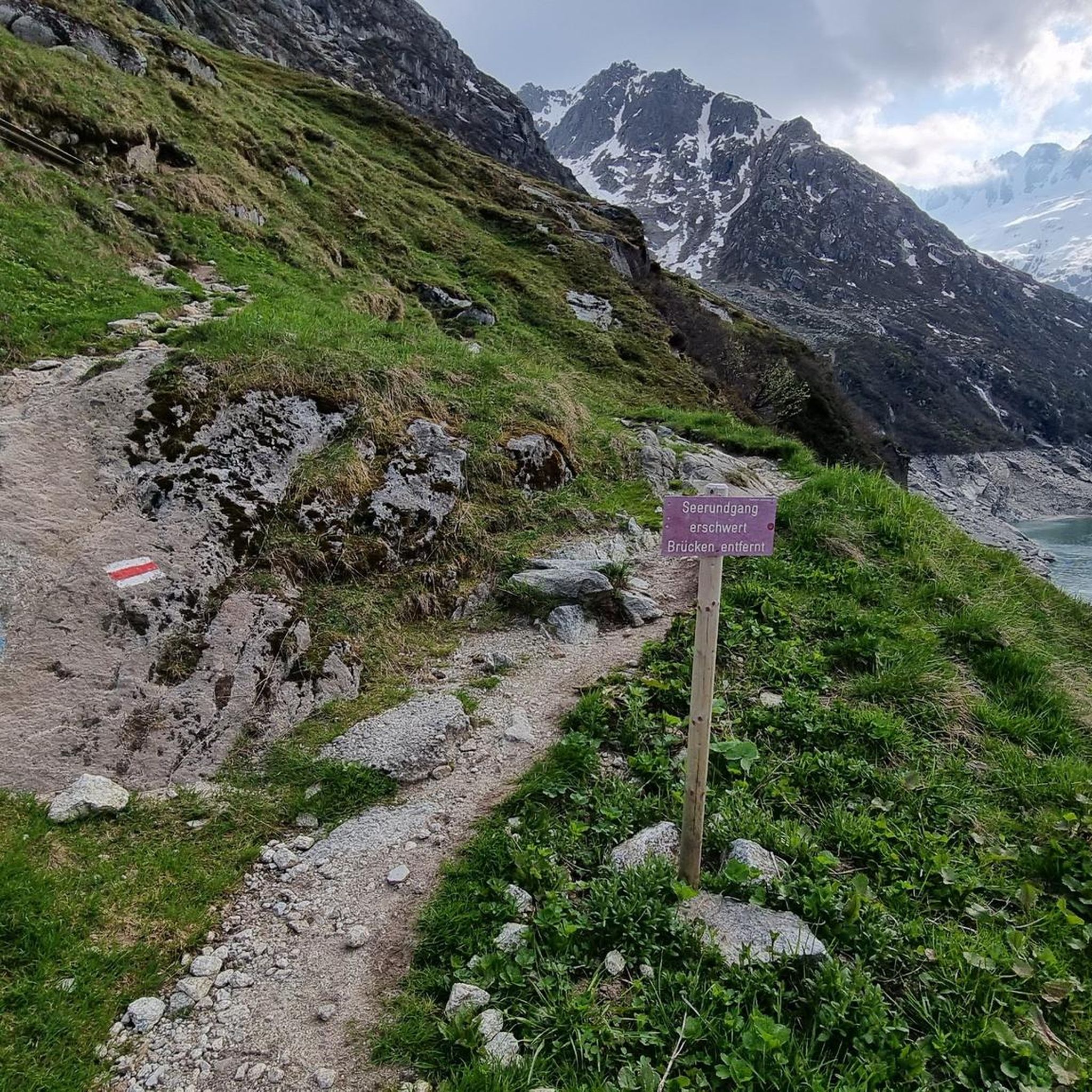
Beautiful path around the lake with dream views of everything the mountains have to offer.
1
0
Frequently Asked Questions
What is the best time of year to hike around Göscheneralpsee?
The hiking season around Göscheneralpsee typically runs from late spring to early autumn, roughly June to October. During these months, the trails are generally free of snow, and the weather is more stable, offering the best conditions for exploring the alpine landscape and enjoying the reservoir views. Always check local weather forecasts before heading out, as conditions can change rapidly in the mountains.
Are there any easy hiking trails suitable for beginners or families with children?
Yes, Göscheneralpsee offers several easier routes. While the region is known for its alpine terrain, there are 28 easy routes available. For a pleasant, less strenuous option, consider the area around the lake itself, which provides relatively flat sections. These trails are perfect for families or those looking for a gentle introduction to the area's beauty.
Can I bring my dog on the hiking trails around Göscheneralpsee?
Most trails around Göscheneralpsee are dog-friendly, but it's crucial to keep your dog on a leash, especially in areas with grazing livestock or protected wildlife. Always carry water for your pet and be prepared to clean up after them. Some areas might have specific restrictions, so look for local signage.
Are there any circular hiking routes around Göscheneralpsee?
Yes, circular routes are a popular way to experience the area. A well-regarded moderate option is the Alpine moorland biotope – Trail Around Göscheneralpsee loop from Göscheneralpsee. This 6.8 km (4.2 miles) trail offers diverse scenery without retracing your steps, providing a comprehensive experience of the alpine moorland and lake surroundings.
Where can I park my car when visiting Göscheneralpsee for hiking?
There are designated parking areas available near Göscheneralpsee, particularly close to the dam and the start of many popular trails. These spots are usually well-marked. During peak season, it's advisable to arrive early to secure a parking space, as the area can get busy.
What kind of natural attractions or landmarks can I expect to see on the trails?
The Göscheneralpsee region is rich in natural beauty. You'll encounter the stunning turquoise waters of the reservoir itself, surrounded by rugged high mountain peaks. Many trails traverse unique alpine moorland biotopes, offering insights into diverse flora and fauna. The area also features glacial valleys and impressive rock formations, characteristic of the Uri canton's alpine landscape.
Are there any mountain huts or places to stop for refreshments along the routes?
Yes, for those seeking a break or a meal, the Bergsee Hut is a notable stop. It's accessible via trails like the Bergsee Hut – Alpine moorland biotope loop from Göscheneralpsee. Mountain huts often provide food, drinks, and sometimes overnight accommodation, offering a traditional alpine experience. Always check their opening times in advance.
How many hiking trails are available in the Göscheneralpsee region?
The Göscheneralpsee region offers a wide variety of hiking experiences, with over 120 distinct hiking trails. These range from easy strolls along the lake to challenging high-alpine routes, ensuring there's something for every fitness level and preference.
What do other hikers say about their experience in Göscheneralpsee?
The Göscheneralpsee area is highly rated by the komoot community, with an impressive average score of 4.8 stars from over 1,000 reviews. Hikers frequently praise the breathtaking alpine scenery, the clear waters of the reservoir, and the well-maintained trails that offer diverse experiences from gentle walks to challenging ascents.
Are there any less crowded hiking options around Göscheneralpsee?
While the main circular routes around the lake can be popular, exploring some of the trails that venture slightly higher into the side valleys or towards less-frequented alpine biotopes can offer a more tranquil experience. Consider routes that lead away from the immediate lake shore for more solitude, especially during peak times.
What is the typical duration for a hike around Göscheneralpsee?
Hiking durations vary significantly depending on the chosen route and your pace. For example, a moderate trail like the Lake Göscheneralp – Circular Hike around Göscheneralpsee loop from Göscheneralpsee typically takes about 5 hours to complete. More challenging and longer routes, such as the Trail Around Göscheneralpsee – Circular Hike around Göscheneralpsee loop from Göscheneralpsee, can take up to 8 hours.
What should I wear for hiking in Göscheneralpsee, especially in summer?
Even in summer, alpine weather can be unpredictable. It's best to dress in layers, including moisture-wicking base layers, an insulating mid-layer, and a waterproof and windproof outer shell. Sturdy hiking boots with good ankle support are essential for the rocky and uneven terrain. Don't forget sun protection (hat, sunglasses, sunscreen) and plenty of water.
Most popular routes around Göscheneralpsee

Get inspired with the komoot mobile app


Explore more
Browse the best Hikes in other regions.
