The best walks and hikes around Embalse de la Serena
4.8
(5)
42
hikers
14
hikes
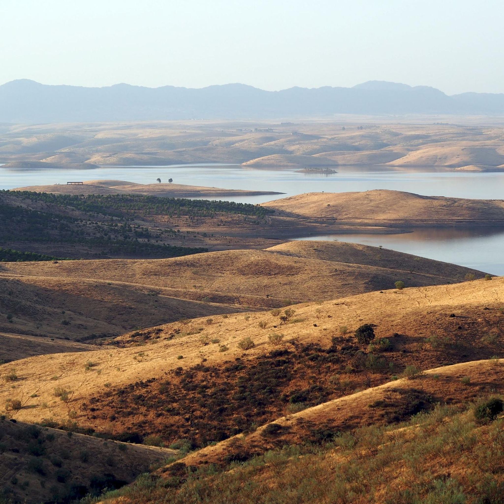
Hiking around Embalse de la Serena offers exploration of Spain's largest reservoir by surface area, situated within the La Siberia Biosphere Reserve. The region is characterized by its expansive natural environment, diverse landscapes, and significant ecological value. It features a vast water body with inland islands, rolling plains, and areas with holm oaks, cork oaks, heather, and juniper. Prominent natural features include the conical Cerro Masatrigo, which became a peninsula after the reservoir's construction.
Best hiking trails around Embalse de la Serena
- The most popular hiking route is Cerro Masatrigo Botanical Trail (SL-BA 198), a 2.9 miles (4.6 km) trail that takes 1 hour 26 minutes to complete. This route offers panoramic views of the reservoir and the distinctive Cerro Masatrigo.
- Another top favourite among local hikers is Peñón del Pez Trail, a difficult 10.6 miles (17.1 km) path. This trail provides panoramic views and diverse landscapes, including substantial elevation gains.
- Local hikers also love the Cerro Masatrigo loop from Monumento natural Cerro Masatrigo, a 1.3 miles (2.1 km) trail leading through the area surrounding the unique conical hill, often completed in about 45 minutes.
- Hiking around Embalse de la Serena is defined by its vast reservoir, undulating terrain, and unique geological formations, alongside rolling plains and characteristic vegetation. The network offers options for different ability levels, from easy paths to more challenging routes.
- The routes in Embalse de la Serena are highly rated by the komoot community with an average score of 4.8 stars from more than 10 reviews. More than 40 hikers have used komoot to explore Embalse de la Serena's varied terrain.
Last updated: May 10, 2026
14
hikers
4.59km
01:26
130m
130m
Hard hike. Great for any fitness level. Sure-footedness, sturdy shoes and alpine experience required.
1
hikers
21.7km
06:23
590m
580m
Hard hike. Very good fitness required. Easily-accessible paths. Suitable for all skill levels.

Sign up for free
17.1km
05:19
600m
600m
Hard hike. Very good fitness required. Easily-accessible paths. Suitable for all skill levels.
4.10km
01:16
160m
160m
Easy hike. Great for any fitness level. Easily-accessible paths. Suitable for all skill levels.
5.0
(2)
11
hikers
Moderate hike. Great for any fitness level. Mostly accessible paths. Sure-footedness required.
Get access to more routes and recommendations from other explorers.
Sign up for free
Already have an account?
Our route recommendations are based on thousands of hikes, rides, and runs completed by other people on komoot.
Start today with a free account
Your next adventure awaits.
Login or Signup


Tips from the Community

Peñón del Pez is a rock formation located in the town of Capilla, in the province of Badajoz. This rock is known for its impressive landscape and rich biodiversity, which includes species such as vultures, Bonelli's eagles, black storks and peregrine falcons.
7
0
Cerro Masatrigo is a hill located in the municipality of Esparragosa de Lares. This hill is known for its almost perfect conical shape, which has earned it the nickname "the magic mountain" It rises 501 meters above sea level and 161 meters above the surrounding terrain. After the construction of the La Serena Dam, Cerro Masatrigo became a peninsula surrounded by the waters of the reservoir.
7
0

Today, the castle is not only not in ruins (it has been restored), but for me it is one of the best preserved in the area, and can be visited. In the mornings it is open for a few hours, it has a well-preserved cistern that is interesting to see, the views, especially with the reservoir full of water, are spectacular.
0
0

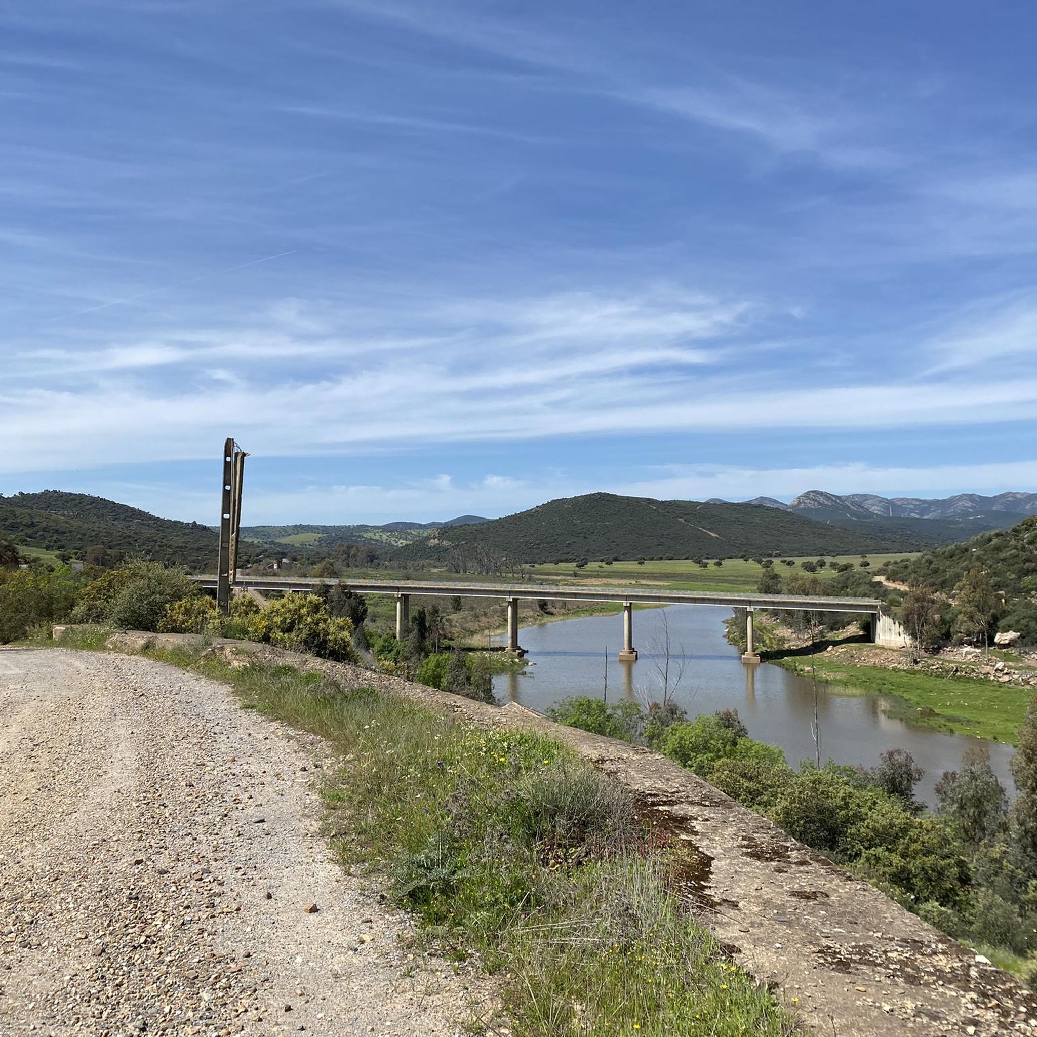
A unique beach on the shores of the Serena reservoir with an old bridge submerged when the water level in the reservoir is law. You can literally walk on water.
1
1
Spectacular views from the Peñón del Pez hiking trails towards Peñalsordo in the valley below and La Torreta peak beyond.
1
1
Spectacular view of Capilla from the walk to the castle above the town. On a clear day you can see it for miles.
1
0
Zarza-Capilla is a small town in the La Serena valley. One of the most interesting monuments in the town is the 16th century Church of Saint Bartholomew.
1
1
The peak of Las Poyatas sits above the town of Zarza-Capilla. Incredible panoramic views of the valley.
1
0
Frequently Asked Questions
How many hiking trails are there in Embalse de la Serena?
There are over 10 hiking routes available around Embalse de la Serena, offering a variety of experiences for different skill levels. The komoot community has explored 14 distinct tours in the area.
What kind of terrain can I expect on hikes around Embalse de la Serena?
The terrain around Embalse de la Serena is characterized by a vast reservoir, undulating landscapes, and unique geological formations. You'll find rolling plains, grasslands, and areas with characteristic vegetation such as holm oaks, cork oaks, heather, and juniper. Some trails, like the Peñón del Pez Trail, include substantial elevation gains.
What natural features or landmarks can I see while hiking around Embalse de la Serena?
Hikers can explore several notable features. The iconic Masatrigo Mountain, often called 'the magic mountain' due to its conical shape, is a prominent landmark. You can also see the impressive La Serena Dam and the Zújar River, which forms a natural border. The sheer size of the reservoir itself, with its inland islands, creates a unique and visually striking landscape.
Are there circular walks available in Embalse de la Serena?
Yes, there are several circular routes. A popular option is the Cerro Masatrigo loop from Monumento natural Cerro Masatrigo, which is a 1.3-mile (2.1 km) trail. Another longer circular option is the Sierra de Las Poyatas Circular Trail.
What do other hikers enjoy about the trails in Embalse de la Serena?
The trails in Embalse de la Serena are highly rated by the komoot community, with an average score of 4.8 stars from over 10 reviews. Hikers often praise the breathtaking panoramic views, the serene atmosphere, and the unique combination of the vast reservoir with the surrounding undulating terrain and geological formations.
Are there family-friendly hiking options in Embalse de la Serena?
While specific 'family-friendly' designations are not always explicit, the area offers a range of difficulty levels. There are 4 easy routes that could be suitable for families, such as the Peñón de Pez Trail, which is 2.6 miles (4.1 km) long with moderate elevation.
Can I hike with my dog in Embalse de la Serena?
Embalse de la Serena is a natural area, and generally, dogs are permitted on trails. However, it's always recommended to keep your dog on a leash, especially given the rich biodiversity and the presence of wildlife. Be mindful of local regulations and other hikers.
What kind of wildlife or biodiversity can I observe while hiking?
Embalse de la Serena is a Special Protection Area for Birds (SPA), making it excellent for birdwatching, particularly for aquatic birds and birds of prey. You might also spot wildlife such as the Great Bustard, Black Stork, otters, and mongooses within the diverse natural environment.
What is the best time to visit Embalse de la Serena for hiking?
The best time to visit for hiking generally depends on personal preference for weather. Spring and autumn offer milder temperatures, which are ideal for longer hikes. Summers can be very hot, so early mornings or late afternoons are preferable if hiking during this season. Winters are generally mild but can be cooler and wetter.
Where can I find parking for hiking trails around Embalse de la Serena?
Parking availability varies by trailhead. For popular spots like Cerro Masatrigo, there are often designated areas near the starting points of trails such as the Cerro Masatrigo Botanical Trail (SL-BA 198). It's advisable to check specific route details on komoot for parking information related to your chosen hike.
Are there any long-distance hiking options in the area?
Yes, for those seeking a longer challenge, routes like the Sierra de Las Poyatas Circular Trail cover over 13 miles (21 km) and involve significant elevation changes, providing a more extensive hiking experience.
Most popular routes around Embalse de la Serena
Most popular attractions around Embalse de la Serena

Get inspired with the komoot mobile app


Explore more
Browse the best Hikes in other regions.
