The best walks and hikes in the Cariboo Mountains
4.4
(1105)
8,357
hikers
37
hikes
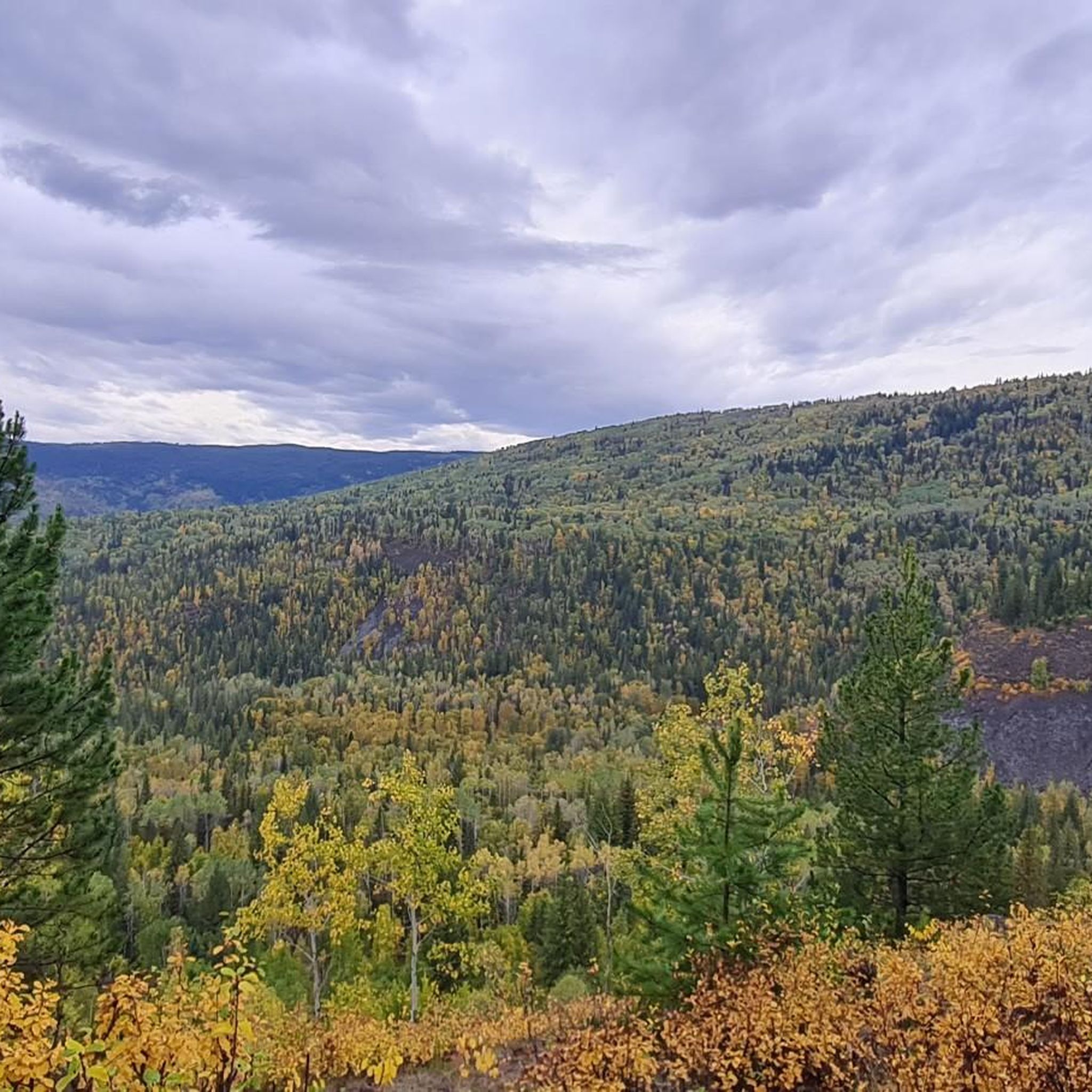
Hiking in the Cariboo Mountains, British Columbia, offers a wilderness experience characterized by diverse and dramatic landscapes. The region features high, serrated peaks and glaciers reaching up to 10,000 feet (3,000 meters), alongside beautiful alpine meadows and vast subalpine forests. Valleys are home to ancient cedar and hemlock forests, with numerous lakes and unique limestone karsts adding to the varied terrain.
Best hiking trails in the Cariboo Mountains
- The most popular hiking route is Moul Falls – View from Moul…
Last updated: September 29, 2026
4.8
(174)
1,171
hikers
7.94km
02:06
70m
70m
Moderate hike. Good fitness required. Easily-accessible paths. Suitable for all skill levels.
4.6
(22)
204
hikers
1.26km
00:25
60m
60m
Easy hike. Great for any fitness level. Easily-accessible paths. Suitable for all skill levels.

4.8
(215)
1,982
hikers
5.25km
01:27
100m
100m
Easy hike. Great for any fitness level. Easily-accessible paths. Suitable for all skill levels.
3.6
(5)
46
hikers
11.7km
03:21
270m
270m
Moderate hike. Good fitness required. Easily-accessible paths. Suitable for all skill levels.
4
hikers
2.39km
00:37
20m
20m
Easy hike. Great for any fitness level. Easily-accessible paths. Suitable for all skill levels.
5
hikers
10.1km
03:36
610m
610m
Moderate hike. Good fitness required. Easily-accessible paths. Suitable for all skill levels.
4.8
(49)
275
hikers
5.26km
01:24
60m
60m
Easy hike. Great for any fitness level. Easily-accessible paths. Suitable for all skill levels.
4.9
(20)
305
hikers
1.49km
00:23
10m
10m
Easy hike. Great for any fitness level. Easily-accessible paths. Suitable for all skill levels.
4.5
(30)
157
hikers
Moderate hike. Good fitness required. Easily-accessible paths. Suitable for all skill levels.
4.8
(38)
202
hikers
Moderate hike. Good fitness required. Easily-accessible paths. Suitable for all skill levels.
Get access to more routes and recommendations from other explorers.
Already have an account?
Our route recommendations are based on thousands of hikes, rides, and runs completed by other people on komoot.
Start today with a free account
Your next adventure awaits.
Popular around Cariboo Mountains
Tips from the Community

You really don't want to go there during the summer! We got absolutely mobbed by thousands of mosquitoes. Honestly, the hike felt less like a nice walk and more like we were trying to escape from the jungle!
0
0

The Murtle River has to be one of the most scenic rivers in all of Canada. Getting its start at the foot of a glacier in the Cariboo Mountains the Murtle River is the largest tributary of the Clearwater River. Along its short 36-kilometre run the Murtle River has seven named waterfalls, including the iconic Helmcken Falls in Wells Gray Provincial Park. Thankfully there are trails tracing along the course of the river by much of its route so you can get out and enjoy this short, but stunning, river.
0
0
At over 140 metres tall, it's easy to see why Helmcken Falls was one of the main reasons for the formation of Wells Gray Provincial Park. While the spectacular waterfall is a main draw during the busy summer season, the area is also popular with ice climbers during winter and the falls are known as the "Yosemite of ice climbing".
1
0

Clearwater River Trail winds through a lush forest to Triple Decker Falls and beyond to Candle Creek Falls. The trail is fairly steep at times, so good footwear and trekking poles can be helpful.
0
0
This dirt pull-off from Clearwater Valley Road is the trailhead for the Clearwater River Trail. There is a small site set up by a local church for borrowing trekking poles and returning them at the end of your adventure. There are no restrooms or water fountains here, so come prepared.
1
0
Triple Decker Falls is a three-tiered waterfall, cascading roughly 60 meters over volcanic rock into a pool at the bottom. The forest around the falls is dense, and the trail is easily accessible from Clearwater Valley Road. After heavy rain, the falls will flow more strongly, but be careful on the trail, as it can get slippery.
1
0
Canim Falls are a set of large falls formed where the Canim River drops about 25 meters. Stairs and viewing platforms make it easy to get a glimpse of these stunning cascades. Spring runoff makes it especially dramatic, and in the coldest months of winter, the falls can freeze. They are also surrounded by forest and basalt cliffs, and the thick forests make the area feel truly wild.
1
0
Mahood Falls is a dramatic waterfall tucked into the backcountry on the path to Canim Falls. The falls plunge over 30 meters through a narrow rock chute, creating a loud, powerful display, and are easily accessible, with a wild atmosphere.
0
0
Frequently Asked Questions
How many hiking trails are available in the Cariboo Mountains?
The Cariboo Mountains offer nearly 40 hiking routes, catering to various skill levels. You'll find everything from easy strolls to more challenging ascents through diverse landscapes.
What types of terrain can I expect when hiking in the Cariboo Mountains?
Hikers in the Cariboo Mountains will encounter a dramatic and varied topography. Expect high, serrated peaks and glaciers, beautiful alpine meadows, and vast subalpine forests. Valleys are home to ancient cedar and hemlock forests, with numerous crystal-clear lakes, extensive wetlands, unique limestone karsts, and volcanic rock canyons adding to the scenic diversity.
Are there any easy, family-friendly hikes in the Cariboo Mountains?
Yes, the Cariboo Mountains offer 20 easy routes suitable for families. A great option is the Clearwater River Trail to Triple Decker Falls, an easy 0.8-mile (1.3 km) path leading through the forest to the multi-tiered waterfalls.
Can I hike with my dog in the Cariboo Mountains?
Many trails in the Cariboo Mountains are dog-friendly, but regulations can vary by park or specific trail. Always check local signage or park websites for the most current rules regarding pets, especially in provincial parks like Wells Gray or Cariboo Mountains Provincial Park, to ensure a pleasant and compliant experience for you and your dog.
Which trails feature waterfalls in the Cariboo Mountains?
The Cariboo Mountains are renowned for their numerous waterfalls. You can explore trails leading to impressive cascades like Helmcken Falls, Moul Falls (where you can walk behind the water), Spahats Creek Falls, and Dawson Falls. The Moul Falls – View from Moul Falls loop is a popular choice for waterfall viewing.
Are there any circular hiking routes in the Cariboo Mountains?
Yes, several circular routes are available for hikers who prefer to start and end at the same point. For example, the Murtle River Bridge – Helmcken Falls loop from Mushbowl offers a moderate 5.3-mile (8.5 km) hike with scenic views.
What is the best time of year to go hiking in the Cariboo Mountains?
The best time for hiking in the Cariboo Mountains is typically from late spring to early autumn (June to September). During these months, the weather is generally milder, trails are clear of snow, and the alpine meadows are in full bloom. Fall offers stunning foliage, while summer provides longer daylight hours.
What kind of wildlife might I encounter on the trails?
The Cariboo Mountains are home to a rich array of wildlife. Hikers might spot grizzly and black bears, mountain goats, moose, and wolves. The region is also a habitat for the rare mountain caribou, making wildlife viewing a significant draw. Always be aware of your surroundings and practice bear safety.
Are there any historical sites or landmarks to explore while hiking?
Beyond natural wonders, the Cariboo Mountains hold historical significance. The region is traversed by parts of the Cariboo Gold Rush Trail, offering a blend of hiking and cultural exploration. You can find trails that follow these historic paths, providing insights into the area's past, such as those near the preserved town of Barkerville.
What do other hikers say about the trails in the Cariboo Mountains?
The trails in the Cariboo Mountains are highly rated by the komoot community, with an average score of 4.5 stars from over 800 reviews. Hikers often praise the diverse landscapes, the abundance of stunning waterfalls, and the true wilderness experience the region offers.
Are there any challenging or advanced hiking routes in the Cariboo Mountains?
Yes, for experienced hikers seeking a challenge, the Cariboo Mountains offer several difficult routes. These trails often lead to higher elevations, providing extensive backcountry opportunities and panoramic views of the rugged peaks and glaciers. There are 3 difficult routes available for those looking for a more strenuous adventure.
Where can I find information about backcountry access or permits for multi-day hikes?
For extensive backcountry adventures and multi-day hikes, especially within provincial parks like Cariboo Mountains Provincial Park or Wells Gray Provincial Park, it's crucial to check with BC Parks for specific regulations, permits, and safety information. While largely undeveloped, these areas require careful planning. You can also find general information about the Cariboo Mountains' natural spaces at spacesfornature.org.
Most popular attractions in the Cariboo Mountains

Get inspired with the komoot mobile app


Explore more
Browse the best Hikes in other regions.
