The best walks and hikes around Embalse de los Bermejales
4.7
(255)
1,065
hikers
36
hikes
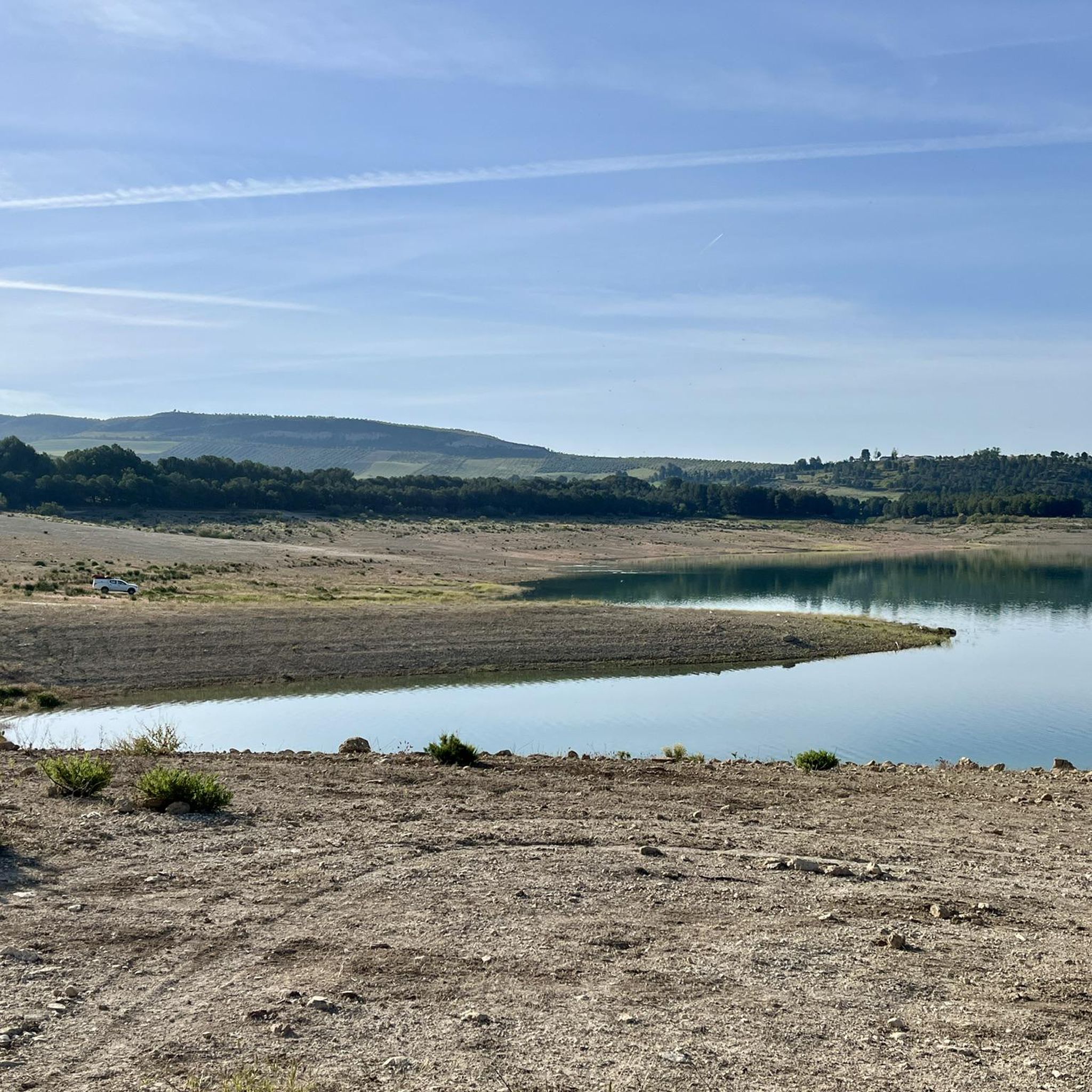
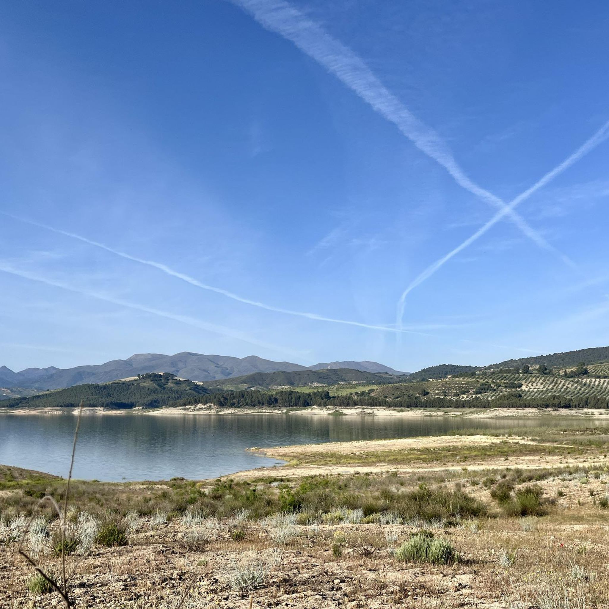
Hiking around Embalse de los Bermejales offers diverse landscapes centered around a large man-made reservoir in Granada province. The area features extensive pine forests, holm oaks, and Mediterranean woodland, contrasting with the turquoise waters of the reservoir. The region is also characterized by the dramatic, deep gorge of the Cacín River, known as "Los Tajos," and is situated within the Sierras de Tejeda, Almijara y Alhama Natural Park, providing mountain views. This varied terrain provides a range of hiking opportunities.
…Last updated: June 25, 2026
4.8
(28)
119
hikers
11.5km
03:14
250m
250m
Moderate hike. Good fitness required. Easily-accessible paths. Suitable for all skill levels.
4.8
(13)
40
hikers
6.88km
01:56
130m
140m
Easy hike. Great for any fitness level. Easily-accessible paths. Suitable for all skill levels.

Sign up for free
3.5
(2)
15
hikers
12.5km
03:34
270m
270m
Moderate hike. Good fitness required. Easily-accessible paths. Suitable for all skill levels.
25.9km
07:20
550m
550m
Hard hike. Very good fitness required. Easily-accessible paths. Suitable for all skill levels.
5.0
(1)
9
hikers
11.3km
03:12
260m
260m
Moderate hike. Good fitness required. Easily-accessible paths. Suitable for all skill levels.
Get access to more routes and recommendations from other explorers.
Sign up for free
Already have an account?
Our route recommendations are based on thousands of hikes, rides, and runs completed by other people on komoot.
Start today with a free account
Your next adventure awaits.
Login or Signup

Other adventures around Embalse de los Bermejales

Tips from the Community

Connection with Routes 13, towards Jayena via Fuente Barranco or Camino Albares and Route 20 Towards Sierra Tejeda. Near this location is a cataloged singular tree, a large Horse Chestnut.
0
0
Area with easy parking next to the Bermejales reservoir dam, where to start or finish the RITPG 17 and connect with the RITPG 19 with connection to the N with Cacín and Santa Cruz del Comercio and to the S, crossing the reservoir dam, with Arenas del Rey and Játar
0
0

The Cacín River flows through the valley of the municipality of Arenas del Rey and empties into the Genil River, forming part of the Guadalquivir basin. It has a total length of approximately 50 km, of which roughly 33 km run from the Los Bermejales reservoir to its confluence. Its valley combines terraces of Quaternary sediments (conglomerates, sands, clays) and an impressive canyon carved through soft materials.
1
0

No longer present or defective and overgrown
0
0
No longer usable and completely overgrown. We arrived from the north side, and the last suspension bridge was no longer accessible. One anchor had broken off, and the wooden planks from the stands were broken or missing. A real shame!
0
0

To access it you have to follow a path half lost among the pines.
0
0
It is a 20th century church
1
0
The shores of the or beaches of Los Bermejales one of the best swamps in Granada to be able to bathe with very good access by car and home by motorhome, but you must be careful that if the terrain were wet it would be fatal for the vehicle's tires They entered in such a way from the clay of the soil that it would even embed the wheels and even walking you could not even walk because of the accumulation of mud that sticks to your shoes.
1
0
Frequently Asked Questions
How many hiking trails are available around Embalse de los Bermejales?
There are over 35 hiking trails around Embalse de los Bermejales, offering a wide range of options for different skill levels. You'll find everything from easy strolls to more challenging routes through varied terrain.
What kind of terrain can I expect on hikes in Embalse de los Bermejales?
The terrain around Embalse de los Bermejales is quite diverse. You can expect paths through extensive pine forests and holm oak woodlands, alongside the turquoise waters of the reservoir, and into dramatic river canyons like the deep gorge of the Cacín River, known as 'Los Tajos'. Some routes offer stunning mountain views as the area is within the Sierras de Tejeda, Almijara y Alhama Natural Park.
Are there any easy, family-friendly hikes around Embalse de los Bermejales?
Yes, there are 13 easy routes suitable for families or those looking for a relaxed walk. A great option is the Cacín River loop from Pantano de los Bermejales, which is 6.7 km long and follows the river, offering pleasant views of the reservoir.
Are there any challenging hikes for experienced trekkers?
For experienced hikers seeking a challenge, there are 5 difficult routes. One notable option is the Mirador de las Yeseras – La Resinera loop from Fornes, which covers nearly 26 km with significant elevation changes, offering panoramic views and a demanding experience.
What natural features or landmarks can I see while hiking?
Hikers can explore several natural features and landmarks. The dramatic gorge of the Cacín River, known as 'Los Tajos', is a highlight, with some trails featuring suspension bridges and metal ladders. You can also visit the Mirador de las Yeseras for panoramic views of the reservoir, or discover the ancient Dolmen de los Bermejales. The reservoir itself, Los Bermejales Reservoir, is a central and beautiful feature.
Are there any circular walks available?
Many of the trails around Embalse de los Bermejales are circular, allowing you to start and end at the same point. For example, the Cacín River Trail – Roman Bridge loop from Pantano de los Bermejales is a popular moderate circular route that explores the river valley and a historic Roman bridge.
What is the best time of year to go hiking in Embalse de los Bermejales?
Embalse de los Bermejales offers pleasant hiking conditions for much of the year. The spring and autumn months are ideal, with milder temperatures and vibrant natural scenery. Even in summer, the clean, warm waters of the reservoir offer opportunities for swimming after a hike, though it's best to hike early in the morning or late afternoon to avoid the midday heat.
Is Embalse de los Bermejales a good place for birdwatching?
Yes, the region's location within the Sierras de Tejeda, Almijara y Alhama Natural Park and its designation as a 'Wetland Andaluz' contribute to a rich biodiversity, including a variety of resident and migratory bird species. This makes it an excellent spot for birdwatching while enjoying your hike.
What do other hikers say about the trails in Embalse de los Bermejales?
The trails in Embalse de los Bermejales are highly rated by the komoot community, with an average score of 4.7 stars from over 200 reviews. Hikers often praise the diverse landscapes, the stunning views of the reservoir and mountains, and the variety of routes catering to different abilities.
Are there any routes that include a Roman bridge?
Yes, the Cacín River Trail – Roman Bridge loop from Pantano de los Bermejales is a moderate 11.5 km route that specifically includes a historic Roman bridge as part of its exploration of the river valley.
Where can I find parking for hiking trails?
Many hiking routes around Embalse de los Bermejales, especially those starting near the reservoir or in nearby villages like Fornes, offer designated parking areas. For example, the Five-Branch Pine is noted as a parking location that can serve as a starting point for trails.
Can I combine hiking with other outdoor activities in the area?
Absolutely! Embalse de los Bermejales is a hub for outdoor activities. Besides hiking, you can enjoy swimming, canoeing, sailing, mountain biking, fishing, camping, and picnicking. The reservoir's clean, warm waters are particularly inviting for water sports.
Most popular routes around Embalse de los Bermejales
Most popular attractions around Embalse de los Bermejales

Get inspired with the komoot mobile app


Explore more
Browse the best Hikes in other regions.
