The best walks and hikes around Lurganare
4.0
(5)
196
hikers
33
hikes
Hiking around Lurganare offers access to a diverse landscape in County Down, Northern Ireland. The region is characterized by its proximity to the rugged Mourne Mountains, the unique geological formations of the Ring of Gullion, and the tranquil waters of the Newry Canal. Trails often feature views of granite peaks, rolling hills, and waterside paths, providing varied terrain for outdoor activities.
Best hiking trails around Lurganare
- The most popular hiking route is Bessbrook War Memorial — loop around the Bessbrook…
Last updated: May 15, 2026
3
hikers
4.32km
01:10
60m
60m
Easy hike. Great for any fitness level. Easily-accessible paths. Suitable for all skill levels.
17
hikers
8.27km
02:08
50m
50m
Moderate hike. Good fitness required. Easily-accessible paths. Suitable for all skill levels.

Sign up for free
8
hikers
3.32km
00:51
10m
10m
Easy hike. Great for any fitness level. Easily-accessible paths. Suitable for all skill levels.
8
hikers
3.78km
00:58
20m
20m
Easy hike. Great for any fitness level. Easily-accessible paths. Suitable for all skill levels.
4
hikers
5.11km
01:23
70m
70m
Easy hike. Great for any fitness level. Easily-accessible paths. Suitable for all skill levels.
Get access to more routes and recommendations from other explorers.
Sign up for free
Already have an account?
Our route recommendations are based on thousands of hikes, rides, and runs completed by other people on komoot.
Start today with a free account
Your next adventure awaits.
Login or Signup


Tips from the Community

Here, too, passersby encounter a "war memorial" in the center of town. Everywhere in the villages and towns, victims were mourned during the terrible wars (especially, but not only, in the first half of the last century) – often young people who had to endure suffering and pain and ultimately paid with their own lives for their service to their fatherland far from home. Their names are always inscribed on the respective memorial to at least keep the memory alive.
0
0
Here, too, hikers and walkers will encounter a "war memorial" in the center of town, as throughout the villages and towns, victims of the terrible wars (especially in the first half of the last century) were mourned – often young people who had to endure suffering and pain and ultimately paid with their own lives for their service to their country far from home. Their names are always inscribed on the respective memorial to at least keep the memory alive.
0
0

The war memorial in Bessbrook stands silently yet full of meaning in the heart of the village. The white obelisk bears the names of almost ninety people who gave their lives in the Second World War - a sign of remembrance and remembrance of those who once lived here and defended their homeland. As you walk past, you can read the inscriptions that tell the stories of those who fell. The square around the memorial is simple, but that is precisely what draws the focus to the message of remembrance and the silent commemoration of the past. The surrounding houses seem to carry the history of the place and you can almost feel how yesterday and today are connected here. A place that makes you pause and reminds you of how important it is to preserve history.
2
0

This War Memorial in Bessbrook is dedicated to the 86 individuals from the village who gave their lives in the Second World War. It is a 17-foot (5.75 meters) tall obelisk.
2
0
This obelisk-shaped War Memorial was erected in memory of nearly ninety individuals from the village who gave their lives in the Second World War.
2
0
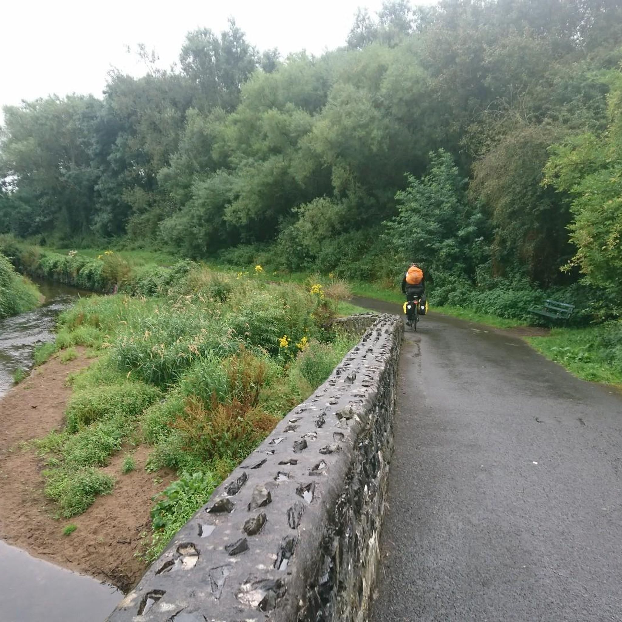
This peaceful pond located in the heart of the village of Bessbrook is an ideal place for a waterside stroll along its paths.
0
0

Frequently Asked Questions
How many hiking trails are available around Lurganare?
There are over 30 hiking routes around Lurganare, offering a variety of experiences from easy strolls to moderate excursions. The region provides diverse terrain, from waterside paths to routes through the unique Ring of Gullion.
Are there easy hiking trails suitable for beginners or families in Lurganare?
Absolutely. Lurganare offers a good selection of easy trails perfect for beginners or families. For instance, the Bessbrook War Memorial — loop around the Bessbrook Pond is an easy 2.7-mile (4.3 km) route that provides a gentle walk. Another accessible option is the Newry River loop from Newry, a 2.3-mile (3.8 km) trail along the riverside.
What kind of natural landscapes can I expect to see while hiking near Lurganare?
Hiking near Lurganare offers a rich tapestry of landscapes. You can expect to see the rugged beauty of the nearby Mourne Mountains, the distinctive geological formations of the Ring of Gullion, and tranquil waterside paths along the Newry Canal and Carlingford Lough. The area is known for its granite peaks, rolling hills, and scenic views of the Irish Sea.
Are there any circular walks around Lurganare?
Yes, many of the trails around Lurganare are designed as loops, allowing for convenient circular walks. For example, the War Memorial Cannon loop from Mullaghglass is a moderate 5.1-mile (8.3 km) circular path that takes you through local historical points of interest.
What are some interesting landmarks or attractions to see along the hiking trails?
The region around Lurganare is rich in points of interest. You can explore the historic Newry Canal Towpath, enjoy the serene Camlough Lake within the Ring of Gullion, or marvel at the impressive Craigmore Viaduct. The Carlingford Lough Greenway also offers scenic views where mountains meet the sea.
Can I bring my dog on the hiking trails around Lurganare?
Many trails in the Lurganare area are dog-friendly, but it's always best to check specific route details and local signage for any restrictions, especially in nature reserves or areas with livestock. Always keep your dog under control, preferably on a leash, and clean up after them to ensure a pleasant experience for everyone.
What do other hikers enjoy most about hiking in Lurganare?
The hiking routes in Lurganare are highly rated by the komoot community, with an average score of 4.0 stars from over 200 hikers. Reviewers often praise the diverse terrain, from tranquil waterside paths to routes offering mountain views, and the variety of options suitable for different ability levels.
Are there any moderate hiking options for those looking for a bit more challenge?
Yes, for those seeking a more extended excursion, there are moderate trails available. The Bessbrook War Memorial – Derrymore House Park loop from Bessbrook is a moderate 3.2-mile (5.1 km) route that provides a good balance of distance and varied scenery.
What is the best time of year to go hiking in the Lurganare region?
The Lurganare region, like much of Northern Ireland, can be enjoyed year-round. Spring and autumn offer pleasant temperatures and beautiful scenery with blooming wildflowers or vibrant fall foliage. Summer provides longer daylight hours, while winter can offer crisp, clear days, though conditions in the Mourne Mountains can be more challenging and require appropriate gear.
Is public transport available to access hiking areas near Lurganare?
While Lurganare itself is a small village, public transport options may be available to access some of the wider hiking areas, particularly towards larger towns like Newry. For specific routes like the Newry Canal Towpath, checking local bus services to Newry would be advisable. Planning ahead is recommended as services can be less frequent in rural areas.
Are there places to find refreshments or accommodation near the hiking trails?
While Lurganare is quiet, nearby towns such as Newry offer a range of cafes, pubs, and accommodation options. Many hiking routes are within a reasonable distance of these amenities, allowing you to enjoy a meal or stay overnight after your hike. It's a good idea to plan your route to pass through or end near these towns if you require facilities.
Most popular attractions around Lurganare

Get inspired with the komoot mobile app


Explore more
Browse the best Hikes in other regions.
