The best walks and hikes around Lake Nero
4.5
(5200)
32,989
hikers
268
hikes
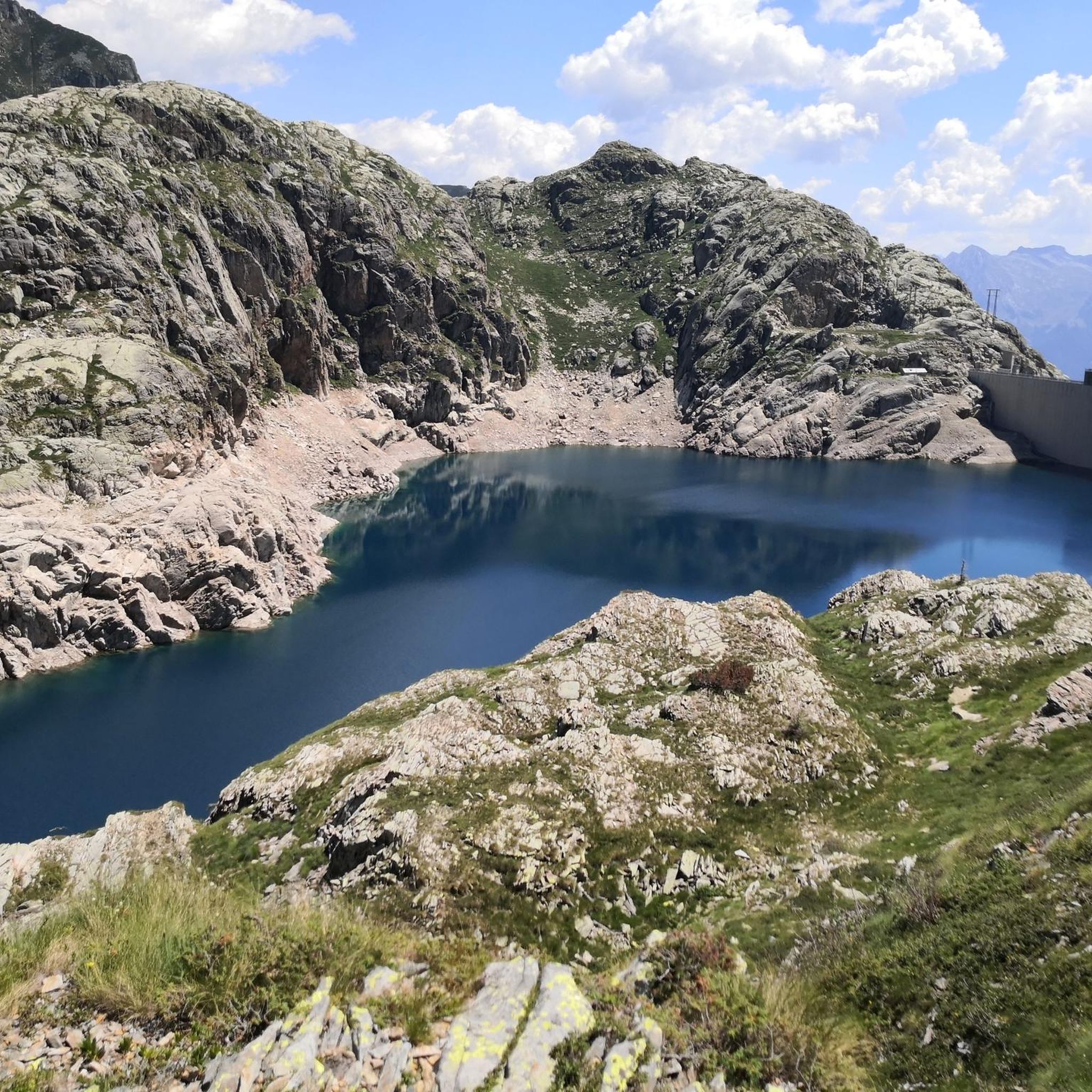
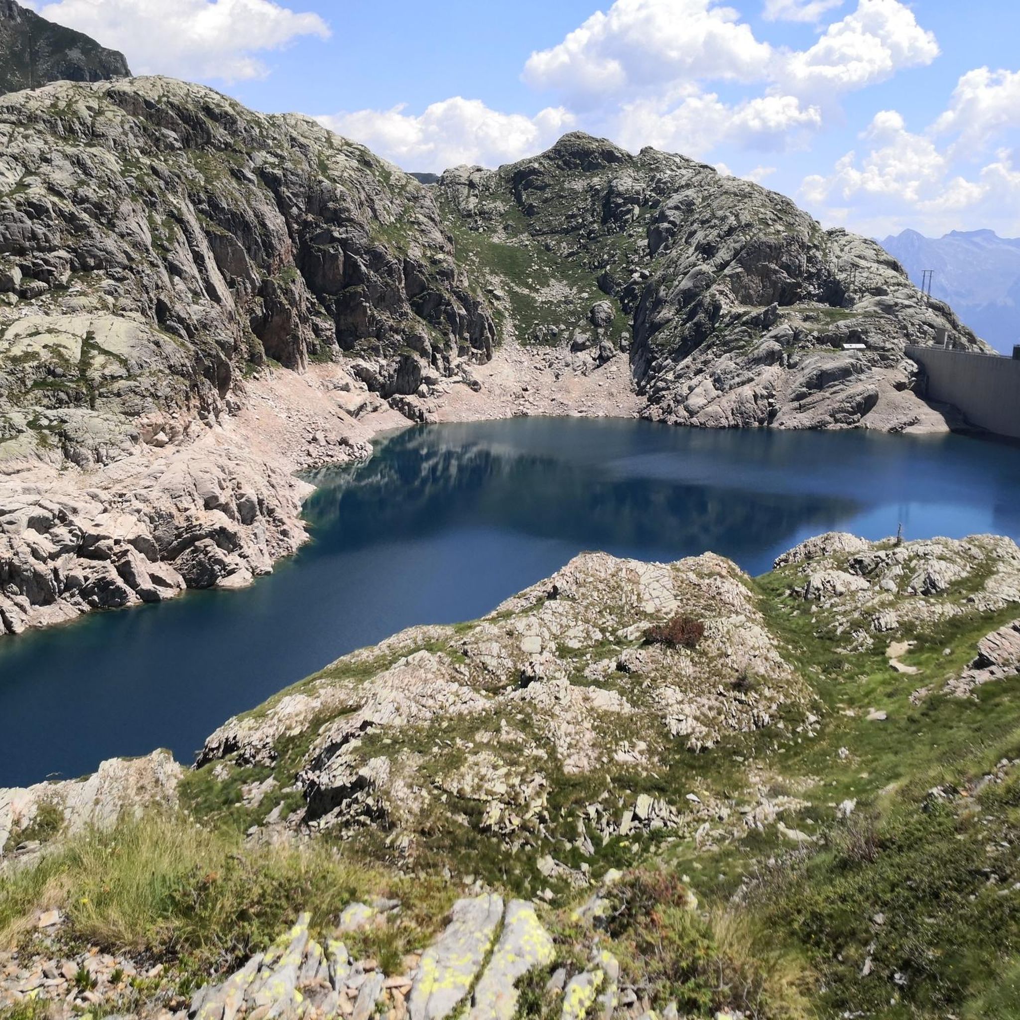
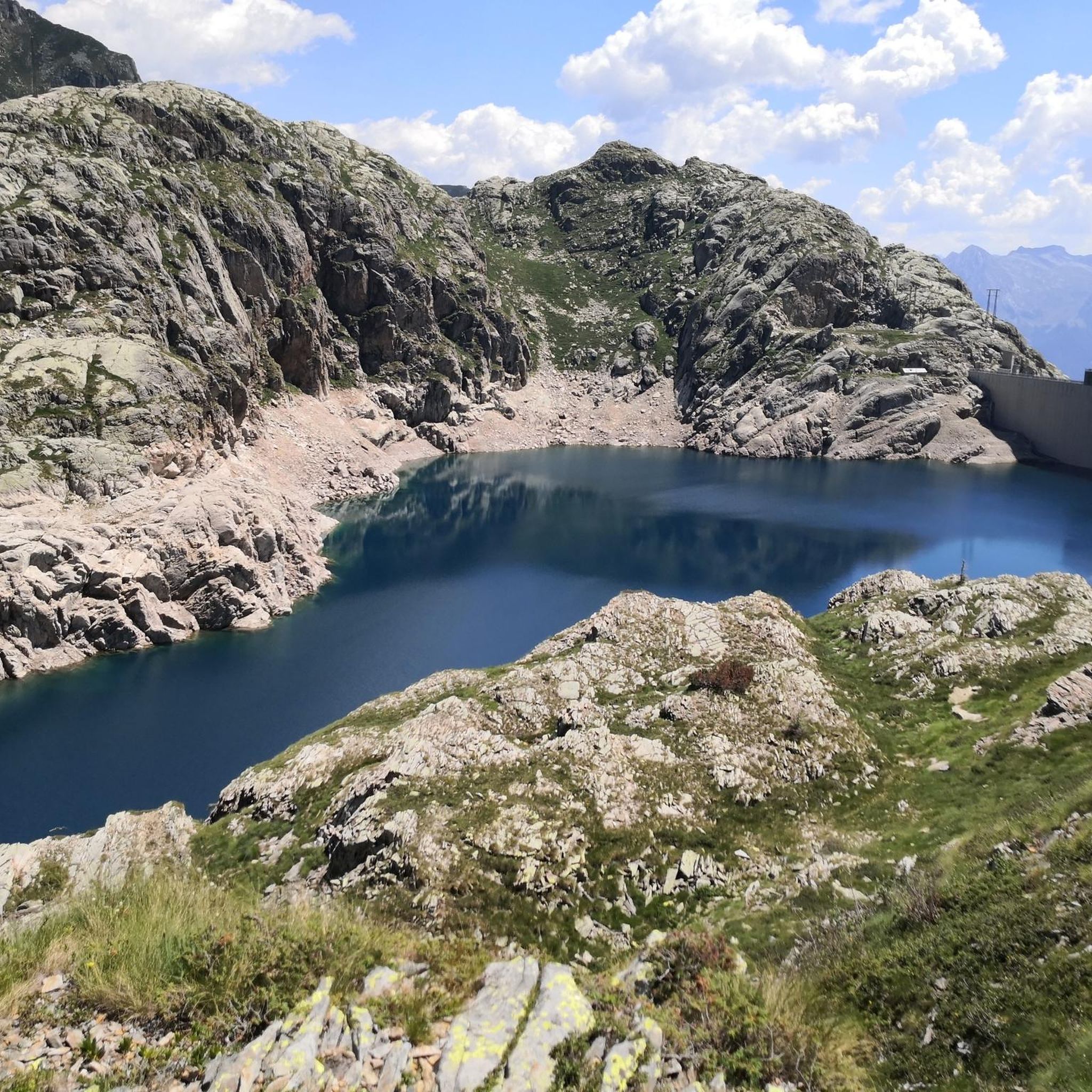
Hiking around Lake Nero reveals a landscape shaped by glacial origins, featuring moraine basins, clear waters, and imposing peaks. The region offers diverse trails that wind through dense woodlands of chestnut, beech, and silver fir, alongside high-altitude meadows. Hikers can expect reflective waters and dramatic backdrops of lush forestry and blue mountains, often enveloped in atmospheric mists. This varied terrain provides a range of experiences, from accessible paths to more challenging ascents.
Best hiking trails around Lake Nero
- The most popular hiking route is Lake Aviasco – Lago Nero loop from Monte Madonnino, a 3.4 miles (5.5 km) trail that takes 2 hours 20 minutes to complete. This difficult route offers views of the glacial lake.
- Another top favourite among local hikers is Mount Madonnino Summit – Portula Pass loop from Monte Madonnino, a difficult 3.0 miles (4.8 km) path. This trail includes significant elevation gain, leading to panoramic mountain views.
- Local hikers also love the Lake Aviasco – Lake Sucotto loop from Monte Madonnino, a 6.8 miles (11.0 km) trail leading through high mountain terrain, often completed in about 5 hours 29 minutes.
- Hiking around Lake Nero is defined by glacial lakes, high mountain passes, and dense woodlands. The network offers options for various ability levels, from moderate walks to difficult, longer treks.
- The routes in Lake Nero are highly rated by the komoot community with an average score of 4.6 stars from over 5,000 reviews. More than 32,000 hikers have used komoot to explore Lake Nero's varied terrain.
Last updated: May 12, 2026
5.0
(1)
6
hikers
10.9km
05:23
720m
730m
Hard hike. Very good fitness required. Sure-footedness, sturdy shoes and alpine experience required.
4.5
(2)
14
hikers
5.48km
02:21
260m
260m
Hard hike. Good fitness required. Sure-footedness, sturdy shoes and alpine experience required.

Sign up for free
5.0
(1)
7
hikers
4.85km
02:31
380m
380m
Hard hike. Good fitness required. Sure-footedness, sturdy shoes and alpine experience required.
4.7
(367)
2,027
hikers
12.5km
06:06
990m
990m
Hard hike. Very good fitness required. Sure-footedness, sturdy shoes and alpine experience required.
4.7
(15)
83
hikers
14.2km
06:45
1,030m
1,040m
Hard hike. Very good fitness required. Sure-footedness, sturdy shoes and alpine experience required.
Get access to more routes and recommendations from other explorers.
Sign up for free
Already have an account?
Our route recommendations are based on thousands of hikes, rides, and runs completed by other people on komoot.
Start today with a free account
Your next adventure awaits.
Login or Signup

Tips from the Community

Monte Madonnino is a peak in the Orobie Alps, 2,502 meters high, located on the natural border between Val Brembana and Val Seriana. It owes its name to the small statue of the Madonna placed on the summit, an exceptional panoramic point from which you can admire giants such as Pizzo del Diavolo di Tenda and Monte Rosa.
0
0

Passo Portula 2273m, a panoramic pass that separates Val Brembana and Val Grabiasca (a side valley of Val Seriana), and divides Monte Madonnino and Monte Reseda.
0
0

The "Mersa spring" in Val Sanguigno is one of the valley's most evocative natural springs, located along the Sanguigno stream above Valgoglio (BG). It's known to hikers as a source of pure water that flows between rocks and peat bogs, nestled in a wild and unspoiled environment.
0
0
The Rifugio Gianpace is located in the Sanguigno Valley, above Valgoglio (BG), at an altitude of 1,330 meters. It is a popular stop for those hiking the trails along the Sanguigno stream and looking to stop for lunch or a scenic break. 🏔️ Features Location: Nestled in the lower Sanguigno Valley, easily reached with a 1.5-2 hour walk from the Aviasco power plant. Services: It offers summer refreshments (lunches, snacks, drinks) and outdoor seating with tables under a wooden canopy. Overnight stay: As it is a private refuge, overnight stays require a reservation. Ambience: Surrounded by cool, humid woods, with the stream flowing alongside, creating a natural backdrop. 📅 Current situation In past years, it has been very popular on summer weekends. Update 2025: The refuge is closed pending a new assignment, following a call for applications published on April 4, 2025. 📌 Historical contact details Website: gianpace.it Phone: +39 347 2191628 Email: rifugiogianpace@gmail.com
0
0

Aluminum bowl fixed to the rock with a chain that can be used to draw water from the nearby stream and quench your thirst
1
0
Important intersection with CAI signs to avoid mistakes in choosing the path, given the rich intersection where it is located, taking the wrong path here could mean not reaching the chosen destination.
1
0
A refuge with full amenities. Easy to reach, even for families. Nestled near the forest, the climate is always cool, even in summer, although humid, given the proximity of the river.
1
0
Frequently Asked Questions
What makes the Lake Nero region a unique destination for hiking?
The Lake Nero region, encompassing several distinct lakes primarily in Italy, is renowned for its landscapes shaped by glacial activity. Hikers can expect to find moraine basins, clear waters, and often imposing peaks. The trails wind through diverse environments, from dense woodlands of chestnut, beech, and silver fir to high-altitude meadows, offering tranquil and scenic experiences.
How many hiking trails are available around Lake Nero?
There are over 260 hiking routes available around Lake Nero, catering to a wide range of abilities. This includes 18 easy routes, 91 moderate routes, and 158 difficult routes, ensuring options for every hiker.
Are there any easy or family-friendly hiking options around Lake Nero?
Yes, the region offers several easy and family-friendly options. For instance, in the Ivrea Morainic Amphitheater, the Lake Pistono Loop Trail (4.3 km) and the Around Lake Pistono — Ring Tour (4.6 km) are both easy paths suitable for all skill levels, winding through dense woods. These types of trails are ideal for families looking for a gentle outdoor experience.
What kind of challenging hikes can I find in the Lake Nero area?
For those seeking a challenge, the Lake Nero region offers numerous difficult routes, often involving significant elevation gain and high mountain terrain. A notable example is the Lago Nero to Rifugio Gianpace Loop (via Route 267), a 14.2 km trail with over 1000 meters of ascent, providing a strenuous but rewarding experience.
Are there any circular hiking routes around Lake Nero?
Yes, many routes in the Lake Nero area are circular, allowing you to start and end at the same point. Popular options include the Lake Aviasco – Lago Nero loop from Monte Madonnino, a 5.5 km difficult trail, and the Mount Madonnino Summit – Portula Pass loop from Monte Madonnino, a 4.8 km difficult path offering panoramic views.
What are some notable natural features or attractions to see while hiking?
The region is rich in natural beauty. Depending on the specific Lake Nero location, you might encounter high-altitude meadows vibrant with flowers like Stelle Alpine in early summer (Valle d'Aosta), or dense woodlands of chestnut, beech, and silver fir. The Tuscan Apennines offer dramatic backdrops of lush green forestry and blue mountains, often swathed in atmospheric mists, and opportunities to spot wildlife like marmots and golden eagles.
Can I reach any mountain refuges or summits from Lake Nero trails?
Yes, several Lake Nero locations offer access to mountain refuges and summits. For example, from the Lago Nero in Cesana Torinese, you can reach Capanna Mautino, a mountain refuge serving as a base for ascents to peaks like Mount Corbioun or Saurel Peak. In the Piacenza Apennines, a hike to Lago Nero can be extended to the summit of Monte Bue at 1,780 meters.
What do other hikers say about the trails around Lake Nero?
The trails around Lake Nero are highly rated by the komoot community, with an average score of 4.6 stars from over 5,000 reviews. Hikers often praise the stunning glacial lakes, the challenging high mountain passes, and the serene beauty of the dense woodlands.
Are there any historical or archaeological points of interest along the trails?
Yes, in some areas, you can combine hiking with historical exploration. For instance, around the Lake Nero in the Ivrea Morainic Amphitheater, some trails pass by fascinating 6,500-year-old archaeological village replicas, offering a glimpse into ancient history amidst nature.
Is there a specific time of year recommended for hiking in the Lake Nero region?
While the best time can vary slightly by specific location and altitude, early summer is often recommended, especially for higher-altitude lakes like the one in Valle d'Aosta, when meadows are vibrant with flowers like Stelle Alpine. However, the region offers diverse experiences throughout the warmer months, with some areas even suitable for winter activities.
Are there any multi-lake hiking tours in the region?
Yes, for those interested in exploring multiple lakes, the region offers tours that connect several bodies of water. An example is the Tour of the 5 Lakes of Valgoglio, a challenging 12.5 km hike that allows you to experience several glacial lakes in one extensive journey.
Most popular routes around Lake Nero

Get inspired with the komoot mobile app


Explore more
Browse the best Hikes in other regions.
