The best walks and hikes around Invaso di Cogliandrino
4.0
(44)
281
hikers
24
hikes
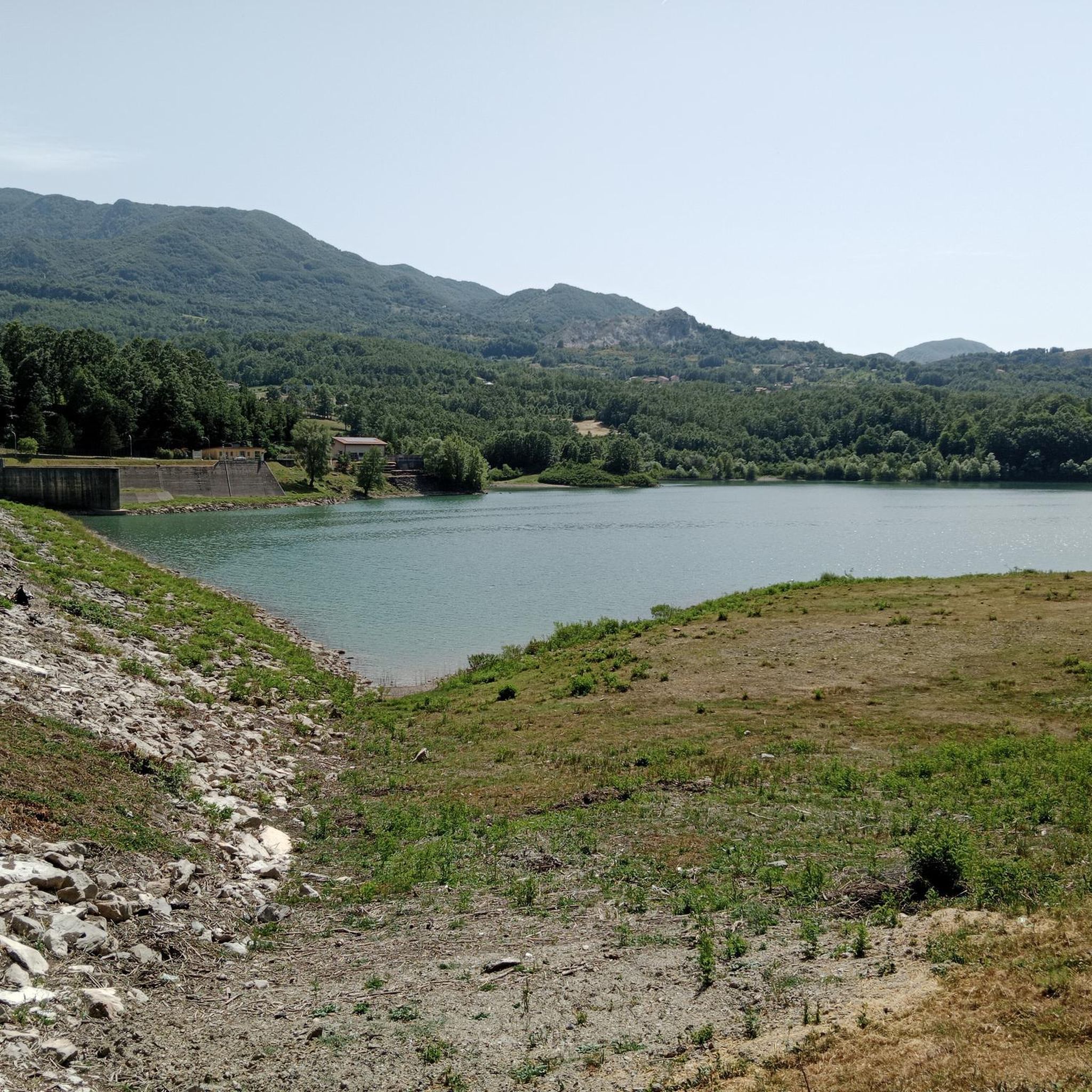
Hiking around Invaso di Cogliandrino offers a variety of trails surrounding the reservoir in the Potenza region. The landscape features a mix of mountainous terrain, with routes leading to summits like Monte Santa Croce and Pizzo Falcone, as well as paths exploring valleys and natural springs. The area is characterized by its natural water features and elevated viewpoints.
Best hiking trails around Invaso di Cogliandrino
- The most popular hiking route is Monte Santa Croce Summit – Pizzo Falcone summit loop…
Last updated: June 25, 2026
5.0
(2)
13
hikers
13.4km
05:07
850m
850m
Hard hike. Very good fitness required. Mostly accessible paths. Sure-footedness required.
5.0
(1)
7
hikers
11.4km
03:14
250m
250m
Moderate hike. Good fitness required. Easily-accessible paths. Suitable for all skill levels.

Sign up for free
4.8
(4)
22
hikers
Moderate hike. Good fitness required. Mostly accessible paths. Sure-footedness required.
10
hikers
16.3km
06:45
1,070m
1,060m
Hard hike. Very good fitness required. Mostly accessible paths. Sure-footedness required.
5.0
(1)
5
hikers
10.7km
03:01
240m
240m
Moderate hike. Good fitness required. Easily-accessible paths. Suitable for all skill levels.
Get access to more routes and recommendations from other explorers.
Sign up for free
Already have an account?
Our route recommendations are based on thousands of hikes, rides, and runs completed by other people on komoot.
Start today with a free account
Your next adventure awaits.
Login or Signup


Tips from the Community


My favourite start to climb Monte Alpi. Mind your fitness level, grades are wild :)
0
0

At this point, if you come in spring, you can see many blossoming flowers.
1
0
The Savino refuge is surrounded by a beautiful beech forest. Here is a table with benches and a fountain: it's the perfect place to stop for a break!
0
0
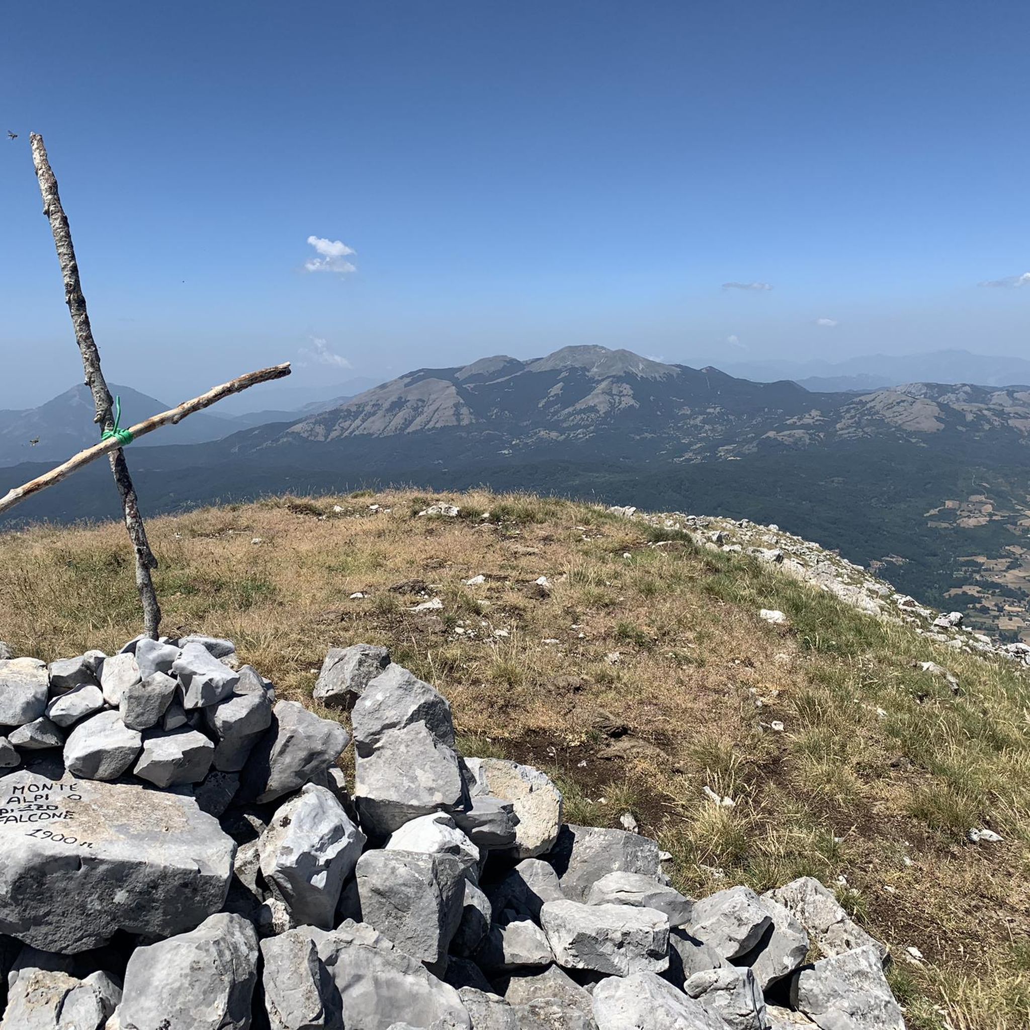
A wonderful "panoramic balcony" on the Pollino National Park. this peak can be reached with a medium-difficulty trek starting from the Favino refuge.
2
0

The Savino refuge is surrounded by a beautiful beech forest. Here is a table with benches and a fountain: it's the perfect place to stop for a break!
2
0

Ideal summit also to be able to camp out with the right precautions. The view is very beautiful, you can see Monte Raparo, Monte Sirino and Serra La Spina.
3
0
Frequently Asked Questions
Are there easy hiking trails suitable for beginners around Invaso di Cogliandrino?
Yes, the Invaso di Cogliandrino area offers a few easier options. While many routes involve mountainous terrain, there are 3 trails categorized as easy, providing a gentler introduction to the region's natural beauty. These are ideal for those new to hiking or looking for a less strenuous walk.
What is the typical length and duration of hikes in the Invaso di Cogliandrino area?
Hikes around Invaso di Cogliandrino vary significantly. You'll find routes ranging from moderate 7.1-mile (11.4 km) paths like the Hot Spring – Latronico loop from Cerri, which takes around 3 hours 14 minutes, to more challenging 8.3-mile (13.4 km) ascents such as the Monte Santa Croce Summit – Pizzo Falcone summit loop from Calda, which can take over 5 hours due to significant elevation gain. Overall, routes can range from a few hours to a full day.
Are there any circular walks around Invaso di Cogliandrino?
Yes, many of the trails in the Invaso di Cogliandrino region are designed as circular routes, allowing you to start and end at the same point. Examples include the Savino Hut and Fountain – Monte Santa Croce Summit loop from Monte Armizzone and the Hot Spring – Latronico loop from Cerri, providing convenient options for exploration.
What is the best time of year to go hiking in Invaso di Cogliandrino?
The best time for hiking around Invaso di Cogliandrino is typically from late spring through early autumn (May to October). During these months, the weather is generally mild and pleasant, and the trails are more accessible. Summer offers warmer temperatures, while spring and autumn provide cooler conditions and vibrant natural colors. Winter hiking is possible but may require specialized gear due to snow and ice at higher elevations.
What kind of terrain can I expect on the hiking trails?
The terrain around Invaso di Cogliandrino is diverse, featuring a mix of mountainous paths, forest trails, and open areas with views of the reservoir. You can expect significant elevation changes on routes leading to summits like Monte Santa Croce and Pizzo Falcone, as well as more undulating paths through valleys and past natural springs. Sturdy hiking boots are recommended for most trails.
Are the hiking trails around Invaso di Cogliandrino suitable for families with children?
While many trails in the region are moderate to difficult, there are 3 easy routes that could be suitable for families, depending on the children's age and hiking experience. For more challenging routes, families with older, experienced children might enjoy the adventure, but it's always best to check the specific trail's difficulty and length before setting out.
Can I bring my dog on the hiking trails in Invaso di Cogliandrino?
Generally, dogs are welcome on hiking trails in the Invaso di Cogliandrino area. However, it's always advisable to keep them on a leash, especially in areas with wildlife or near livestock. Be sure to carry water for your dog and clean up after them to maintain the natural environment for everyone.
What should I wear and bring for a hike in Invaso di Cogliandrino?
For hiking in Invaso di Cogliandrino, wear sturdy hiking boots with good ankle support, as many trails involve uneven and mountainous terrain. Layered clothing is recommended to adapt to changing weather conditions, especially at higher altitudes. Always bring sufficient water, snacks, a map or GPS device (like komoot), sun protection, and a first-aid kit. For longer or more challenging hikes, consider trekking poles.
Are there any natural springs or water features to see along the routes?
Yes, the region is known for its natural water features. Some routes, such as the Hot Spring – Latronico loop from Cerri, specifically highlight a hot spring. You'll also find paths leading past natural springs and, of course, the Invaso di Cogliandrino reservoir itself, offering scenic views and points of interest.
What do other hikers enjoy most about hiking in Invaso di Cogliandrino?
The Invaso di Cogliandrino area is highly rated by the komoot community, with an average score of 4.2 stars from over 30 reviews. Hikers often praise the diverse landscape, including the panoramic views from mountain summits like Monte Santa Croce and Pizzo Falcone, the tranquility of the natural springs, and the overall variety of trails that cater to different skill levels.
How many hiking trails are available around Invaso di Cogliandrino?
There are over 20 distinct hiking trails available around Invaso di Cogliandrino. These routes offer a range of experiences, from easier walks to challenging ascents, ensuring options for various preferences and fitness levels.
Are there any particularly challenging hikes for experienced trekkers?
Yes, for experienced trekkers seeking a challenge, the Invaso di Cogliandrino area offers 6 difficult routes. An example is the Latronico – Monte Santa Croce Summit loop from Latronico, which covers 10.1 miles (16.3 km) with over 1000 meters of elevation gain, requiring good fitness and preparation.
Most popular routes around Invaso di Cogliandrino

Get inspired with the komoot mobile app


Explore more
Browse the best Hikes in other regions.
