The best MTB trails around Lacs des Hôpitaux
4.3
(17)
80
riders
4
rides
Mountain biking around Lacs des Hôpitaux offers routes through the mountainous landscapes of the Bugey region, characterized by forests, valleys, and views of the Alps. The area features a diverse topography with natural lakes, rivers, and waterfalls, supported by a karst underground network. Trails often traverse varied terrain, including elevated points that can offer panoramic vistas. The region's natural features provide a scenic backdrop for mountain biking.
Best mountain bike trails around Lacs des Hôpitaux
- The most popular mountain bike…
Last updated: June 27, 2026
4.0
(1)
6
riders
27.6km
02:38
750m
750m
Moderate mountain bike ride. Good fitness required. Advanced riding skills necessary.
4
riders
19.5km
01:59
600m
600m
Moderate mountain bike ride. Good fitness required. Advanced riding skills necessary.

Sign up for free
1
riders
20.3km
02:14
670m
670m
Moderate mountain bike ride. Good fitness required. Suitable for all skill levels.
3
riders
21.2km
01:48
410m
410m
Moderate mountain bike ride. Good fitness required. Suitable for all skill levels.
5.0
(1)
3
riders
40.9km
03:02
760m
760m
Moderate mountain bike ride. Good fitness required. Suitable for all skill levels.
Our route recommendations are based on thousands of hikes, rides, and runs completed by other people on komoot.
Start today with a free account
Your next adventure awaits.
Login or Signup



Tips from the Community

Veyrin is a small village rich in curiosities. You can find an old bread oven, a mural on iron, and metal sculptures there. A beautiful place to stop for a moment.
0
0

Beautiful and very wild without cars
0
0

Officially referenced pass and completely passable by road bike!
1
0

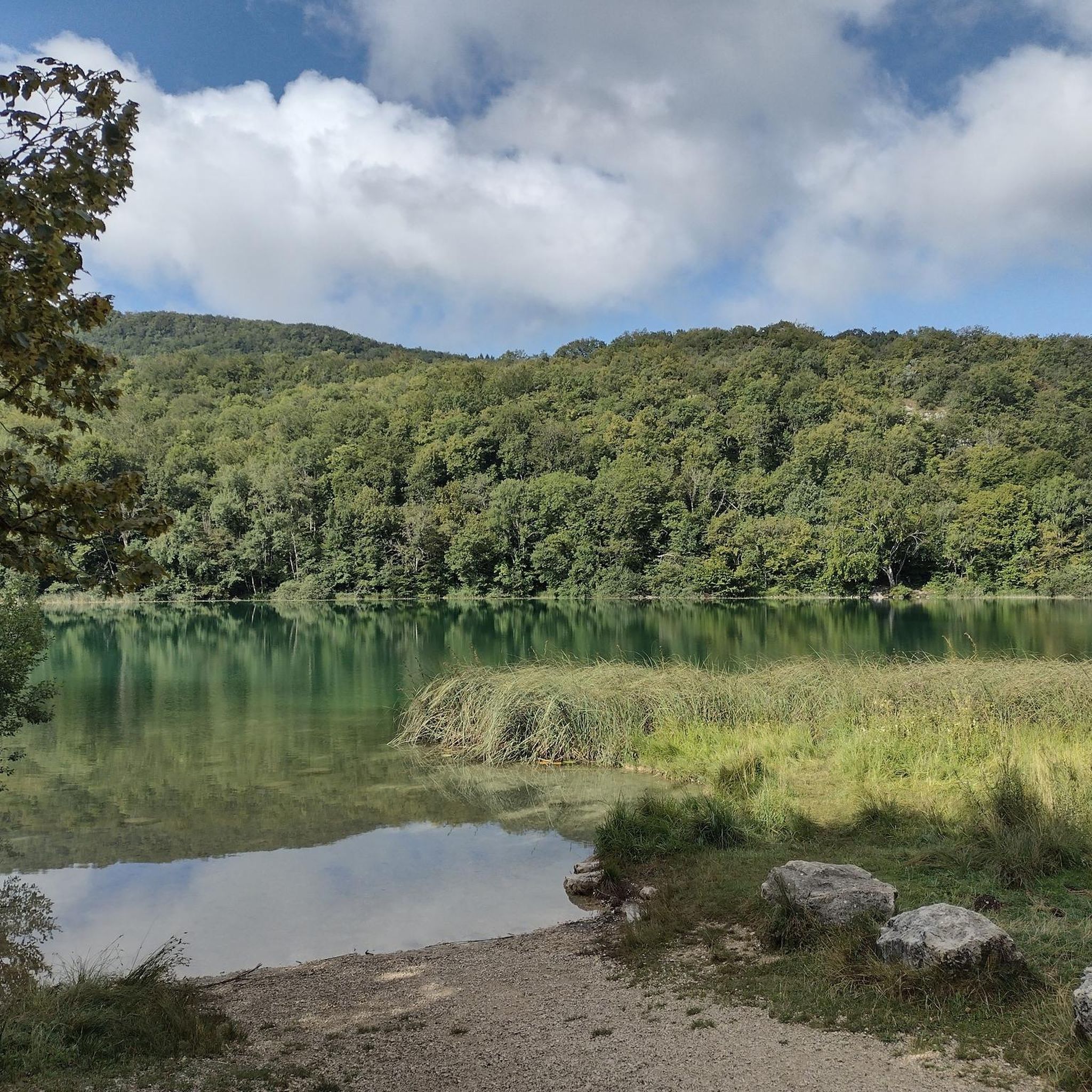
Lake Ambléon is located in the Bas-Bugey massif, in a valley of the Tentanet mountain (712 m above sea level). Its area is 5.58 hectares. Recognized as a natural zone of ecological, fauna and flora interest (ZNIEFF) type I, it is made up of a marshy part and a deeper zone, which however does not exceed ten meters in depth Lake Ambléon, accessible by the D41 road which connects Ambléon to Lhuis, is frequented in summer by fishermen and walkers. Nearby a stele was erected in memory of the Ambléon maquis. Source: Wikipedia
3
0

The pass, located at an altitude of 1,050 meters, offers you a magnificent view of the Alps and the Rhône valley. Like most of the peaks in this region, it sometimes allows you to see Mont Blanc.
2
0

Very nice road with a very progressive drop 👌🏻 very calm in terms of traffic 😀
1
0

Nice single-track trail along the stream. Downhill it's okay but sometimes you have to put your foot down. Uphill...good luck! In the wet season, there are small fords. Nothing extreme but you must already have a small level
0
0
Frequently Asked Questions
How many mountain bike trails are featured around Lacs des Hôpitaux?
This guide highlights 5 mountain bike trails around Lacs des Hôpitaux, offering a range of experiences. The broader Ain department and Bugey region boast extensive networks, with over 1,500 km of marked trails across diverse landscapes.
What is the typical difficulty level of mountain bike trails in this area?
The trails featured in this guide are predominantly moderate, offering a good balance for most mountain bikers. For example, the Petit Pertuis Pass – La Croix de la Roche loop from Lompnas is a moderate route with significant elevation gain. There is also one difficult route, the Virignin footbridge – Blue Valley loop from Innimond, for those seeking a greater challenge.
Are there any circular mountain bike routes around Lacs des Hôpitaux?
Yes, many of the routes in the area are circular, allowing you to start and end in the same location. Examples include the Petit Pertuis Pass – La Croix de la Roche loop from Lompnas and the Cascades de la Brive loop from Lompnas, both offering scenic round trips.
What natural features or attractions can I expect to see along the mountain bike trails?
The trails often wind through mountainous landscapes, dense forests, and valleys. You can expect to encounter scenic water features like the Lacs des Hôpitaux themselves, and impressive waterfalls such as the Brive Waterfall and the 60-meter-high Cerveyrieu Waterfall. From elevated points, like those found on the Petit Pertuis Pass – La Croix de la Roche loop, you might even catch panoramic views of the Alps and Mont Blanc.
Are there any trails that pass by waterfalls?
Absolutely. The Cascades de la Brive loop from Lompnas is a popular trail that leads directly past the beautiful Brive Waterfalls, offering a refreshing stop amidst forested areas.
What do other mountain bikers enjoy most about mountain biking in Lacs des Hôpitaux?
The area is highly rated by the komoot community, with an average score of 4.5 stars from over 14 reviews. Mountain bikers often praise the diverse topography, the serene natural setting, and the varied terrain that includes forests, valleys, and scenic water features.
Is it possible to access the mountain bike trails using public transport?
While the immediate Lacs des Hôpitaux area is quite rural, the broader Bugey region has towns and villages from which many trails are accessible. For specific public transport options to trailheads, it's advisable to check local transport schedules for the Ain department, as direct access to all starting points might require a car.
Where can I find parking for mountain biking near Lacs des Hôpitaux?
Many trailheads in the Bugey region, including those for routes like the Petit Pertuis Pass – La Croix de la Roche loop from Lompnas, typically have designated parking areas in nearby villages or at specific starting points. It's recommended to check the individual route details on komoot for precise parking information for each trail.
What is the best time of year to go mountain biking around Lacs des Hôpitaux?
The Bugey region, where Lacs des Hôpitaux is located, offers pleasant conditions for mountain biking from spring through autumn. Spring brings lush greenery and blooming flora, while autumn provides vibrant foliage. Summer is also popular, but be mindful of warmer temperatures. Winter conditions can vary, with some higher elevation trails potentially experiencing snow or ice.
Are there any family-friendly mountain bike trails in the area?
While the trails in this guide are generally moderate to difficult, the wider Bugey Sud area offers nearly 300 km of marked mountain biking circuits, including options specifically designed to be family-friendly. These routes often weave through the countryside, past lakes and marshes, providing a gentler experience for all ages.
Can I bring my dog on the mountain bike trails?
Many natural areas in France, including those in the Bugey region, are generally dog-friendly, especially on marked trails. However, it's always best to keep your dog on a leash, especially in areas with wildlife or near livestock. Check local regulations or specific trail guidelines if you have concerns, particularly within protected ecological zones like the ZNIEFF around the lakes.
How long do the mountain bike trails typically take to complete?
The duration varies depending on the trail's length and your pace. For example, the Via ferrata - Guinguette loop from Chappe Fougère is about 18.5 km and takes approximately 1 hour 52 minutes, while the longer Mountainbike loop from Marchamp, at 40.7 km, typically takes around 3 hours to complete.
Most popular routes around Lacs des Hôpitaux

Get inspired with the komoot mobile app


Explore more
Browse the best MTB trails in other regions.
