The best walks and hikes around Lac de Montriond
4.5
(2651)
30,547
hikers
10
hikes
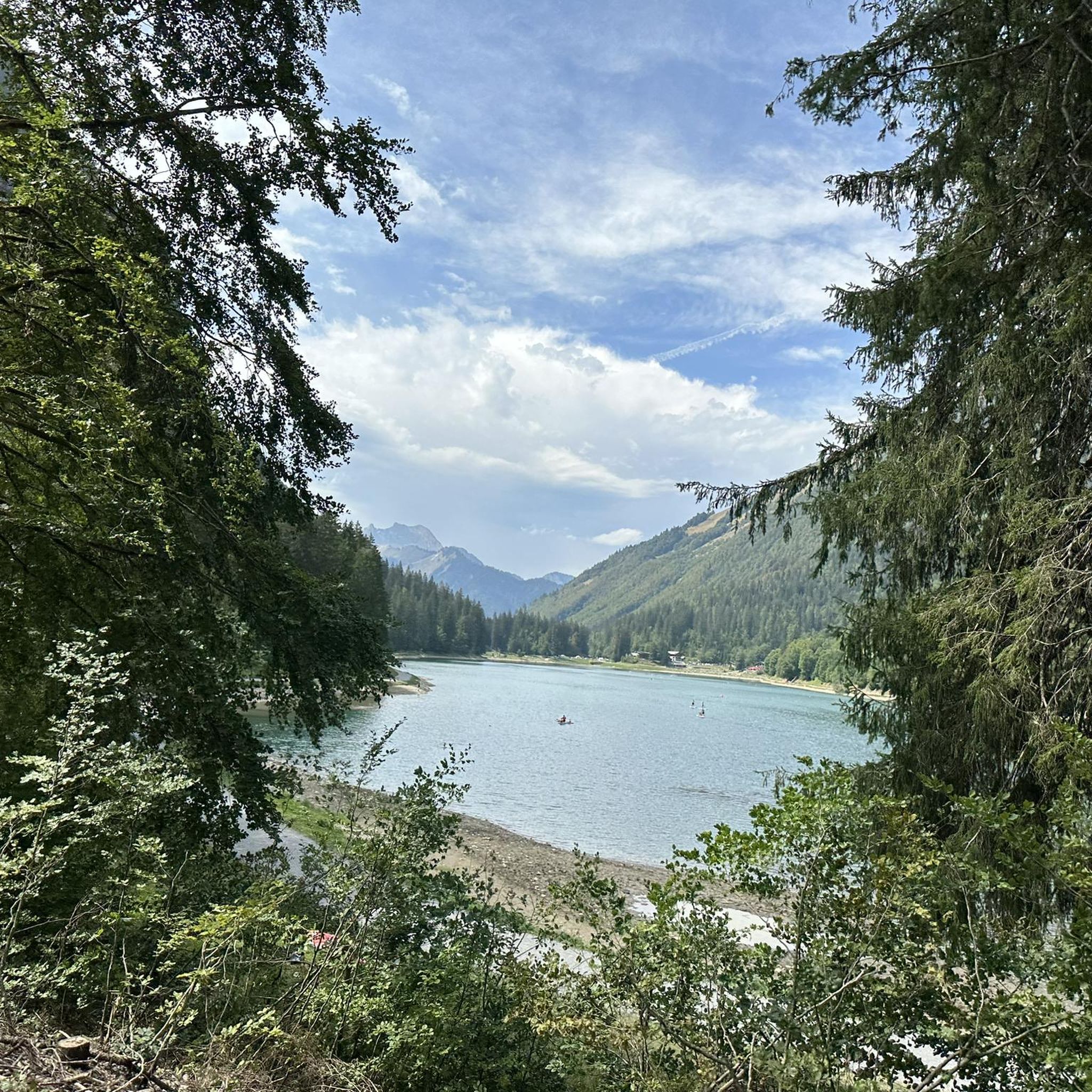
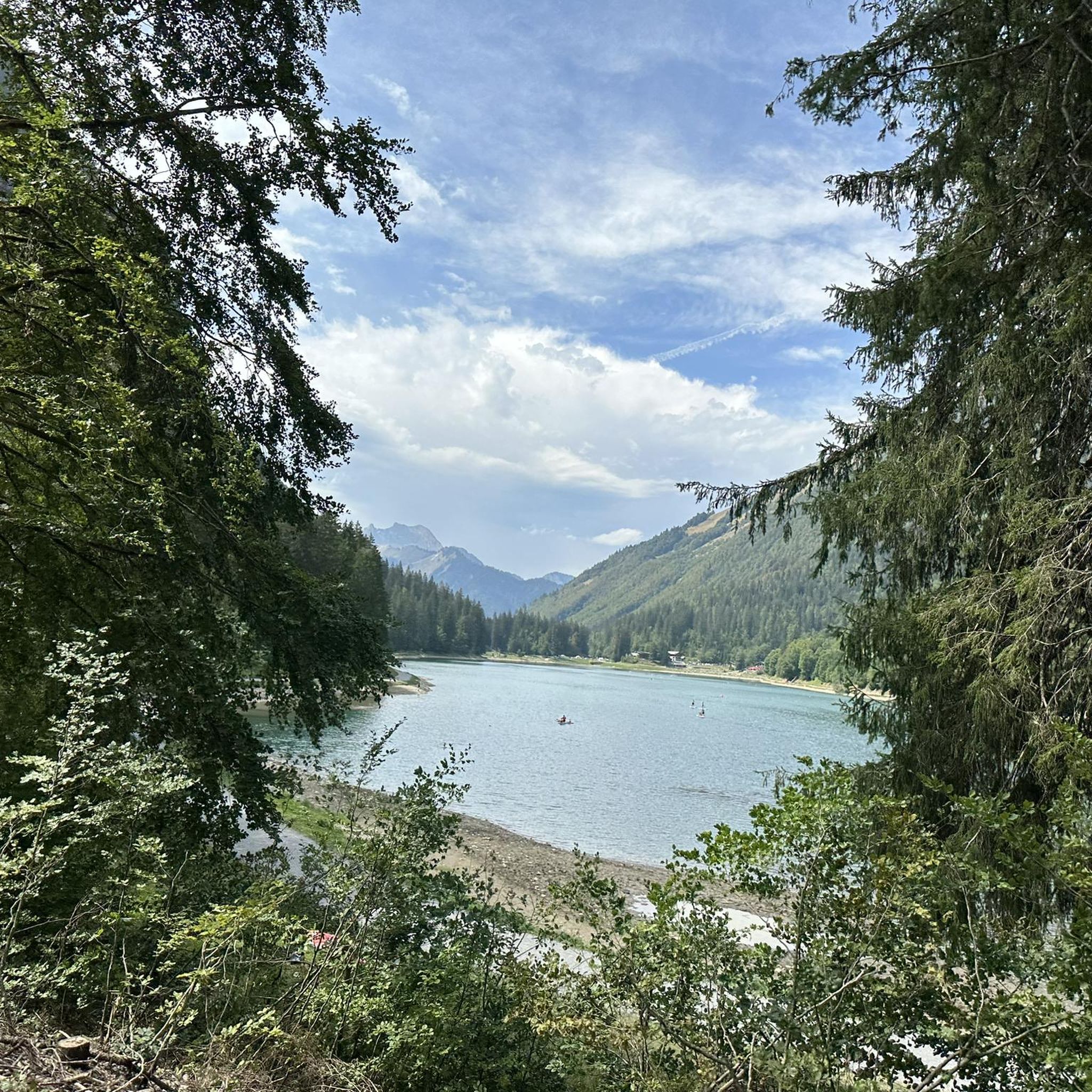
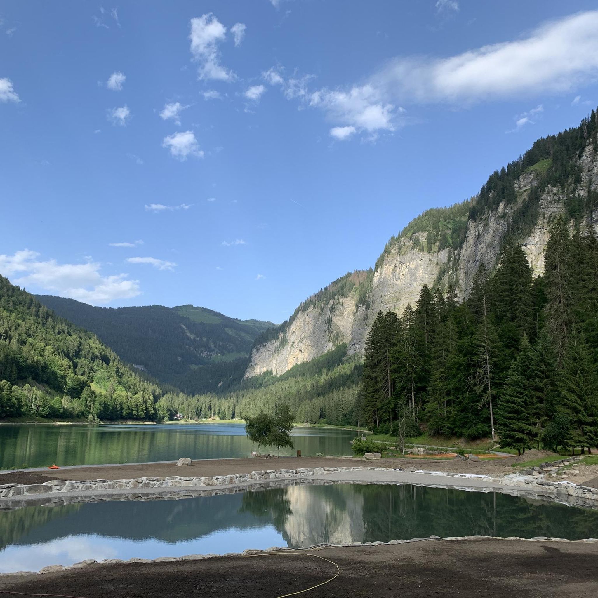
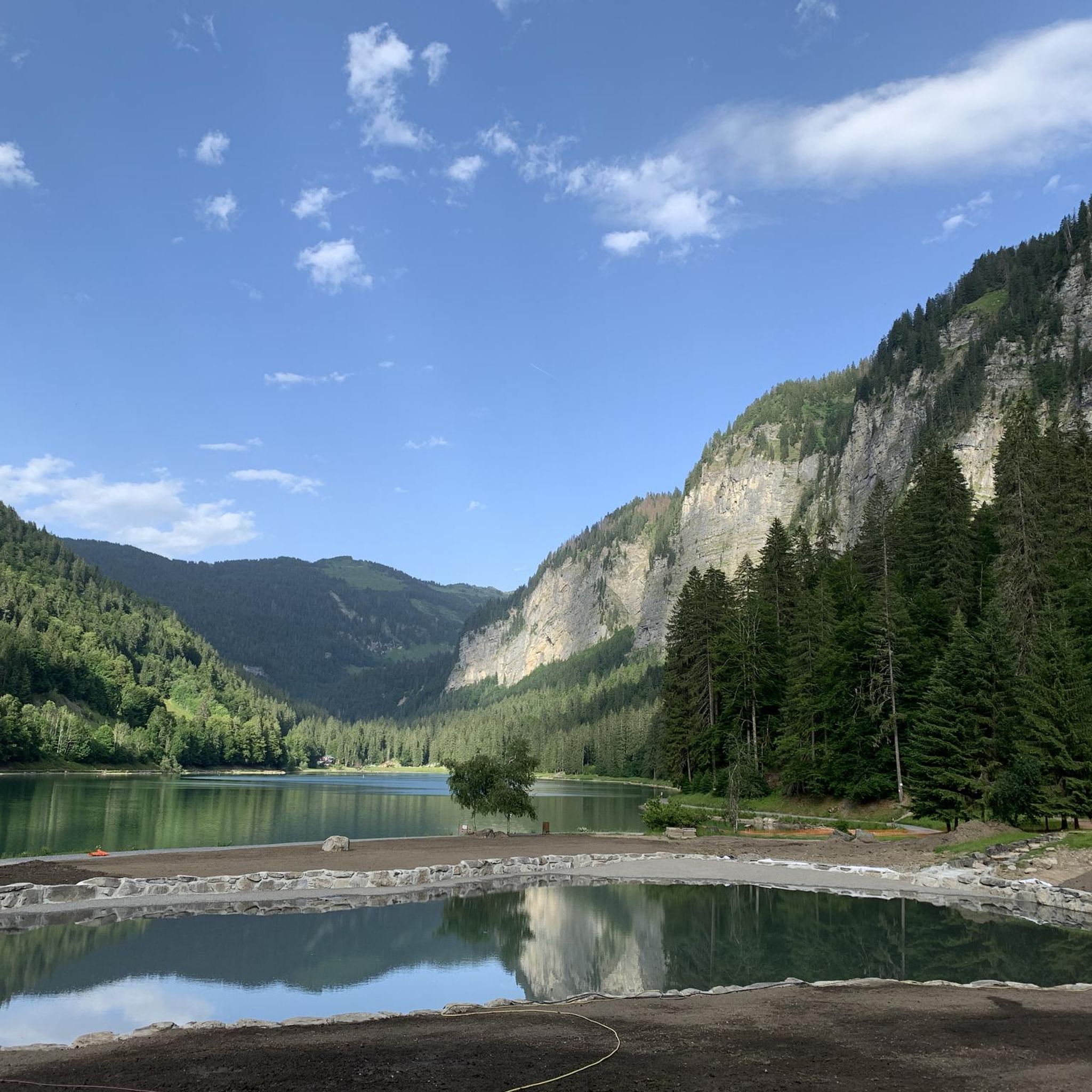
Hiking around Lac de Montriond offers diverse trails set within a significant alpine landscape. The region features a picturesque mountain lake, surrounded by towering cliffs and dense forests. As part of the Chablais UNESCO Global Geopark, the area provides insights into its geological history, including the lake's formation by a landslide. The terrain varies from flat lakeside paths to ascents through woodlands and towards higher viewpoints.
Best hiking trails around Lac de Montriond
- The most popular hiking route is Lac de Montriond – Lac de Montriond loop from Lac de Montriond, a 4.1 miles (6.5 km) trail that takes 1 hour 50 minutes to complete, offering a full circuit around the lake.
- Another top favourite among local hikers is Cascade d'Ardent – Lac de Montriond loop from Lac de Montriond, a moderate 5.5 miles (8.8 km) path. This route includes a significant climb and leads to the notable Ardent Waterfall.
- Local hikers also love the Tavaneuse Pass – Lac de Tavaneuse loop from Lac de Montriond, a 10.0 miles (16.2 km) trail leading through varied alpine terrain with a substantial elevation gain, often completed in about 7 hours 11 minutes.
- Hiking around Lac de Montriond is defined by its emerald green lake, dramatic cliffs, and forested paths leading to waterfalls and panoramic viewpoints. The network offers options for different ability levels, from easy lakeside strolls to challenging mountain ascents.
- The routes in Lac de Montriond are highly rated by the komoot community with an average score of 4.5 stars from over 1900 reviews. More than 24000 hikers have used komoot to explore Lac de Montriond's varied terrain.
Last updated: October 12, 2026
4.5
(89)
1,144
hikers
6.66km
01:52
130m
130m
Easy hike. Great for any fitness level. Easily-accessible paths. Suitable for all skill levels.
4.8
(26)
244
hikers
11.9km
03:53
500m
500m
Moderate hike. Good fitness required. Easily-accessible paths. Suitable for all skill levels.

4.7
(7)
154
hikers
8.83km
02:57
410m
410m
Moderate hike. Good fitness required. Easily-accessible paths. Suitable for all skill levels.
5.0
(2)
32
hikers
17.3km
07:43
1,340m
1,350m
Hard hike. Very good fitness required. Sure-footedness, sturdy shoes and alpine experience required.
5.0
(1)
57
hikers
Easy hike. Great for any fitness level. Easily-accessible paths. Suitable for all skill levels.
Get access to more routes and recommendations from other explorers.
Already have an account?
Our route recommendations are based on thousands of hikes, rides, and runs completed by other people on komoot.
Start today with a free account
Your next adventure awaits.

Tips from the Community


Beautiful views after the effort of the climb.
2
0

The Ardent waterfall is a true emblem and natural jewel of the Aulps valley. Above the Montriond lake, it is also the starting point of a pretty forest trail.
2
0
Beautifully situated lake - perfect for chilling out.
5
0

A small pass before entering the Aulps valley and descending towards Lake Montriond
0
0
An incredible valley before arriving at the chalets of Ardens! Far from everything 😍
0
0
Frequently Asked Questions
What types of hiking trails can I find around Lac de Montriond?
The area offers a diverse range of trails, from flat, pushchair-friendly paths encircling the lake to more challenging ascents through forests and up to panoramic viewpoints. You'll experience picturesque mountain scenery, dense woodlands, and dramatic cliffs, all within the Chablais UNESCO Global Geopark.
Are there easy, family-friendly hikes available?
Yes, Lac de Montriond is excellent for families and beginners. The flat, approximately 3-3.5 km long path encircling the lake, often called the Lac de Montriond – Trail around the lake loop, is ideal for a relaxed stroll and is even pushchair-friendly. There are 4 easy routes in total.
Can I see any waterfalls while hiking in the area?
Absolutely. The impressive Cascade d'Ardent is a significant natural attraction. You can reach it via a pleasant walk from the lake, such as the Cascade d'Ardent – Lac de Montriond loop, which takes you through forested paths to this beautiful site.
Are there any challenging hikes for experienced trekkers?
Yes, for those seeking more demanding routes, the region provides options with substantial elevation gain. An example is the Tavaneuse Pass – Lac de Tavaneuse loop, a 16.2 km trail with over 1,200 meters of elevation gain, offering varied alpine terrain. There are 2 difficult routes available.
What natural features are notable around Lac de Montriond?
The region is renowned for its 'emerald green' lake, formed by a landslide from the Nantaux mountain. Towering cliffs provide a dramatic backdrop, and the area is part of the Chablais UNESCO Global Geopark, offering insights into its geological history. Diverse ecosystems with forests and clearings are common along the trails.
Are there good viewpoints on the hiking trails?
Many trails offer excellent views. Higher vantage points like Les Guéritolles provide panoramic vistas stretching towards Morzine and Essert-Romand. More challenging routes, such as the Grand Tour of Mont-Chéry, offer extensive views of the Mont Blanc range and the Pre-Alps.
Is parking available for hikers at Lac de Montriond?
Yes, there is parking available directly at Lac de Montriond, making it convenient to access the various trailheads around the lake and for routes leading further afield.
Can I reach Lac de Montriond by public transport?
While specific public transport details can vary by season, the village of Montriond is generally accessible, and some local bus services may connect to the lake, especially during peak tourist seasons. It's advisable to check local transport schedules for the most current information.
What do other hikers enjoy most about the trails around Lac de Montriond?
The trails around Lac de Montriond are highly rated by the komoot community, with an average score of 4.5 stars from over 1,900 reviews. Hikers frequently praise the stunning emerald green lake, the dramatic cliff scenery, and the variety of paths that cater to all abilities, from leisurely lakeside strolls to challenging mountain ascents.
Are there circular hiking routes around Lac de Montriond?
Yes, many of the most popular routes are circular. For instance, the Lac de Montriond – Lac de Montriond loop offers a full circuit around the lake, and the Lac de Montriond – Cascade d'Ardent loop combines the lake with a visit to the waterfall.
What is the best time of year to go hiking in Lac de Montriond?
The best time to hike is typically from spring through autumn when the weather is mild and trails are clear. Autumn offers the added beauty of changing foliage and opportunities for foraging. In winter, some trails may be suitable for snowshoeing, and the Cascade d'Ardent freezes, becoming a spot for ice climbing.
Are there places to eat or drink near the hiking trails?
Yes, there are cafes and restaurants located around Lac de Montriond, particularly near the main lake area. These establishments offer convenient spots to refresh and refuel before or after your hike, often with scenic views of the lake.
Most popular routes around Lac de Montriond

Get inspired with the komoot mobile app


Explore more
Browse the best Hikes in other regions.
