The best running trails around Lac de la Girotte
4.5
(67)
8,440
runners
139
runs
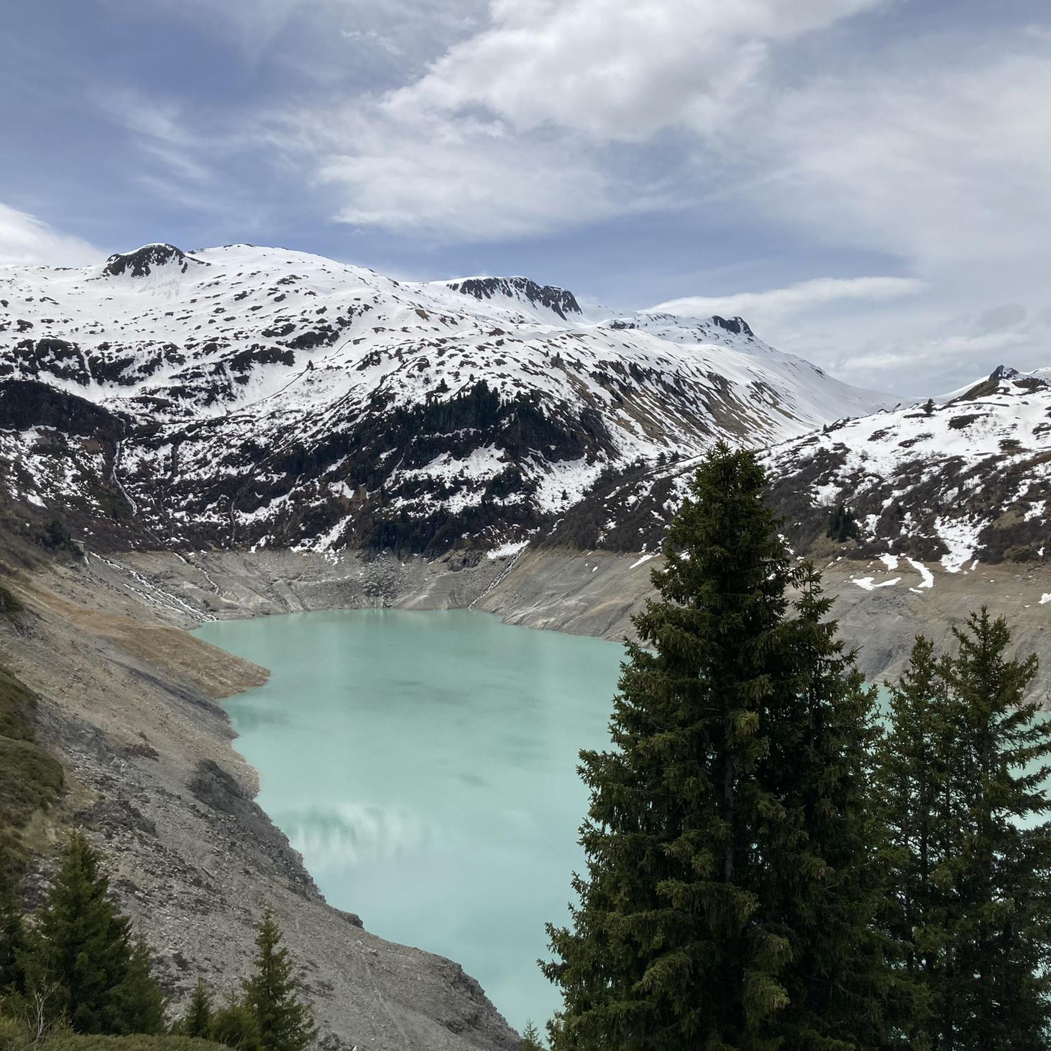
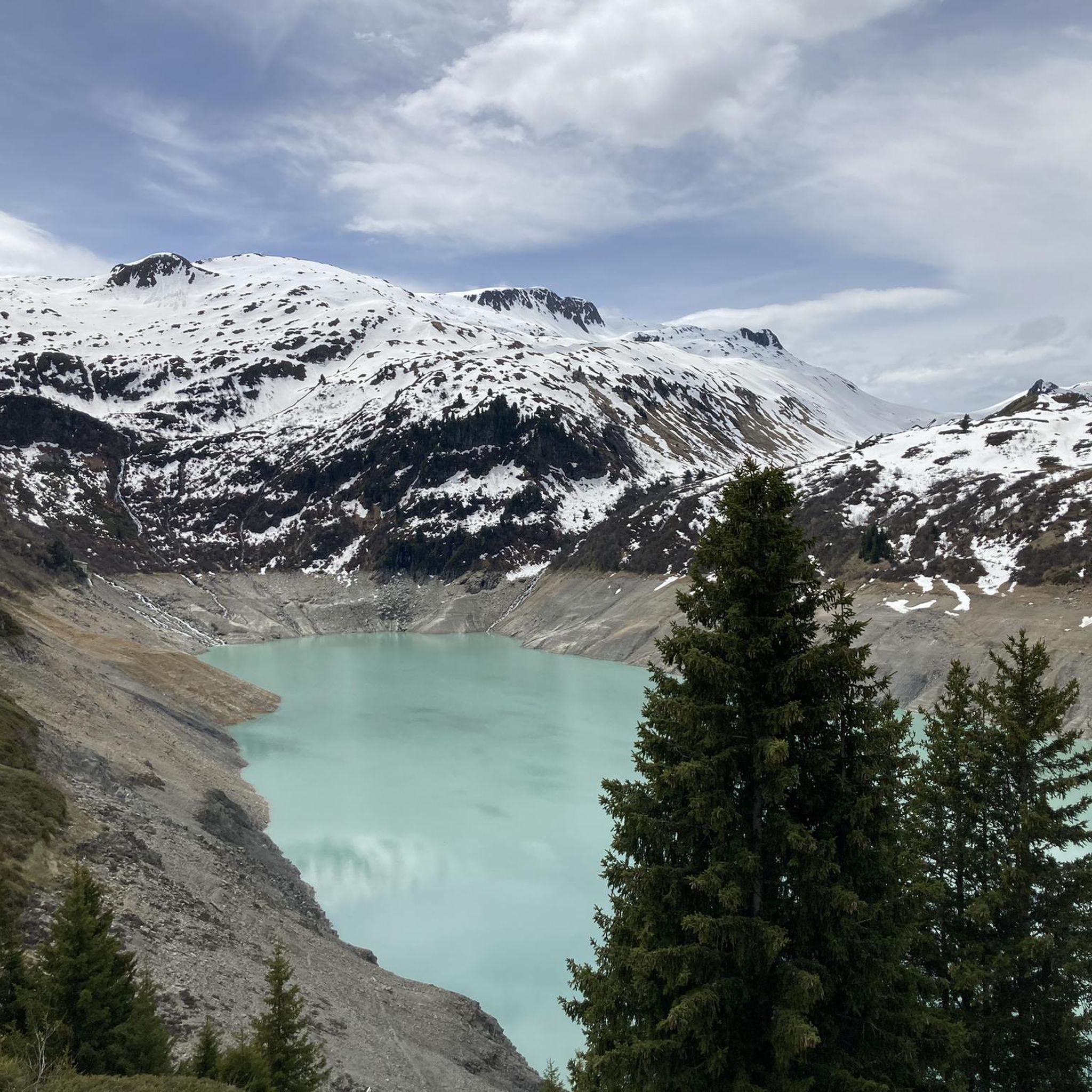
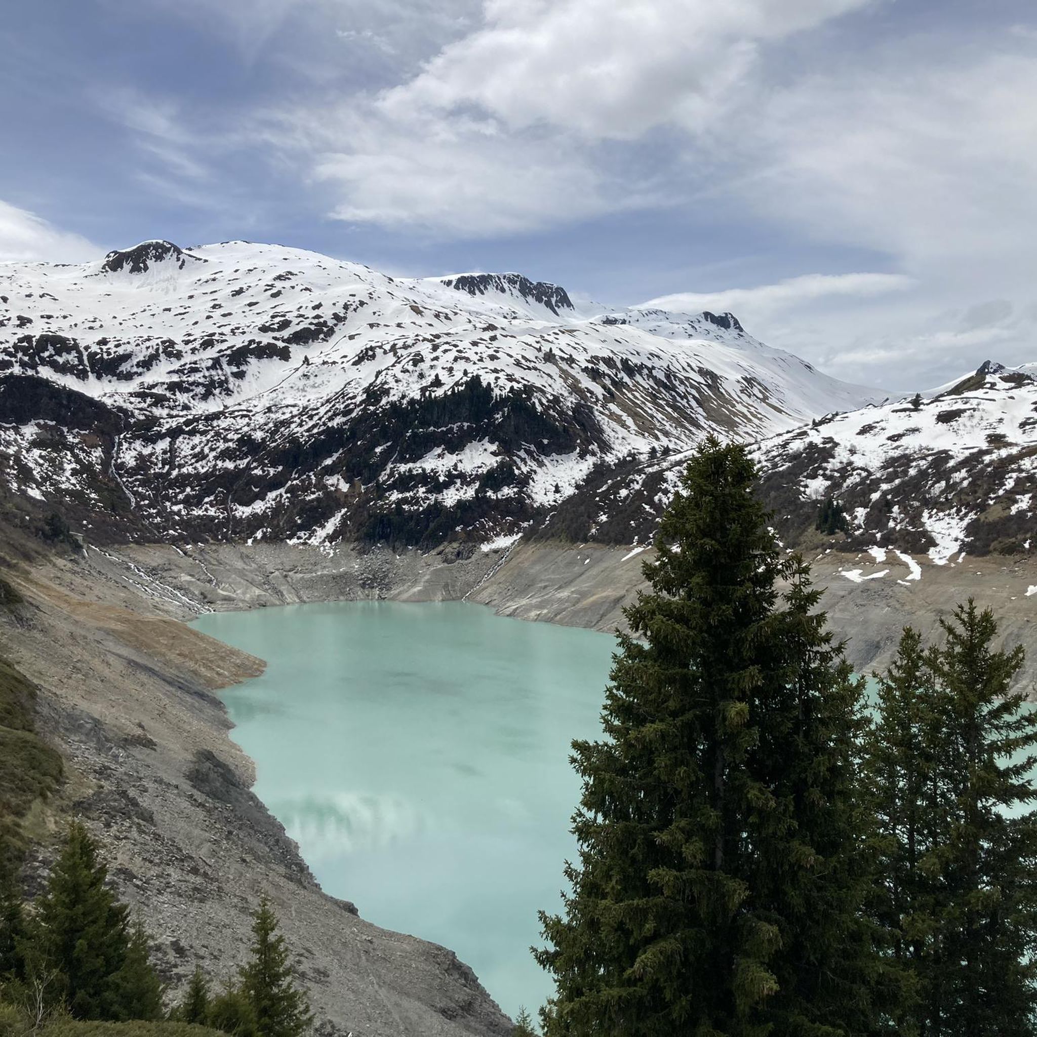
Jogging routes around Lac de la Girotte traverse the scenic Beaufortain massif in Savoie, France, at an elevation of approximately 1753 meters. The region is characterized by its high-altitude lake with distinctive milky or greenish water, surrounded by an alpine environment offering panoramic views, including glimpses of the Mont-Blanc massif. Trails often incorporate the impressive Girotte Dam, a multi-arched concrete structure, and vary from accessible paths to more challenging sections.
Best jogging routes around Lac de la Girotte
- The most popular jogging route is Hauteluce loop from Barrage de la Girotte, a 7.6 miles (12.2 km) trail that takes 1 hour 19 minutes to complete. This moderate route offers views of the surrounding alpine landscape.
- Another top favourite among local runners is Hauteluce – Hauteluce loop from Barrage de la Girotte, a moderate 6.6 miles (10.6 km) path. This route provides a consistent running experience through the area's natural beauty, typically completed in 1 hour 8 minutes.
- Local runners also love the Girotte Dam loop from Barrage de la Girotte, an 8.4 miles (13.5 km) trail leading through varied alpine terrain, often completed in about 2 hours 28 minutes.
- Jogging around Lac de la Girotte is defined by its high-altitude lake, the rugged Beaufortain massif, and the impressive Girotte Dam. The network offers options for different ability levels, from moderate paths to more difficult trails with significant elevation gain.
- The routes in Lac de la Girotte are highly rated by the komoot community with an average score of 4.6 stars from more than 70 reviews. More than 9000 runners have used komoot to explore Lac de la Girotte's varied terrain.
Last updated: June 28, 2026
5.0
(1)
50
runners
12.2km
01:20
210m
210m
Moderate run. Good fitness required. Mostly paved surfaces. Suitable for all skill levels.
19
runners
13.5km
02:28
870m
870m
Hard run. Very good fitness required. Sure-footedness, sturdy shoes and alpine experience required.

Sign up for free
5
runners
12.9km
02:16
760m
760m
Hard run. Very good fitness required. Sure-footedness, sturdy shoes and alpine experience required.
19
runners
10.1km
01:39
460m
460m
Hard run. Very good fitness required. Sure-footedness, sturdy shoes and alpine experience required.
41
runners
19.2km
03:20
1,210m
1,210m
Hard run. Very good fitness required. Sure-footedness, sturdy shoes and alpine experience required.
Get access to more routes and recommendations from other explorers.
Sign up for free
Already have an account?
Our route recommendations are based on thousands of hikes, rides, and runs completed by other people on komoot.
Start today with a free account
Your next adventure awaits.
Login or Signup

Tips from the Community

Church worth seeing in Hauteluce.
2
0
Nice pleasant place with church, shop and restaurants.
2
0


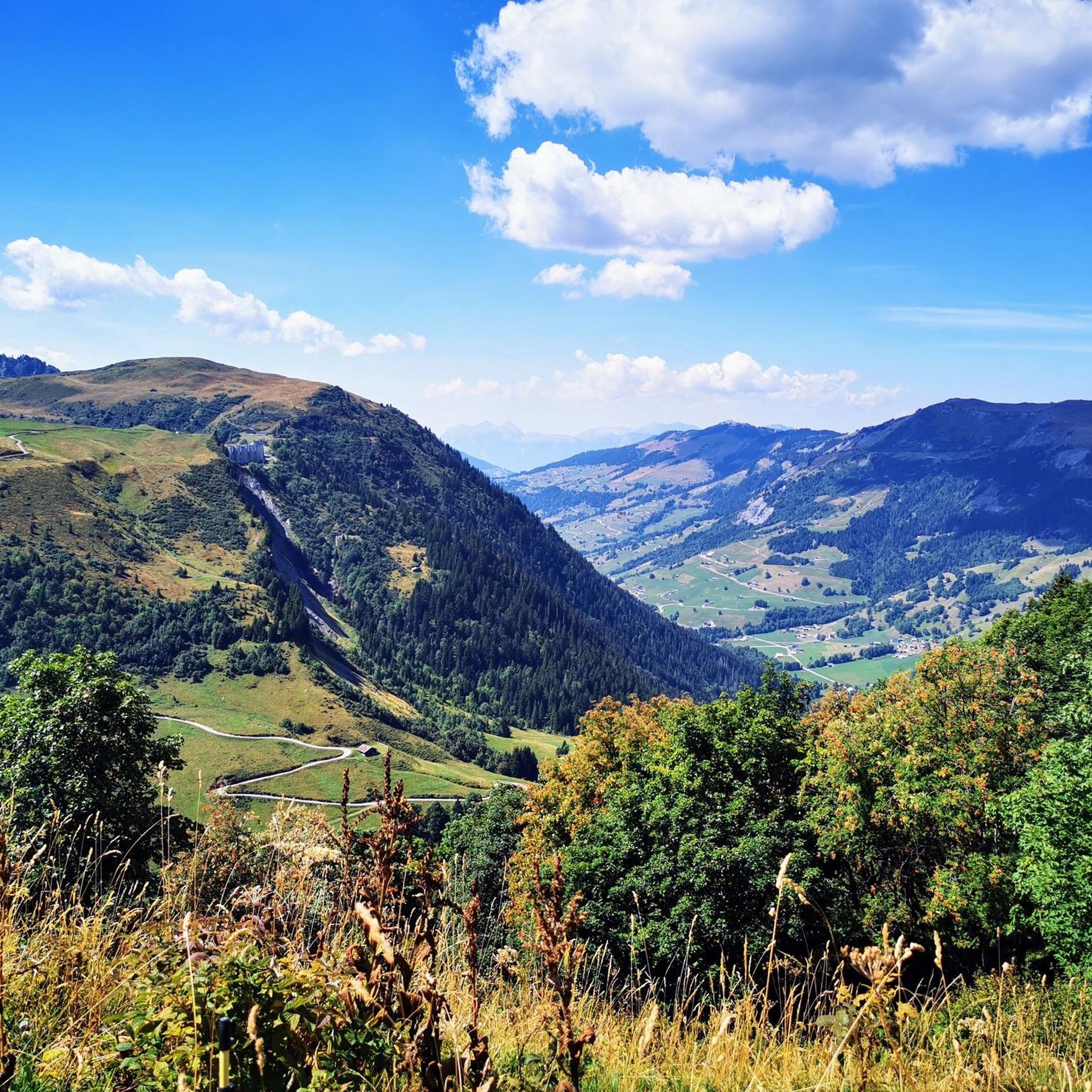
The pass is 1,989 m high and runs along a paved track between Beaufortain and Val Montjoie. The landscape is dominated by the Aguille Croche peak, where hiking trails lead to its northern summit, where the Alpine glaciers are located. From the summit you can also see the Aravis mountain range or the Girotte dam. In this sense, it is a very popular pass for mountain bike routes.
2
1
The Col de Joly is an impressive mountain pass straddling the Savoie and Haute-Savoie regions. The impressive natural balcony formed at the top is remarkable, offering a wonderful view of the Montblanc massif. The pass is 1,989 m high. It runs along a paved track that runs between Beaufortain and Val Montjoie. The landscape is dominated by the Aguille Croche peak, where hiking trails lead to its northern summit, where the Alpine glaciers are located. From the summit we can also see the Aravis mountain range or the Girotte dam. In this sense, it is a very popular pass for mountain bike routes.
3
1

Built between 1666 and 1672, the Saint-Jacques-d'Assyrie church is dedicated to the eponymous saint, who came to evangelize this valley around the middle of the 5th century.
0
0

On beautiful summer evenings, many people often sit up there next to their cars to admire the sunset at Mont Blanc!
3
0
Frequently Asked Questions
How many running routes are available around Lac de la Girotte?
There are over 140 dedicated running routes around Lac de la Girotte, offering a wide range of options for different skill levels. These trails are highly rated by the komoot community, with an average score of 4.6 stars.
What is the best time of year to go jogging near Lac de la Girotte?
The optimal season for jogging around Lac de la Girotte is generally from late spring through early autumn. During this period, trails are typically clear of snow, allowing for safe and enjoyable runs amidst the stunning alpine scenery.
Are there any easy or beginner-friendly running trails in the area?
While many routes in the Beaufortain massif are moderate to difficult, there are a few easier options. The area offers some mostly accessible paths suitable for those with good fitness looking for a less strenuous run. You can find 3 easy routes and 25 moderate routes on komoot.
Can I find circular running routes around Lac de la Girotte?
Yes, the area features several circular running routes. For example, the Hauteluce loop from Barrage de la Girotte is a popular 12.2 km moderate trail. Another option is the Hauteluce – Hauteluce loop from Barrage de la Girotte, which is 10.6 km long and also offers a consistent running experience.
What kind of views can I expect while running around Lac de la Girotte?
Joggers can enjoy stunning panoramic views that frequently include glimpses of the majestic Mont-Blanc massif. The trails also offer sights of the unique milky or greenish water of Lac de la Girotte, surrounded by the rugged beauty of the Beaufortain massif.
Are there any notable landmarks or attractions along the running routes?
Absolutely. The impressive Girotte Dam, a multi-arched concrete structure, is a significant attraction that many running routes incorporate. It adds an interesting historical and architectural element to the natural landscape, offering a unique landmark during your run. Consider the Girotte Dam loop from Barrage de la Girotte for a route that features this landmark.
Is there parking available near the trailheads for Lac de la Girotte?
Yes, parking is generally available near popular starting points, such as Barrage de la Girotte, which serves as a common access point for many of the running trails in the area.
What is the typical difficulty level of running trails in this region?
The running trails around Lac de la Girotte offer varied terrain. While there are some accessible paths, many routes are considered moderate to difficult, often involving significant elevation gain due to the alpine environment of the Beaufortain massif. Out of 146 routes, 118 are rated difficult.
Can I reach the running trails around Lac de la Girotte using public transport?
Access to Lac de la Girotte and its trailheads by public transport can be limited due to its isolated, high-altitude location. It's advisable to check local bus schedules or consider shuttle services if available, especially from nearby towns like Hauteluce, as direct routes to the dam are not always frequent.
What makes running around Lac de la Girotte unique?
The uniqueness of running around Lac de la Girotte stems from its high-altitude setting at approximately 1753 meters, the distinctive milky or greenish glacial meltwater of the lake, and the dramatic backdrop of the Beaufortain massif with glimpses of Mont-Blanc. The combination of natural beauty and the impressive Girotte Dam creates a truly memorable experience.
Are there any longer, more challenging running options for experienced trail runners?
Yes, experienced trail runners will find plenty of challenging options. Many routes feature significant elevation gain and varied alpine terrain. For instance, the Girotte Dam – Sallestet Pass loop from Barrage de la Girotte is a difficult 12.8 km route with substantial elevation changes, perfect for those seeking a strenuous workout.
What should I wear for jogging in the Lac de la Girotte area?
Given the alpine environment and high elevation, it's recommended to wear layers, even in warmer months, as weather conditions can change rapidly. Sturdy trail running shoes with good grip are essential for navigating varied terrain, and bringing water and sun protection is always wise.
Most popular routes around Lac de la Girotte

Get inspired with the komoot mobile app


Explore more
Browse the best Running Trails & Routes in other regions.
