The best walks and hikes around Lac de la Girotte
4.6
(1939)
28,555
hikers
301
hikes
Hiking around Lac de la Girotte offers diverse trails within the Beaufortain massif in Savoie, France. The region is characterized by its alpine environment, featuring glacial-fed waters and panoramic views that include glimpses of the Mont-Blanc massif. The impressive Girotte Dam, a significant engineering feat, also forms a prominent landmark in the area. This landscape provides varied terrain for hikers, from lake loops to extended mountain treks.
Best hiking trails around Lac de la Girotte
- The most popular hiking route…
Last updated: July 9, 2026
5.0
(1)
2
hikers
6.94km
02:46
380m
370m
Moderate hike. Good fitness required. Mostly accessible paths. Sure-footedness required.
4.6
(10)
146
hikers
8.14km
03:30
550m
550m
Moderate hike. Good fitness required. Mostly accessible paths. Sure-footedness required.

Sign up for free
5.0
(7)
88
hikers
16.7km
07:02
1,060m
1,060m
Hard hike. Very good fitness required. Mostly accessible paths. Sure-footedness required.
14
hikers
17.5km
06:26
940m
940m
Hard hike. Very good fitness required. Mostly accessible paths. Sure-footedness required.
5.0
(4)
21
hikers
18.4km
06:32
840m
840m
Hard hike. Very good fitness required. Mostly accessible paths. Sure-footedness required.
Get access to more routes and recommendations from other explorers.
Sign up for free
Already have an account?
Our route recommendations are based on thousands of hikes, rides, and runs completed by other people on komoot.
Start today with a free account
Your next adventure awaits.
Login or Signup

Tips from the Community

Quiet walk from Col de Joly
0
0

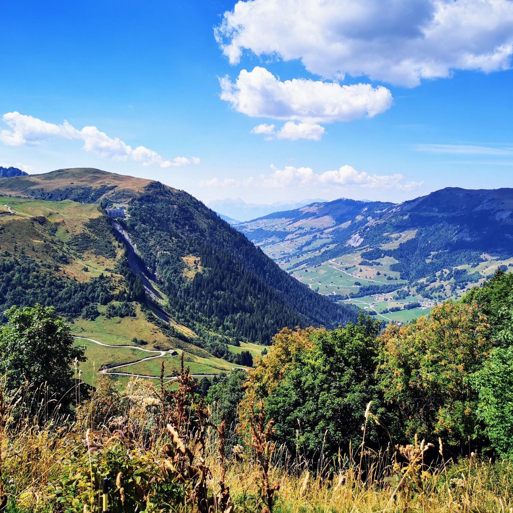
The pass is 1,989 m high and runs along a paved track between Beaufortain and Val Montjoie. The landscape is dominated by the Aguille Croche peak, where hiking trails lead to its northern summit, where the Alpine glaciers are located. From the summit you can also see the Aravis mountain range or the Girotte dam. In this sense, it is a very popular pass for mountain bike routes.
2
1
The Col de Joly is an impressive mountain pass straddling the Savoie and Haute-Savoie regions. The impressive natural balcony formed at the top is remarkable, offering a wonderful view of the Montblanc massif. The pass is 1,989 m high. It runs along a paved track that runs between Beaufortain and Val Montjoie. The landscape is dominated by the Aguille Croche peak, where hiking trails lead to its northern summit, where the Alpine glaciers are located. From the summit we can also see the Aravis mountain range or the Girotte dam. In this sense, it is a very popular pass for mountain bike routes.
3
1

Superb view of Mt Blanc from the mountain pastures
0
0

On beautiful summer evenings, many people often sit up there next to their cars to admire the sunset at Mont Blanc!
3
0

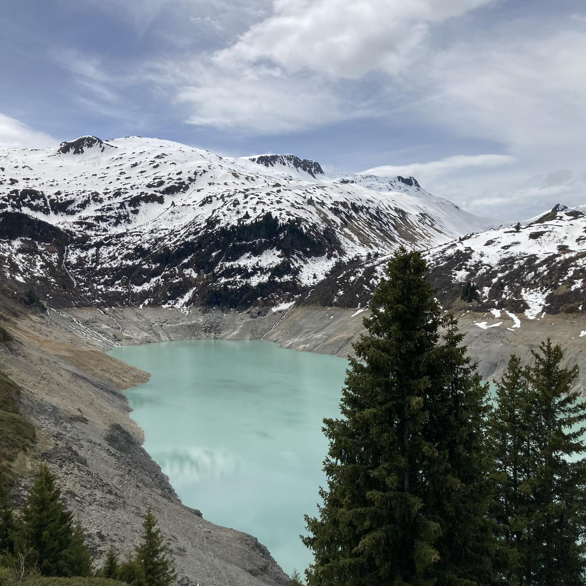
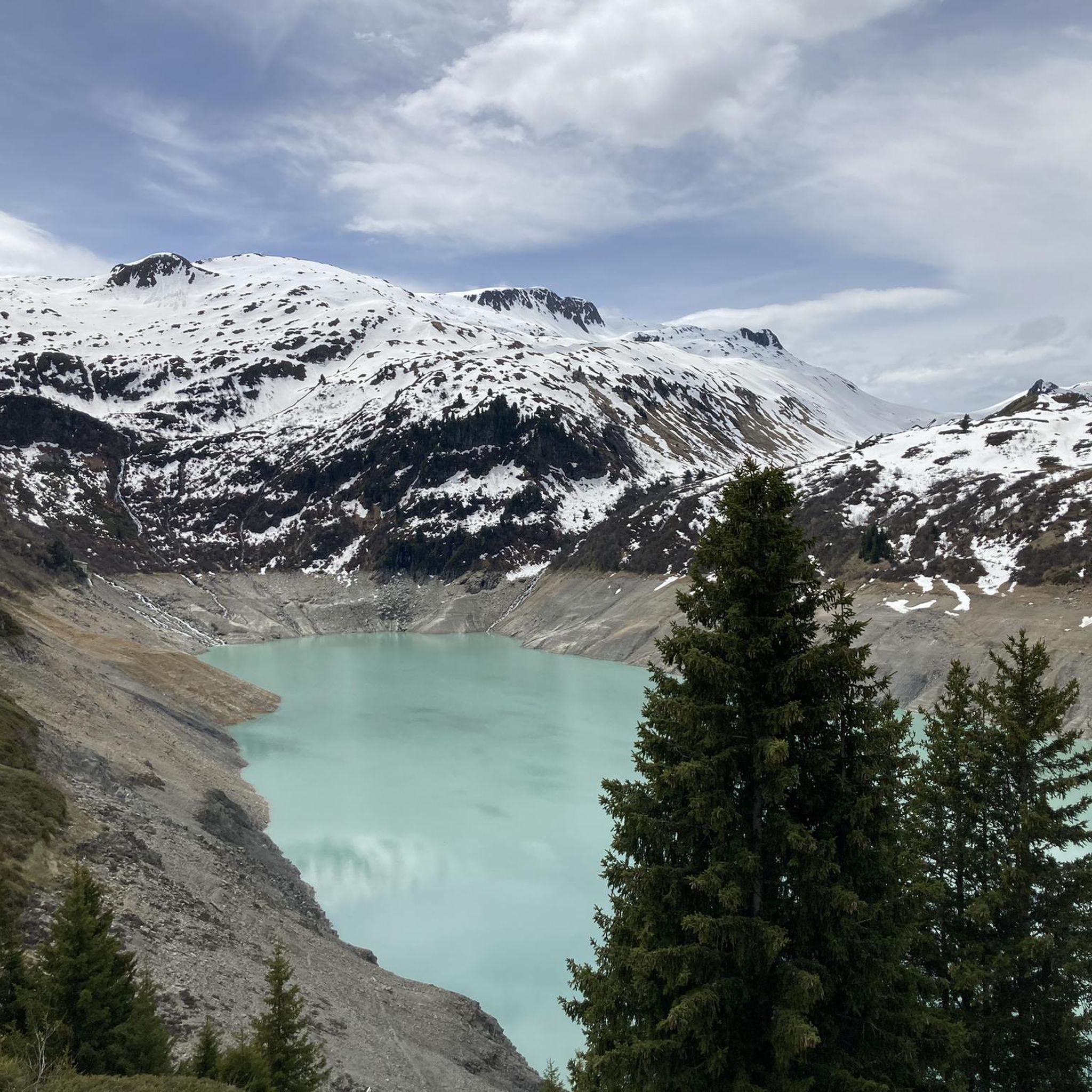
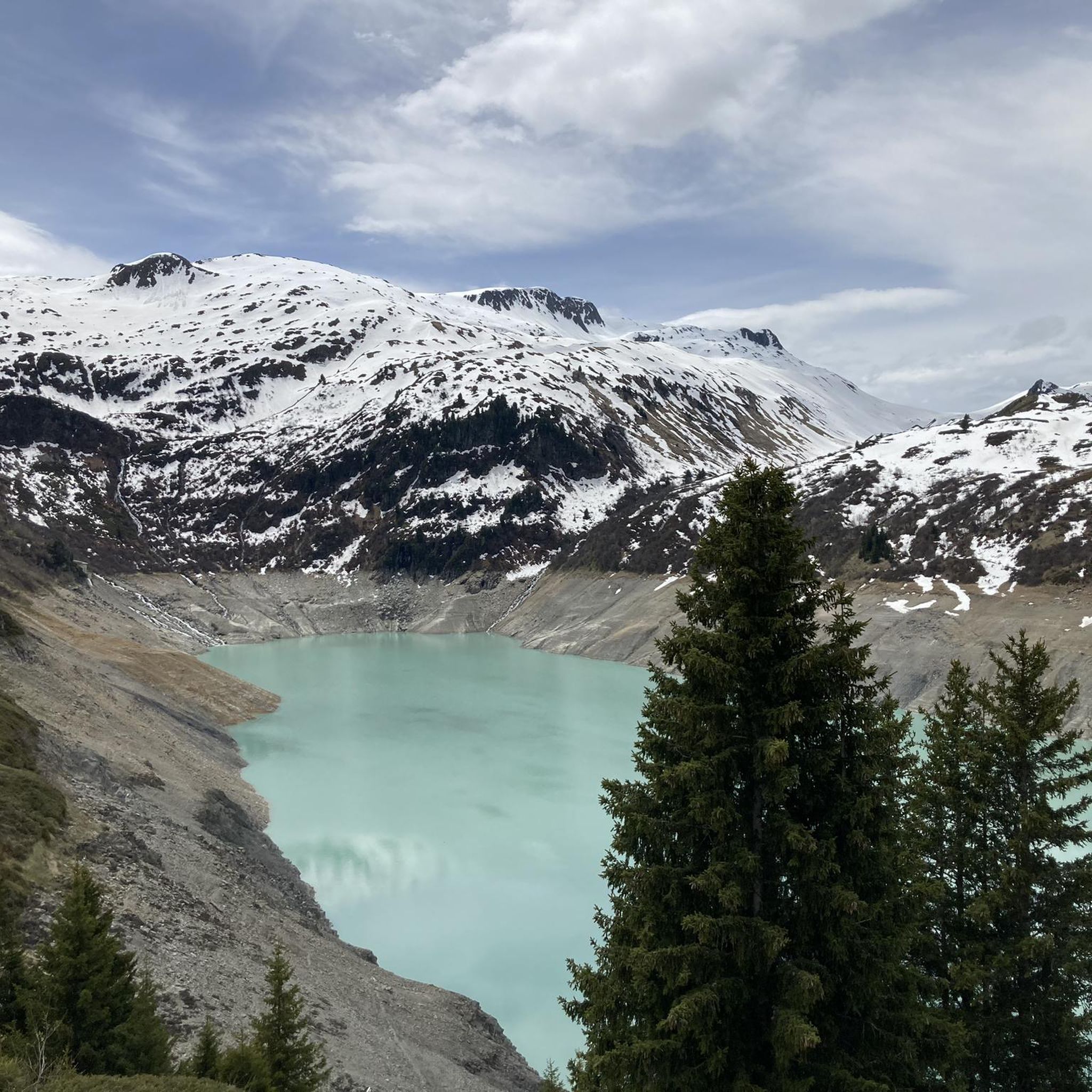
The Girotte dam retains the waters of the Tré la Tête glacier, which gives a milky color to its lake. At an altitude of 1,750 meters, the structure superbly overlooks the Dorinet gorges.
2
0

Lac de Roselette is a small natural lake on the slopes of Contamines Montjoie
0
0
Frequently Asked Questions
What kind of hiking trails can I expect around Lac de la Girotte?
Lac de la Girotte offers a diverse range of hiking trails within the Beaufortain massif. You'll find everything from moderate loops around the lake to challenging, extended treks into the surrounding alpine environment. The terrain often features significant elevation changes, providing a true mountain hiking experience.
How many hiking routes are available in the Lac de la Girotte area?
There are over 300 hiking routes available around Lac de la Girotte. This includes approximately 58 easy trails, 149 moderate routes, and 93 more difficult options, ensuring there's a path for various fitness levels and preferences.
What are the most notable natural features or landmarks to see while hiking near Lac de la Girotte?
Hikers are often captivated by the lake's distinctive milky or greenish water, a result of glacial meltwater. The impressive Girotte Dam itself is a significant engineering marvel and a prominent landmark. Beyond the lake, you'll encounter stunning alpine scenery and panoramic views, including distant glimpses of the Mont-Blanc massif.
Are there any circular hiking routes around Lac de la Girotte?
Yes, there are several circular routes. A popular moderate option is the Lac de la Girotte loop from Barrage de la Girotte, which takes about 3 hours 30 minutes. For a more challenging full-day trek, consider the Lac de la Girotte – Lac Noir loop from Barrage de la Girotte, which is 16.7 km and requires very good fitness.
What is the best time of year to go hiking around Lac de la Girotte?
The optimal time for hiking around Lac de la Girotte is generally from late spring through early autumn. During these months, the trails are typically clear of snow, making them accessible and enjoyable. Winter hiking can be possible but requires specialized equipment and experience due to snow and ice conditions.
Are there family-friendly hiking options near Lac de la Girotte?
While many trails involve moderate to challenging terrain, there are easier sections and shorter loops, especially directly around the dam, that can be suitable for families. It's best to check the difficulty and distance of specific routes to ensure they match your family's capabilities.
What do other hikers enjoy most about the trails around Lac de la Girotte?
The area is highly rated by the komoot community, with an average score of 4.6 stars from nearly 2,000 reviews. Hikers frequently praise the breathtaking panoramic views, the unique glacial-fed waters of the lake, and the sense of alpine escape. The impressive Girotte Dam is also often highlighted as an interesting feature.
Is there parking available for hikers at Lac de la Girotte?
Accessing the trails around Lac de la Girotte typically involves starting from the Barrage de la Girotte (Girotte Dam). Parking facilities are usually available in this vicinity, though it's advisable to arrive early during peak season to secure a spot.
Can I reach Lac de la Girotte using public transport?
Public transport options directly to Lac de la Girotte are limited due to its alpine location. Access is primarily by car, often followed by a hike to the lake itself. It's recommended to check local bus services to nearby towns like Beaufort-sur-Doron and then plan for a taxi or a longer hike from there.
Are dogs allowed on the hiking trails around Lac de la Girotte?
Generally, dogs are permitted on hiking trails in the French Alps, but it's crucial to keep them on a leash, especially in areas with livestock or protected wildlife. Always ensure you clean up after your dog and respect local regulations, which may vary by specific trail or season.
Are there any cafes or restaurants near the hiking trails for refreshments?
While the immediate vicinity of Lac de la Girotte is quite remote, there might be small refuges or seasonal establishments closer to the dam or along popular routes during the peak hiking season. For more substantial options, you would typically need to descend to nearby villages like Beaufort-sur-Doron.
What kind of views can I expect from higher viewpoints like Col du Joly?
From higher viewpoints such as Col du Joly, you can expect truly expansive vistas of the surrounding peaks and valleys. These elevated positions offer magnificent panoramas that often include clear, distant views of the majestic Mont-Blanc massif, making the climb well worth the effort. A challenging route to this area is the Col du Joly – Fenêtre Pass loop from Barrage de la Girotte.
Most popular routes around Lac de la Girotte

Get inspired with the komoot mobile app


Explore more
Browse the best Hikes in other regions.
