The best walks and hikes around Berrocalejo De Aragona
4.4
(61)
803
hikers
47
hikes
Hiking around Berrocalejo De Aragona offers exploration of a traditional Castilian village set within mountainous and rocky terrain. The region is characterized by elevated landscapes and impressive granite rock formations, known as "berrocales." Situated at an altitude of 1,102 meters, the area provides diverse routes for nature observation, influenced by the Río Voltoya. This environment is suitable for various outdoor activities, particularly hiking.
Best hiking trails around Berrocalejo De Aragona
- The most popular hiking route is Bernuy-Salinero from Ávila —…
Last updated: May 20, 2026
5.0
(1)
9
hikers
Moderate hike. Good fitness required. Easily-accessible paths. Suitable for all skill levels.
4.0
(2)
2
hikers
11.7km
03:33
420m
410m
Moderate hike. Good fitness required. Easily-accessible paths. Suitable for all skill levels.

Sign up for free
20.9km
06:31
810m
810m
Hard hike. Very good fitness required. Easily-accessible paths. Suitable for all skill levels.
15.3km
04:34
460m
450m
Hike the 9.5-mile Cueva Mingubela from Ojos-Albos circular by the Río Voltoya, a moderate route with ancient rock art and river views.
2.89km
00:46
30m
30m
Easy 1.8-mile circular hike near Bernuy-Salinero to the ancient Dolmen del Prado de Las Cruces, through holm oak pastures.
Get access to more routes and recommendations from other explorers.
Sign up for free
Already have an account?
Our route recommendations are based on thousands of hikes, rides, and runs completed by other people on komoot.
Start today with a free account
Your next adventure awaits.
Login or Signup



Tips from the Community

Mingubela Cave, also known as Peña Mingubela, is a fascinating rock shelter located near the small village of Ojos Albos in Ávila, Spain. This site is known for its ancient cave paintings, which depict various figures, including warriors, some of whom are shown holding shields or in prayer positions. The cave is divided by a stone column, which adds to its unique structure. If you are interested in visiting, it is important to note that the cave is only accessible on foot and the path can be quite steep, so it is advisable to bring a flashlight and seek precise directions from locals. Additionally, there are several hiking trails in the area, such as the circular trail from Ojos Albos that includes La Atalaya and Mingubela Cave.
5
0
This dolmen has an ancient history, being used as a burial place from the end of the Neolithic to the beginning of the Bronze Age, covering the last centuries of the fourth millennium BC. until the first third of the second millennium BC. Its presence evokes mystery and connects us with the ancient cultures that built it.
2
0

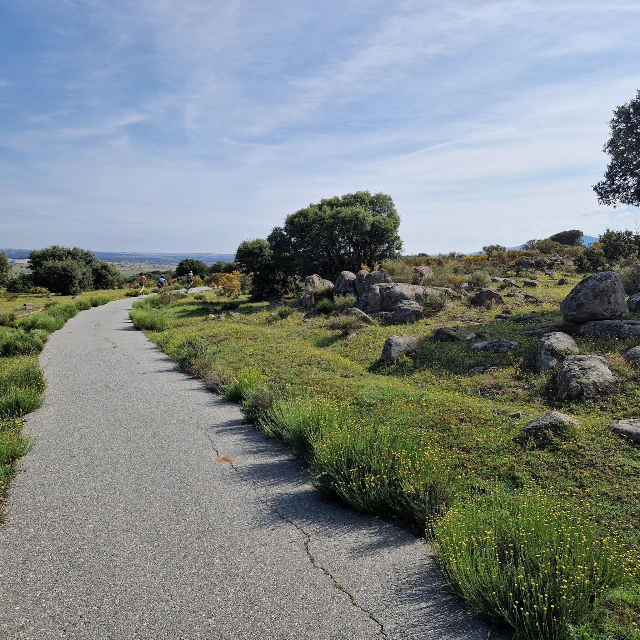
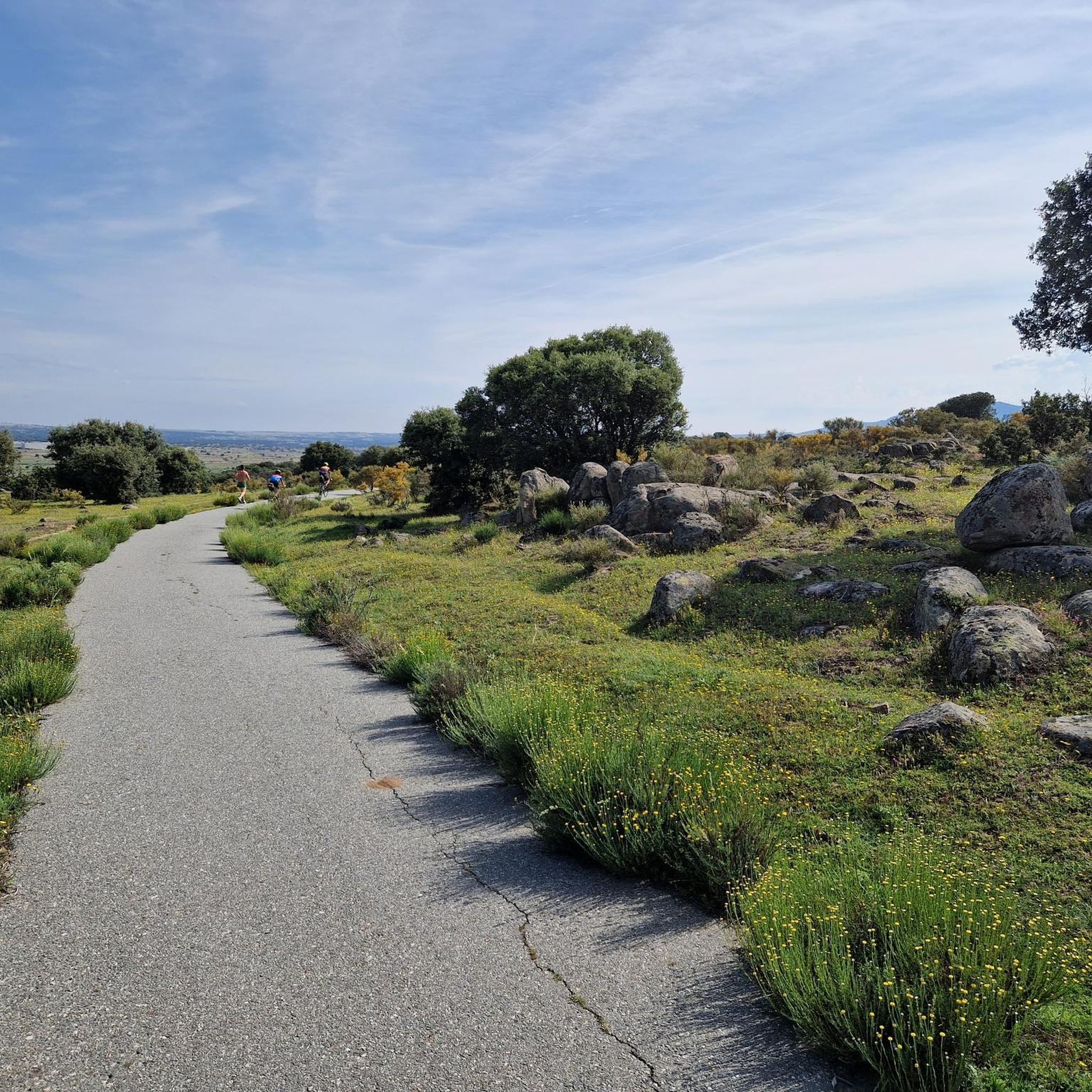
On our tour from Lisbon via Porto to Madrid in 2023, one of the things I particularly remember is this wonderful drive through the unique landscape. Incredibly beautiful for several kilometers! View of the mountains, herds of cattle, colorful flowers along the way. 1A.👌👌
1
0

Natural route on foot and by bicycle that runs through the old commercial and livestock routes from Ávila to the lands of Campo de Voltoya. The route leads towards Bernuy-Salinero and beyond.
1
0
Megalithic monument built with granite or slate from a local quarry for ceremonial purposes.
1
1
Going up from the Serones reservoir, do not forget to look back and see the fertile and green meadows of the Voltoya River valley.
2
0

On the other side of the Arroyo del Corral is this well-known cave where cave paintings are found. Just above it, we can find Peña de la Mora.
0
1
At the end of the Sierra de Ojos-Albos is El Pelado, which is the last mountain after descending towards Aldeavieja. The name corresponds exactly to what the peak looks like, completely peeled with mills on top.
1
0
Frequently Asked Questions
How many hiking trails are available in Berrocalejo De Aragona?
Berrocalejo De Aragona offers a diverse network of over 45 hiking trails. These routes cater to various skill levels, including easy, moderate, and difficult options, allowing you to explore the region's unique landscapes.
What kind of terrain can I expect when hiking in Berrocalejo De Aragona?
The terrain in Berrocalejo De Aragona is characterized by its elevated, mountainous, and rocky nature. You'll encounter impressive granite rock formations, locally known as "berrocales," and routes often follow river valleys, such as those influenced by the Río Voltoya. This creates a scenic and varied hiking experience.
Are there easy hiking trails suitable for beginners or families in Berrocalejo De Aragona?
Yes, there are several easy hiking trails perfect for beginners or families. For instance, the Dolmen del Prado de las Cruces Trail is a relatively short and accessible route, taking about 46 minutes to complete. This allows for a gentle introduction to the region's natural beauty.
Are there any circular hiking routes in Berrocalejo De Aragona?
Yes, the region features several circular routes. A notable option is La Atalaya y Cueva Mingubela — circular desde Ojos-Albos, a moderate 7.3-mile (11.7 km) path that offers scenic views around Ojos-Albos and Cueva Mingubela. Another is The Embalse de Serones from Ojos-Albos — circular by the río Voltoya, a more challenging 20.9 km route.
What historical or cultural sights can I explore while hiking in Berrocalejo De Aragona?
Beyond the natural beauty, you can discover several historical and cultural points of interest. The village itself boasts traditional Castilian architecture. You might encounter the Iglesia Parroquial de Santa María with its 17th-century Baroque altarpiece, an ancient Romanesque arch in the local cemetery, or a unique stone shield carved into a granite outcrop in the town square. There's also an old mill and a triple-slab bridge over the Arroyo de Cortos to explore.
Are there any natural landmarks or unique geological features to see?
Absolutely. The region is famous for its elevated, mountainous, and stony terrain, featuring impressive granite rock formations known as "berrocales." The Río Voltoya also influences the landscape, with some routes offering views of the river and ancient rock art, such as those near Cueva Mingubela.
What do other hikers enjoy most about hiking in Berrocalejo De Aragona?
The hiking experience in Berrocalejo De Aragona is highly rated by the komoot community, with an average score of 4.4 stars from over 50 reviews. Hikers often praise the diverse mountainous terrain, the unique granite rock formations, and the tranquil river valleys that define the area.
Are dogs allowed on the hiking trails in Berrocalejo De Aragona?
While specific regulations can vary, generally, dogs are welcome on hiking trails in rural areas like Berrocalejo De Aragona, especially if kept on a leash. It's always a good idea to check local signage for any specific restrictions, particularly in protected natural areas, and ensure your dog is well-behaved around wildlife and other hikers.
What is the best time of year to go hiking in Berrocalejo De Aragona?
Given its mountainous and elevated terrain, spring and autumn are generally ideal for hiking in Berrocalejo De Aragona. The weather is typically milder, and the natural scenery is vibrant. Summer can be warm, so early mornings or late afternoons are recommended, while winter offers a different, often serene, experience, though some higher routes might be more challenging.
Are there any longer, more challenging routes for experienced hikers?
Yes, for experienced hikers seeking a challenge, routes like The Embalse de Serones from Ojos-Albos — circular by the río Voltoya offer a difficult 20.9 km journey with significant elevation changes. This route provides an extensive exploration of the region's rugged landscapes.
Are there any nearby attractions or cities worth visiting after a hike?
Yes, the historic city of Ávila is very close to Berrocalejo De Aragona. You can visit the impressive Ávila City Walls, explore the Plaza del Mercado Chico, or see the Basilica of San Vicente of Ávila. There's also an Old Roman bridge over the Adaja River nearby, offering more cultural and historical exploration.
Are there options for public transport to reach hiking trails in Berrocalejo De Aragona?
Berrocalejo De Aragona is a small, traditional village. While public transport options directly to trailheads might be limited, it is situated just 9 km from Ávila, which is better connected. From Ávila, you may need to arrange local transport or drive to reach specific starting points for hikes.
Most popular routes around Berrocalejo De Aragona
Most popular attractions around Berrocalejo De Aragona

Get inspired with the komoot mobile app


Explore more
Browse the best Hikes in other regions.
