The best running trails around Santibáñez De Béjar
4.0
(1)
22
runners
8
runs
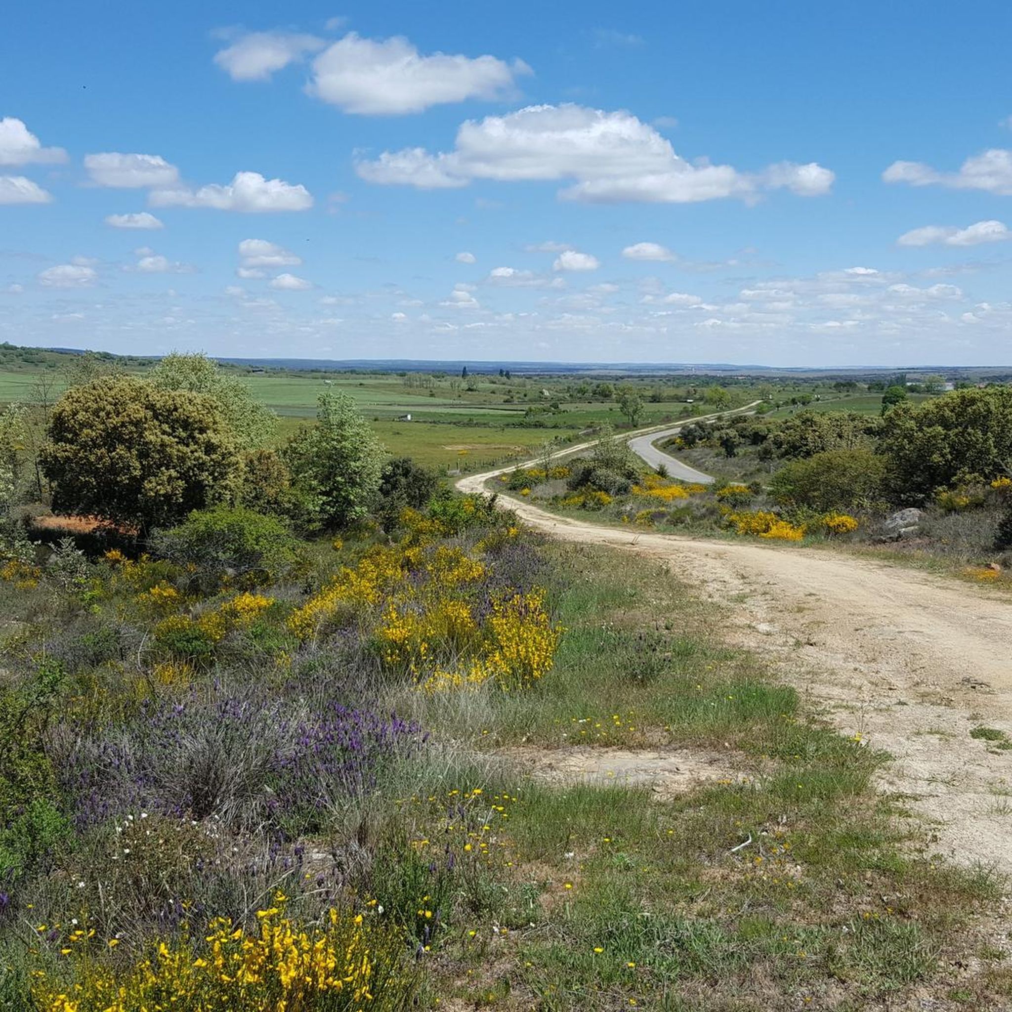
Jogging routes around Santibáñez De Béjar traverse a diverse landscape within the Sierras de Béjar y Francia Biosphere Reserve. The region features green, leafy forests and steep mountains, offering varied terrain for runners. Elevations range significantly, providing options from gentle paths to more challenging uphill runs. This area is characterized by its rich ecosystems, including oak, chestnut, and ash forests, which offer shaded paths for running.
Best jogging routes around Santibáñez De Béjar
- The most popular jogging route is Guijuelo…
Last updated: June 28, 2026
4.0
(1)
4
runners
8.88km
00:56
80m
80m
Moderate run. Good fitness required. Mostly paved surfaces. Suitable for all skill levels.
3
runners
9.79km
01:19
430m
430m
Hard run. Very good fitness required. Sure-footedness, sturdy shoes and alpine experience required.

Sign up for free
3
runners
15.9km
01:44
250m
240m
Hard run. Very good fitness required. Mostly paved surfaces. Suitable for all skill levels.
2
runners
7.48km
00:50
120m
120m
Moderate run. Good fitness required. Mostly paved surfaces. Suitable for all skill levels.
2
runners
10.3km
01:09
140m
140m
Moderate run. Good fitness required. Mostly paved surfaces. Suitable for all skill levels.
Get access to more routes and recommendations from other explorers.
Sign up for free
Already have an account?
Our route recommendations are based on thousands of hikes, rides, and runs completed by other people on komoot.
Start today with a free account
Your next adventure awaits.
Login or Signup



Tips from the Community

Between Puente del Congosto and Guijo de Ávila, the Cañada Real Soriana Occidental runs very close to the Tormes River, which makes the journey much more pleasant.
0
0

This is the tourist and gastronomic area of Guijuelo, considered the birthplace of acorn-fed Iberian ham with Protected Designation of Origin (PDO Guijuelo). More than 150 ham and cured meat producers are concentrated here. The cold, dry climate of the Sierra de Béjar favors a slow, natural curing process, giving the ham a sweeter, more unctuous flavor.
3
0

You cannot leave Guijuelo without eating its famous ham! The town is famous for the high quality of its hams and sausages from Iberian pigs. Although the meat comes largely from Extremadura and Andalusia, here it finds the perfect place for its curing, thanks to a characteristic cold and dry climate.
2
1

Frequently Asked Questions
What kind of terrain can I expect on running routes around Santibáñez De Béjar?
The region, part of the Sierras de Béjar y Francia Biosphere Reserve, offers a diverse landscape. You'll find green, leafy forests with shaded paths, as well as steep mountainous terrain. This provides options ranging from gentle paths to more challenging uphill runs, with significant elevation changes on some routes.
Are there any easy or moderate running routes suitable for beginners in the area?
Yes, there are routes suitable for different fitness levels. For a moderate and relatively gentle run, consider the Guijuelo Jamón District loop from Antigua Estación de Guijuelo, which is about 6.2 km with gentle elevation changes. Another moderate option is the Jesús Route loop from Ledrada, covering 7.48 km.
Where can I find more challenging or long-distance running trails near Santibáñez De Béjar?
For a more demanding experience, the area offers several difficult routes. The La Charca – Cabecillo de los Dados loop from Fuentes de Béjar is a challenging 27.2 km path with significant elevation gain. Another difficult option is the Running loop from San Bartolomé de Béjar, which is 9.8 km through mountainous terrain.
What natural features or landmarks can I see while jogging in Santibáñez De Béjar?
The region is rich in natural beauty and historical sites. You can explore diverse ecosystems including oak, chestnut, and ash forests. Notable landmarks include the historic El Bosque de Béjar, a 16th-century ducal hunting ground with tranquil ponds and winding paths. Other points of interest nearby include the Ponseca Bridge and the Puente del Congosto.
Are there any circular running routes available?
Yes, many of the routes in the area are circular, allowing you to start and finish at the same point. Examples include the Guijuelo Jamón District loop, the La Charca – Cabecillo de los Dados loop, and the Running loop from San Bartolomé de Béjar.
What do other runners say about the jogging routes in Santibáñez De Béjar?
The running routes in Santibáñez De Béjar are highly rated by the komoot community, with an average score of 4.0 stars. Runners often praise the varied terrain, from green forests to challenging mountainous paths, and the opportunities to explore the rich natural and cultural heritage of the region.
Is Santibáñez De Béjar suitable for family-friendly running or walking?
While specific family-friendly running routes are not detailed, the region's diverse landscapes offer options. The historic El Bosque de Béjar, with its serene paths and natural beauty, could be a pleasant option for families looking for a gentle jog or walk. Always check route difficulty and length to ensure it suits your family's needs.
What is the best time of year to go jogging in Santibáñez De Béjar?
The region's diverse ecosystems, including well-preserved forests, offer shaded paths which can be particularly pleasant during warmer months. Spring and autumn generally provide mild temperatures and beautiful scenery, making them ideal for running. Summers can be warm, but shaded forest trails offer respite. Winters can be cooler, especially in mountainous areas, but still offer opportunities for invigorating runs.
Are there any routes that offer panoramic views or viewpoints?
The mountainous terrain surrounding Santibáñez De Béjar provides excellent opportunities for panoramic views. Routes with significant elevation gain, such as the difficult La Charca – Cabecillo de los Dados loop, are likely to offer stunning vistas of the Sierras de Béjar y Francia Biosphere Reserve.
How many running routes are available around Santibáñez De Béjar?
There are 5 curated running routes available in this guide for Santibáñez De Béjar, offering a range of difficulties and distances to explore the region's diverse landscapes.
Can I access running trails using public transport in Santibáñez De Béjar?
While the guide doesn't specify direct public transport links to every trailhead, many routes start from nearby towns like Antigua Estación de Guijuelo, Fuentes de Béjar, San Bartolomé de Béjar, and Ledrada. It's advisable to check local public transport schedules and connections to these starting points when planning your run.
Are there any specific permits required to jog on trails in the Santibáñez De Béjar region?
Generally, no specific permits are required for jogging on the public trails within the Sierras de Béjar y Francia Biosphere Reserve. However, it's always good practice to respect local regulations, especially when running through natural parks or private land. Always stay on marked paths.
Most popular attractions around Santibáñez De Béjar

Get inspired with the komoot mobile app


Explore more
Browse the best Running Trails & Routes in other regions.
