The best road cycling routes around Truchas
5.0
(2)
98
riders
8
rides
Road cycling around Truchas offers challenging terrain within the Sangre de Cristo Mountains, featuring significant elevation changes and diverse landscapes. The region is characterized by high desert, foothills, forests, and mountains, with routes often winding through the renowned High Road to Taos Scenic Byway. Cyclists can expect well-paved surfaces on many routes, encountering substantial climbs and descents. The area's high elevation provides panoramic views of the surrounding peaks and valleys.
Best road cycling routes around Truchas
- The most popular road…
Last updated: October 24, 2026
10
riders
104km
06:07
2,560m
2,560m
Hard road ride. Very good fitness required. Mostly well-paved surfaces and easy to ride.
5.0
(1)
34
riders
40.5km
02:16
870m
870m
Moderate road ride. Good fitness required. Mostly well-paved surfaces and easy to ride.

16
riders
45.9km
02:10
550m
550m
Moderate road ride. Good fitness required. Mostly well-paved surfaces and easy to ride.
8
riders
68.7km
03:55
1,610m
1,610m
Hard road ride. Very good fitness required. Mostly well-paved surfaces and easy to ride.
3
riders
38.1km
01:47
460m
460m
Moderate road ride. Good fitness required. Mostly well-paved surfaces and easy to ride.
Get access to more routes and recommendations from other explorers.
Already have an account?
Our route recommendations are based on thousands of hikes, rides, and runs completed by other people on komoot.
Start today with a free account
Your next adventure awaits.
Other adventures around Truchas

Tips from the Community

For how well-kept it is and for being included in the Beautiful Villages.
0
0

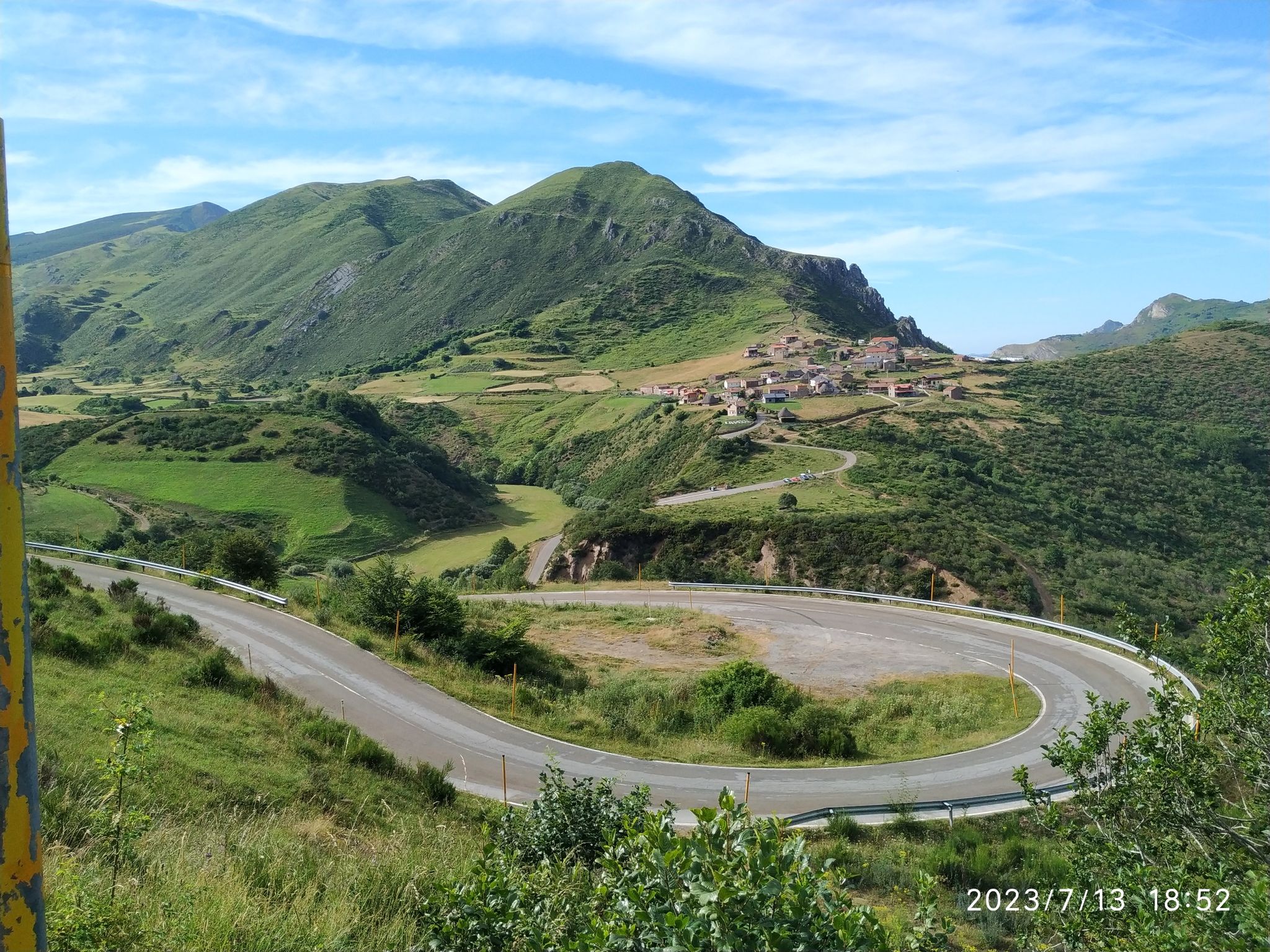
From this stretch of road, as you slowly climb, you'll be able to glimpse Peña Aguda.
0
0
The La Baña road has a winding climb that tests cyclists' endurance with its tight curves and steady gradients. From its highest sections, there are breathtaking views of the incredible León landscape.
0
0
The Peña Aguda Pass is a steep climb. From its summit, you'll enjoy panoramic views of the mountains and valleys that make the effort to get there worthwhile.
0
0

At the end of the 11th century, Osmundo, Bishop of Astorga, ordered the construction of a bridge (partly made of iron = pons ferrata) over the Sil for the pilgrims on the Way of St. James, near which a settlement was built. At the "pons ferrata", the iron bridge, the Knights Templar built a huge castle on a surface area of 160 x 90 m to protect the pilgrims on the Way of St. James. The medieval castle complex was inhabited by the Knights Templar from 1178 to 1312. Source: Wikipedia
5
0

This old tower is a beautiful and visible symbol in the landscape. It is worth a visit.
1
0

The Templars' heyday from the 12th to 14th centuries led to the construction of this mighty fortress, among other things to protect the pilgrims on the Way of St. James. The rampart on the city hill stands out impressively against the mountain backdrop and absolutely conforms to the stereotypical image of a knight's castle. It is sensationally well maintained and a feast for the eyes.
6
0

The order, often referred to simply as the "Order of the Knights Templar," whose full name is "Poor Knights of Christ and of Solomon's Temple in Jerusalem," takes us mentally back to the 13th century. Founded in the Holy Land, it spread surprisingly quickly to many countries in Central Europe, and this castle complex in Ponferrada, northern Spain, was one of its numerous branches. The order gained notoriety through its dissolution in 1312 by the French king and the pope, and many of its members were burned at the stake as alleged heretics. The main reason for the dissolution, however, was not the members' human and religious misconduct (heresy), which was merely a pretext, but the legendary wealth of this order. King Philip IV of France primarily wanted to secure the treasures to bolster his coffers.
6
0
Frequently Asked Questions
How many road cycling routes are available around Truchas?
There are 9 road cycling routes around Truchas listed on komoot, offering a variety of experiences for cyclists. These routes range from moderate to difficult, with significant elevation changes characteristic of the Sangre de Cristo Mountains.
What is the best time of year for road cycling in Truchas?
The fall is generally considered the ideal time for road cycling in Truchas due to mild temperatures and vibrant autumn colors. While routes are rideable year-round, the high elevation means weather can change rapidly, so checking forecasts is always recommended.
Are there challenging climbs for advanced road cyclists in Truchas?
Absolutely. Truchas is known for its challenging terrain, particularly as a key stop on the renowned High Road to Taos Scenic Byway. Routes like the Sierra de la Cabrera Loop feature over 8,300 feet of climbing, providing a substantial test for advanced riders. Another demanding option is the Cruz de Ferro (Iron Cross) – Molinaseca loop from La Taberna de Filiel, which includes over 6,700 feet of elevation gain.
What kind of scenery can I expect on the road cycling routes around Truchas?
Road cycling around Truchas offers panoramic views of the majestic Sangre de Cristo Mountains, high desert terrain, and diverse landscapes including foothills, forests, and mountain passes. You'll experience significant elevation shifts through sandstone canyons, alpine forests, and wide-open mesas, with stunning close-up views of the Truchas Peaks.
Are there any circular road cycling routes in the Truchas area?
Yes, several routes are designed as loops. For example, the Sierra de la Cabrera Loop and the Truchas Village – Truchas Road loop from Baíllo / Vayellu are popular circular options that allow you to start and end in the same location.
What cultural attractions can I explore near the cycling routes in Truchas?
Truchas is a historically rich village with a unique cultural heritage. You can visit the early 19th-century Nuestra Señora del Rosario church, known for its *santero* art, or explore local art galleries like 'Eight Million Gods'. The Truchas History Museum also offers insights into the village's past. These attractions provide a fascinating blend of history and art amidst your cycling adventure.
Are there any natural landmarks or points of interest along the road cycling routes?
Yes, the region boasts several natural highlights. You might encounter features like the Waterfall and Bridge of the Arroyo del Silencio, or pass through picturesque settlements such as Peñalba de Santiago Village and Montes de Valdueza Village. The area is also home to various mountain passes, including El Morredero Pass, offering stunning views.
Is Truchas suitable for family-friendly road cycling?
The road cycling routes directly around Truchas are generally characterized by significant elevation changes and challenging terrain, making them more suitable for experienced cyclists. While the region offers diverse outdoor activities, specific family-friendly road cycling routes with minimal elevation are not prominently featured in the immediate Truchas area.
What are the parking options for road cyclists in Truchas?
While specific designated cyclist parking areas are not detailed, Truchas is a small village. Cyclists often find parking in or near the village center or at trailheads along the High Road to Taos Scenic Byway, which passes through the area. It's advisable to look for public parking spaces or inquire locally upon arrival.
Where can cyclists find refreshments or accommodation in Truchas?
Truchas, though small, offers some local amenities. You can find places for refreshments or meals within the village. For a wider range of options, nearby towns along the High Road to Taos Scenic Byway may offer more choices for cafes, restaurants, and accommodation. The village's unique charm also includes local art galleries that might offer a place to rest and browse.
What do other cyclists enjoy most about road cycling in Truchas?
The road cycling routes in Truchas are highly rated by the komoot community, with an average score of 5.0 stars. Cyclists frequently praise the challenging climbs, the breathtaking panoramic views of the Sangre de Cristo Mountains, and the unique experience of cycling through a historically rich high-desert landscape.
Are there any permits required for road cycling in the Truchas area?
Generally, no specific permits are required for road cycling on public roads in the Truchas area. However, it's important to note that bicycles are typically not permitted within designated wilderness areas, such as the nearby Pecos Wilderness. Always stick to established roads and trails where cycling is allowed.
Most popular routes around Truchas
Most popular attractions around Truchas

Get inspired with the komoot mobile app


Explore more
Browse the best Road cycling routes in other regions.
