The best cycling routes around Esplegares
23
riders
8
rides
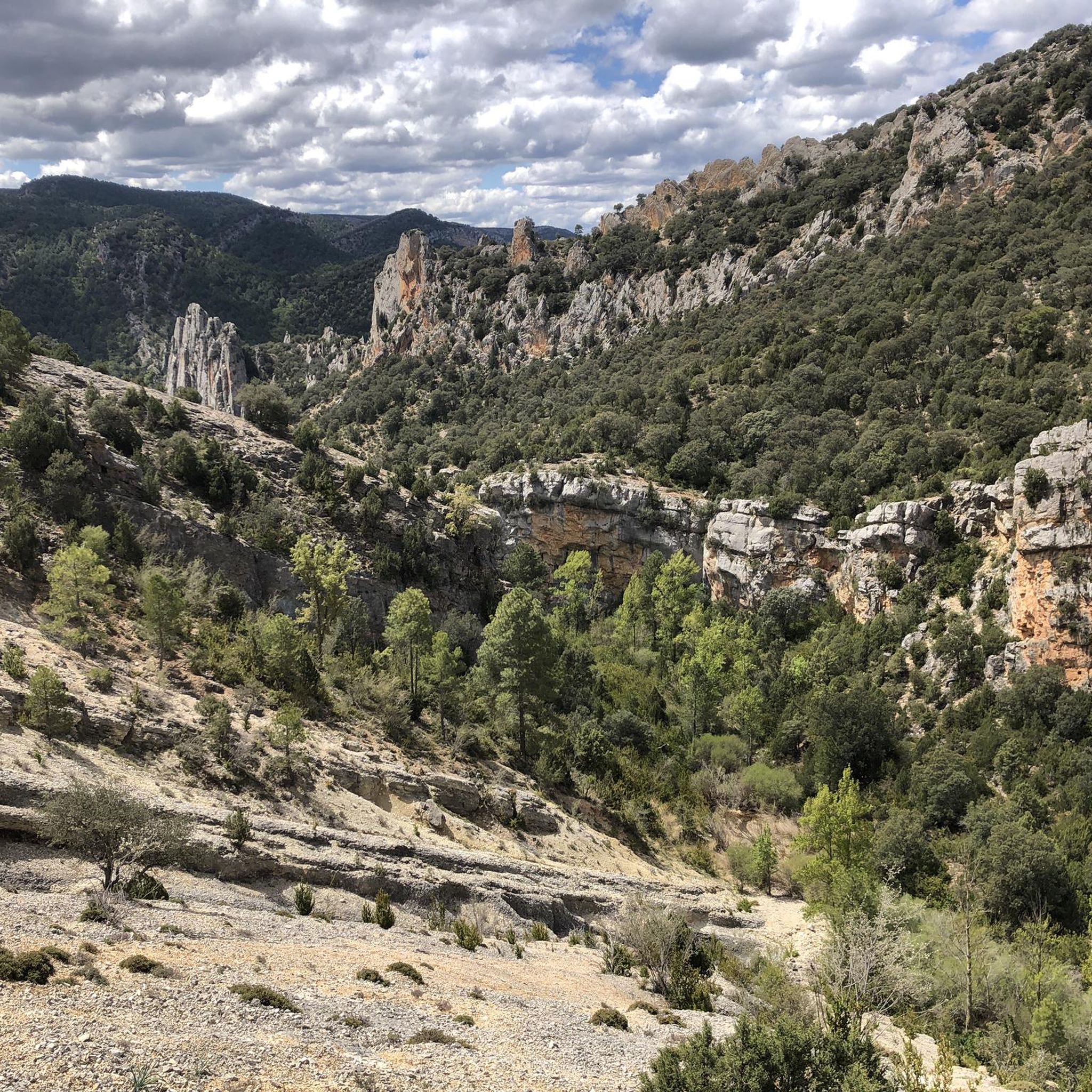
Touring cycling around Esplegares offers routes through a diverse landscape at the foothills of the Alto Tajo Natural Park and bordering the Alcarria Alta plateau. The region features dramatic canyons, river gorges carved by the Tagus and Ablanquejo rivers, and unique geological formations. Cyclists encounter juniper and holm oak forests, alongside extensive lavender fields on the Alcarria Alta, providing varied terrain from mountainous sections to flatter areas. The geological makeup, with limestone and red sandstone formations, creates a visually distinct…
Last updated: June 28, 2026
5
riders
42.5km
02:51
690m
690m
Hard bike ride. Very good fitness required. Mostly paved surfaces. Suitable for all skill levels.
7
riders
39.4km
02:37
630m
630m
Hard bike ride. Very good fitness required. Mostly paved surfaces. Suitable for all skill levels.

Sign up for free
4
riders
48.0km
03:06
650m
650m
Hard bike ride. Very good fitness required. Mostly paved surfaces. Suitable for all skill levels.
3
riders
39.4km
03:08
700m
700m
Hard bike ride. Very good fitness required. Mostly paved surfaces. Suitable for all skill levels.
4
riders
Hard bike ride. Good fitness required. You may need to push your bike for some segments of this route.
Get access to more routes and recommendations from other explorers.
Sign up for free
Already have an account?
Our route recommendations are based on thousands of hikes, rides, and runs completed by other people on komoot.
Start today with a free account
Your next adventure awaits.
Login or Signup
Popular around Esplegares
Tips from the Community

We have a source
0
0
Fountain, shop, bar and a rural house managed by the town hall, all the services available in this pretty, very pretty village, crossed by the river and giving access to a beautiful canyon.
0
0

In Luzon the carnival is celebrated in a very unique way and stopping in the square to have a drink we were able to learn what the "Los Diablos y Mascaritas de Luzón" are. It is worth returning in February or seeing them at the Guadalajara bottargas concentration.
0
0

Extraordinary town, on the banks of the Tajuña River, full of history. From its Celtiberian Castros through its Roman Camps, to its Cuevas del Cid and its Muslim towers. Nearby is one of the most characteristic Dolmens of the plateau, the Portillo del Cortes Dolmen. There were also menhirs although with the concentration of land they disappeared. Its churches are also of extraordinary value. Its very welcoming people.
1
0

Unknown town but with a lot of charm. The Tajuña pass stands out with its orchards, the cave where they say the Cid Campeador spent the night in his exile, and its tower on top of the rocky outcrops.
0
1

Luzón is a particular town from Alcarria on the Camino del Cid, through which the Montañas Vacías XL route also passes. In its urban area, the church of San Pedro and the museum of schools stand out, as well as a series of rock sculptures that look out from a cliff. On the other hand, Luzon has a bar, which makes it ideal for a stopover on the way.
1
0

Town of the homonymous municipality in the province of Guadalajara, located on the edge of one of the gorges of the Tajuña River.
2
0
Alcolea del Pinar is the typical La Mancha village in the alcarria. Its location next to the A-2 highway makes it an ideal place to stop for refreshments and refill water cans. In its surroundings there are extensive cereal fields frequented by an important population of roe deer.
1
0
Frequently Asked Questions
What kind of terrain can I expect on touring cycling routes near Esplegares?
Touring cycling around Esplegares offers a diverse landscape. You'll encounter the dramatic canyons and river gorges of the Alto Tajo Natural Park, with significant elevation changes and rugged sections. The routes also border the Alcarria Alta plateau, known for its extensive lavender fields and a mix of mountainous and flatter terrain. Expect varied surfaces, including some unpaved segments, set against a backdrop of juniper and holm oak forests, and unique geological formations of limestone and red sandstone.
Are there any circular touring cycling routes available around Esplegares?
Yes, all the touring cycling routes around Esplegares are circular. For example, you can explore the Shelter cabin – Basic shelter loop from Saelices de la Sal, the Ablanque loop from Saelices de la Sal, or the Church of San Pedro de Luzón loop from Saelices de la Sal, all starting and ending in Saelices de la Sal.
What is the best season for touring cycling in the Esplegares region?
The region's extensive lavender fields on the Alcarria Alta plateau suggest that late spring to early summer, when the lavender is in bloom, would be particularly picturesque. However, the varied terrain of the Alto Tajo Natural Park means that spring and autumn generally offer more moderate temperatures for tackling the challenging routes and significant elevation changes.
What natural landmarks or attractions can I see along the touring cycling routes near Esplegares?
The routes offer access to several natural wonders. You can discover the unique Cueva de los Casares, marvel at the Stone Waterfall (Cascada de Piedra) in Parque Natural del Alto Tajo, or experience the dramatic landscapes of the Valley of Miracles. The Pico del Alar also offers impressive views.
Are there any historical or cultural points of interest near the cycling routes?
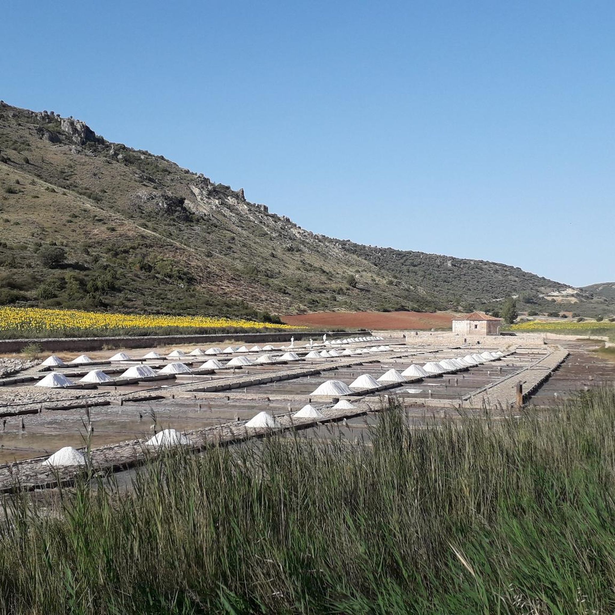
Yes, beyond the natural beauty, you can find historical sites. The Tagüenza Bridge is a notable landmark. You might also encounter the Ruins of the Inesperada Salt Factory, offering a glimpse into the region's industrial past. The village of Esplegares itself has cultural heritage, including the Church of Nuestra Señora de la Asunción and old lavender stills.
Are the touring cycling routes around Esplegares suitable for families or beginners?
The touring cycling routes around Esplegares are generally considered difficult, featuring significant elevation gains and rugged terrain, especially within the Alto Tajo Natural Park. This makes them more suitable for experienced riders seeking a challenge rather than families with young children or beginner cyclists. Some segments may even require pushing bikes due to their difficulty.
Can I bring my dog on the touring cycling routes in the Esplegares area?
While the natural environment of the Alto Tajo Natural Park and Alcarria Alta is appealing for outdoor activities, specific regulations regarding dogs on cycling routes can vary. It's always best to check local park rules for the Alto Tajo Natural Park regarding pets, especially in protected areas, to ensure a pleasant and compliant experience for you and your dog.
What are some of the longer touring cycling routes available?
For a longer ride, consider the Church of San Pedro de Luzón loop from Saelices de la Sal, which covers 29.9 miles (48.0 km). Another substantial option is the Ablanque loop from Saelices de la Sal, at 26.4 miles (42.5 km).
Are there any routes that offer particularly scenic views of the lavender fields?
The Alcarria Alta plateau, bordering Esplegares, is famous for its extensive lavender (espliego) fields, from which the village derives its name. While specific routes are not highlighted for lavender viewing, any route that ventures into the Alcarria Alta region, such as the Stone House – Anguita Village and Church loop from Padilla del Ducado, would likely offer picturesque scenery, especially during the bloom season.
What is the elevation gain like on these touring cycling routes?
The touring cycling routes around Esplegares feature significant elevation gains, reflecting the rugged terrain of the Alto Tajo Natural Park. For instance, the PORTILLO HUERTAPELAYO TUNNEL – Open shelter loop from Huertapelayo involves over 700 meters of ascent, and the Ablanque loop from Saelices de la Sal has nearly 700 meters of climbing. Riders should be prepared for challenging ascents.
What do other touring cyclists say about cycling in Esplegares?
More than 20 touring cyclists have used komoot to explore Esplegares's varied terrain. They often praise the dramatic canyons, river gorges, and extensive lavender fields that define the region. The network of routes is appreciated by experienced riders seeking challenging rides with significant elevation changes and stunning natural backdrops.
Most popular attractions around Esplegares

Get inspired with the komoot mobile app


Explore more
Browse the best Cycling routes in other regions.
