The 11 Most Amazing Peaks around Arenas Del Rey
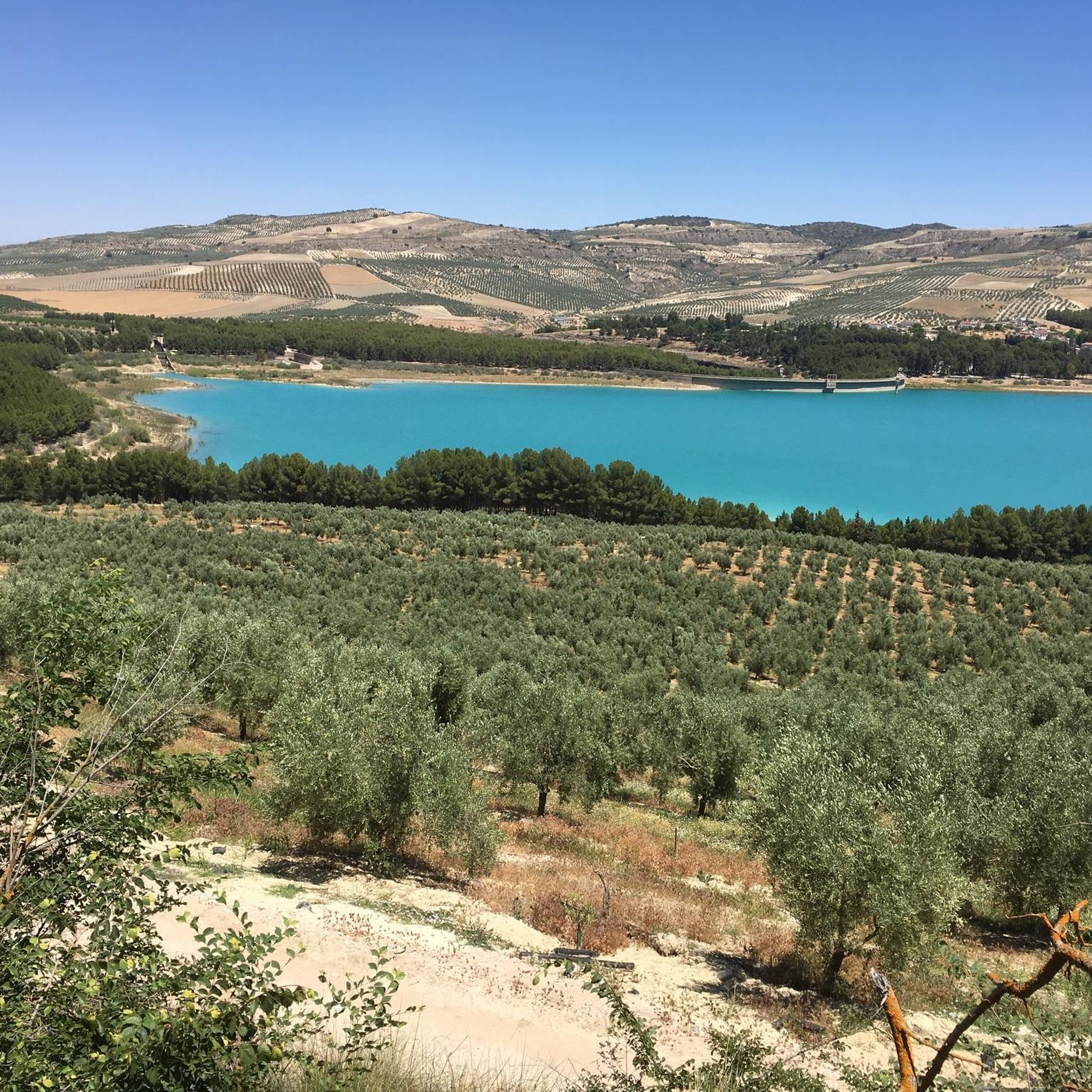
Mountain peaks around Arenas Del Rey are located in the Poniente Granadino region of Granada, Spain. The municipality sits at the foot of mountains, adjacent to the Embalse de los Bermejales reservoir. This area provides access to various mountain peaks, offering opportunities for hiking and exploration. The region features 11 distinct peaks, presenting diverse options for outdoor activities.
Best mountain peaks around Arenas Del Rey
- The most popular mountain peaks is El Fuerte Peak, a summit known for its…
Last updated: June 29, 2026
Pico del Cielo Summit
Highlight • Summit
Translated by Google •
Tip by

El Fuerte Peak
Highlight • Summit
Translated by Google •
Tip by

Sign up now to discover places like this
Get recommendations on the best single tracks, peaks, & plenty of other exciting outdoor places.
Sign up for free
Cerro Verde
Highlight • Summit
Tip by

Cerro Lucero (1,779 m)
Highlight • Summit
Translated by Google •
Tip by

El Macho Marble Quarry
Highlight • Structure
Translated by Google •
Tip by

Sign up for free to discover even more peaks around Arenas Del Rey.
Sign up for free
Already have an account?
Start today with a free account
Your next adventure awaits.
Login or Signup
Popular around Arenas Del Rey




Tips from the Community

Cerro Verde is a prominent hill in the Axarquía, offering wide views of the surrounding mountains and valleys. Located on the edge of the Sierras de Tejeda, Almijara y Alhama Natural Park, it forms part of the transition between the cultivated landscapes of the Axarquía and the rugged terrain of the higher sierras. The area is characterised by Mediterranean vegetation, traditional terraced agriculture, and a network of historic paths that have connected local communities for centuries.
0
0

Tip: Take a jacket with you as the summit is often in fog. The weather can change quickly.
0
0

Descent very steep in several places, with high steps down. Finding the way challenging at a few points, but doable with Komoot. Speed sometimes 2 km/h
0
0

My favorite peak in the Sierra de Almijara, I love it 😍🎈
0
0

Pico del Cielo is an impressive peak located in the Sierras de Tejeda, Almijara, and Alhama Natural Park, near Nerja. The route is approximately 20 km (round trip) and can take between 6 and 7 hours to complete. It's a challenging hike in terms of endurance, but technically easy.
1
1
Take plenty of water and good shoes. A great hike, with great views.
0
1
The views are spectacular; the climb is worth it.
0
2

A summit cross decorated with mirrors. Perfect for a summit selfie :)
2
1
Frequently Asked Questions
What are some of the most notable mountain peaks to explore around Arenas Del Rey?
The region offers several impressive peaks. Among them are El Fuerte Peak, known for its exceptional panoramic views, and Pico del Cielo Summit, which provides stunning vistas of the Axarquía region and the Nerja coast. Another highly regarded peak is Cerro Lucero (1,779 m) in the Sierra de Almijara mountains, appreciated for its rewarding experience.
What kind of terrain and difficulty can I expect on the mountain peaks in the Sierra de Tejeda, Almijara, and Alhama Natural Park?
Peaks like Pico del Cielo Summit are known for demanding and technical sections, requiring good endurance. Similarly, Cerro Lucero (1,779 m) involves challenging routes with significant elevation gain, demanding a very good level of fitness. Many trails are classified as challenging or intermediate.
What is the best time of year to hike the mountain peaks near Arenas Del Rey?
It is highly advisable to avoid hiking during the hot summer months of June, July, and August due to intense heat. Even September can be challenging. The cooler months, such as October, are generally more suitable for these demanding trails.
Are there any specific tips for hiking Pico del Cielo Summit?
Pico del Cielo is a significant undertaking, typically a 20 km round trip that can take 6 to 7 hours. While technically straightforward, it requires good endurance. Visitors should come prepared with ample water and appropriate footwear, as there are no water sources along the way. The summit offers wonderful views of the Axarquía and Nerja coast.
What makes Cerro Lucero a popular peak for hikers?
Cerro Lucero (1,779 m) is a highly regarded peak in the Sierra de Almijara mountains, favored for its impressive stature and the rewarding experience it offers. Hikers often find the summit views to be well worth the challenging climb.
What outdoor activities are available near the mountain peaks around Arenas Del Rey?
Beyond peak bagging, the region offers diverse outdoor opportunities. You can find various hiking trails, including routes along the Cacín River and around the Pantano de los Bermejales. There are also numerous road cycling routes and running trails, catering to different fitness levels.
Are there any circular hiking routes around the peaks near Arenas Del Rey?
Yes, there are circular hiking options. For instance, a challenging 20.4 km circular hike to Cerro del Lucero starts from Los Enebrales, passing by the Los Machos quarry and the Mota Ramblas. Other moderate and easy circular routes can be found along the Cacín River from Pantano de los Bermejales.
What are some of the natural landmarks or viewpoints to look out for?
Many peaks themselves serve as excellent viewpoints, offering panoramic vistas. For example, El Fuerte Peak provides exceptional views of the surrounding mountains. The region also features natural monuments and the Embalse de los Bermejales reservoir, enhancing the scenic beauty.
How long do typical hikes to these mountain peaks take?
The duration varies significantly by peak and route. For example, the hike to Pico del Cielo Summit is typically a 20 km round trip that can take between 6 to 7 hours. The challenging route to Cerro Lucero (1,779 m) from Los Enebrales is also around 20 km and requires a substantial time commitment.
What do visitors particularly enjoy about the mountain peaks around Arenas Del Rey?
Visitors frequently praise the spectacular and panoramic views from the summits, such as those from Pico del Cielo Summit and El Fuerte Peak. The rewarding experience of reaching challenging peaks like Cerro Lucero (1,779 m) is also a highlight for many.
Are there any historical sites near the mountain peaks?
Yes, for example, the El Macho Marble Quarry is a notable historical site that can be encountered on some routes. It offers a glimpse into the region's past industries and provides a unique viewpoint.
Most popular routes around Arenas Del Rey
Most popular attractions around Arenas Del Rey

Get inspired with the komoot mobile app


Explore more
See even more amazing summits around Arenas Del Rey with these guides:
