The best walks and hikes around Arenas Del Rey
4.5
(977)
4,024
hikers
15
hikes
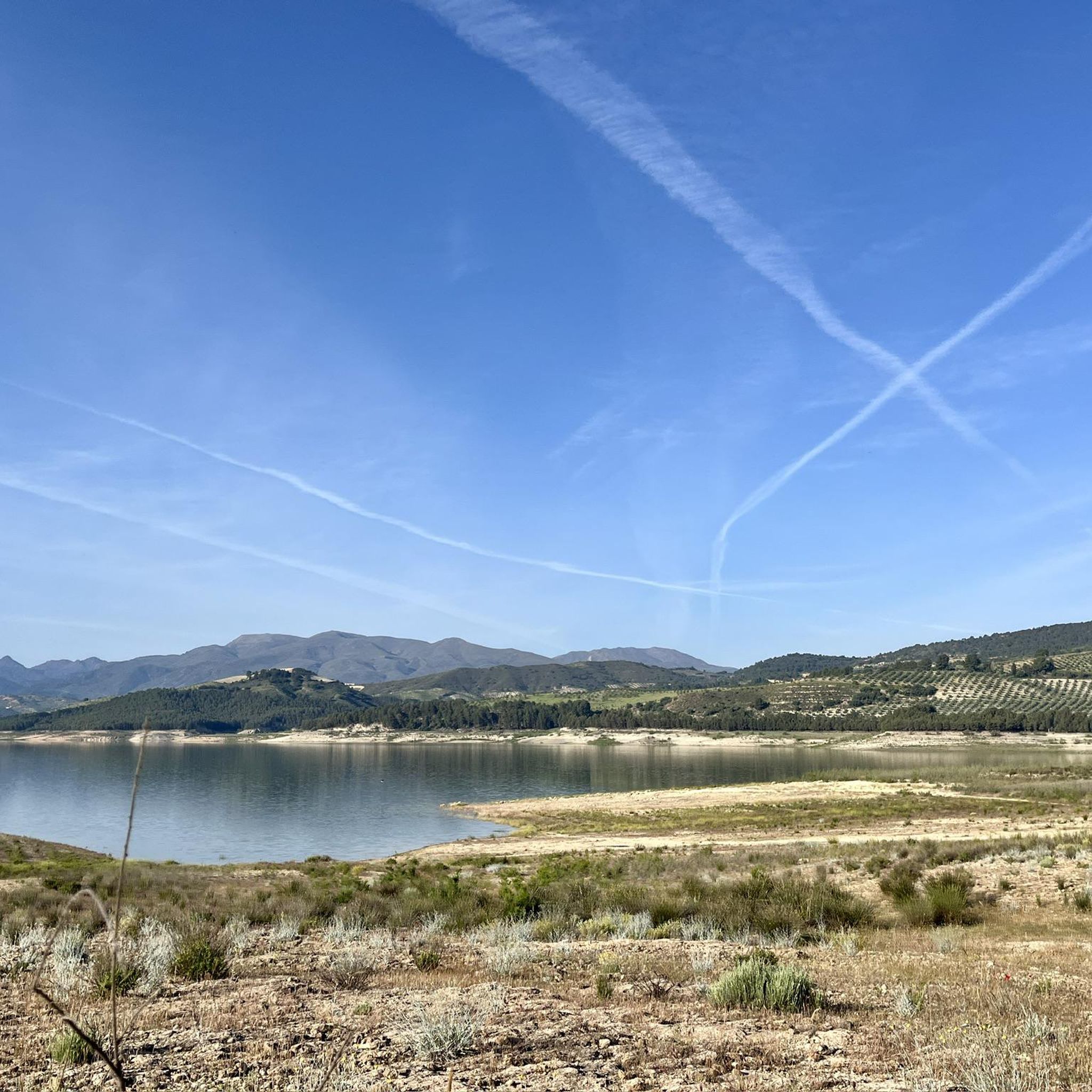
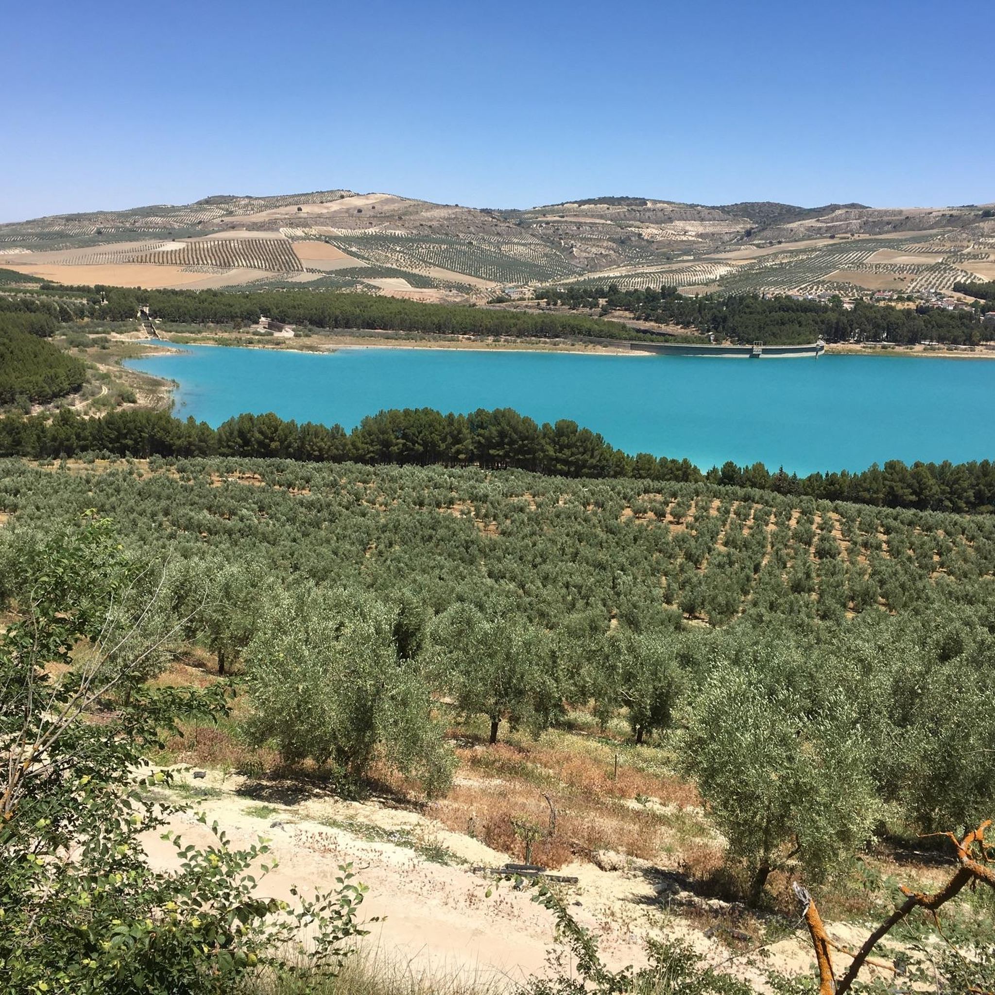
Hiking around Arenas Del Rey offers diverse landscapes shaped by geological features and water bodies. The region features the Embalse de los Bermejales reservoir and the Cacín River, which carves a notable gorge. To the north, the Sierra Tejeda mountain range presents a striking vista of reddish-brown rock. The area also includes cultivated almond fields and various natural monuments like canyons and mountain passes.
Best hiking trails around Arenas Del Rey
- The most popular hiking route is Cerro del Lucero desde Los Enebrales – circular by the Los Machos quarry and the Mota Ramblas, a 12.7 miles (20.4 km) trail that takes 5 hours 46 minutes to complete. This difficult route offers expansive views across the landscape.
- Another top favourite among local hikers is Cacín River Trail – Roman Bridge loop from Pantano de los Bermejales, a moderate 7.1 miles (11.5 km) path. This trail follows the river, showcasing its gorge and surrounding natural beauty.
- Local hikers also love the La Resinera loop from Fornes, a 6.4 miles (10.3 km) trail leading through forested areas, often completed in about 2 hours 56 minutes.
- Hiking around Arenas Del Rey is defined by the serene reservoir, dramatic river gorges, and rugged mountain ranges. The network offers options for easy, moderate, and difficult routes, catering to various ability levels.
- The routes in Arenas Del Rey are highly rated by the komoot community with an average score of 4.6 stars from more than 900 reviews. More than 3,700 hikers have used komoot to explore Arenas Del Rey's varied terrain.
Last updated: May 18, 2026
12
hikers
Hard hike. Very good fitness required. Sure-footedness, sturdy shoes and alpine experience required.
4.8
(28)
119
hikers
11.5km
03:14
250m
250m
Moderate hike. Good fitness required. Easily-accessible paths. Suitable for all skill levels.

Sign up for free
4.8
(13)
40
hikers
6.88km
01:56
130m
140m
Easy hike. Great for any fitness level. Easily-accessible paths. Suitable for all skill levels.
4.0
(4)
20
hikers
10.3km
02:56
240m
240m
Moderate hike. Good fitness required. Easily-accessible paths. Suitable for all skill levels.
3.5
(2)
15
hikers
12.5km
03:34
270m
270m
Moderate hike. Good fitness required. Easily-accessible paths. Suitable for all skill levels.
Get access to more routes and recommendations from other explorers.
Sign up for free
Already have an account?
Our route recommendations are based on thousands of hikes, rides, and runs completed by other people on komoot.
Start today with a free account
Your next adventure awaits.
Login or Signup




Tips from the Community

Area with easy parking next to the Bermejales reservoir dam, where to start or finish the RITPG 17 and connect with the RITPG 19 with connection to the N with Cacín and Santa Cruz del Comercio and to the S, crossing the reservoir dam, with Arenas del Rey and Játar
0
0

The Cacín River flows through the valley of the municipality of Arenas del Rey and empties into the Genil River, forming part of the Guadalquivir basin. It has a total length of approximately 50 km, of which roughly 33 km run from the Los Bermejales reservoir to its confluence. Its valley combines terraces of Quaternary sediments (conglomerates, sands, clays) and an impressive canyon carved through soft materials.
1
0

No longer present or defective and overgrown
0
0

My favorite peak in the Sierra de Almijara, I love it 😍🎈
0
0

To access it you have to follow a path half lost among the pines.
0
0
It is a 20th century church
1
0
This is a viewpoint located in the Bermejales dam, right on the path that leads us to make the Ruta de los Tajos de los Bermejales
1
0
Frequently Asked Questions
How many hiking trails are available in Arenas Del Rey?
Arenas Del Rey offers a variety of hiking experiences, with 15 distinct trails recorded on komoot. These routes cater to different fitness levels, ensuring there's something for everyone to explore.
Are there easy hiking options suitable for beginners or families?
Yes, Arenas Del Rey has several easy hiking options. For instance, the Cacín River loop from Pantano de los Bermejales is an easy 6.7 km trail that follows the river, perfect for a relaxed outing. In total, there are 3 easy routes available in the area.
Can I find circular hiking routes in Arenas Del Rey?
Absolutely. Many of the trails in Arenas Del Rey are circular, offering convenient starting and ending points. A popular moderate circular route is the La Resinera loop from Fornes, which takes you through forested areas.
What kind of natural landscapes can I expect to see while hiking in Arenas Del Rey?
The region boasts diverse landscapes, from the serene Embalse de los Bermejales reservoir and the dramatic gorge carved by the Cacín River, to the striking reddish-brown rock faces of the Sierra Tejeda mountain range. You'll also encounter cultivated almond fields, especially beautiful during their bloom in winter, and thick conifer forests.
Are there any trails that feature water elements like rivers or waterfalls?
Yes, the area is rich in water features. The Cacín River Trail – Roman Bridge loop from Pantano de los Bermejales is a moderate 11.5 km path that follows the river, showcasing its impressive gorge and natural beauty. The Bermejales Reservoir itself is a central feature for many routes.
What are some notable attractions or landmarks to explore near the hiking trails?
Beyond the trails, you can explore natural monuments like the Enginal Pass within the Sierras de Tejeda, Almijara, and Alhama Natural Park, known for its romantic nature. The area also features various peaks such as Cerro Lucero (1,779 m) and the El Macho Marble Quarry, offering unique sights.
What do other hikers say about the trails in Arenas Del Rey?
The hiking routes in Arenas Del Rey are highly regarded by the komoot community, with an impressive average rating of 4.6 out of 5 stars from over 900 reviews. Hikers often praise the varied terrain, from tranquil river paths to challenging mountain ascents, and the stunning natural scenery.
When is the best time of year to go hiking in Arenas Del Rey?
The region offers beauty year-round. January and February are particularly special for witnessing the almond trees in full blossom across the terraced fields. In winter, the Sierra Tejeda mountains are often capped with snow, adding to the picturesque quality. Spring and autumn generally offer pleasant temperatures for hiking.
Are there any challenging hikes for experienced trekkers?
Yes, for those seeking a challenge, Arenas Del Rey offers several difficult routes. The Cerro del Lucero desde Los Enebrales is a demanding 20.4 km circular trail that involves significant elevation gain, offering expansive views across the landscape. There are 4 difficult routes in total.
Is there parking available near the trailheads?
While specific parking details vary by trailhead, many routes, such as those starting from Pantano de los Bermejales or Fornes, are generally accessible by car, and you can typically find parking facilities or roadside parking near these popular starting points.
Can I bring my dog on the hiking trails in Arenas Del Rey?
The natural environment of Arenas Del Rey is generally welcoming to dogs, but it's always recommended to check specific trail regulations or local signage for any restrictions, especially within protected natural park areas. Keeping dogs on a leash is usually a good practice to protect local wildlife, including chameleons which are a protected species in the area.
Most popular attractions around Arenas Del Rey

Get inspired with the komoot mobile app


Explore more
Browse the best Hikes in other regions.
