Attractions and Places To See around Aranda De Moncayo - Top 20
Best attractions and places to see around Aranda De Moncayo are situated at the foot of the Moncayo mountain, offering a blend of historical sites and natural landscapes. The region features ancient landmarks, cultural heritage, and picturesque natural settings. Visitors can explore the town's medieval and Arab origins, delve into Celtiberian history, and experience the diverse flora of the Moncayo Natural Park. The area also includes the Maidevera Reservoir and the Aranda River Valley.
Best attractions and places to see…
Last updated: May 11, 2026
Cueva de los Pilares
Highlight • Cave
Translated by Google •
Tip by

Borobia
Highlight • Settlement
Translated by Google •
Tip by

Sign up now to discover places like this
Get recommendations on the best single tracks, peaks, & plenty of other exciting outdoor places.
Sign up for free
Soriano Water Nature Trail
Highlight • Trail
Translated by Google •
Tip by

View of Calcena
Highlight • Viewpoint
Translated by Google •
Tip by

Valcongosto Gorge
Highlight • Gorge
Translated by Google •
Tip by
Sign up for free to discover even more attractions around Aranda De Moncayo.
Sign up for free
Already have an account?
Start today with a free account
Your next adventure awaits.
Login or Signup
Other adventures around Aranda De Moncayo

Tips from the Community

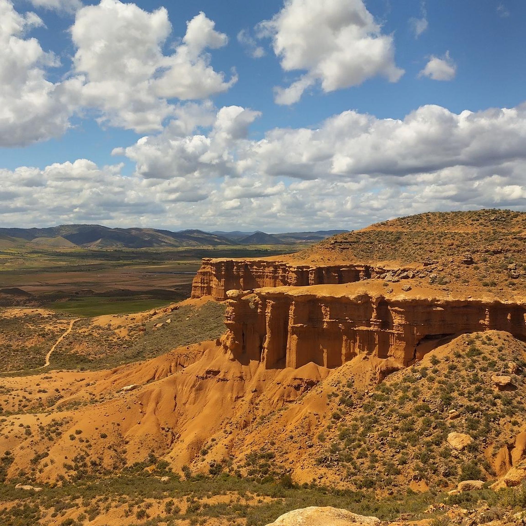
At the Collado de la Atalaya you have to head northeast along the slope of the mountain range following a level path marked with stone markers. The path crosses the Las Hoyas de los Portillos valley and climbs halfway through the pine forest towards the wall of the Muela del Cerro Morrón. In the pine forest you have to keep climbing towards the east and at the base of the walls connect with the path coming from the north face of the mountain. The landmarks are clear between the pine trees and the mole wall, they jump a couple of small slopes near other cavities and lead to the spectacular Cueva de los Pilares, a fantastic natural rock sanctuary with arches, vaults and giant columns. The climb to the summit of the mole leaves from the cave through the canal located to the west, it is a clear and obvious climb, it has stone markers and although it seems that there is no exit with good visibility, it is a simple section along some aerial ledges without too many complications, unless the rock is wet, it cannot even be classified as a climbing step, rather technical mountain hiking. The milestones enter the large inclined molar plain and take the direction of the summit through the center of the mountain.
0
1
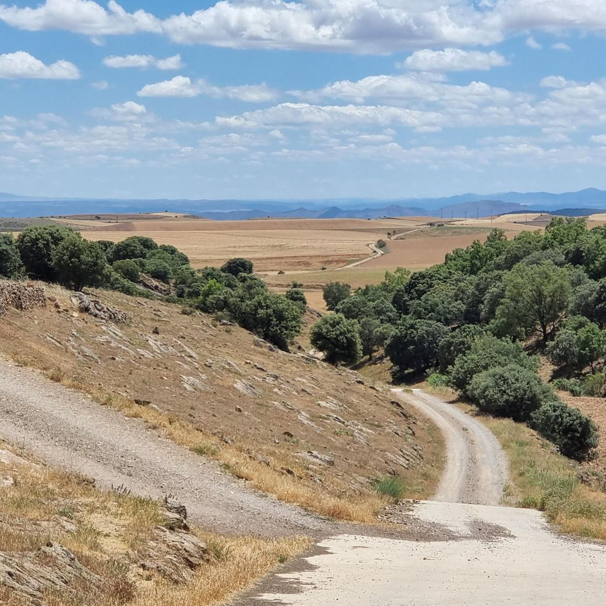
The third day of the cycling trip is delicious, almost all favorable terrain and very seductive landscapes until Ciria. The descent passes through the detour of the Cruz de las Heladas hill, in the beautiful pastoral meadows of El Hoyuelo. The name refers to a group of women from Beratón who were surprised by a snow blizzard and froze to death, only the cavalry survived. The lane crests the last hills of Moncayo and goes down towards Beratón. In the ravines on the left, the Isuela River is born, one of the main tributaries of the Jalón River, therefore we are still on the Mediterranean slope of the Iberian System. In Beratón we take the photo from the stone cruise and continue planning at full pedal along an impeccable track that surrounds the Sierra del Tablado and ends in Borobia, with a small hostel open all year round, it is the main refreshment point of the stage. The route runs through the karst plateaus of the Manubles River and in the Corrales de las Cabezas it descends to the limestone canyon of the Celorrio barracks, a spectacular gorge of rocky slopes that leads to the Ciria road. The landscapes along the route never cease to surprise. In the Middle Ages, the town of Ciria was a strategic step on the old borders between Arabs and Christians, it has a rock fortress and a medieval urban layout. The castle is perched on steep, isolated cliffs outside the town, watching over the course of the Manubles River. You have to walk a few minutes to reach the wall of the old fortress. In the urban area, the large volume of the Gothic church in the staggered distribution of the town draws attention. The route of the old Santander-Mediterranean railway passes in Ciria, our destination to return to the city of Soria because this section has been recovered by the Natural Trails network and offers a fantastic cycling alternative for gravel bikepacking. The link from the town to the old railway is simple through the Manubles plain and a lane that goes up to the roadbed. In the ditch there is a sign dedicated to the town of Ciria and then a small curved tunnel with automatic artificial lighting. The first section of the natural path is a gentle climb to El Pozuelo and the Tordesalas station, the entrance to the Soriano moor and the Duero basin. The rest of the trip is a flat landscape with no notable changes of pace in the immense colorful plains of the Campos de Gómara, dedicated mainly to cereal cultivation. The railway passes near the towns but never touches the urban centres, you have to detour to get water or any type of provision. We stopped at the hermitage of the Silos, near Portillo de Soria, which is next to the road, has shade and a pleasant place to take the last supplies we have left and regain strength. In the next section there are more abandoned stations, some of good size that demonstrate the commercial importance that the railway had during its time of service. The rest area of the old Martialay station announces the end of the journey. The natural path ends at the Valcorba Industrial Estate, about four kilometers before Soria. The route runs through the streets of the industrial warehouses and comes out to the roundabout of the N-234 highway that enters Soria via the Duero River. At the end of the descent there is a detour to the left that enters directly into the Soto Playa gardens, crosses the Duero over the crab pedestrian bridge and ends at the parking lot. End of the cycling adventure. The value of a trip is not measured by the distance traveled or the number of photos, but rather by the desire to start the next one.
0
0

From this point, on the outskirts of Calcena, you have a good view of the whole town with its traditional houses and its magnificent natural environment.
2
0

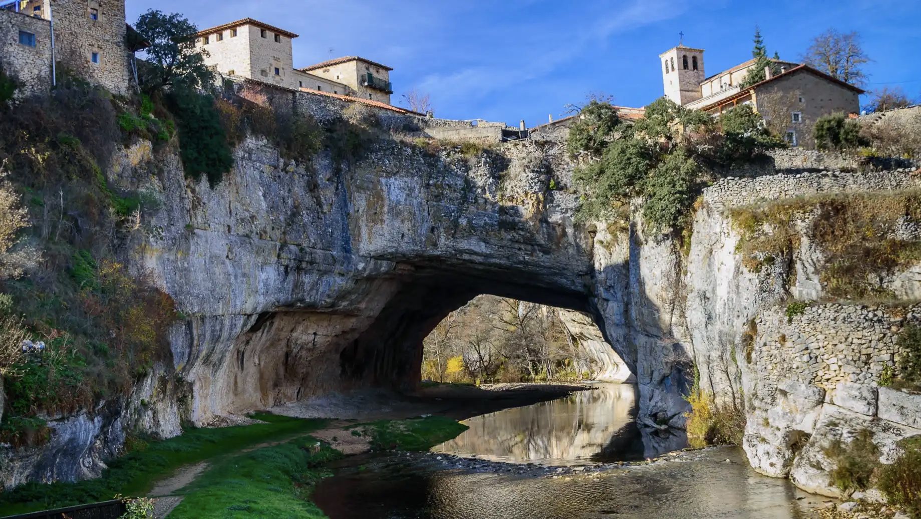
Along the course of the Río Manubles we find the town of Borobia, which is sandwiched between the Sierra de Tablado and Toranzo, to the north of the town itself.
0
0

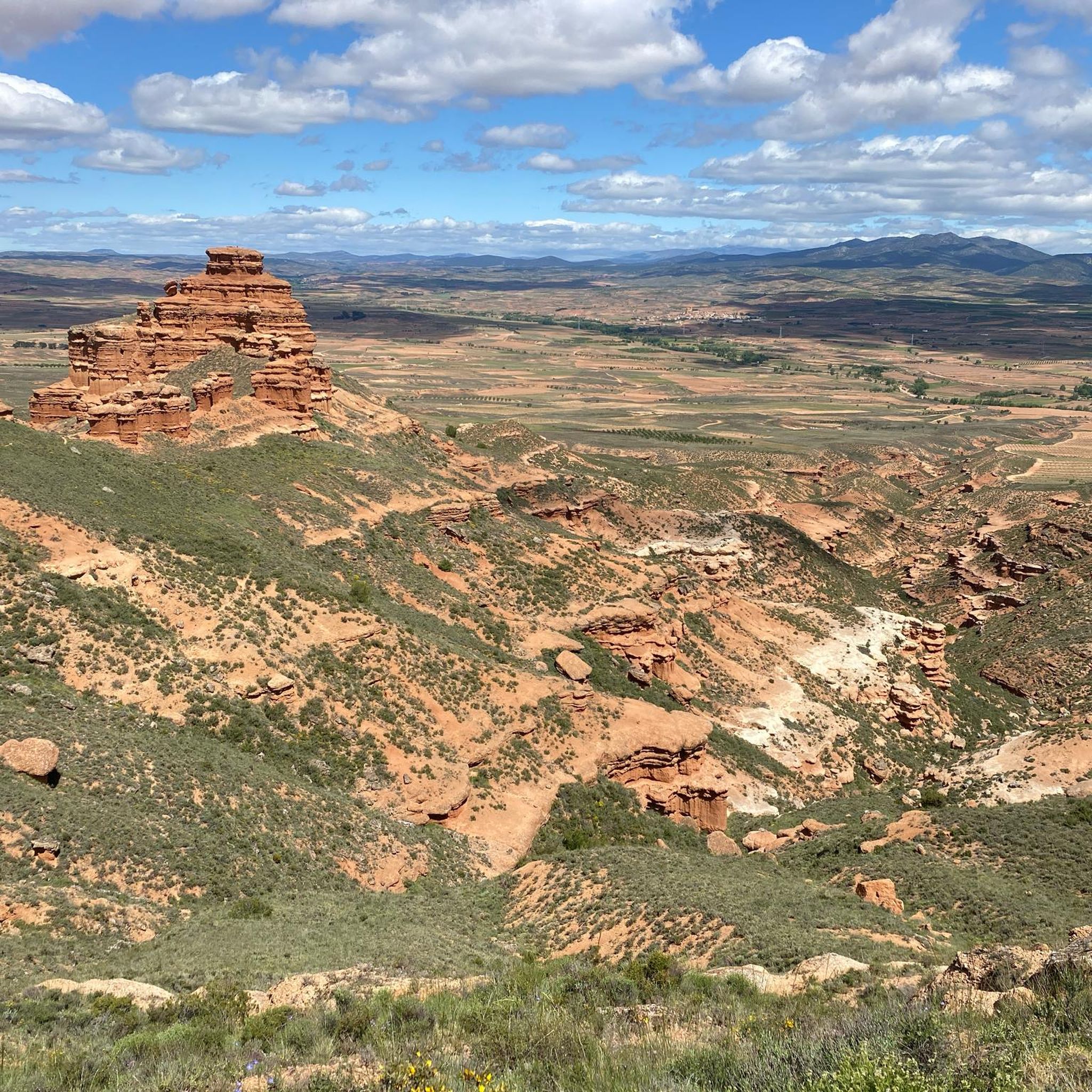
Spectacular setting in the Moncayo Natural Park with these formations at the entrance to the Cueva de los Pilares, at the foot of the Muela del Col
1
1
Beautiful picture that the almond fields give us (during the spring season) and the town of Calcena in the background that will surely make us take out the camera to photograph.
1
1
The so-called "strait of Gibraltar" is located in the Valcongosto ravine, very close to the town of Purujosa. It is advisable to walk with firm footing since the terrain is usually slippery depending on the water level, but it is definitely worth it.
1
0

Borobia is a small, picturesque village that has found its appeal to tourists thanks to its clear skies, free of light pollution. This makes it ideal for stargazing.
1
0
Frequently Asked Questions
What historical sites can I explore in and around Aranda de Moncayo?
Aranda de Moncayo is rich in history. You can visit the 12th-century Castle of Aranda de Moncayo, a significant historical landmark of Muslim origin. The Church of the Assumption, built between the 15th and 16th centuries, features a Mudéjar tower and valuable religious art. Other notable historical buildings include Casa Galán and the Antigua Casa del Inquisidor. Evidence of Roman presence can be seen at the Fuente del Chorro and a preserved bridge. Additionally, the Castle and Church of San Millán de Berdejo in the Manubles Valley offer another glimpse into the region's past.
What natural attractions are there near Aranda de Moncayo?
The area boasts significant natural beauty. You can explore the Moncayo Natural Park, known for its diverse flora and numerous trails, including the Cerro Morrón Summit which offers impressive views. Within the park, you'll find the spectacular Cueva de los Pilares, a natural rock sanctuary with arches and giant columns. The Maidevera Reservoir provides recreational opportunities like fishing and canoeing, and the town overlooks the picturesque Valle del Río Aranda.
Are there family-friendly activities or attractions in the area?
Yes, there are family-friendly options. The village of Borobia is noted for its clear skies, making it ideal for stargazing, which can be a unique family experience. Exploring the natural landscapes of the Moncayo Natural Park also offers many opportunities for family walks and enjoying nature, though some trails might be more challenging. The Maidevera Reservoir is also suitable for family recreation.
What kind of outdoor activities can I do near Aranda de Moncayo?
The region around Aranda de Moncayo is excellent for various outdoor activities. You can find numerous routes for running, road cycling, and mountain biking. For specific routes and details, you can explore the Running Trails around Aranda De Moncayo, Road Cycling Routes around Aranda De Moncayo, and MTB Trails around Aranda De Moncayo guides.
Are there hiking trails available, especially in Moncayo Natural Park?
Absolutely. The Moncayo Natural Park, which Aranda de Moncayo is situated near, offers numerous trails for hiking. These trails provide access to diverse flora and breathtaking views, including from the Cerro Morrón Summit. You can also find trails leading to natural wonders like the Cueva de los Pilares. For detailed hiking routes, refer to the Running Trails around Aranda De Moncayo guide, which includes many suitable for hiking.
What is the best time of year to visit Aranda de Moncayo for outdoor activities?
The Moncayo Natural Park experiences a blend of Mediterranean and Atlantic climates, leading to diverse conditions. Spring and autumn generally offer pleasant temperatures for hiking and exploring. Summer is also suitable, especially for higher altitudes, but can be warm in the valleys. Winter can bring snow to the Moncayo mountain, making it ideal for winter sports enthusiasts but requiring appropriate gear for hiking.
Where can I learn about the ancient Celtiberian history of the area?
To delve into the ancient Celtiberian history, visit the Espacio Aratikos (Aratikos Exhibition Space). This interpretive center helps visitors understand the Celtiberian city of Aratikos, which was located within the municipal area of Aranda de Moncayo. The archaeological site of Castejón I-El Romeral, where Aratikos once stood, is a Cultural Heritage Site showcasing monumental Celtiberian architecture.
Are there any viewpoints offering panoramic scenery?
Yes, several locations offer stunning views. The Cerro Morrón Summit, at an altitude of 1,731 meters within the Moncayo Natural Park, provides impressive panoramic views of the Moncayo massif and the Ebro valley. The Castle and Church of San Millán de Berdejo, perched on a rocky crag, also offers scenic vistas of the Manubles Valley.
What do visitors particularly enjoy about the attractions around Aranda de Moncayo?
Visitors appreciate the blend of historical charm and natural beauty. The clear skies over Borobia are a highlight for stargazing. The spectacular setting and unique formations of the Cueva de los Pilares are also highly regarded. Many enjoy the historical significance and architectural beauty of sites like the Castle and Church of San Millán de Berdejo, and the overall picturesque landscapes of the Moncayo Natural Park.
Are there any specific trails for cycling near Aranda de Moncayo?
Yes, the area is well-suited for cycling. The Soriano Water Nature Trail is a notable option that can be enjoyed by cyclists. Additionally, you can find a variety of routes for both road cycling and mountain biking, with detailed information available in the Road Cycling Routes around Aranda De Moncayo and MTB Trails around Aranda De Moncayo guides.
Is there public transport available to reach attractions or trailheads from Aranda de Moncayo?
While Aranda de Moncayo is a small town, public transport options directly to specific trailheads within the Moncayo Natural Park might be limited. It is generally recommended to have private transportation for easier access to the more remote natural attractions and hiking starting points. For local travel, checking regional bus schedules would be advisable, but direct routes to all attractions are not guaranteed.
Do I need permits or pay entry fees for hiking in Moncayo Natural Park?
Generally, there are no specific permits or entry fees required for general hiking access to the Moncayo Natural Park. However, it's always good practice to check for any local regulations or specific requirements for certain areas or activities, especially during peak seasons or for organized events. Information on this is typically available from local tourist offices or park visitor centers.
Most popular routes around Aranda De Moncayo
Most popular attractions around Aranda De Moncayo

Get inspired with the komoot mobile app


Explore more
Still not found the Highlight you’re looking for? See guides of the top attractions in other regions:
