The best walks and hikes around Aranda De Moncayo
5.0
(5)
45
hikers
20
hikes
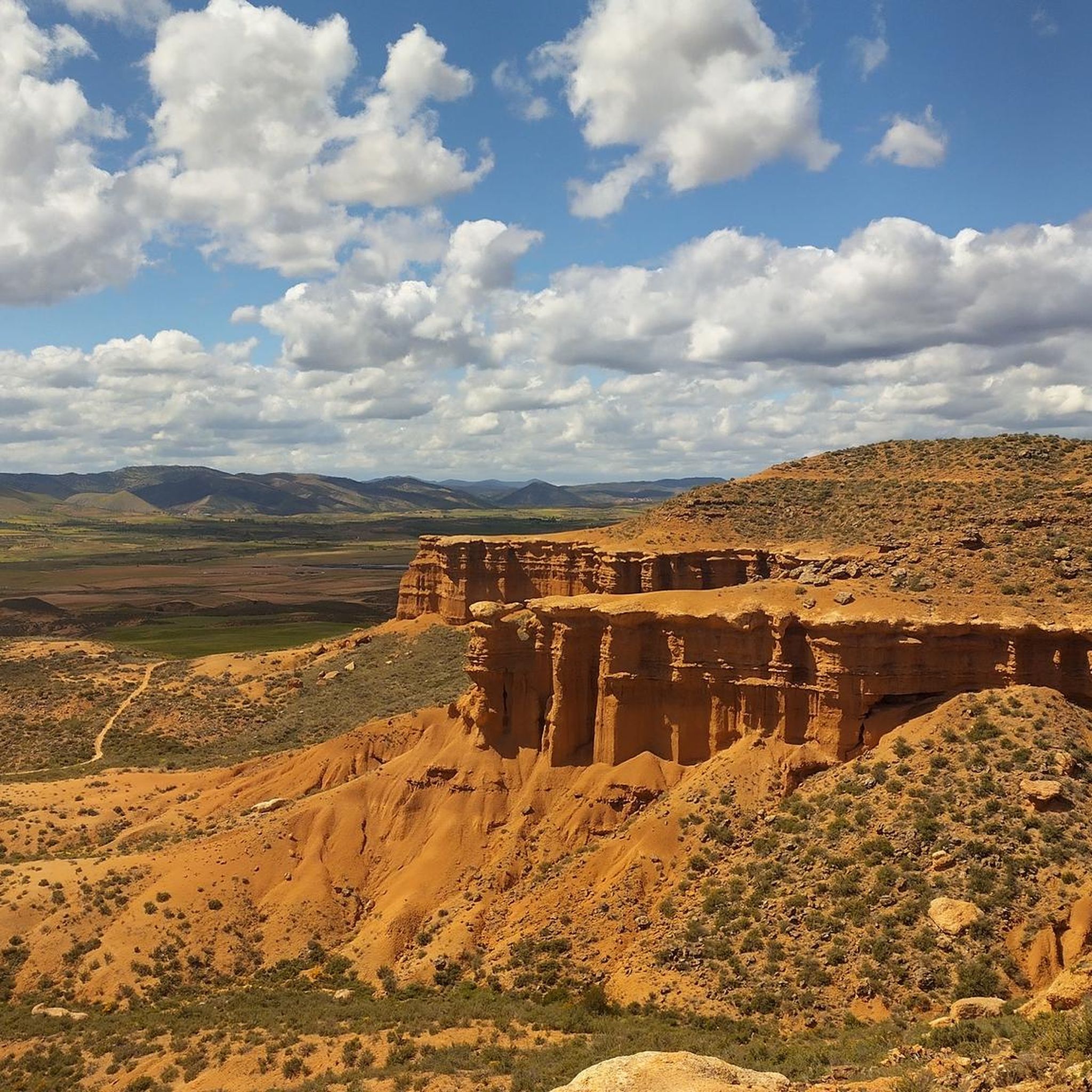
Hiking around Aranda De Moncayo offers access to diverse natural landscapes, primarily centered around the Moncayo Natural Park. The region features varied mountainous terrain, including peaks like Cabezo Cuartal and Cerro Morrón, alongside extensive oak, pine, and beech forests. River valleys, such as those formed by the Aranda and Isuela rivers, add to the varied ecosystems, which range from arid zones to lush woodlands. This area presents a unique transition from dry hills to glacial cirques over short distances.
Best hiking trails around Aranda De Moncayo
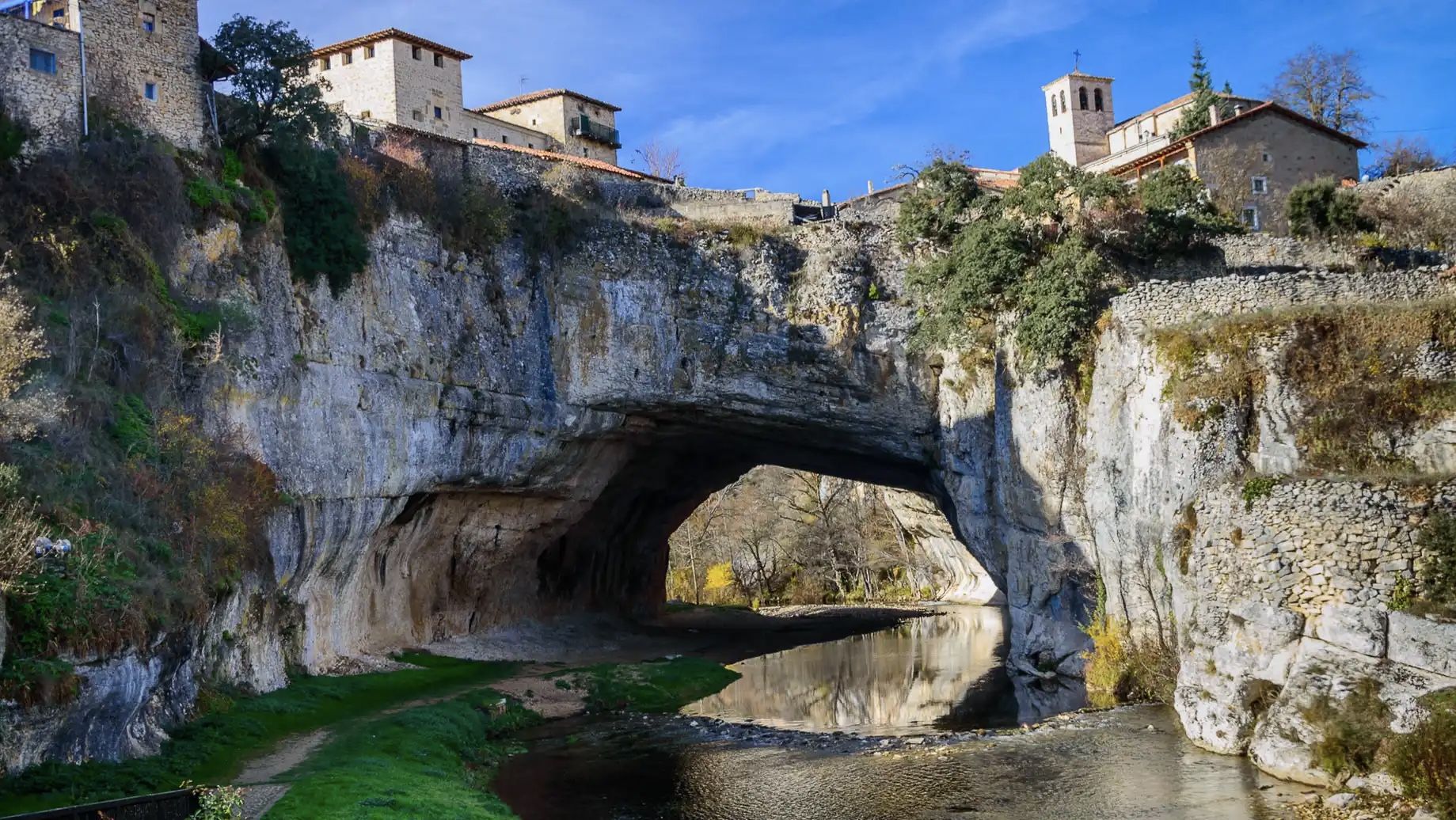
- The most popular hiking route is Valcongosto Gorges and Cuartún - circular from Purujosa, a 4.5 miles (7.3 km) trail that takes 2 hours 8 minutes to complete. This moderate route features the Valcongosto Gorges and offers views of the Cuartún area.
- Another top favourite among local hikers is Mirador de la Ermita de San Cristobal from Calcena — circular by Penas del Cabo, a moderate 5.3 miles (8.5 km) path. This trail leads to the viewpoint of Ermita de San Cristobal, offering panoramic vistas.
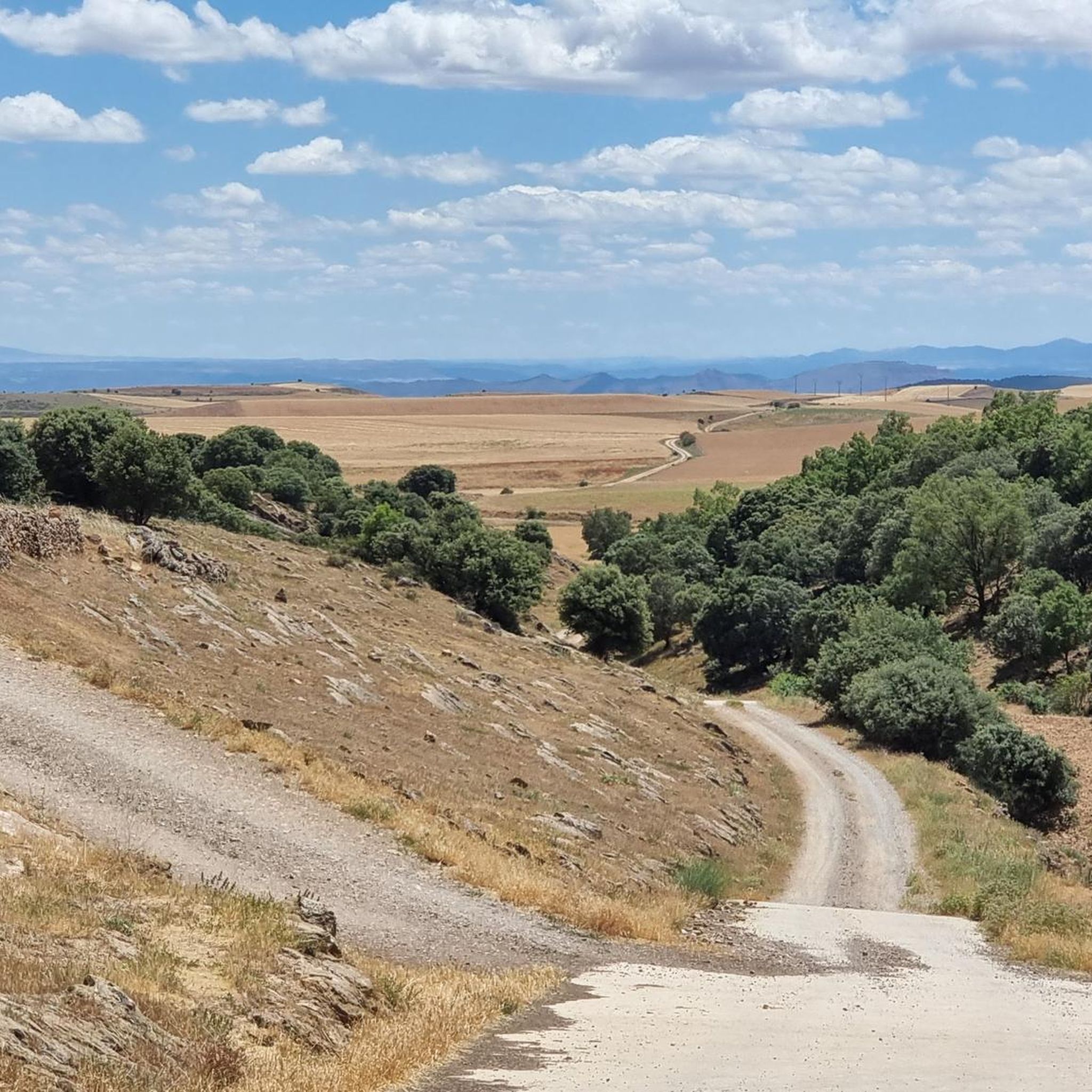
- Local hikers also love the Cabezo Cuartal y Nacimiento del río Isuela – circular desde Beratón por la Sierra del Moncayo, a 6.3 miles (10.1 km) trail leading through the Sierra del Moncayo, often completed in about 3 hours 4 minutes.
- Hiking around Aranda De Moncayo is defined by varied mountainous terrain, diverse forest ecosystems, and river valleys. The network offers options for different ability levels, with 13 moderate and 3 difficult hiking trails available.
- The routes in Aranda De Moncayo are highly rated by the komoot community with an average score of 5.0 stars from 4 reviews. More than 30 hikers have used komoot to explore Aranda De Moncayo's varied terrain.
Last updated: June 28, 2026
5.0
(2)
4
hikers
7.26km
02:08
210m
210m
Moderate hike. Good fitness required. Easily-accessible paths. Suitable for all skill levels.
5
hikers
Moderate hike. Good fitness required. Easily-accessible paths. Suitable for all skill levels.

Sign up for free
3
hikers
Moderate hike. Good fitness required. Easily-accessible paths. Suitable for all skill levels.
5.0
(1)
2
hikers
Hard hike. Very good fitness required. Easily-accessible paths. Suitable for all skill levels.
15.9km
04:15
180m
180m
Moderate hike. Good fitness required. Easily-accessible paths. Suitable for all skill levels.
Get access to more routes and recommendations from other explorers.
Sign up for free
Already have an account?
Our route recommendations are based on thousands of hikes, rides, and runs completed by other people on komoot.
Start today with a free account
Your next adventure awaits.
Login or Signup
Other adventures around Aranda De Moncayo

Tips from the Community

The Peñas del Cabo Caves are located on the western cliffs of the Peñas del Cabo, near Calcena, in the province of Zaragoza, Aragon. These caves are known for their impressive geological structure and speleothems, such as stalactites, stalagmites and flowstones. One of the most popular caves is the Cueva Honda, which has been used as a shelter for livestock and has housed archaeological remains from the Neolithic period. In addition, the cave is an important refuge for bat colonies during the summer. The caves offer a unique experience for caving and nature lovers.😊
4
0
The Mirador de la Ermita de San Cristóbal is located in the municipality of Los Fayos, in the province of Zaragoza, Aragon. This viewpoint offers spectacular views of the Queiles River Valley and the surrounding area, including the Val reservoir. The San Cristóbal hermitage, located next to the viewpoint, is a place of great historical and cultural interest. Built in the 17th century, the hermitage is an example of religious architecture in the region. Access to the viewpoint and the hermitage can be made through several hiking routes that run through the area, offering the opportunity to enjoy nature and panoramic views.
4
0

From this point, on the outskirts of Calcena, you have a good view of the whole town with its traditional houses and its magnificent natural environment.
2
0

Medieval fortress located on top of the hill near the town of Ciria. The history of the castle is linked to the passage of Muslims through the area, since it served to monitor their passage.
1
0
Near the town of Ciria, walking along a wide dirt road, we have excellent views of the Zapato cave.
1
0
Between the towns of Ciria and Borobia, we find the Ciria Lagoon. In the area we will find an information panel that will give us more information about the place.
1
0
At this point we will find an informative poster (very worn) facing the beautiful Muela de Beratón.
1
1
Cabezo Cuartal (1,506 m) located in the Sierra del Moncayo, offers us magnificent views of the mountains that surround us such as the Muela de Beratón. The access from the road to the Cabezo is without a path, but we can easily find it walking through the open forest.
1
1
Frequently Asked Questions
How many hiking trails are available around Aranda De Moncayo?
There are 16 hiking trails around Aranda De Moncayo. These include 13 moderate routes and 3 more challenging options, offering a variety of experiences for different fitness levels.
Are there any family-friendly hiking routes in the Aranda De Moncayo area?
While the guide primarily lists moderate and difficult trails, many sections of the Moncayo Natural Park offer gentler paths suitable for families. The region's diverse landscapes, from river valleys to forests, provide engaging environments for all ages to explore. For specific family-friendly options, it's best to check individual route details for elevation and terrain.
What kind of landscapes can I expect to see while hiking near Aranda De Moncayo?
Hiking near Aranda De Moncayo offers a remarkable diversity of landscapes. You'll encounter the imposing Moncayo mountain range with its varied environments, from arid zones to lush beech and pine forests. River valleys, such as those formed by the Aranda and Isuela rivers, are also prominent. The area is known for its unique transition from dry hills to glacial cirques over short distances, providing ever-changing scenery.
Are there any circular hiking routes around Aranda De Moncayo?
Yes, there are several circular hiking routes available. One popular option is the Valcongosto Gorges and Cuartún - circular from Purujosa, a moderate 4.5-mile trail. Another is the Mirador de la Ermita de San Cristobal from Calcena — circular by Penas del Cabo, which offers panoramic views.
What are some notable natural attractions or points of interest along the trails?
The region boasts several natural attractions. You can explore the Cueva de los Pilares, a spectacular cave within the Moncayo Natural Park. Hikers can also reach the Cerro Morrón Summit for impressive vistas, or visit the Soriano Water Nature Trail.
What is the best time of year to go hiking in Aranda De Moncayo?
Aranda De Moncayo offers hiking opportunities throughout much of the year. Spring and autumn are particularly pleasant, with mild temperatures and vibrant natural colors. The Moncayo's northern slopes are known for atmospheric mists, especially in cooler months, adding to the scenic beauty. Summer can be warm, so early morning or late afternoon hikes are recommended, while winter hiking is possible but may require appropriate gear for higher elevations.
Are there any historical or cultural sites to see while hiking in the area?
Yes, Aranda De Moncayo is rich in history. The village itself features a Muslim-origin castle (though in ruins) and the Gothic church of La Asunción. The wider region has archaeological remnants from Celtiberian and Roman eras, including the Aratikos site and a Roman bridge. These historical elements can be integrated into your outdoor explorations, offering a cultural dimension to your hikes.
What do other hikers say about the trails in Aranda De Moncayo?
The trails in Aranda De Moncayo are highly rated by the komoot community, with an average score of 5.0 stars from 4 reviews. Hikers often praise the varied mountainous terrain and diverse forest ecosystems, highlighting the rewarding views from peaks like Cabezo Cuartal and Cerro Morrón.
Are there any trails that lead to prominent peaks or viewpoints?
Absolutely. The region is dotted with peaks offering magnificent panoramas. The Cabezo Cuartal y Nacimiento del río Isuela – circular desde Beratón por la Sierra del Moncayo route leads through the Sierra del Moncayo, providing access to views from Cabezo Cuartal (1,506 m). The Mirador de la Ermita de San Cristobal from Calcena also offers extensive vistas.
Can I find trails that are suitable for a full day of hiking?
Yes, for those seeking a longer adventure, there are more demanding trails. The Calcena - Trasobares - Barranco de Valdeplata - Calcena — circular by the Moncayo Natural Park is a difficult 16.5-mile route that typically takes over 8 hours to complete, offering an immersive experience in the natural park.
Are there any trails that pass by water bodies or reservoirs?
The region features river valleys, such as those formed by the Aranda and Isuela rivers. While specific trails directly along the Embalse de Maidevera (Maidevera Reservoir) are not detailed in this guide, the reservoir is a significant local feature offering scenic views and water-based activities. The Cueva del Zapato, Laguna de Ciria, and Laguna de Borobia Loop passes by natural lagoons, providing beautiful waterside scenery.
What is the typical duration for hikes in Aranda De Moncayo?
Hike durations vary depending on the route's length and difficulty. For example, the moderate Valcongosto Gorges and Cuartún - circular from Purujosa takes approximately 2 hours and 8 minutes. Longer, more challenging routes like the Calcena - Trasobares - Barranco de Valdeplata - Calcena can take over 8 hours.
Most popular attractions around Aranda De Moncayo

Get inspired with the komoot mobile app


Explore more
Browse the best Hikes in other regions.
