The best MTB trails around Narros Del Puerto
3.8
(7)
31
riders
8
rides
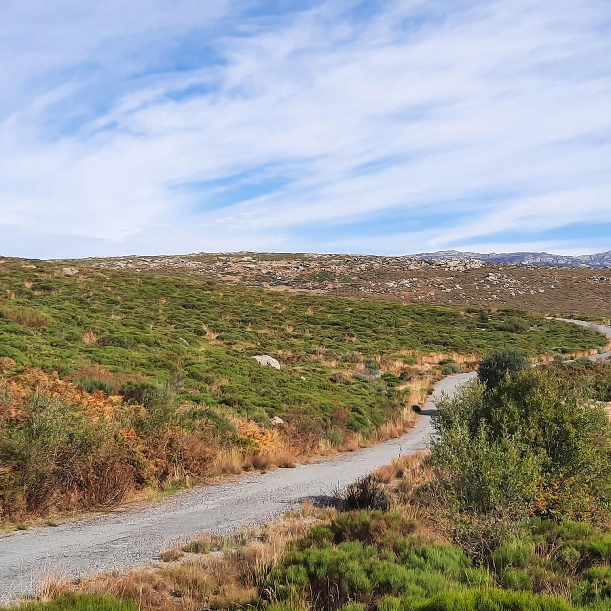
Mountain biking around Narros Del Puerto offers diverse terrain within the Valle Amblés, surrounded by the Sierra de Ávila, La Serrota, and Paramera mountain ranges. The landscape features varied topography, from the flat expanses of the valley to challenging mountainous sections, with elevations near 1,152 meters. Cyclists can explore farmlands, meadows, extensive forests, and riparian environments along the Adaja River and Ullaque stream. This region provides a mix of natural corridors and historical routes, suitable for different mountain biking experiences.
…Last updated: July 1, 2026
2.5
(2)
7
riders
36.8km
04:04
1,170m
1,170m
This difficult 22.9-mile mountain biking route near Villatoro offers challenging terrain and scenic views with 3832 feet of elevation gain.
4
riders
48.7km
04:42
1,020m
1,020m
Hard mountain bike ride. Very good fitness required. Suitable for all skill levels.

Sign up for free
4
riders
69.4km
06:28
1,220m
1,220m
Hard mountain bike ride. Very good fitness required. Suitable for all skill levels.
2
riders
38.7km
03:50
850m
850m
Moderate mountain bike ride. Good fitness required. Suitable for all skill levels.
5.0
(5)
3
riders
29.4km
03:07
910m
900m
Hard mountain bike ride. Very good fitness required. Suitable for all skill levels.
Get access to more routes and recommendations from other explorers.
Sign up for free
Already have an account?
Our route recommendations are based on thousands of hikes, rides, and runs completed by other people on komoot.
Start today with a free account
Your next adventure awaits.
Login or Signup
Popular around Narros Del Puerto


Tips from the Community

A stream on the outskirts of the town that even in these times runs a trickle of water, you can see it in the rainy season.
0
0

It is the only rebuilt mill that still works, but the person who made it work died and I don't know if there is anyone who can teach it and put it into operation.
0
0

From Puerto de Villatoro itself, a road appears in a northerly direction that goes towards the center of Villanueva del Campillo, with impressive views of the area.
0
0
Population that is located at the foot of the northern side of the Sierra de Panamera and that on one of its sides is the Castillo de Manqueospese. As it is surrounded by mountains, as soon as you get up, you can see the entire core.
0
0
At this point it is said that the Río Adaja is born and there appear a set of springs and springs that give us water in case we are without it! Beautiful valley!
0
0
The Río de la Garaganta descends through this valley that has formed over the years and that lets us see how the Sierra de Panamera peaks rise behind us.
1
0
The relief of the municipality is formed by two mountainous areas separated by the Amblés valley, through which the Adaja river runs, which is born in the territory. The northern area is called Sierra de Villanueva, a branch of the Sierra de Ávila.
0
0

The Muñotello roll symbolizes the jurisdictional independence obtained by the town with respect to the Villatoro council in 1733, during the reign of Felipe V. The construction is made of carved granite, it is five meters high and represents the sovereignty of the town of Muñotello to administer Justice. The prisoners were tied to the stone pillory during the trial and depending on the sentence they were stoned to death or released.
0
0
Frequently Asked Questions
What are the difficulty levels of mountain bike trails around Narros Del Puerto?
The mountain bike trails in Narros Del Puerto cater to various skill levels. You'll find 2 easy routes, 5 moderate routes, and 1 difficult route, offering a good mix for different experiences.
Are there any beginner-friendly mountain bike trails in the area?
Yes, there are a couple of easy mountain bike routes suitable for beginners or those looking for a more relaxed ride. These routes typically feature less challenging terrain and elevation changes, allowing you to enjoy the scenic Valle Amblés at a comfortable pace.
What kind of distances and elevation gains can I expect on mountain bike trails here?
The trails vary significantly. For example, a challenging route like Villatoro and Garganta de los Hornos Loop covers about 22.9 miles (36.8 km) with over 1100 meters of elevation gain. Moderate options, such as Castillo de Villaviciosa – Fuente Fría Picnic Area loop from Solosancho, are around 24.0 miles (38.7 km) with about 850 meters of ascent.
Are most mountain bike trails in Narros Del Puerto circular?
Many of the mountain bike routes around Narros Del Puerto are designed as loops, allowing you to start and finish at the same point. This includes popular options like the Villatoro and Garganta de los Hornos Loop and the Castillo de Villaviciosa – Fuente Fría Picnic Area loop from Solosancho.
What natural features or scenic viewpoints can I expect to see while mountain biking?
You'll encounter diverse landscapes, from the flat expanses of the Valle Amblés to the imposing Sierra de Ávila, La Serrota, and Paramera mountain ranges. The routes often follow the Adaja River valley and Ullaque stream, offering riparian environments. Keep an eye out for unique rock formations like those in 'Los Lanchales' and the prominent 'el canto del águila' rock. The Serrota summit and Las Fuentes Pass offer stunning views.
Are there any historical sites or landmarks to explore along the trails?
Yes, the region is rich in history. You can ride along ancient paths like the Cañada Real Leonesa Occidental, a historical drover's road, or parts of the Camino Teresiano. Notable landmarks include the Rollo de Muñotello and the Ruins of Monasterio del Risco, which add a cultural dimension to your ride.
What do other mountain bikers enjoy the most about mountain biking in Narros Del Puerto?
The area is highly rated by the komoot community, with an average score of 3.0 stars from 6 reviews. Mountain bikers often praise the varied terrain, which ranges from valley floors to challenging mountainous sections, and the opportunity to immerse themselves in the natural beauty and rich biodiversity of the region.
Is Narros Del Puerto a good destination for mountain biking in winter?
While the region offers year-round beauty, winter conditions can vary, especially in the higher elevations of the Sierra de Ávila, La Serrota, and Paramera mountains. It's advisable to check local weather forecasts and trail conditions before planning a winter ride, as some sections might be affected by snow or ice.
Are there any specific areas known for challenging mountain biking?
For experienced mountain bikers seeking a challenge, routes that venture into the Sierra de Ávila, La Serrota, and Paramera mountain ranges will offer significant elevation gains and technical sections. The Sotalbo – Fuente Fría Picnic Area loop from Solosancho, for instance, is a difficult 30.3-mile (48.7 km) trail leading through the Sierra de Ávila foothills.
What is the best time of year to go mountain biking in Narros Del Puerto?
Spring and autumn generally offer the most pleasant conditions for mountain biking in Narros Del Puerto, with milder temperatures and vibrant landscapes. The forests and poplar groves transform beautifully with the seasons, providing picturesque routes. Summer can be hot, so early morning or late afternoon rides are recommended.
Are there options for longer, more adventurous mountain bike tours?
Absolutely. For those looking for a longer adventure, the Arroyo Prodesagar – Rollo de Muñotello loop from Villatoro is a challenging 70.2 km (43.6 miles) route with over 1200 meters of elevation gain, offering an extensive exploration of the region's diverse terrain.
Most popular routes around Narros Del Puerto
Most popular attractions around Narros Del Puerto

Get inspired with the komoot mobile app


Explore more
Browse the best MTB trails in other regions.
