The best walks and hikes around Parc Natural Comunal de les Valls del Comapedrosa
4.6
(1732)
17,353
hikers
423
hikes
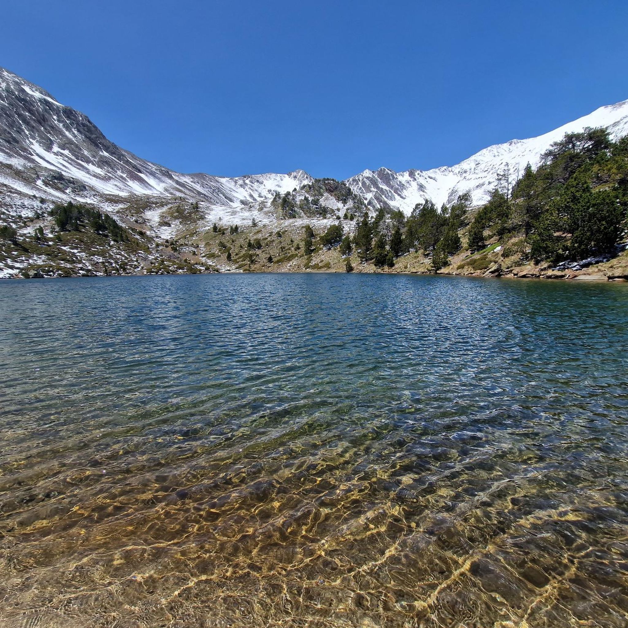
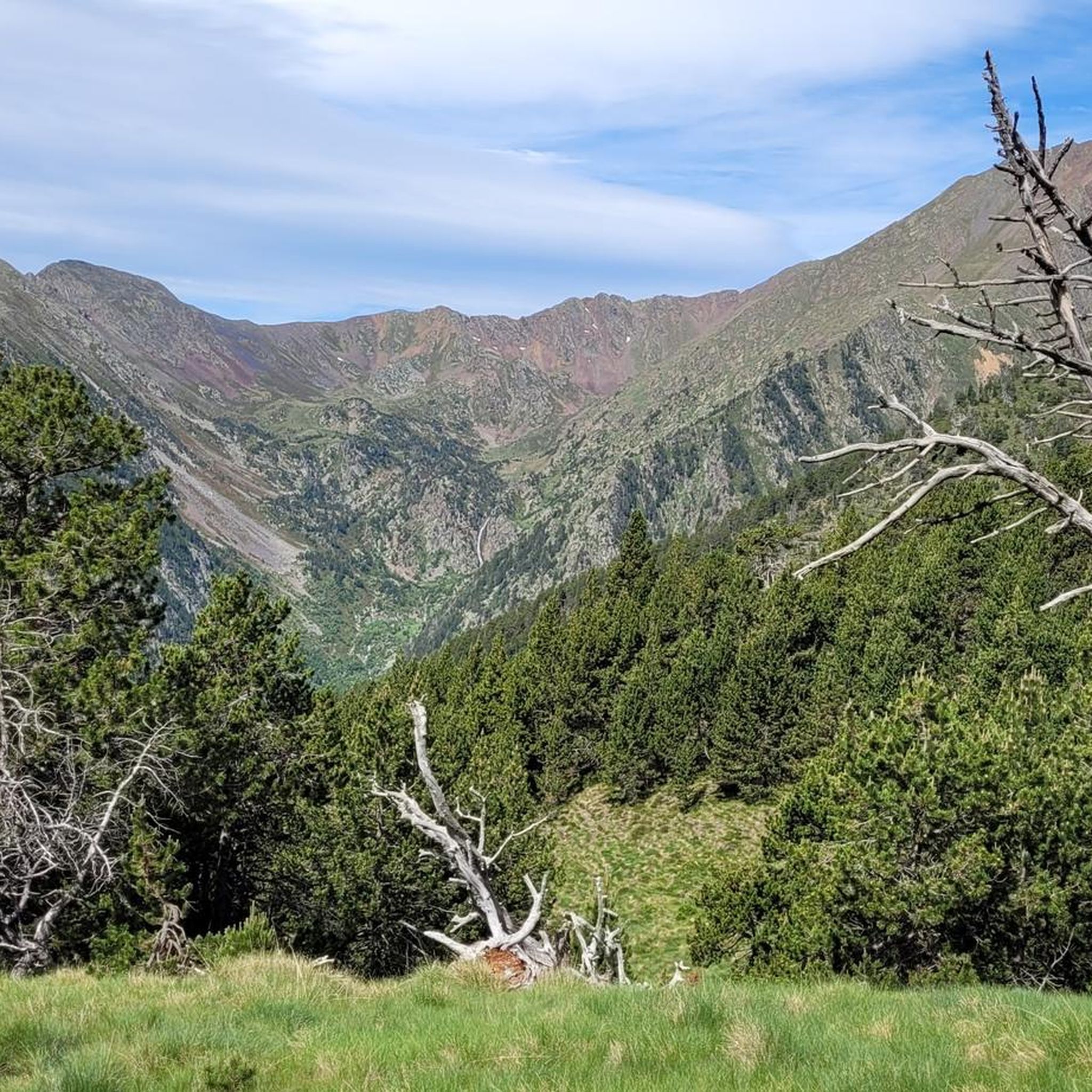
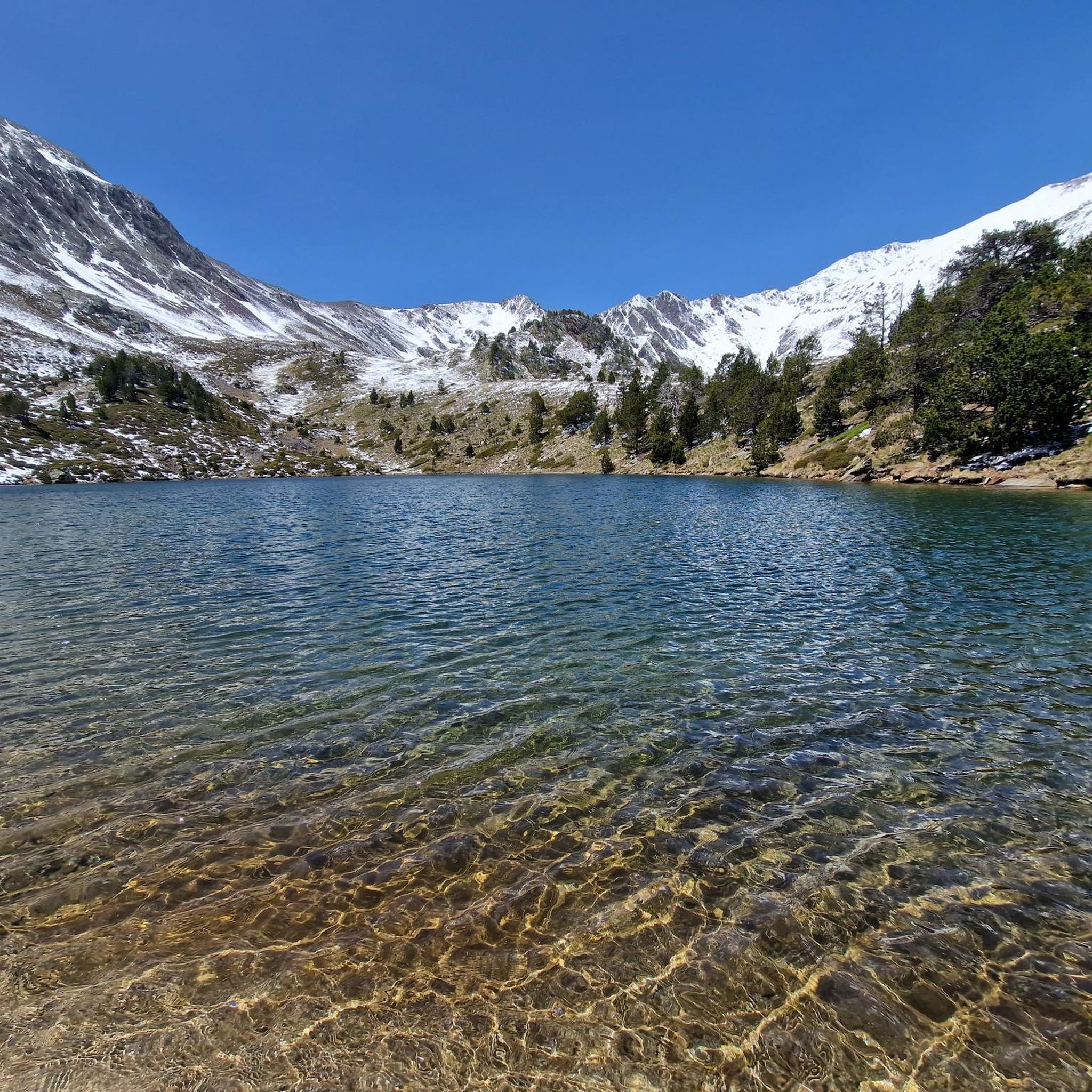
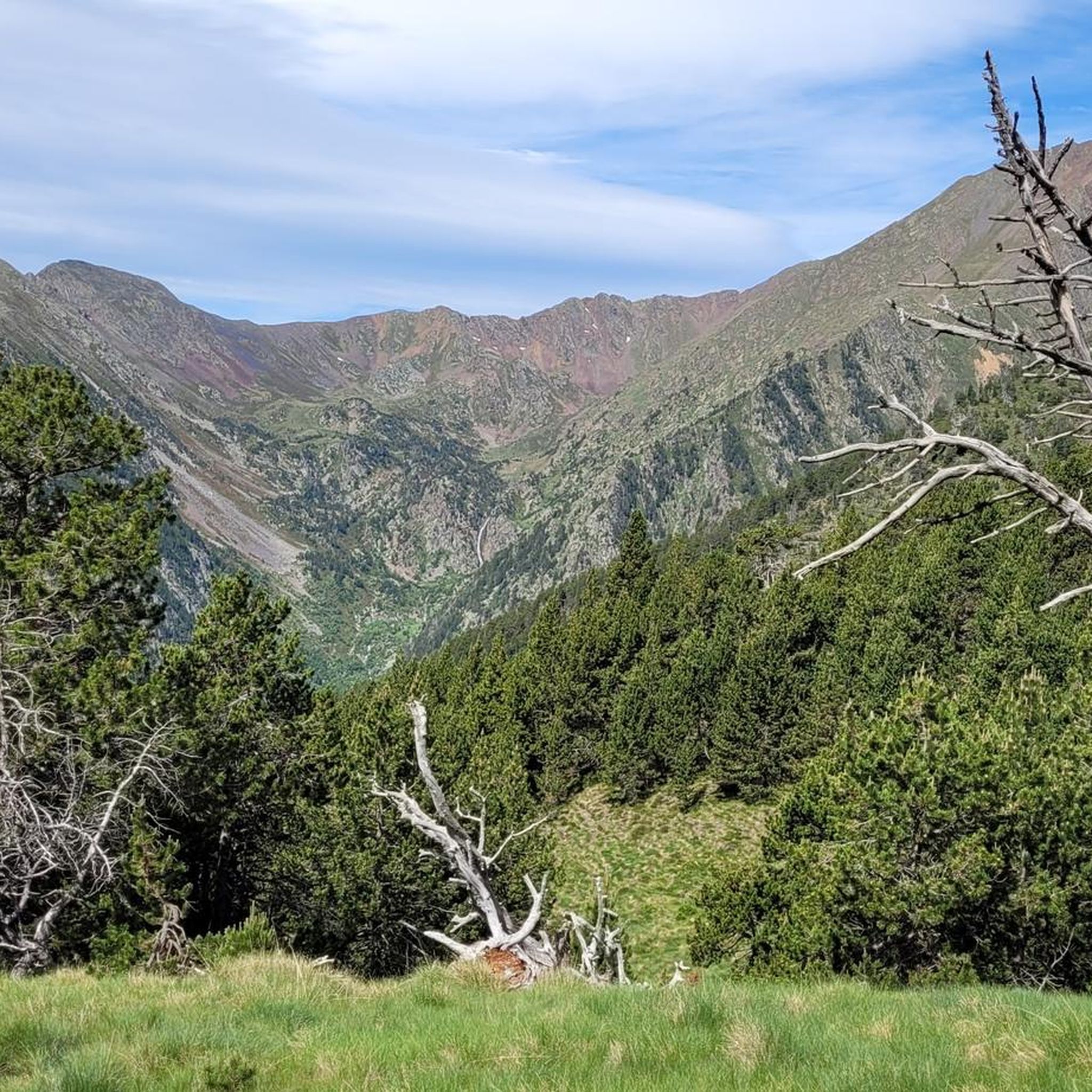
Hiking trails around Parc Natural Comunal de les Valls del Comapedrosa traverse a high-mountain environment shaped by glacial morphology, featuring U-shaped valleys and cirques. The terrain transitions from dense white birch groves in lower valleys to high-altitude shrub zones with common juniper. Hikers encounter exposed rock formations, ridges, and numerous glacial lakes, including Estany Negre and Estany de les Truites. Rivers such as Riu Pollós and Riu de Comapedrosa carve through the valleys, contributing to the park's diverse landscape.
Best hiking trails around Parc Natural Comunal de les Valls del Comapedrosa
- The most popular hiking route is Parque Natural Comunal de les Valls del Comapedrosa por el valle — ida y vuelta por la Portella de Baiau, a 9.0 miles (14.5 km) trail that takes 7 hours 11 minutes to complete, leading through the valley towards Portella de Baiau.
- Another top favourite among local hikers is Ascent to Pico de Comapedrosa — circular Parque Natural Comunal de les Valls del Comapedrosa, a difficult 8.3 miles (13.4 km) path. This circular route offers an ascent to the highest peak in Andorra, Coma Pedrosa.
- Local hikers also love the Coll de les Cases Loop, a 6.0 miles (9.7 km) trail leading through alpine landscapes and offering panoramic views, often completed in about 4 hours 2 minutes.
- Hiking around Parc Natural Comunal de les Valls del Comapedrosa is defined by high-mountain peaks, glacial lakes, and dense forests. The network offers options for various ability levels, from challenging ascents to more moderate paths.
- The routes in Parc Natural Comunal de les Valls del Comapedrosa are highly rated by the komoot community with an average score of 4.6 stars from more than 1600 reviews. More than 16000 hikers have used komoot to explore Parc Natural Comunal de les Valls del Comapedrosa's varied terrain.
Last updated: July 4, 2026
4.8
(49)
596
hikers
Hard hike. Very good fitness required. Mostly accessible paths. Sure-footedness required.
4.7
(14)
215
hikers
Hard hike. Very good fitness required. Sure-footedness, sturdy shoes and alpine experience required.

Sign up for free
4.6
(8)
17
hikers
9.71km
04:02
680m
680m
This difficult 6.0-mile (9.7 km) circular hike from Arinsal offers panoramic views from Coll de les Cases and follows the Río Pollós.
5.0
(2)
13
hikers
Hike the challenging 8.8-mile Ascent to Pic del Clot del Cavall, gaining 3877 feet through Andorra's high-mountain landscapes.
2
hikers
Hard hike. Very good fitness required. Easily-accessible paths. Suitable for all skill levels.
Get access to more routes and recommendations from other explorers.
Sign up for free
Already have an account?
Our route recommendations are based on thousands of hikes, rides, and runs completed by other people on komoot.
Start today with a free account
Your next adventure awaits.
Login or Signup
Popular around Parc Natural Comunal de les Valls del Comapedrosa
Running Trails around Parc Natural Comunal de les Valls del Comapedrosa
Road Cycling Routes around Parc Natural Comunal de les Valls del Comapedrosa
Cycling around Parc Natural Comunal de les Valls del Comapedrosa
MTB Trails around Parc Natural Comunal de les Valls del Comapedrosa

Mountain Hikes around Parc Natural Comunal de les Valls del Comapedrosa

Gravel biking around Parc Natural Comunal de les Valls del Comapedrosa
Tips from the Community

The path to the descent on the southeast side only exists in some places and should only be hiked with experience.
0
0
Lots of mosquitoes and flies. Much cooler than 200m earlier.
0
0

Small reservoir with clear water in a magnificent setting
0
0

When is the price per person per night?
0
0

The highest mountain in Andorra is feasible as a day trip from the country. However, one should be careful, some experienced hikers have already gotten lost. 😜 And the way to Spain or France is long... The easiest ascent is rated T3 according to the SAC scale. On the descent, I went a bit off the summit path in a northeastern direction and descended there. A bit more demanding (T4), but in this case, due to the scree in the upper part, it is easier to navigate on the descent. Here I saw some salamanders.
1
0

If there is snow during the summer, you can climb Comapedrosa via its northern ridge.
0
0
Welcome to the roof of Andorra. Ascent without any complexity. You can descend by following the ridge northwards to the pass, and from there continue down the scree slope. The route is easy to follow except for the scree, which requires a bit of improvisation on the way down.
0
0

Small, unguarded shelter found in this area between the Comapedrosa and Arcalís valleys. A perfect stone cabin to spend the night if the weather conditions worsen or simply to take shelter under a roof.
0
0
Frequently Asked Questions
How many hiking trails are available in Parc Natural Comunal de les Valls del Comapedrosa?
There are over 420 hiking trails within Parc Natural Comunal de les Valls del Comapedrosa, offering a wide range of options from easy strolls to challenging high-mountain ascents. The komoot community has rated these routes highly, with an average score of 4.6 stars.
What are the typical terrain and elevation changes like in Parc Natural Comunal de les Valls del Comapedrosa?
The park features dramatic alpine terrain, characterized by U-shaped valleys and cirques, remnants of glacial activity. You'll encounter diverse ecological zones, from dense white birch groves in lower valleys to high-altitude shrub zones. As you ascend, the terrain becomes more technical, with rough, rocky ground and exposed rock formations. Expect significant elevation gains on many routes, especially those leading to higher peaks.
Are there any circular hiking routes in Parc Natural Comunal de les Valls del Comapedrosa?
Yes, the park offers several rewarding circular routes. One notable option is the Coll de les Cases Loop, a 6.0-mile (9.7 km) trail that provides panoramic views of the alpine landscape. Another challenging circular route is the Ascent to Pico de Comapedrosa, which takes you to Andorra's highest peak.
What natural features and landmarks can I see while hiking in the park?
The park is rich in natural beauty. You can explore stunning glacial lakes like Black Lake of Comapedrosa and Trout Lake. The highest point, Coma Pedrosa Summit, offers expansive views. You'll also find high-mountain refuges such as Comapedrosa Refuge, and picturesque forest scenery in the Comapedrosa Valley.
Are there any easy hiking trails suitable for families in Parc Natural Comunal de les Valls del Comapedrosa?
While many trails in the park are challenging, there are over 100 easy routes available. These typically involve less elevation gain and cover shorter distances, making them suitable for families or those seeking a more relaxed experience. Look for paths in the lower valleys, which often feature dense white birch groves and gentler terrain.
Can I bring my dog on the hiking trails in Parc Natural Comunal de les Valls del Comapedrosa?
The Parc Natural Comunal de les Valls del Comapedrosa is generally dog-friendly, but it's always advisable to keep your dog on a leash, especially in areas with livestock or protected wildlife. Ensure you carry enough water for your pet and clean up after them to preserve the natural environment.
What is the best time of year to go hiking in Parc Natural Comunal de les Valls del Comapedrosa?
The best time to hike in Parc Natural Comunal de les Valls del Comapedrosa is typically from late spring to early autumn (June to September). During these months, the snow has usually melted from higher elevations, and the weather is more stable. However, be aware that some high-altitude lakes, like Estany Negre, can remain frozen until July depending on the season.
Are there any challenging multi-day hikes or refuges in the park?
Yes, the park is well-suited for challenging multi-day treks, with several high-mountain refuges available. The Comapedrosa Refuge (Refugi del Pla de l'Estany) is a key intermediate point for longer hikes, offering a place to rest and resupply. Routes like the Parque Natural Comunal de les Valls del Comapedrosa por el valle can be part of longer adventures.
Is public transport available to access Parc Natural Comunal de les Valls del Comapedrosa?
Public transport options are available to reach the vicinity of the park, particularly from nearby towns like La Massana and Arinsal. From these points, you can often find local bus services or taxi options that can take you closer to trailheads. It's recommended to check local schedules for the most up-to-date information.
Do I need any special permits to hike in Parc Natural Comunal de les Valls del Comapedrosa?
Generally, no special permits are required for day hiking within Parc Natural Comunal de les Valls del Comapedrosa. However, if you plan to stay overnight in refuges, it's advisable to check their booking requirements in advance, especially during peak season. Always respect park regulations and leave no trace.
What is the longest difficult hike in the park?
One of the longest difficult hikes is the Parque Natural Comunal de les Valls del Comapedrosa por el valle — ida y vuelta por la Portella de Baiau, which spans approximately 9.0 miles (14.5 km) and involves significant elevation gain, typically taking over 7 hours to complete.
Most popular routes around Parc Natural Comunal de les Valls del Comapedrosa
Most popular attractions around Parc Natural Comunal de les Valls del Comapedrosa

Get inspired with the komoot mobile app


