The best cycling routes around National Park Hoces del Cabriel
4.5
(9)
212
riders
34
rides
Touring cycling routes around National Park Hoces del Cabriel navigate a landscape characterized by the Cabriel River, which carves out impressive gorges and meanders. The region features dramatic cliffs and unique rock formations, such as Los Cuchillos de Contreras. Routes often follow riverbanks or utilize well-maintained gravel roads and some paved sections, providing varied terrain for cyclists. The park's topography includes both gentle slopes and areas with significant elevation changes.
Best touring cycling routes around National Park Hoces del Cabriel
…Last updated: July 11, 2026
8
riders
Hard bike ride. Very good fitness required. Mostly paved surfaces. Suitable for all skill levels.
6
riders
Moderate bike ride. Good fitness required. Mostly paved surfaces. Suitable for all skill levels.

Sign up for free
2
riders
33.5km
03:15
760m
760m
This difficult 20.8-mile gravel cycling route in Parque Natural Hoces de Cabriel offers stunning views of the Cabriel River and Cuchillos de
5.0
(3)
14
riders
29.0km
02:03
550m
550m
Hard bike ride. Very good fitness required. Mostly paved surfaces. Suitable for all skill levels.
5
riders
Moderate bike ride. Good fitness required. Mostly paved surfaces. Suitable for all skill levels.
Get access to more routes and recommendations from other explorers.
Sign up for free
Already have an account?
Our route recommendations are based on thousands of hikes, rides, and runs completed by other people on komoot.
Start today with a free account
Your next adventure awaits.
Login or Signup
Popular around National Park Hoces del Cabriel

GR 238 Tierra del Vino - A journey on foot through lands of silence
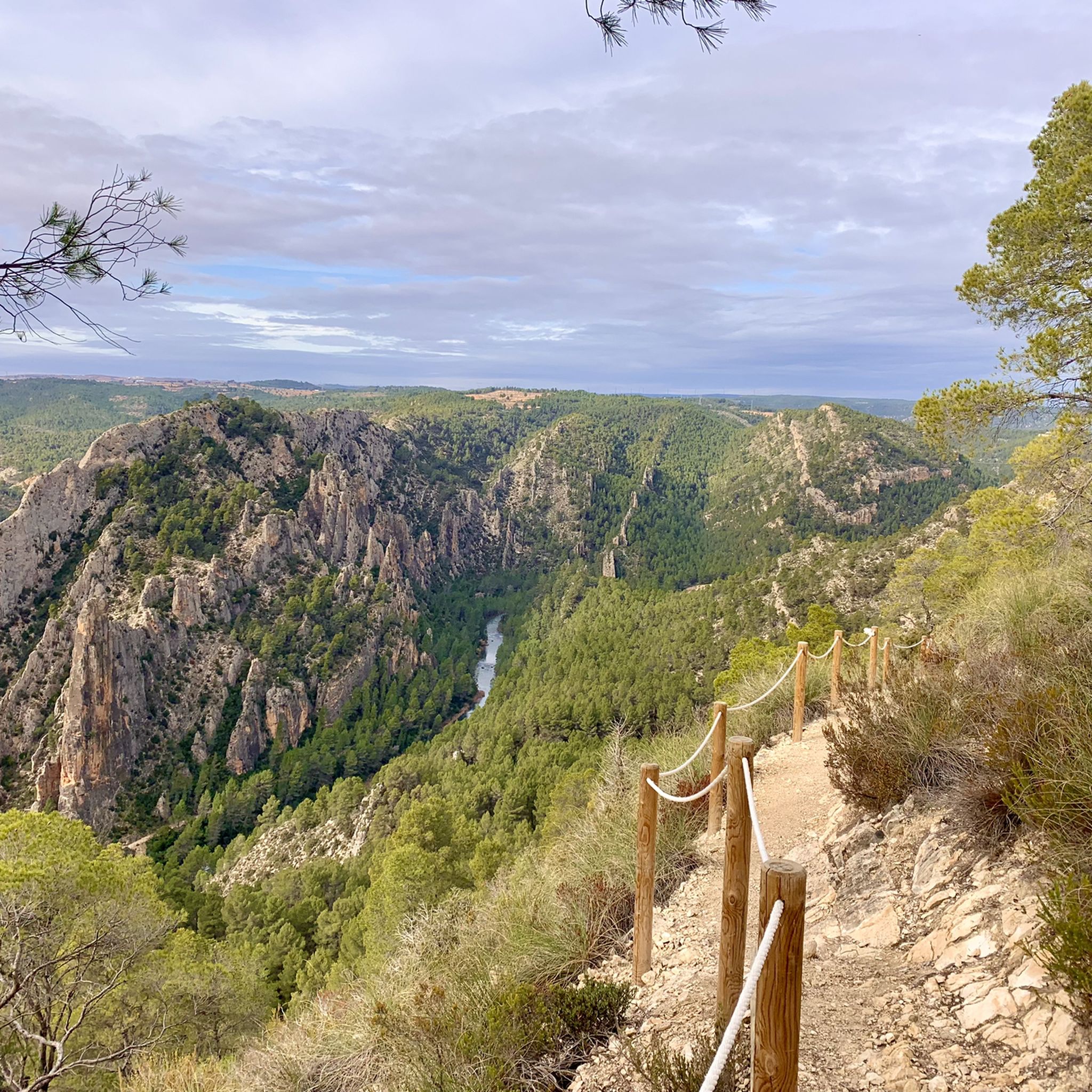
Hiking around National Park Hoces del Cabriel
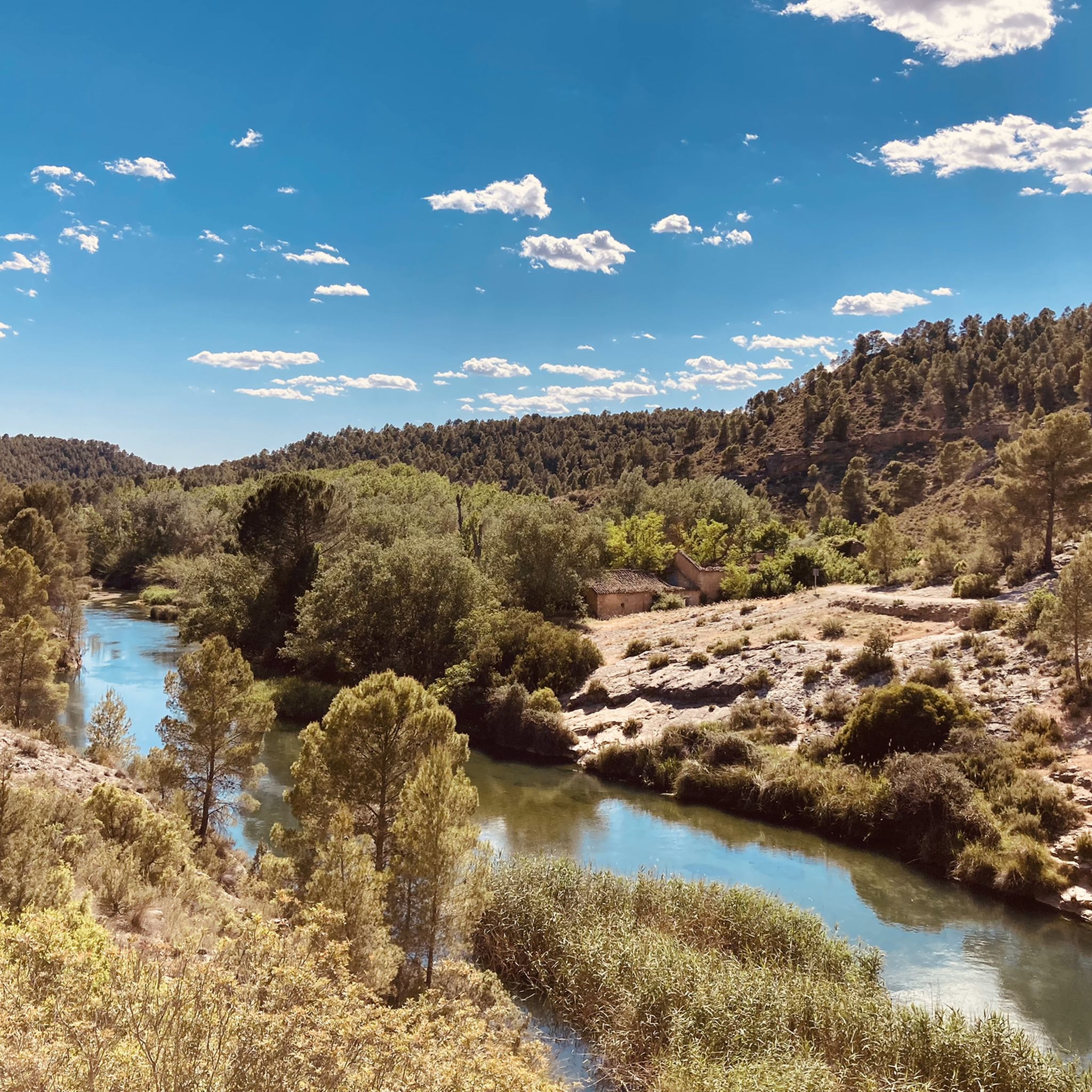
MTB Trails around National Park Hoces del Cabriel
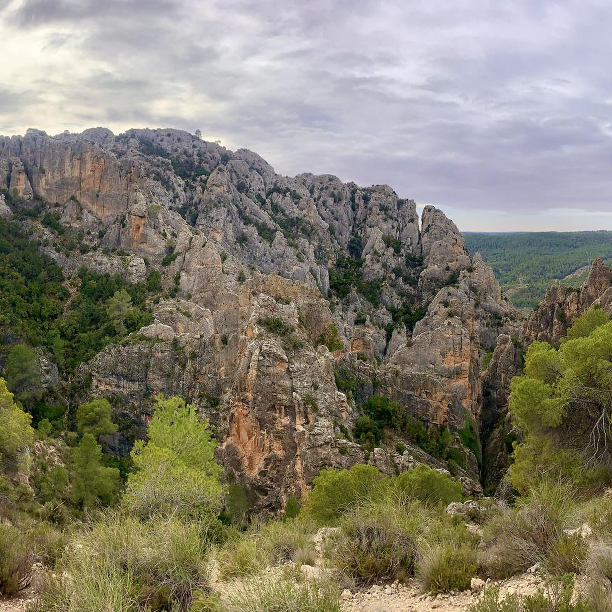
Road Cycling Routes around National Park Hoces del Cabriel

Gravel biking around National Park Hoces del Cabriel
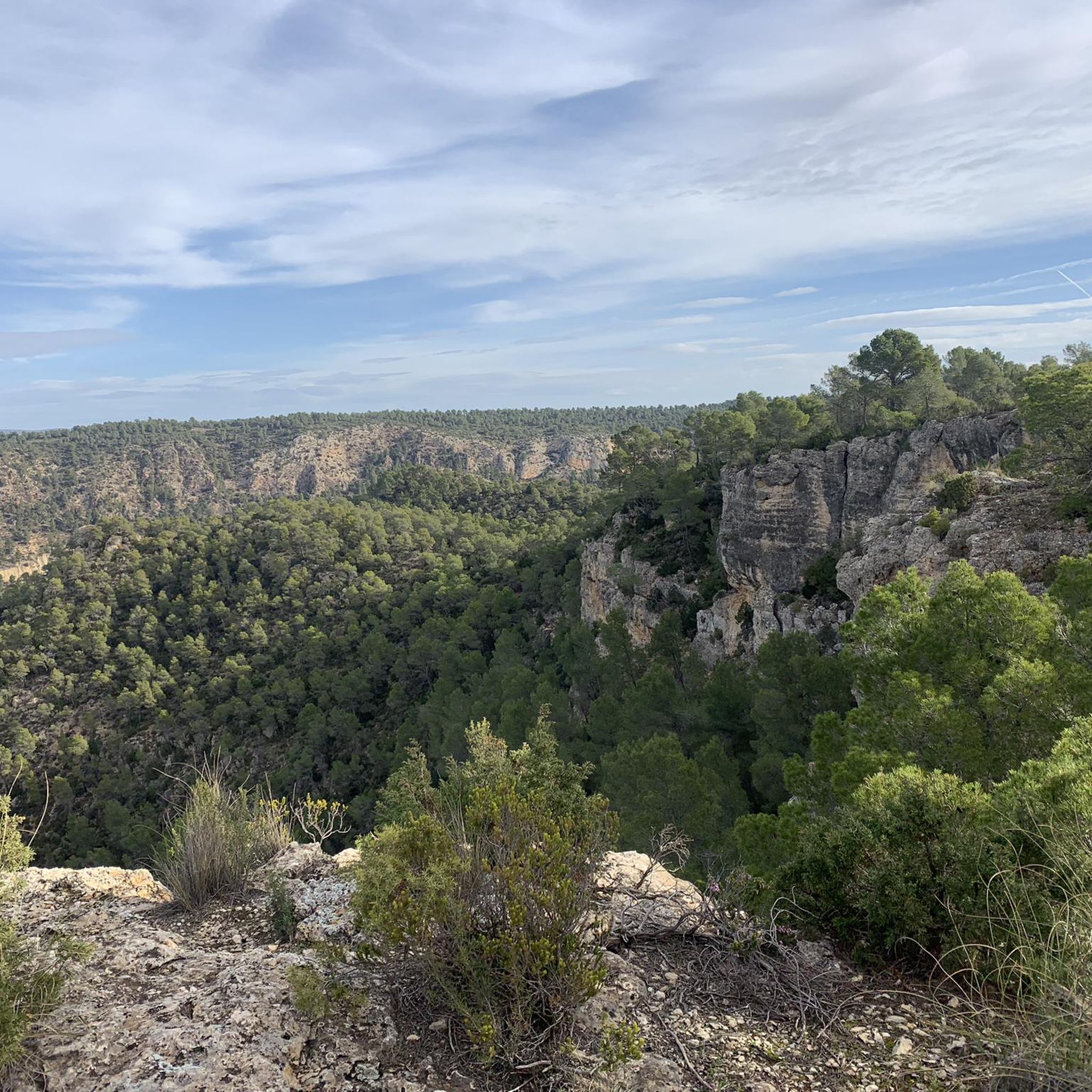
Running Trails around National Park Hoces del Cabriel
Other adventures around National Park Hoces del Cabriel

Tips from the Community

Beautiful viewpoint of the dam, the river and the factory.
11
0
Square remarkable tower.
12
0
The Contreras dam (Embalse de Contreras) is a 129-meter-high arch dam built in 1972. Located on the border of the provinces of Cuenca (Castilla-La Mancha) and Valencia, the dam spans the Cabriel and Guadazaón rivers. The reservoir serves mainly for water supply, flood protection, and irrigation.
11
1
Some houses are still inhabited!!
0
0
Villargordo del Cabriel is a municipality in the Requena-Utiel region, in the province of Valencia. The town is located on the banks of the Cabriel River and is on the border between Castilla-La Mancha and the Valencia region. One of the biggest tourist attractions is the beautiful nature, which is remarkably well preserved.
14
0
Small village in a beautiful setting, with a central square, a small shop and a huge church.
13
0

Viewpoint next to the old N-III highway After passing the engineer's house, a turnoff leads to the viewpoint located above the old N-III highway. Sweeping views of the reservoir from a high, accessible point.
4
0
Hiking: Popular routes, such as the "Engineer's House" trail, offer viewpoints overlooking the reservoir and the Cabriel River gorges. Guided tours: Occasionally, the Hydrographic Confederation and the Villargordo Town Council organize tours and talks in the village of Contreras. Historic roads: The abandoned section of the old N-III highway and the Contreras Hills attract engineering enthusiasts, with their original 20th-century asphalt and signage.
9
0
Frequently Asked Questions
How many touring cycling routes are available in National Park Hoces del Cabriel?
There are over 35 touring cycling routes in National Park Hoces del Cabriel. These routes offer a diverse range of experiences, from moderate to difficult, allowing cyclists to explore the unique landscapes of the region.
What kind of terrain can I expect on touring cycling routes in National Park Hoces del Cabriel?
The routes in National Park Hoces del Cabriel feature varied terrain. You'll find well-maintained gravel roads and some paved sections, often following riverbanks. The landscape includes both gentle slopes and areas with significant elevation changes, traversing dramatic cliffs and unique rock formations carved by the Cabriel River.
What natural features and landmarks can I see while cycling in National Park Hoces del Cabriel?
While cycling, you can experience the impressive gorges and meanders of the Cabriel River, dramatic cliffs, and unique rock formations like Los Cuchillos de Contreras. Don't miss viewpoints such as Hoz del Rabo de la Sartén Viewpoint or La Fonseca Viewpoint, offering panoramic vistas of the valley.
Are there any historical sites or interesting structures along the routes?
Yes, the region boasts several points of historical and engineering interest. You can encounter the historic 16th-century Vadocañas Bridge over the Cabriel River, and the impressive 19th-century Contreras Bridge below the Contreras Dam. There are also historical sites like the Peñas Blancas Path Trench and the Contreras Trench.
Are there any easy touring cycling routes suitable for beginners?
While many routes in the park are rated moderate to difficult due to elevation changes, the Turia-Cabriel Nature Trail offers sections with gentle slopes and well-maintained gravel roads that can be suitable for touring bikes. For a moderate option, consider the Venta del Moro – Venta del Moro loop from Casas del Rey, which covers 28.4 km with moderate elevation.
What do other touring cyclists say about the routes in National Park Hoces del Cabriel?
The routes in National Park Hoces del Cabriel are highly rated by the komoot community, with an average score of 4.5 stars from over 5 reviews. Cyclists often praise the stunning natural beauty, the dramatic landscapes of the Cabriel River gorges, and the unique rock formations like Los Cuchillos de Contreras.
Are there any circular touring cycling routes in the park?
Yes, many routes in the park are designed as loops, allowing you to start and end at the same point. An example is the Contreras Viewpoint – Contreras Inn loop from Sendero de Los Cuchillos del Cabriel, an 29.0 km route offering views of the Cuchillos del Cabriel.
What is the best time of year to go touring cycling in National Park Hoces del Cabriel?
The National Park Hoces del Cabriel is generally enjoyable for cycling during spring and autumn when temperatures are milder. These seasons offer pleasant weather for exploring the diverse landscapes and observing wildlife without the extreme heat of summer or the chill of winter.
Are there options for longer distance touring cycling in the area?
Yes, the broader Cabriel Valley Biosphere Reserve promotes cycling on long routes, suggesting the presence of roads with low traffic density suitable for extended tours. The extensive Turia-Cabriel Nature Trail, over 121 km long, also provides opportunities for multi-day touring, connecting different natural parks.
Can I find routes that offer views of the Contreras Dam?
Absolutely. The Contreras Dam is a significant landmark in the area. You can find routes like the Contreras Dam – Cabriel Valley Viewpoint loop from Villargordo del Cabriel, which leads through the Cabriel Valley and offers views of the dam and surrounding landscape.
What kind of wildlife might I encounter while cycling?
As a UNESCO Biosphere Reserve and Special Protection Area for Birds (SPA), the park is rich in wildlife. You might spot raptors such as Bonelli's eagle and golden eagle soaring above the gorges. The pristine Cabriel River is also home to river fauna, including otters.
Are there any particularly challenging routes for experienced touring cyclists?
Yes, for experienced touring cyclists seeking a challenge, there are several difficult routes. The Cuchillos de Contreras and Moluengo Peak Loop is a difficult 33.5 km path that traverses areas with dramatic rock formations and significant elevation changes, making it a rewarding ride.
Most popular routes around National Park Hoces del Cabriel
Most popular attractions around National Park Hoces del Cabriel

Get inspired with the komoot mobile app


Explore more
Browse the best Cycling routes in other regions.
