The best walks and hikes around O Pereiro De Aguiar
4.6
(223)
1,233
hikers
16
hikes
Hiking around O Pereiro De Aguiar offers a diverse landscape characterized by rolling hills and lush greenery. The municipality is deeply connected to the Miño River, which forms part of its northwestern boundary, and the Loña River, which traverses the area, featuring reservoirs like Cachamuíña. These river systems, combined with indigenous forests and varied elevations, provide a rich environment for outdoor activities.
Best hiking trails around O Pereiro De Aguiar
- The most popular hiking route is Royal Trail of San…
Last updated: October 3, 2026
4.3
(6)
15
hikers
14.2km
03:47
150m
150m
Moderate hike. Good fitness required. Easily-accessible paths. Suitable for all skill levels.
4.4
(5)
10
hikers
5.67km
01:34
100m
110m
Easy hike. Great for any fitness level. Easily-accessible paths. Suitable for all skill levels.

9
hikers
9.30km
02:32
140m
140m
Moderate hike. Good fitness required. Easily-accessible paths. Suitable for all skill levels.
4.8
(9)
72
hikers
7.41km
01:56
60m
60m
Easy hike. Great for any fitness level. Easily-accessible paths. Suitable for all skill levels.
6
hikers
6.97km
01:53
90m
90m
Easy hike. Great for any fitness level. Easily-accessible paths. Suitable for all skill levels.
Get access to more routes and recommendations from other explorers.
Already have an account?
Our route recommendations are based on thousands of hikes, rides, and runs completed by other people on komoot.
Start today with a free account
Your next adventure awaits.

Tips from the Community

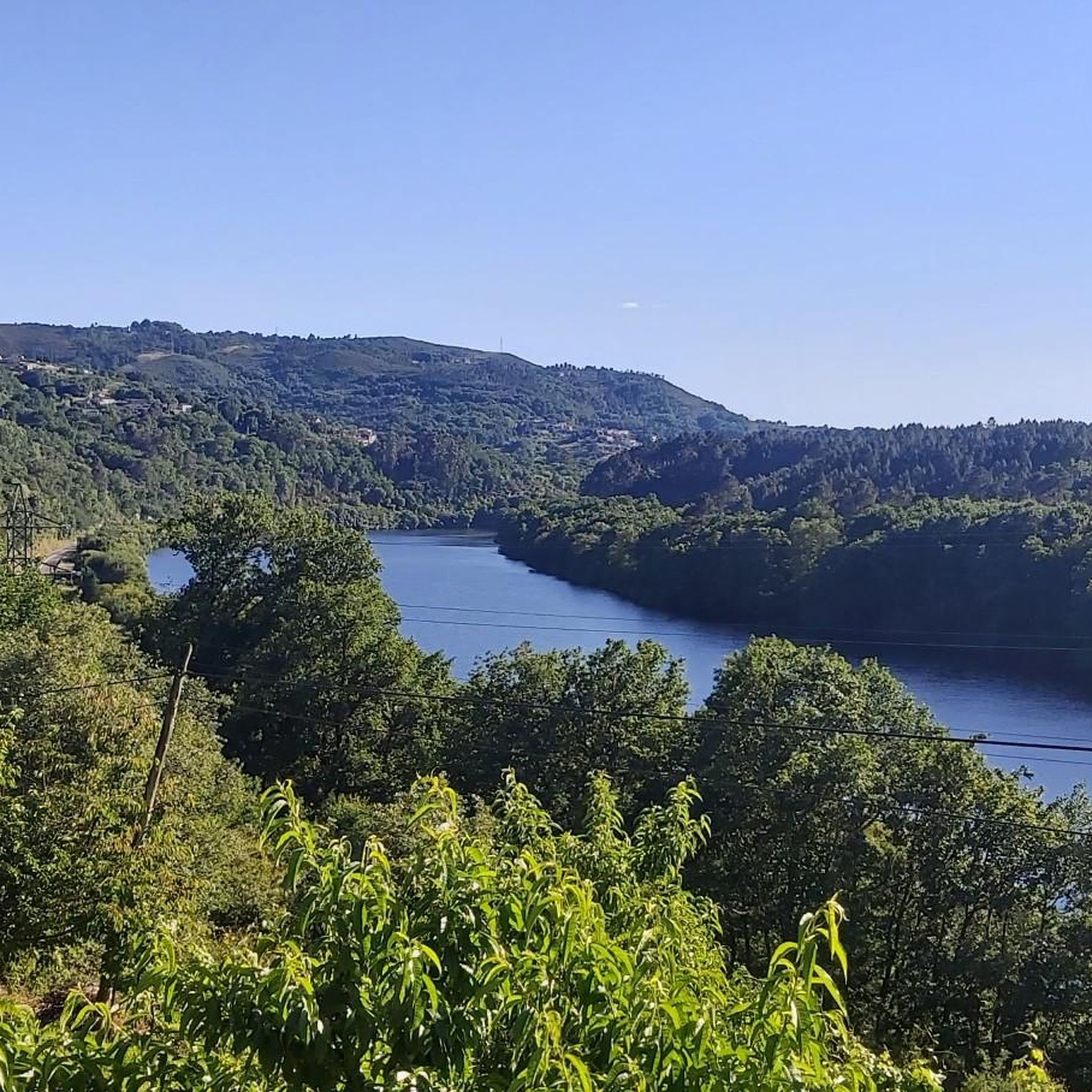
Location: in the municipality of Pereiro de Aguiar (Ourense), on the Loña River, a tributary of the Miño. Uses: water supply, irrigation, hydroelectric power generation, fishing; it is not navigable or suitable for swimming. Circular walk: approximately 4 km (3.7 km to be exact), easy difficulty, ideal for families and dogs—although they must be kept on a leash—offering shade, rest areas, and beautiful views.
1
0
Location: in the municipality of Pereiro de Aguiar (Ourense), on the Loña River, a tributary of the Miño. Uses: water supply, irrigation, hydroelectric power generation, fishing; it is not navigable or suitable for swimming. Circular walk: approximately 4 km (3.7 km to be exact), easy difficulty, ideal for families and dogs—although they must be kept on a leash—offering shade, rest areas, and beautiful views.
1
0

Area of recreational and sports activities around Lake Cachamuíña. The reservoir captures the waters of the Loña River (Lonia). Perfect place for a quiet bike tour and a picnic.
2
1

Around the hills of the Chaira five mills are found, walking beside the Loña river: mill of Sr. Xosé, Zapateiro mill, Cambeiro mill, Orentino mill and Faba mill. A beautiful attraction with which, in addition, you can learn about the engineering behind each one of the mills.
2
1
Mirador del Monte da Chaira, located about 400 meters away, offers a beautiful view of the Cachamuiña reservoir.
3
0
Reservoir on the da Lonia river, 10 minutes from the city of Ourense. The area has a large green area where you can enjoy great tranquility, as well as a children's playground and a bio-healthy park.
3
0
Frequently Asked Questions
How many hiking trails are available in O Pereiro de Aguiar?
There are over 90 hiking trails in O Pereiro de Aguiar, offering a wide range of options for different skill levels and preferences. You can find routes exploring river systems, historical sites, and scenic viewpoints.
Are there easy hiking options suitable for beginners or families?
Yes, O Pereiro de Aguiar offers many easy trails. Nearly half of the routes, over 45, are classified as easy. A great option for families or beginners is the Embalse de Cachamuiña – circular by the Loña river, which is about 5.7 km long and features shaded areas around the reservoir.
What kind of natural features can I expect to see on the trails?
The region is characterized by its lush greenery, rolling hills, and significant river systems. You'll encounter the Miño River along the northwestern boundary and the Loña River, which features reservoirs like Cachamuíña and Castadón. Many trails wind through indigenous forests, offering pleasant shade and scenic views. Elevated points like Chaodarcas (647m) and Monte da Chaira (449m) provide varied terrain and vistas.
Are there any circular hiking routes in O Pereiro de Aguiar?
Yes, several circular routes are available. The Route of the mills of the Loña river – circular from A Derrasa is a popular moderate option showcasing historical mills. Another is the Embalse de Cachamuiña – circular by the Loña river, which is an easy 5.7 km loop perfect for a relaxed walk.
What historical or cultural landmarks can be explored while hiking?
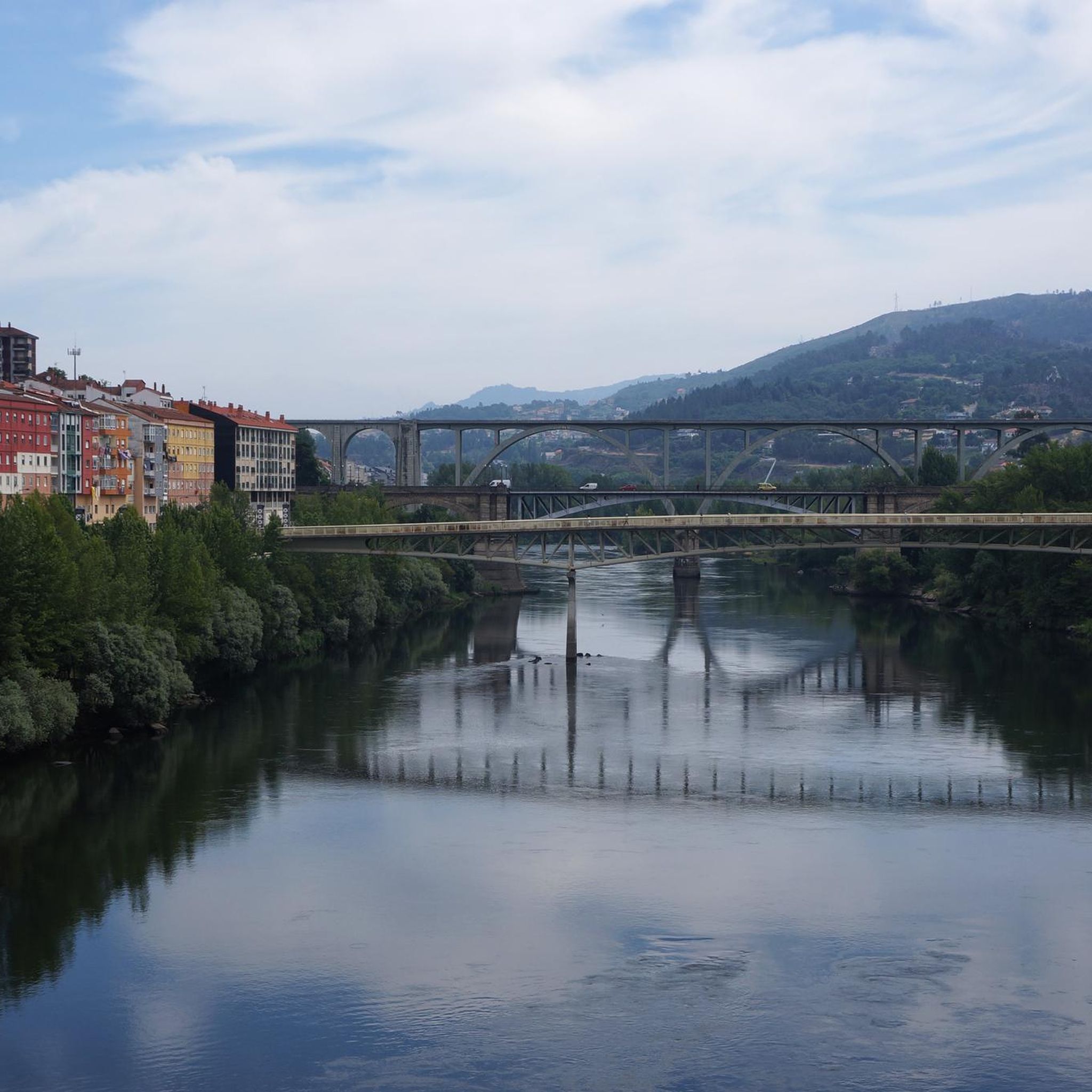
You can combine natural beauty with historical discovery. The Royal Trail of San Pedro de Rocas leads through forests to an ancient rock-carved monastery. The Loña River Mill Route highlights ethnographic interest, showcasing old mills. Nearby Ourense also offers historical sites like the Ponte Vella (Roman Bridge) and the Cathedral of San Martín.
Are there any trails that feature waterfalls?
While the region is rich in river systems, a specific highlight for waterfalls is the Trail to Gundrei Waterfall, which offers a chance to experience this natural feature.
What do other hikers enjoy most about the trails in O Pereiro de Aguiar?
The trails in O Pereiro de Aguiar are highly rated by the komoot community, with an average score of 4.6 stars from over 160 reviews. Hikers often praise the diverse landscapes, the tranquility of the indigenous forests, and the well-maintained paths along the rivers and reservoirs.
Are the hiking trails in O Pereiro de Aguiar dog-friendly?
Many trails in O Pereiro de Aguiar are suitable for dog walkers, especially the circular routes around the reservoirs and through the woodlands. The low-difficulty circular walk around the Loña River reservoir, for example, is noted as perfect for dog walkers, offering shaded areas and resting spots.
Are there any viewpoints offering panoramic views?
Yes, the hilly terrain of O Pereiro de Aguiar provides several opportunities for scenic vistas. Notable viewpoints in the surrounding gorges include Pedra Longa Viewpoint and A Lampa Viewpoint, offering stunning perspectives of the landscape.
What is the best time of year to go hiking in O Pereiro de Aguiar?
O Pereiro de Aguiar's lush greenery makes it appealing throughout much of the year. Spring and autumn generally offer the most comfortable temperatures for hiking, with vibrant foliage or pleasant mild weather. Summer can also be enjoyable, especially on trails that provide shade from the indigenous forests or along the riverbanks.
Is there public transport available to reach the trailheads?
O Pereiro de Aguiar is located just 7 km from Ourense, the provincial capital. While specific public transport details to individual trailheads may vary, its proximity to Ourense suggests that local bus services or taxis could provide access to the general area, from which many trails are accessible.
Are there any challenging hikes for experienced hikers?
While the majority of trails are easy to moderate, there are a few more challenging options for experienced hikers. The region's rolling hills and elevated points, such as Chaodarcas, contribute to routes with greater elevation gain, providing a more strenuous experience for those seeking it.
Most popular routes around O Pereiro De Aguiar
Most popular attractions around O Pereiro De Aguiar

Get inspired with the komoot mobile app


Explore more
Browse the best Hikes in other regions.
