The best road cycling routes around Cabezarados
58
riders
4
rides
Road cycling around Cabezarados, situated in the Campo de Calatrava region of Ciudad Real, Spain, offers a diverse landscape for cyclists. The area is characterized by unique volcanic formations, extensive holm oak and cork oak forests, and undulating roads. Riders can expect to traverse agricultural fields, vineyards, and olive groves, providing varied scenery throughout the routes.
Best road cycling routes around Cabezarados
- The most popular road cycling route is Abenójar, Saceruela, and Luciana Loop, a 72.0 miles (116.0 km)…
Last updated: August 20, 2026
10
riders
116km
05:22
1,020m
1,020m
Hard road ride. Very good fitness required. Mostly well-paved surfaces and easy to ride.
30
riders
112km
06:07
900m
900m
Hard road ride. Very good fitness required. Some segments of this route may be unpaved and difficult to ride.

Sign up for free
10
riders
29.0km
01:07
90m
90m
Easy road ride. Great for any fitness level. Mostly well-paved surfaces and easy to ride.
6
riders
43.0km
02:02
490m
490m
Moderate road ride. Good fitness required. Mostly well-paved surfaces and easy to ride.
3
riders
Moderate road ride. Good fitness required. Some segments of this route may be unpaved and difficult to ride.
Our route recommendations are based on thousands of hikes, rides, and runs completed by other people on komoot.
Start today with a free account
Your next adventure awaits.
Login or Signup
Popular around Cabezarados

Tips from the Community

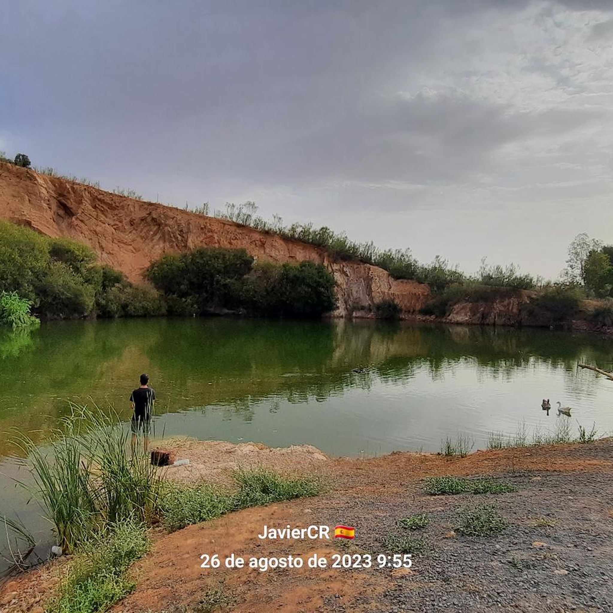
The rock crossing on the Bullaque River next to the Los Ejidos Recreational Area in Luciana (Ciudad Real) is a natural passage that allows wading across the river when its flow is low, especially in summer.
21
0
Detour to the Hermitage of the Holy Cross. Located southwest of the town, nestled at the summit of the mountain range that gives it its name, it is 3 km from Piedrabuena and at an altitude of 791 m. From this viewpoint, you can see the town and surrounding areas, including the Piedrabuena volcano. An important monument here is the Hermitage of the Sierra de la Cruz, built in the late 19th century. Every May 3rd, the Piedrabuena pilgrimage is held on this hill.
15
0
Located at the foot of the Monumento al Minero, an imposing bronze sculpture by Pepe Noja that represents the city's mining history, it borders the volcanic area of Campo de Calatrava and is close to the Alcudia Valley. Mining activity is of particular importance with the Mining Museum, a building that surrounds an old headframe and simulates a coal selection workshop. On its two floors, the museum addresses the transformation of Puertollano into an industrial city due to the discovery of coal.
13
0
Detour to the Hermitage of the Holy Cross. It is located southwest of the town, nestled at the summit of the mountain range that gives it its name, 3km from Piedrabuena and 791m high. From this viewpoint you can see the town and its surroundings, such as the Piedrabuena volcano. An important monument that we find in the place is the Sierra de la Cruz Hermitage, built at the end of the 19th century. Every May 3, the Piedrabuena pilgrimage is celebrated on this hill.
26
0
Piedrabuena is located in the northwestern central part of the province, on the edge of Campo de Calatrava. It is a land with water, dazzling with its green color and with the life that runs through the Bullaque River and numerous streams such as Bullaquejo, Puerto de las Tinajas or Alcornocal. The Natural Monument of the Piedrabuena Volcano is located, as its name indicates, in the town of Piedrabuena (Ciudad Real), in the volcanic area of Campo de Calatrava. Its age could range between eight and one and a half million years. This volcano is undoubtedly one of the most extensive spots formed by eruptive rocks in the region. The place where the exit conduit was located is located to the north-northeast of the town. Above it, lava materials accumulated, giving rise to a steep hill. From there, a large blanket or flow spread widely, surrounding what is now the urban center.
20
0
Highway CM-4109, entrance to Alcolea de Calatrava and next to the detour that takes us to the Sierra la Cruz Volcano. And next to the Alcolea greenway.
17
0
It was developed during the second third of the 16th century within the style called "Renaissance Purism" Located on Pl. de España -Alcolea de Calatrava, Cdad. Real
17
0
It has a single nave, covered with a gable roof, equipped with a side tower with a bell tower and an entrance door on one side. The walls, built with quartzite, are rendered and whitewashed.
27
0
Frequently Asked Questions
How many road cycling routes are available around Cabezarados?
Komoot offers 4 road cycling routes around Cabezarados. These routes vary in difficulty, providing options for different skill levels.
What kind of terrain can I expect when road cycling in Cabezarados?
Road cycling in Cabezarados offers a diverse landscape characterized by unique volcanic formations, extensive holm oak and cork oak forests, and undulating roads. You'll traverse agricultural fields, vineyards, and olive groves, providing varied scenery throughout your ride. The region's generally well-paved, quiet minor roads are ideal for cycling.
What is the best time of year for road cycling in Cabezarados?
While specific seasonal recommendations are not detailed, the region's climate suggests spring and autumn would be ideal for road cycling, offering pleasant temperatures for exploring the volcanic landscapes and agricultural fields without the extreme heat of summer or potential chill of winter.
Are there routes suitable for beginners or less experienced road cyclists?
Yes, there is an easy route available. The Woman with Jug Statue – CM-4115 Caracuel Lagoon loop from Villamayor de Calatrava is an 18.2 miles (29.4 km) trail that leads through agricultural fields and near the Caracuel Lagoon, typically completed in about 1 hour 8 minutes.
What are the options for experienced road cyclists seeking a challenge?
For experienced cyclists, there are two difficult routes. The Abenójar, Saceruela, and Luciana Loop is a 72.0 miles (116.0 km) trail with significant elevation gain. Another challenging option is the Rollo de Justicia (Cabezarados) – San Juan Bautista Parish loop from Cabezarados, a 74.7 miles (120.2 km) path exploring the local area and historical points.
Are there any circular road cycling routes in the area?
Yes, all the featured road cycling routes around Cabezarados are designed as loops, allowing you to start and finish at the same point. Examples include the Abenójar, Saceruela, and Luciana Loop and the Piedrabuena – Alcolea Green Trail loop from Los Pozuelos de Calatrava.
What historical landmarks or points of interest can I see while cycling around Cabezarados?
Cabezarados and its surroundings offer several historical points of interest. In the village itself, you can find the 15th-century Jurisdictional Roll in the main square and the 18th-century San Pantaleón Church. Along some routes, you might pass by sites like El Martinete or the Jurisdictional Pillory of Cabezarados, reflecting the region's rich history.
Are there any natural viewpoints or scenic spots along the routes?
The region is known for its unique volcanic terrain, extensive holm oak and cork oak forests, and seasonal lagoons. Routes often provide views of agricultural fields, vineyards, and olive groves. The area around the 'volcano of Las Cabezas' and the Caracuel Lagoon, featured in the Woman with Jug Statue – CM-4115 Caracuel Lagoon loop, offer particularly scenic natural spots.
Is parking available for road cyclists in Cabezarados?
While specific parking facilities for cyclists are not detailed, Cabezarados is a small municipality, and parking is generally available within the village, especially near its main square or residential areas, from where many routes can be accessed.
Are there places to eat or stay for cyclists in Cabezarados?
Cabezarados, as a rural Spanish village, offers local amenities. You can expect to find traditional eateries and possibly small guesthouses or rural accommodations. For more options, nearby larger towns in the Campo de Calatrava region would provide a wider selection of cafes, pubs, and hotels.
What do other road cyclists say about the routes in Cabezarados?
The road cycling routes around Cabezarados are highly regarded by the komoot community, with an average rating of 5.0 stars. Over 170 road cyclists have explored the varied terrain, often praising the unique volcanic landscapes and the quiet, well-paved roads that allow for an immersive experience in the rural environment.
Are there any moderate difficulty road cycling routes in the area?
Yes, there are two moderate routes available. The Piedrabuena – Alcolea Green Trail loop from Los Pozuelos de Calatrava covers 43.1 km, and the Los Pozuelos de Calatrava – Los Pozuelos de Calatrava loop from Los Pozuelos de Calatrava is 46.9 km long, both offering a balanced challenge for intermediate riders.
Most popular routes around Cabezarados
Most popular attractions around Cabezarados

Get inspired with the komoot mobile app


Explore more
Browse the best Road cycling routes in other regions.
