The best road cycling routes around Aliaguilla
275
riders
29
rides
Road cycling routes around Aliaguilla traverse a diverse landscape within the Serranía Baja region of Cuenca, Spain. The area features mountainous and hilly terrain, with elevations reaching over 1,000 meters, alongside deep ravines and extensive pine forests. Cyclists encounter varied topography, transitioning from dense woodlands to agricultural fields of cereal, almond trees, and vineyards. The region's paved roads offer routes with significant elevation gains, providing a range of challenges.
Best road cycling routes around Aliaguilla
- The most popular road cycling…
Last updated: June 29, 2026
22
riders
122km
05:56
1,820m
1,820m
Hard road ride. Very good fitness required. Mostly well-paved surfaces and easy to ride.
21
riders
Moderate road ride. Good fitness required. Mostly well-paved surfaces and easy to ride.

Sign up for free
20
riders
118km
05:40
1,390m
1,390m
Hard road ride. Very good fitness required. Mostly well-paved surfaces and easy to ride.
17
riders
Hard road ride. Very good fitness required. Some segments of this route may be unpaved and difficult to ride.
12
riders
39.6km
01:38
250m
250m
Easy road ride. Great for any fitness level. Mostly well-paved surfaces and easy to ride.
Get access to more routes and recommendations from other explorers.
Sign up for free
Already have an account?
Our route recommendations are based on thousands of hikes, rides, and runs completed by other people on komoot.
Start today with a free account
Your next adventure awaits.
Login or Signup
Popular around Aliaguilla
Tips from the Community

Villargordo del Cabriel is a municipality in the Requena-Utiel region, in the province of Valencia. The town is located on the banks of the Cabriel River and is on the border between Castilla-La Mancha and the Valencia region. One of the biggest tourist attractions is the beautiful nature, which is remarkably well preserved.
14
0

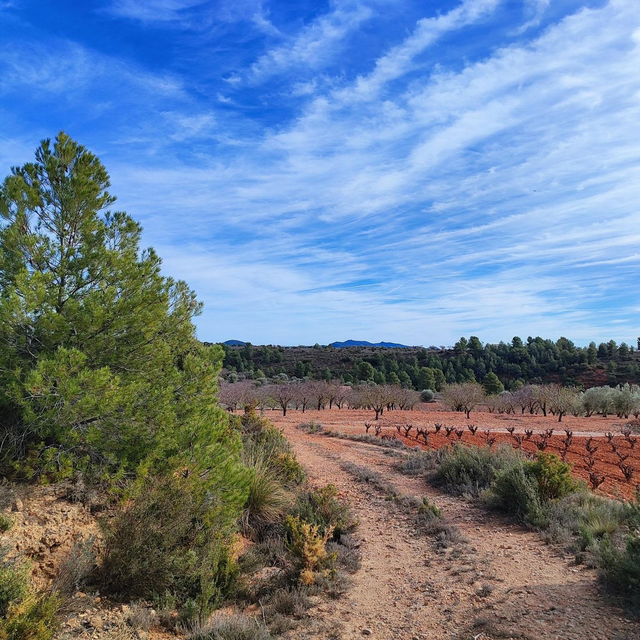
Leaving La Loberuela towards the track, the path begins clearly and well defined with trail signs and small cairns indicating directions before entering the rural road between fields and hills.
0
0
This village is located on a hill between two ravines, with houses scattered around the old hermitage of San José, which in summer also serves as a meeting place for the residents.
0
0
The entrance to the village of Camporrobles leads into a typical rural village of the Utiel-Requena region, with its parish church of Our Lady of the Assumption and its bell tower visible from afar, surrounded by traditional houses and streets that lead to the village center. It is a peaceful and pleasant place, ideal for a break, stretching your legs, and recharging your batteries before continuing your journey.
0
0

Viewpoint next to the old N-III highway After passing the engineer's house, a turnoff leads to the viewpoint located above the old N-III highway. Sweeping views of the reservoir from a high, accessible point.
4
0


Be careful...I had a puncture here due to bad road surfaces
0
0
Frequently Asked Questions
How many road cycling routes are available around Aliaguilla?
Aliaguilla offers a diverse selection of over 25 road cycling routes. These routes cater to various skill levels, with options ranging from easy, moderate, to difficult, ensuring there's a suitable ride for every cyclist.
What kind of terrain and landscapes will I encounter on road cycling routes in Aliaguilla?
Road cycling around Aliaguilla features a varied and scenic landscape. You'll experience mountainous and hilly terrain with significant elevation gains, winding through dense pine forests, savin junipers, and holm oaks. The routes also transition into extensive fields of cereal, almond trees, and vineyards, offering a diverse visual experience. The roads are predominantly paved, providing a smooth surface for cycling.
Are there challenging road cycling routes for experienced cyclists in Aliaguilla?
Yes, Aliaguilla is well-suited for experienced cyclists seeking a challenge. Many routes feature substantial elevation gains, with some requiring very good fitness levels. For instance, the Dirt track with views – Ademuz loop from Talayuelas is a difficult route covering over 126 km with more than 2,100 meters of ascent. Another demanding option is the Cardenete Castle – Monasterio de Tejeda loop from Camporrobles, a 121 km ride with over 1,800 meters of climbing.
Are there any easier or family-friendly road cycling options in Aliaguilla?
While many routes offer significant challenges, there are easier options available. For those looking for a less strenuous ride, the region provides routes suitable for all skill levels, including some with shorter durations and less elevation gain. An example of an easy route is the Roadbike loop from Camporrobles, which covers about 39 km with around 250 meters of elevation gain.
What are some notable points of interest or attractions along the road cycling routes?
As you cycle, you can explore several interesting points. The routes may pass near the historic Monasterio de Tejeda. You might also encounter charming settlements like Aliaguilla itself or Garaballa. The region is also known for its panoramic viewpoints, such as the View of Camporrobles, offering stunning vistas of the surrounding landscapes.
Are there any scenic viewpoints accessible by road bike in the Aliaguilla area?
Absolutely. The mountainous terrain around Aliaguilla offers numerous opportunities for breathtaking views. Natural lookouts like La Atalaya provide panoramic views of the valley. The area around El Telegrafo, over 1,400 meters high, also offers extensive panoramic views from Collado Pedro Chova, rewarding cyclists after a climb.
What is the best time of year for road cycling in Aliaguilla?
Aliaguilla experiences a Mediterranean mountain climate. The best times for road cycling are typically spring and autumn when temperatures are milder and the natural scenery is vibrant. Summers can be warm, especially at lower elevations, while winters bring colder temperatures and potential for snow at higher altitudes, making spring and autumn ideal for comfortable rides.
Are there any circular road cycling routes available?
Yes, many of the road cycling routes around Aliaguilla are designed as loops, allowing you to start and finish in the same location. For example, the La Loberuela – Monasterio de Tejeda loop from Talayuelas is a moderate 71 km circular route, and the Villargordo del Cabriel – Contreras Viewpoint loop from Mira offers a challenging 116 km circular ride through mountainous landscapes.
What kind of natural features define the cycling experience in Aliaguilla?
The road cycling experience in Aliaguilla is defined by its diverse natural features. You'll ride through extensive pine forests, part of the 'sea of pines' in the Sierra de Talayuelas y Aliaguilla Special Conservation Zone. The region is also characterized by deep ravines and its proximity to the dramatic scenery of the Hoces del Cabriel Natural Park, adding to the visual appeal of the routes.
Is there information on parking for cyclists in Aliaguilla?
While specific designated cyclist parking areas are not detailed, Aliaguilla is a village in a rural setting. Cyclists typically find parking in or near the village centers where routes often begin or pass through. It's advisable to check local signage upon arrival for the most suitable parking options.
What do other road cyclists enjoy most about cycling in Aliaguilla?
Road cyclists frequently praise the varied terrain and stunning natural beauty of the Aliaguilla region. The combination of challenging climbs through mountainous landscapes and scenic rides through dense pine forests and agricultural fields is a common highlight. The well-maintained paved surfaces and the sense of immersion in nature also contribute to a highly-rated cycling experience.
Most popular routes around Aliaguilla
Most popular attractions around Aliaguilla

Get inspired with the komoot mobile app


Explore more
Browse the best Road cycling routes in other regions.
