The best walks and hikes around San Leonardo De Yagüe
4.8
(222)
1,636
hikers
53
hikes
Hiking around San Leonardo De Yagüe offers access to varied terrain, situated south of the Urbión and La Demanda mountain ranges in the Comarca de Pinares. The region is characterized by extensive pine forests and limestone formations, notably within the Cañón del Río Lobos Natural Park. River valleys and viewpoints with vistas of the surrounding landscapes are common features on the trails. This area provides a diverse environment for outdoor activities, from river-carved canyons to high-mountain access.
Best hiking trails…
Last updated: July 4, 2026
4.0
(5)
11
hikers
Moderate hike. Good fitness required. Mostly accessible paths. Sure-footedness required.
4.7
(22)
168
hikers
Moderate hike. Good fitness required. Mostly accessible paths. Sure-footedness required.

Sign up for free
5.0
(3)
31
hikers
Easy hike. Great for any fitness level. Easily-accessible paths. Suitable for all skill levels.
5.0
(2)
18
hikers
Hard hike. Very good fitness required. Easily-accessible paths. Suitable for all skill levels.
4.5
(4)
13
hikers
12.8km
03:22
110m
110m
Moderate hike. Good fitness required. Easily-accessible paths. Suitable for all skill levels.
Get access to more routes and recommendations from other explorers.
Sign up for free
Already have an account?
Our route recommendations are based on thousands of hikes, rides, and runs completed by other people on komoot.
Start today with a free account
Your next adventure awaits.
Login or Signup
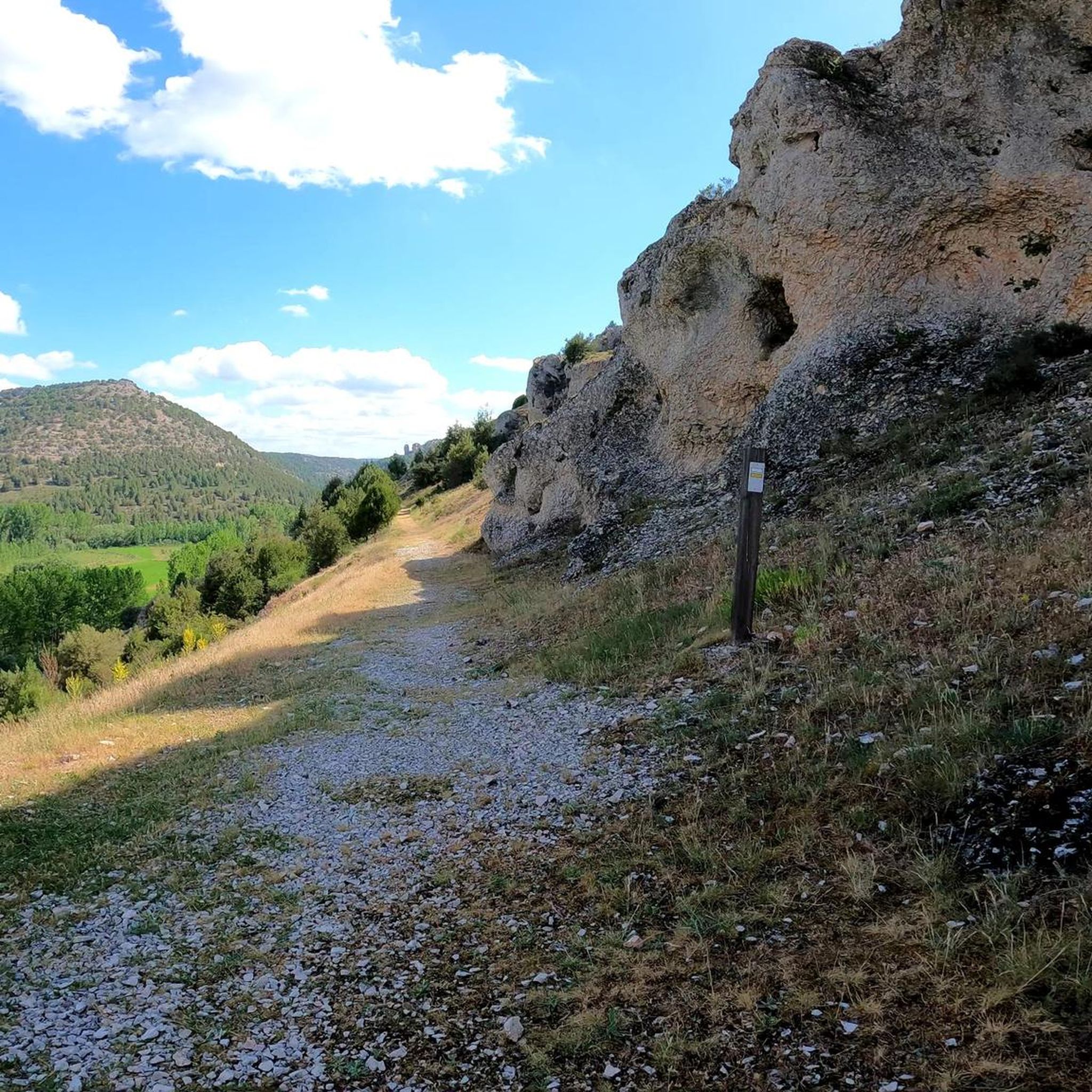
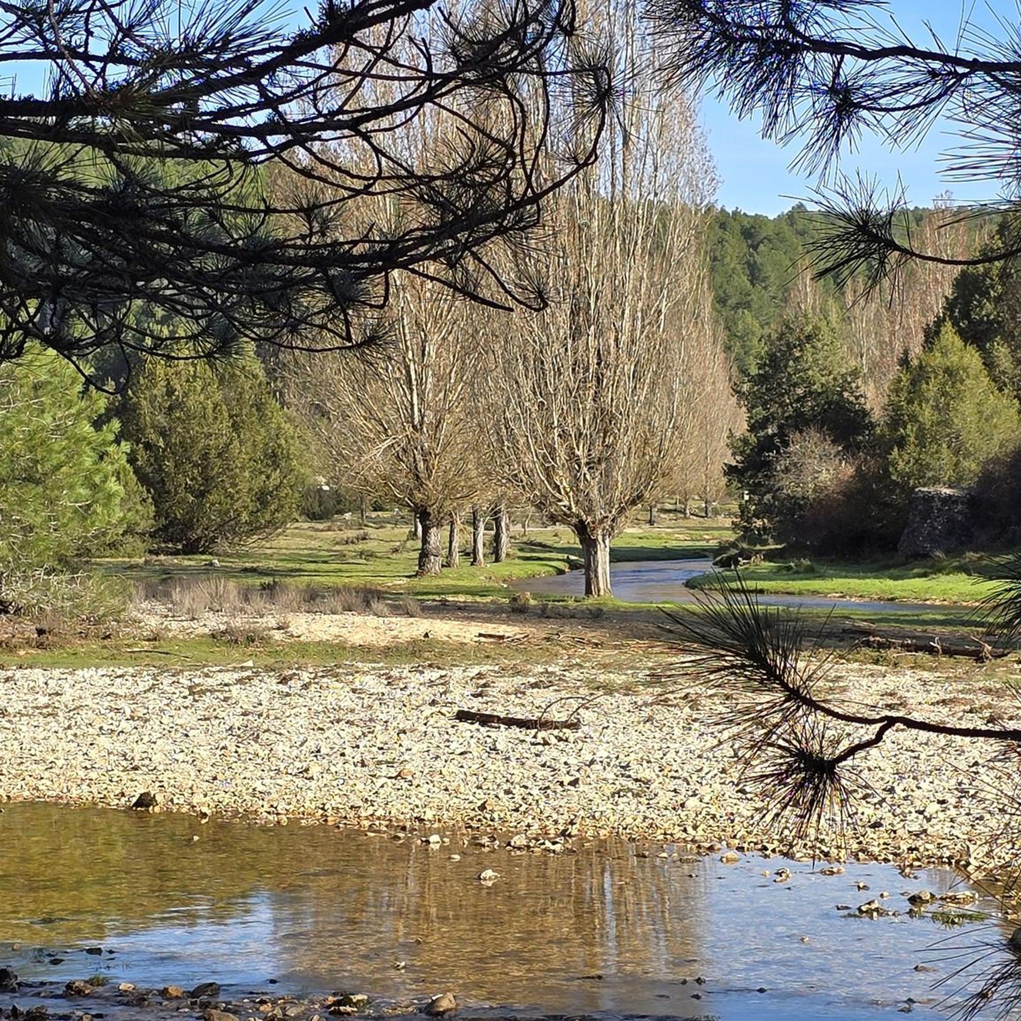
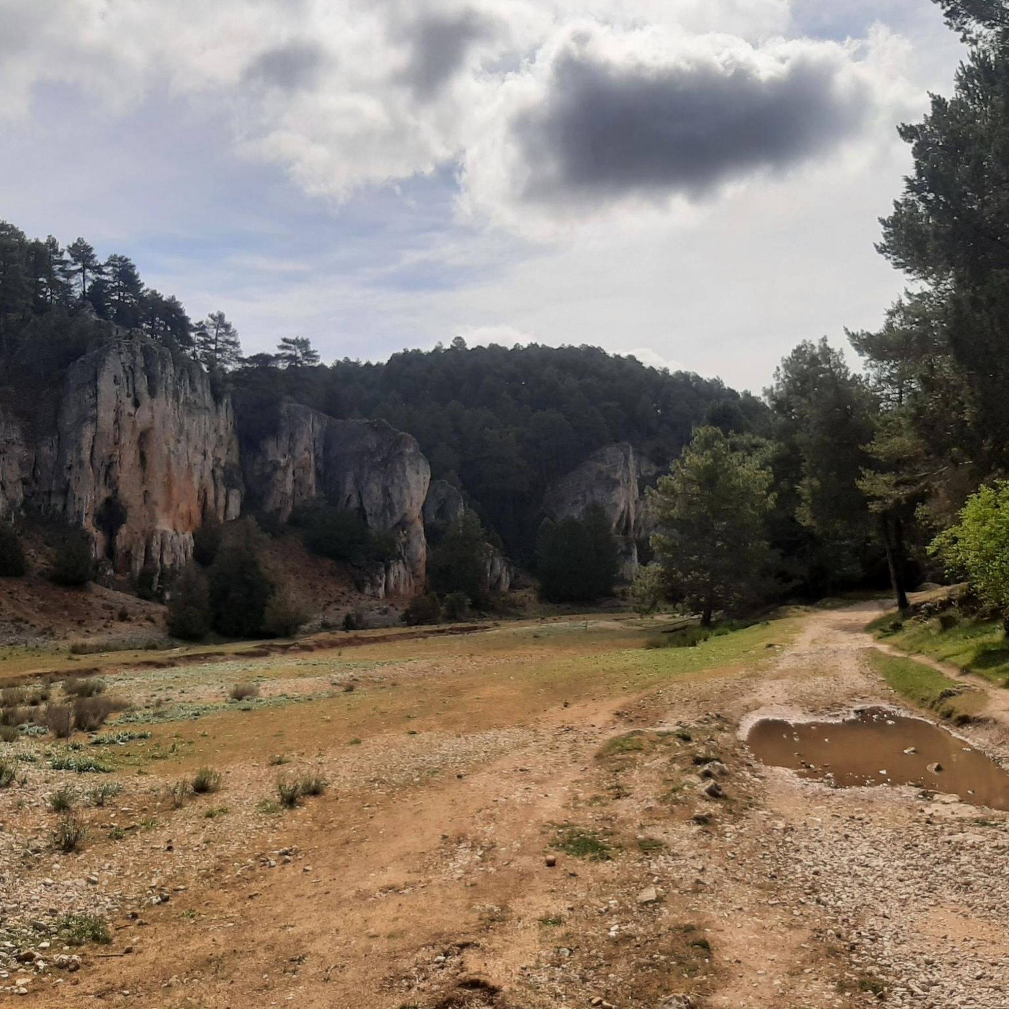
Tips from the Community

Spectacular area for hiking routes
0
0

One of the resources traditionally exploited in the region was honey collection. This spot, known as "El Colmenar de los Frailes," housed the Templar community's beehives. They were made from hollowed tree trunks, each with a stone slab placed on top as a lid, leaving small entrance areas for the bees. They lined the rocky outcrops of the Canyon.
0
1

The Hermitage of San Bartolomé is a fascinating church located in the Cañón del Río Lobos Natural Park, in the communities of Herrera de Soria, Nafría de Ucero, and Ucero. Built in the first quarter of the 13th century, in a style that transitions from Romanesque to Gothic.
4
0
Nice area for outdoor activities.
0
0
Nice area for outdoor activities.
0
0
Frequently Asked Questions
How many hiking trails are there around San Leonardo De Yagüe?
There are nearly 60 hiking routes available around San Leonardo De Yagüe, catering to various skill levels. You'll find a good mix, with 20 easy trails, 29 moderate, and 7 more challenging options to explore the diverse landscapes of the region.
What kind of terrain can I expect on the trails?
The terrain around San Leonardo De Yagüe is quite varied. You'll encounter extensive pine forests, particularly in the Comarca de Pinares, and impressive limestone formations, especially within the River Lobos Canyon Natural Park. Trails can range from relatively easy paths along river valleys to more challenging ascents in the canyon sides or high-mountain landscapes towards the Sierra de Urbión and Sierra de la Demanda.
Are there any easy, family-friendly hikes in the area?
Yes, there are several easy routes suitable for families. For a unique experience, consider visiting El Bosque Mágico in Fuente del Pino, an enchanted forest with imaginary beings. For a more traditional hike, the Bridge of the Seven Eyes – Boca del Ocejo loop from Parque Natural del Cañón del Río Lobos is an easy 6.4 km trail that takes just over 2 hours to complete, offering beautiful canyon views.
Can I bring my dog on the hiking trails?
Many trails in natural areas like the River Lobos Canyon Natural Park generally allow dogs, often requiring them to be on a leash to protect wildlife, especially during nesting seasons for birds like griffon vultures. It's always best to check specific park regulations or local signage for each trail. The extensive pine forests and local routes like "La Sierra" are generally welcoming for walks with your canine companion.
Are there any circular hiking routes?
Yes, many routes in the area are circular, allowing you to start and end in the same location. A popular moderate circular option is the Cañón de Casarejos y Cañón del río Lobos – circular desde Casarejos por el barranco de la Calzada, which is 14.4 km long and takes about 4 hours 30 minutes. Another local favorite is the Las Fuentes – El Pozo Perín loop from San Leonardo de Yagüe, an 8.9 km trail through pine forests and oak groves.
What are the best places to explore or landmarks to see along the trails?
The region is rich in natural and historical landmarks. Within the River Lobos Canyon, you can explore the Cueva Grande, a natural cave, and the 13th-century Romanesque Ermita de San Bartolomé. Other notable natural features include the Devil's Eye (Natural Rock Arch) and the Boca del Ocejo. Don't miss the ruins of the 16th-century Castle of San Leonardo de Yagüe in the town itself.
What is the best time of year for hiking in San Leonardo De Yagüe?
The best time for hiking in San Leonardo De Yagüe is generally spring and autumn when temperatures are mild and the natural scenery is vibrant. Spring brings lush greenery and wildflowers, while autumn offers beautiful fall colors in the extensive pine and oak forests. Summer can be pleasant, especially in the shaded canyon areas, but can also be hot. Winter hiking is possible, particularly on lower elevation trails, but higher areas like the Sierra de Urbión may experience snow and colder conditions.
Are there any viewpoints with panoramic views?
Yes, the varied terrain offers several viewpoints. Many local routes provide vistas of the surrounding landscapes, including the Segovia and Madrid mountain ranges. Within the River Lobos Canyon, the Gullurías Viewpoint offers spectacular views of the impressive limestone cliffs and the river below.
How long do hikes around San Leonardo De Yagüe typically take?
Hike durations vary significantly depending on the route's length and difficulty. Easy trails, like the 6.4 km Bridge of the Seven Eyes – Boca del Ocejo loop, can be completed in just over 2 hours. Moderate routes, such as the 17.9 km Colmenar de los Frailes – Boca del Ocejo loop, typically take around 4 hours 50 minutes. For more challenging and longer routes, like the 22.8 km Fuente de los Agualinos – Footbridge over the Río Lobos loop, you should plan for over 6 hours.
What do other hikers enjoy most about hiking in San Leonardo De Yagüe?
The area is highly rated by the komoot community, with an average score of 4.87 stars from over 200 reviews. Hikers frequently praise the stunning natural beauty of the River Lobos Canyon, the tranquility of the extensive pine forests, and the variety of trails suitable for different abilities. The well-preserved natural environment and the opportunity to spot wildlife like griffon vultures are also commonly highlighted.
Is public transport available to reach hiking trailheads?
While San Leonardo de Yagüe is a starting point for many trails, public transport options directly to specific trailheads within the natural parks can be limited. It's advisable to check local bus schedules for connections to nearby villages that might serve as access points. For ultimate flexibility, driving to trailheads and utilizing designated parking areas is often the most convenient option.
Are there any long-distance trails passing through the area?
Yes, San Leonardo de Yagüe is traversed by significant long-distance trails. The GR-86 (Sendero Ibérico Soriano) passes through the municipality, with sections like Navaleno – San Leonardo and San Leonardo – Ucero, the latter offering extensive exploration of the River Lobos Canyon Natural Park. The ancient Camino Soriano de Santiago also runs through the town, providing a historical pilgrimage route.
Most popular routes around San Leonardo De Yagüe
Most popular attractions around San Leonardo De Yagüe

Get inspired with the komoot mobile app


Explore more
Browse the best Hikes in other regions.
