The best walks and hikes around Parco naturale regionale delle Prealpi Giulie
4.5
(10709)
52,054
hikers
40
hikes
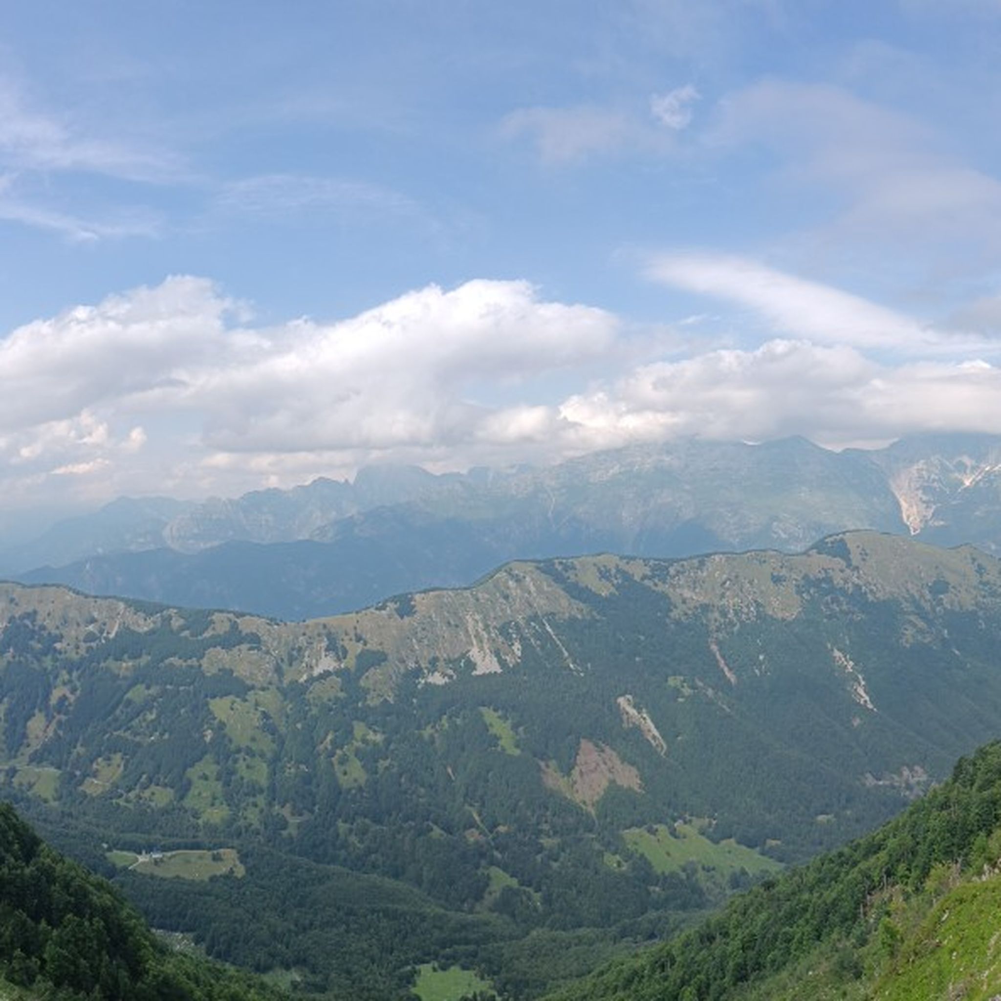
Hiking around Parco naturale regionale delle Prealpi Giulie offers diverse landscapes, from deep gorges carved by rivers to vast alpine forests and high dolomite peaks. The region is characterized by crystal-clear waters, caves, springs, and distinctive karst rock formations. Its unique appeal stems from a convergence of Mediterranean, Illyrian, and Alpine biogeographic areas, supporting rich biodiversity and an extensive network of trails.
Best hiking trails around Parco naturale regionale delle Prealpi Giulie
- The most popular hiking route is Alta Via Resiana Loop, a 4.6 miles (7.3 km) trail that takes 3 hours 45 minutes to complete. This moderate route explores the Resia Valley's natural beauty.
- Another top favourite among local hikers is Monte Zaiavor - loop hike in the Prealpi Giulie Natural Park, a difficult 10.6 miles (17.0 km) path. This challenging route offers significant elevation gain and panoramic views within the natural park.
- Local hikers also love the At Passo Tanamea along the Mea stream – loop from the Pian dei Ciclamini refuge, a 3.9 miles (6.2 km) trail leading through varied terrain along the Mea stream, often completed in about 1 hour 47 minutes.
- Hiking around Parco naturale regionale delle Prealpi Giulie is defined by deep gorges, alpine forests, and karst rock formations. The network offers options for different ability levels, from gentle walks to challenging multi-day treks.
- The routes in Parco naturale regionale delle Prealpi Giulie are highly rated by the komoot community with an average score of 4.4 stars from over 2,700 reviews. More than 12,800 hikers have used komoot to explore Parco naturale regionale delle Prealpi Giulie's varied terrain.
Last updated: July 7, 2026
4.9
(46)
218
hikers
7.33km
03:46
670m
670m
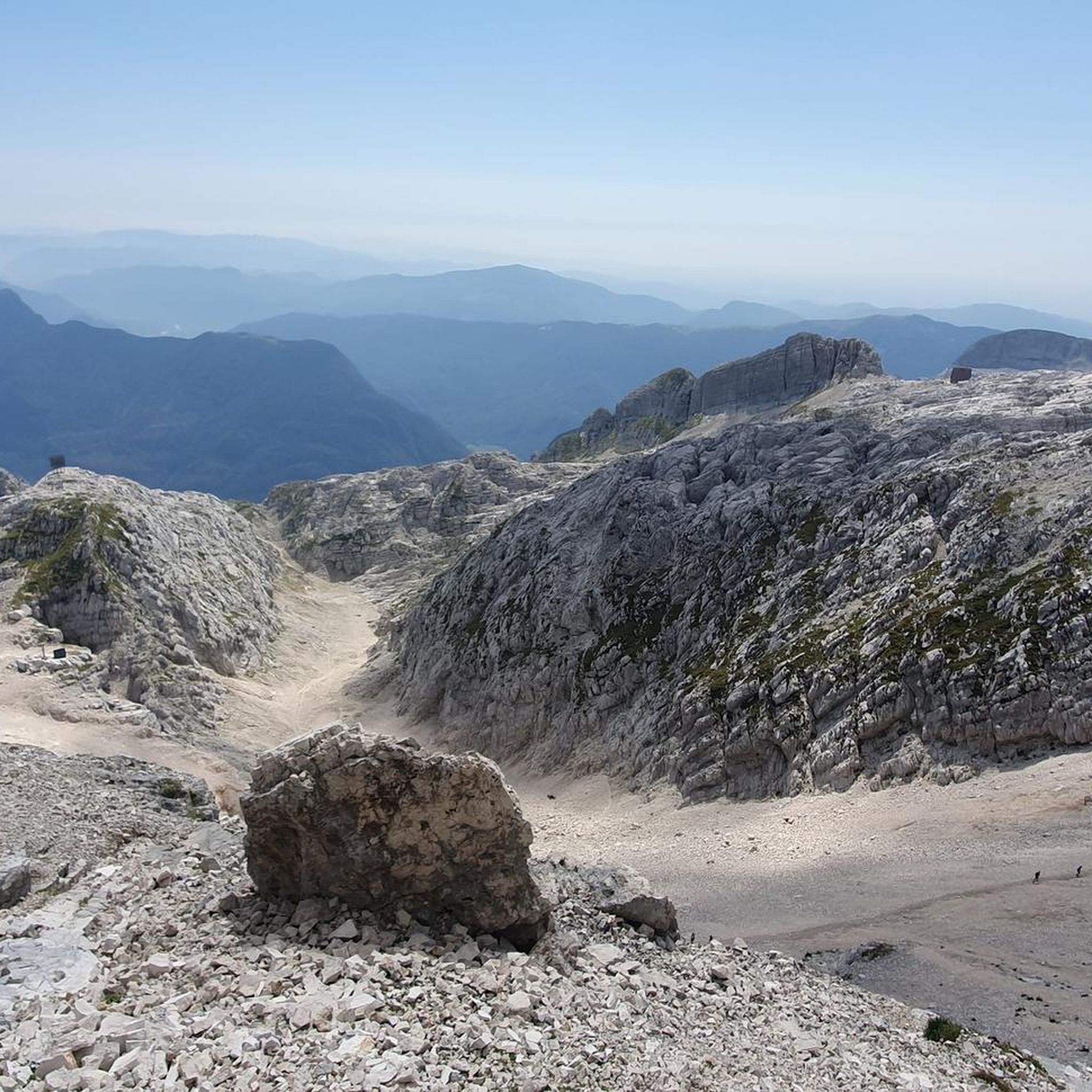
Embark on the Alta Via Resiana Loop, a moderate hiking route that takes you through the Julian Prealps Nature Park. This trail offers a challenging experience, covering 4.6 miles (7.3 km) with a significant elevation gain of 2187 feet (666 metres). You can expect to complete the loop in about 3 hours and 45 minutes, enjoying constantly changing views as you traverse crests overlooking the Resia Valley and the distinctive "lunar" rock formations of the Canin massif.
Planning your visit requires careful consideration, as this route is recommended for expert hikers who are well-equipped. You will need sure-footedness and a good head for heights due to some exposed sections along the way. The best time to hike is during the summer season, typically from June to September, though you might still encounter snow in early June. Be prepared with necessary equipment, including a harness, via ferrata kit, and helmet for any equipped sections you might encounter.
This loop is notable for its spectacular panoramic views, offering sweeping vistas of the Friulian plain. The route passes through diverse and solitary environments, including the prominent Mount Guarda / Skutnik, providing a unique perspective on the region's natural beauty. It's an excellent choice if you are seeking adventure and a true mountain experience within the Julian Prealps.
4.6
(21)
109
hikers
17.0km
07:30
1,090m
1,090m
Embark on the Monte Zaiavor loop hike, a difficult 10.6-mile (17.0 km) adventure in the Prealpi Giulie Natural Park that demands very good fitness and sturdy shoes. This challenging route features a significant 3589 feet (1094 metres) of elevation gain, taking around 7 hours and 29 minutes to complete. You will traverse beautiful beech forests, which eventually give way to meadows before the ruins of Casera Zaiavor, and experience a steep climb towards Casera Nischiuarch. From the summit, you can enjoy a wonderful panoramic view over the entire valley, stretching from the Julian Alps to Slovenia.
Given the difficult nature of this hike and its duration, it is wise to start early in the day to allow ample time for completion before dusk. The trail, specifically path CAI 727, connects Passo Tanamea with the Church of Sant'Anna di Carnizza, serving as a key access point. Be prepared for a mix of accessible paths and sections that require alpine experience, especially the final 200 metres to the summit, which are steep but without significant exposure.
This loop is a favorite among local hikers for its spectacular panoramic views across the Julian Prealps. Monte Zaiavor lies within the heart of the Prealpi Giulie Natural Park, a natural gem known for its intact environment and rich biodiversity, resulting from the convergence of Mediterranean, Illyrian, and Alpine biogeographic areas. The park is also recognized as the Italian Julian Alps Biosphere Reserve by UNESCO, highlighting its importance in conservation. You might also spot remnants of military fortifications from the Cold War along the way.

Sign up for free
4.6
(28)
127
hikers
Moderate hike. Great for any fitness level. Mostly accessible paths. Sure-footedness required.
4.4
(17)
97
hikers
Moderate hike. Good fitness required. Easily-accessible paths. Suitable for all skill levels.
4.8
(20)
110
hikers
This difficult 6.3-mile (10.2 km) hike to Monte Zaiavor from Passo Tanamea offers panoramic views across the Julian Prealps.
Get access to more routes and recommendations from other explorers.
Sign up for free
Already have an account?
Our route recommendations are based on thousands of hikes, rides, and runs completed by other people on komoot.
Start today with a free account
Your next adventure awaits.
Login or Signup
Popular around Parco naturale regionale delle Prealpi Giulie
Road Cycling Routes around Parco naturale regionale delle Prealpi Giulie
Cycling around Parco naturale regionale delle Prealpi Giulie
Running Trails around Parco naturale regionale delle Prealpi Giulie
MTB Trails around Parco naturale regionale delle Prealpi Giulie

Mountain Hikes around Parco naturale regionale delle Prealpi Giulie
Gravel biking around Parco naturale regionale delle Prealpi Giulie
Tips from the Community

The Nischiuarch Alpine Hut is located in a beautiful grassy valley west of the mountain of the same name. Located at just under 1,200 meters above sea level, it is a convenient base at the eastern end of the long Musi mountain range. Completely renovated, the hut consists of two buildings: the one that is always open has a ground-floor room with a stove, table, bench, and adjoining cellar, while upstairs there are a couple of bed frames with mattresses. It can be reached from S. Anna di Carnizza in about an hour, or via CAI trail no. 739, Passo Tanamea, in the municipality of Lusevera, S.S. 646, in about an hour and a half. Useful Information - Water: Non-potable, but available depending on seasonal weather conditions - Beds: 6 - Wood-burning stove, some dishes, small pantry with basic necessities - Firewood: A small supply is available at the facility or easily found in the surrounding woods The facility also has 14 additional beds in the area reserved for recognized institutions and associations. Keys can be requested by emailing info@parcoprealpigiulie.it Shelters are a valuable asset to our area, providing hikers with a valuable base for trekking. When using them, it is important not to leave any traces of your presence, so we recommend: - Do not leave food easily accessible to mice and other animals; - Clean common areas; - Take all waste down to the valley. This facility is always open and unmanaged; maintenance is handled by the Park Authority with the essential contribution of local volunteers and all users! More info at: https://www.parcoprealpigiulie.it/it/principale/attivita/ricoveri-montani/ricovero-casera-nischiuarch
0
0

In this period there is snow towards the arrival at the Bivacco which hides the path. Crampons and gaiters are recommended.
0
0
The Pian dei Ciclamini Refuge is located in Alta Val Torre, a few kilometers from the border with Slovenia. Easily accessible by car, it offers an excellent base for various outdoor activities or for those looking for a place to spend a holiday in Nature. It is an accessible and sustainable refuge, for children and families, hikers and pilgrims, climbers and cyclists, motorcyclists and campers, without forgetting people with disabilities who can enjoy a structure and a path equipped for their needs. The large availability of beds also makes it an excellent choice for seminars, team buildings or retreats of various kinds.
1
0

Very steep climb towards Casera Nischiuarch.
0
0

Path maintained by the CAI marked and numbered 727, which connects Passo Tanamea with the Church of Sant'Anna di Carnizza passing through the Monte Zaiavor vent. In this stretch the path is immersed in the undergrowth, continuing uphill the panorama opens up from the Julian Alps to Slovenia.
0
0
Musi is a hamlet of Lusevera, in Friuli Venezia Giulia, surrounded by the Musi Mountains and the Torre stream. The town is almost uninhabited, there is a church dedicated to San Giovanni and from here you can set off on various excursions within the Regional Natural Park of the Julian Prealps.
1
0
Chisalizza is an ancient village in the Alta Val Torre, abandoned for decades. It was a place of pastoral and agricultural life, and could only be reached on foot from Musi, a hamlet of Lusevera. Today there are only a few stone houses, some renovated, and a votive chapel of Sant'Agostino, restored after the 1976 earthquake.
1
0
The Pian dei Ciclamini refuge is a hotel-bar-trattoria located in the upper Val Torre, in the heart of the Julian Prealps Natural Park. It is also easily accessible by car and is suitable for families, hikers, climbers and cyclists thanks to the possibility of multiple paths nearby for an outing in the mountains.
0
0
Frequently Asked Questions
How many hiking trails are available in Parco naturale regionale delle Prealpi Giulie?
The Parco naturale regionale delle Prealpi Giulie offers a vast network of trails, with over 40 hiking routes documented on komoot. These range from easy strolls to challenging multi-day treks, catering to all experience levels.
What makes hiking in Parco naturale regionale delle Prealpi Giulie unique?
This region is characterized by a remarkable convergence of Mediterranean, Illyrian, and Alpine biogeographic areas, resulting in incredibly diverse landscapes. You'll find deep gorges, vast alpine forests, high dolomite peaks, crystal-clear waters, and distinctive karst rock formations. The rich biodiversity, with over 1,250 plant species, adds to its unique appeal.
Are there easy hiking trails suitable for beginners or families?
Yes, the park offers several easy options perfect for families or those seeking gentle walks. Examples include the Resia Valley Cycle Path, the Rio Barman Gorge loop, and the Val Saisera Nature Trail. These routes allow you to enjoy the natural beauty without significant elevation gain.
Can I find challenging hikes for experienced trekkers?
Absolutely. For experienced hikers, the park provides numerous challenging routes. The Monte Zaiavor - loop hike is a difficult 17 km path with significant elevation gain, offering panoramic views. Other demanding options include the Mount Canin Tour and long-distance trails like 'The Flower Trail' (70 km) and 'Trekking in the Enchanted Woods' (40 km).
Are there any waterfalls to see while hiking in the park?
Yes, the park is home to beautiful waterfalls. The spectacular 80-meter-high Slizza Waterfall is a notable feature along some popular trails. Additionally, the 'Trekking in the Enchanted Woods' route is known to pass by hidden waterfalls.
What natural attractions can I explore along the trails?
Beyond the diverse landscapes, you can discover several natural attractions. The idyllic Black Lake (Cernica) is perfect for relaxation, and the picturesque Fonda Lakes offer stunning scenery amidst flower-filled meadows. The Botanical path of Monte Plauris allows exploration of the unique flora, while traditional mountain huts provide opportunities for rest and local culinary experiences.
Are there any notable peaks or viewpoints in the area?
The park boasts impressive peaks and scenic viewpoints. You can find highlights like Mount Zaiavor and Mount Plauris. For breathtaking vistas, consider the View from the Predolina Saddle towards Slovenia, which offers expansive panoramic views.
Can I find circular walks in Parco naturale regionale delle Prealpi Giulie?
Yes, many trails in the park are designed as circular routes, allowing you to start and end at the same point. An example is the At Passo Tanamea along the Mea stream – loop from the Pian dei Ciclamini refuge, which offers varied terrain and a convenient loop structure.
What do other hikers enjoy the most about hiking in Parco naturale regionale delle Prealpi Giulie?
The area is highly rated by the komoot community, with an average score of 4.4 stars from over 2,700 reviews. Hikers often praise the diverse landscapes, from deep gorges to alpine forests, the crystal-clear waters, and the well-maintained network of trails that cater to all abilities. The unique blend of Mediterranean, Illyrian, and Alpine environments is frequently highlighted.
Is Parco naturale regionale delle Prealpi Giulie suitable for hiking with dogs?
While the park is a natural area, it's generally possible to hike with dogs, provided they are kept on a leash and you adhere to park regulations, especially concerning wildlife protection. Always check specific trail rules or local signage, particularly in protected zones or near grazing animals.
Are there opportunities for multi-day treks in the park?
Yes, for those looking for longer adventures, the park offers multi-day trekking options. 'The Flower Trail' spans 70 km, and 'Trekking in the Enchanted Woods' covers 40 km, allowing you to immerse yourself in the diverse ecosystems and experience the region's natural beauty over several days.
What kind of wildlife can I expect to see?
The park is a haven for wildlife due to its rich biodiversity. You might encounter red deer, roe deer, chamois, alpine ibexes, and wild boars. Birdwatchers can look out for various species, including the rock partridge, which is a symbol of the park.
Most popular routes around Parco naturale regionale delle Prealpi Giulie
Most popular attractions around Parco naturale regionale delle Prealpi Giulie

Get inspired with the komoot mobile app


Explore more
Browse the best Hikes in other regions.
