The best cycling routes around Fuente La Reina
4.6
(46)
733
riders
51
rides
Touring cycling routes around Fuente La Reina are situated in the mountainous terrain of the Alto Mijares region within the Valencian Community. The area is characterized by tall peaks, verdant valleys, and the nearby Mijares River, offering diverse landscapes for cyclists. Elevations typically range between 800 and 1,000 meters, providing challenging routes. The region features forests, natural springs like the "Queen's Fountain," and historical structures.
Best touring cycling routes around Fuente La Reina
- The most popular touring cycling route is…
Last updated: June 28, 2026
5.0
(1)
7
riders
31.6km
02:46
820m
820m
Hard bike ride. Very good fitness required. Mostly paved surfaces. Suitable for all skill levels.
4.0
(1)
40
riders
39.3km
03:25
910m
900m
Hard bike ride. Very good fitness required. Mostly paved surfaces. Suitable for all skill levels.

Sign up for free
27
riders
32.3km
03:13
920m
920m
Hard bike ride. Very good fitness required. Mostly paved surfaces. Suitable for all skill levels.
5.0
(2)
18
riders
30.9km
03:36
1,320m
1,330m
Hard bike ride. Very good fitness required. Mostly paved surfaces. Suitable for all skill levels.
4.0
(1)
15
riders
59.1km
04:10
1,150m
1,140m
Hard bike ride. Very good fitness required. Mostly paved surfaces. Suitable for all skill levels.
Get access to more routes and recommendations from other explorers.
Sign up for free
Already have an account?
Our route recommendations are based on thousands of hikes, rides, and runs completed by other people on komoot.
Start today with a free account
Your next adventure awaits.
Login or Signup
Tips from the Community

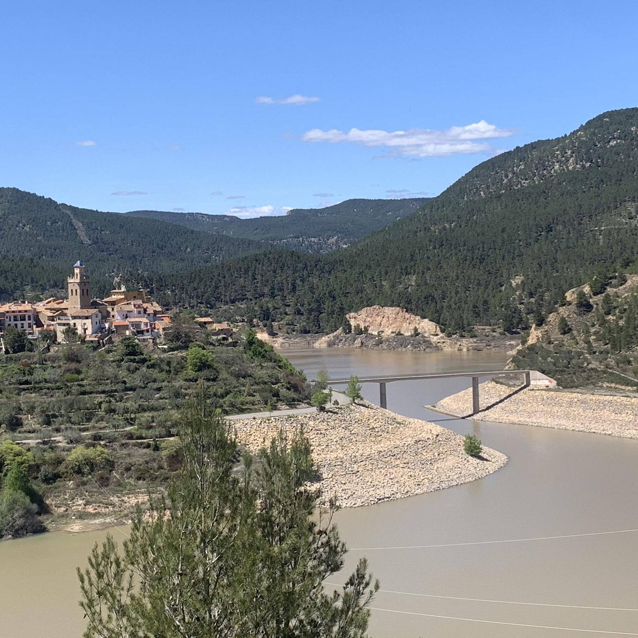
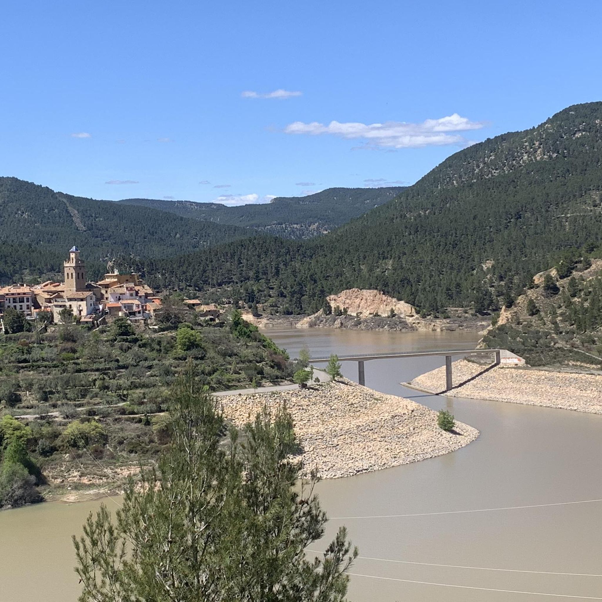
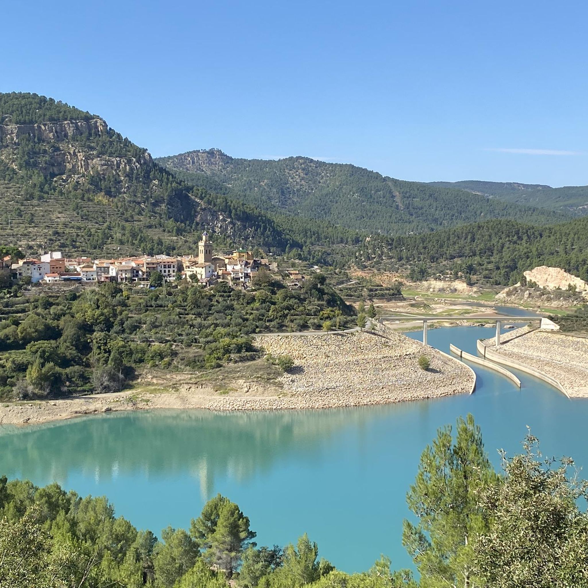
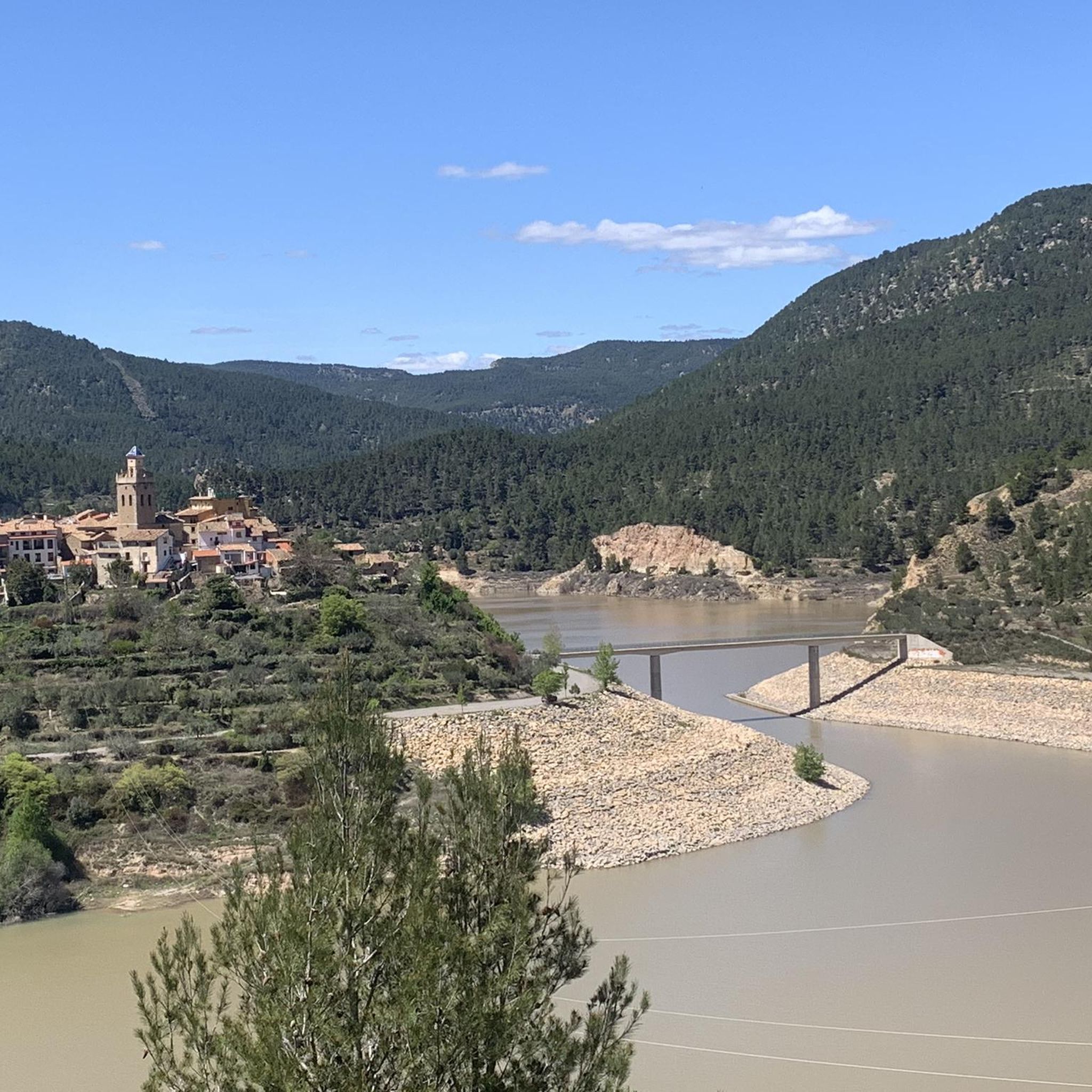
There are several points from which you can access the water. The most recommended is just past Puebla de Arenoso, the town that gives its name to the reservoir, not Montanejos.
0
0
There is a charge for admission during peak months (summer), and there is also a charge for parking. Check the municipal website for rates.
1
0

A good place to cool off a bit on hot days
0
0

Pools in the river, crowded
0
0

It is worth climbing Santa Barbara Peak for its impressive views.
0
0

The Charles IV Bridge in Olba is a historic structure that crosses the Mijares River. This bridge, built in the 18th century, is known for its stone architecture and its importance in connecting local routes. Originally, it had four arches, but two of them were destroyed during the Civil War. The bridge is a highlight on several hiking trails, such as the one from Olba to Fuente los Pertegaces. This circular route allows you to enjoy the natural beauty of the valley and other points of interest such as the Salud aqueduct.
7
0
This aqueduct, which has a length of 8 km, provided water to several important districts of Olba and its urban centre. The aqueduct is made up of a masonry road attached to a rocky cliff, with small arches to overcome ravines or rocky outcrops. Although it originally had four arches, today only one complete arch and the base of another remain. It is a popular place for hiking, offering routes that allow you to explore both the aqueduct and the surrounding landscapes.
7
0

Beautiful village with wonderful bathing spots
1
0
Frequently Asked Questions
How many touring cycling routes are available in Fuente La Reina?
There are over 50 touring cycling routes around Fuente La Reina, offering a variety of experiences for different skill levels.
What is the best time of year for touring cycling in Fuente La Reina?
Fuente La Reina experiences a Mediterranean mountain climate. Warm, dry summers are ideal for exploration, while mild and pleasant springs and autumns also make it suitable for year-round outdoor activities.
What are the typical difficulty levels for touring cycling routes in Fuente La Reina?
The routes in Fuente La Reina primarily cater to experienced cyclists, with 44 routes rated as difficult and 12 as moderate. There is also 1 easy route available. The mountainous terrain often involves significant elevation gains.
Are there any circular touring cycling routes in Fuente La Reina?
Yes, many routes are designed as loops. For example, you can explore the Gravel circular by the Arenoso Reservoir or the Montanejos Hot Springs – Arenos Reservoir loop from Montanejos.
What natural features can I expect to see along the touring cycling routes?
You'll encounter stunning natural landscapes, including tall peaks, verdant valleys, and the nearby Mijares River. Notable features include the crystal-clear waters of the "Queen's Fountain" (Fuente de la Reina), the Estrechos de Chillapájaros (Mijares River Narrows), and the Montanejos Hot Springs.
Are there any historical landmarks or points of interest to explore while cycling?
Yes, the region is rich in history. You might pass by the 18th-century Charles IV Bridge in Olba, traditional architecture in villages like Montanejos, or ancient constructions such as the "Noria" (waterwheel) and the old Justo Mill.
Where can I find scenic viewpoints on the touring cycling routes?
The mountainous terrain offers numerous scenic vistas. Look out for viewpoints like the View of Embalse de Arenoso and Muela de Mijares from El Morrón de Campos or the Monte la Copa Viewpoint, which provide breathtaking panoramas of the valleys and reservoirs.
Are there any family-friendly touring cycling routes in Fuente La Reina?
While most routes are rated moderate to difficult due to the mountainous terrain and elevation changes, there is at least one easy route available. For families, it's advisable to check the specific route details for distance and elevation to ensure it matches your family's fitness level.
What kind of terrain and elevation can I expect on these routes?
You can expect mountainous terrain with elevations typically ranging between 800 and 1,000 meters. Routes often feature significant elevation gains, with some paths including unpaved segments, requiring good fitness. For example, the Villanueva de Viver loop has over 1300 meters of elevation gain.
What do other touring cyclists say about the routes in Fuente La Reina?
The touring cycling routes in Fuente La Reina are highly rated by the komoot community, with an average score of 4.7 stars from over 40 reviews. Cyclists often praise the diverse landscapes, challenging climbs, and the natural beauty of the region.
Are there options for food and drink along the routes?
The routes often connect picturesque villages such as Montanejos, Montán, and Olba. These towns typically offer cafes, restaurants, and shops where you can refuel and find refreshments during your ride.
Is there public transport or parking available near the routes?
While specific public transport options directly to trailheads may be limited, parking is generally available in the towns and villages that serve as starting points for many routes, such as Montanejos or Puebla de Arenoso.
Can I bring my dog on the touring cycling routes?
The surrounding forests and mountains are home to diverse wildlife. While many outdoor areas in Spain are dog-friendly, it's always recommended to keep dogs on a leash, especially in natural parks or areas with wildlife, and to check local regulations for specific routes or protected areas.
Most popular routes around Fuente La Reina
Most popular attractions around Fuente La Reina

Get inspired with the komoot mobile app


Explore more
Browse the best Cycling routes in other regions.
