The best walks and hikes around Bissendorfer Moor
4.6
(4016)
16,043
hikers
1,063
hikes
Hiking around Bissendorfer Moor offers access to a significant natural area in Lower Saxony, Germany, characterized by its unique raised bog landscape. The region features expansive, largely treeless open moorland, supporting diverse vegetation including bell heather, cotton grass, and sphagnum mosses. A distinctive natural feature is the Muswillensee, a bog pond, alongside former peat extraction sites now filled with rainwater. Peripheral areas include pine-birch moor forests and sphagnum quaking meadows, while adjacent areas like Kananohe offer varied scenery with forests…
Last updated: October 4, 2026
4.8
(5)
17
hikers
Easy hike. Great for any fitness level. Easily-accessible paths. Suitable for all skill levels.
4.9
(8)
27
hikers
Easy hike. Great for any fitness level. Easily-accessible paths. Suitable for all skill levels.

5.0
(1)
8
hikers
3.29km
00:50
10m
10m
Easy hike. Great for any fitness level. Easily-accessible paths. Suitable for all skill levels.
3
hikers
3.17km
00:48
0m
0m
Easy hike. Great for any fitness level. Easily-accessible paths. Suitable for all skill levels.
4.7
(44)
135
hikers
9.51km
02:24
10m
10m
Moderate hike. Good fitness required. Easily-accessible paths. Suitable for all skill levels.
Get access to more routes and recommendations from other explorers.
Already have an account?
Our route recommendations are based on thousands of hikes, rides, and runs completed by other people on komoot.
Start today with a free account
Your next adventure awaits.

Tips from the Community

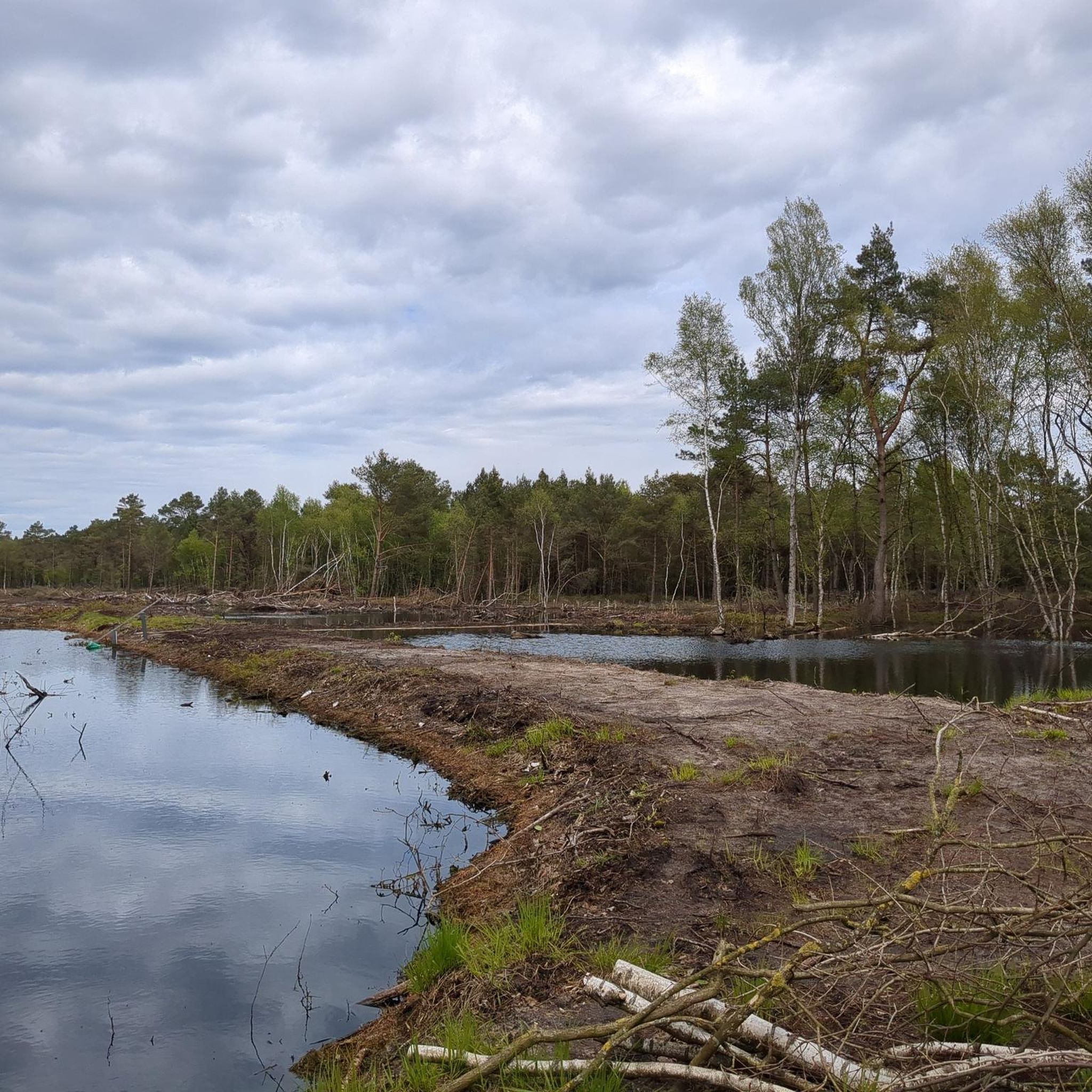
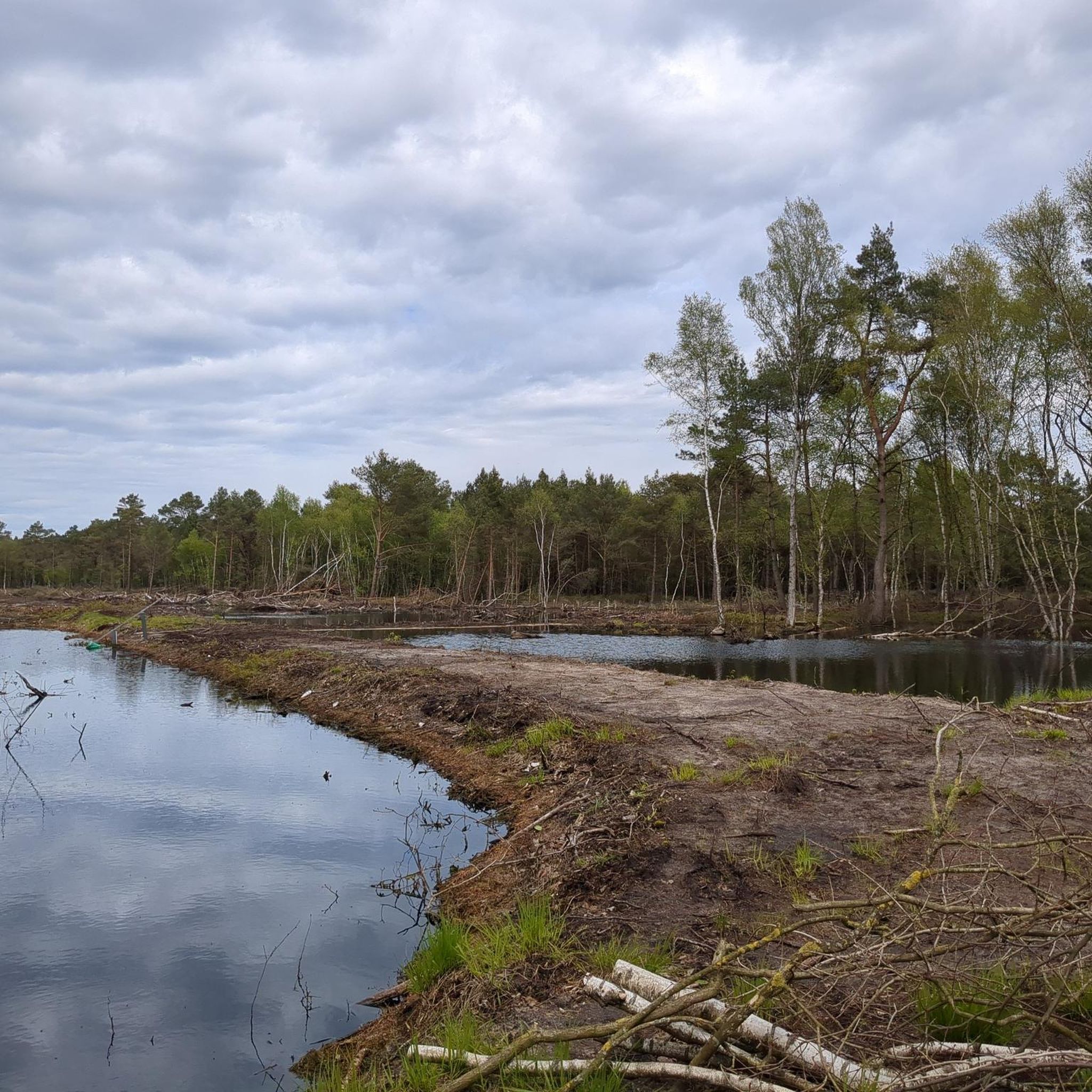
Warning: The entire area is a huge construction site; the path from the east is no longer accessible and practically non-existent. Extremely disappointing... 😔
1
0

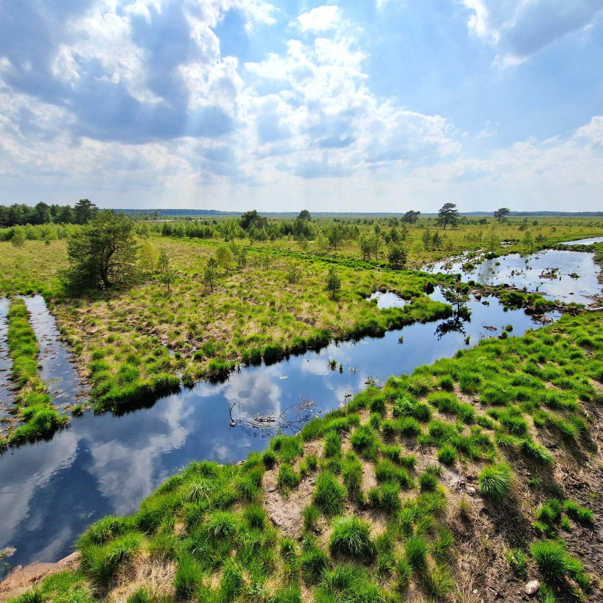
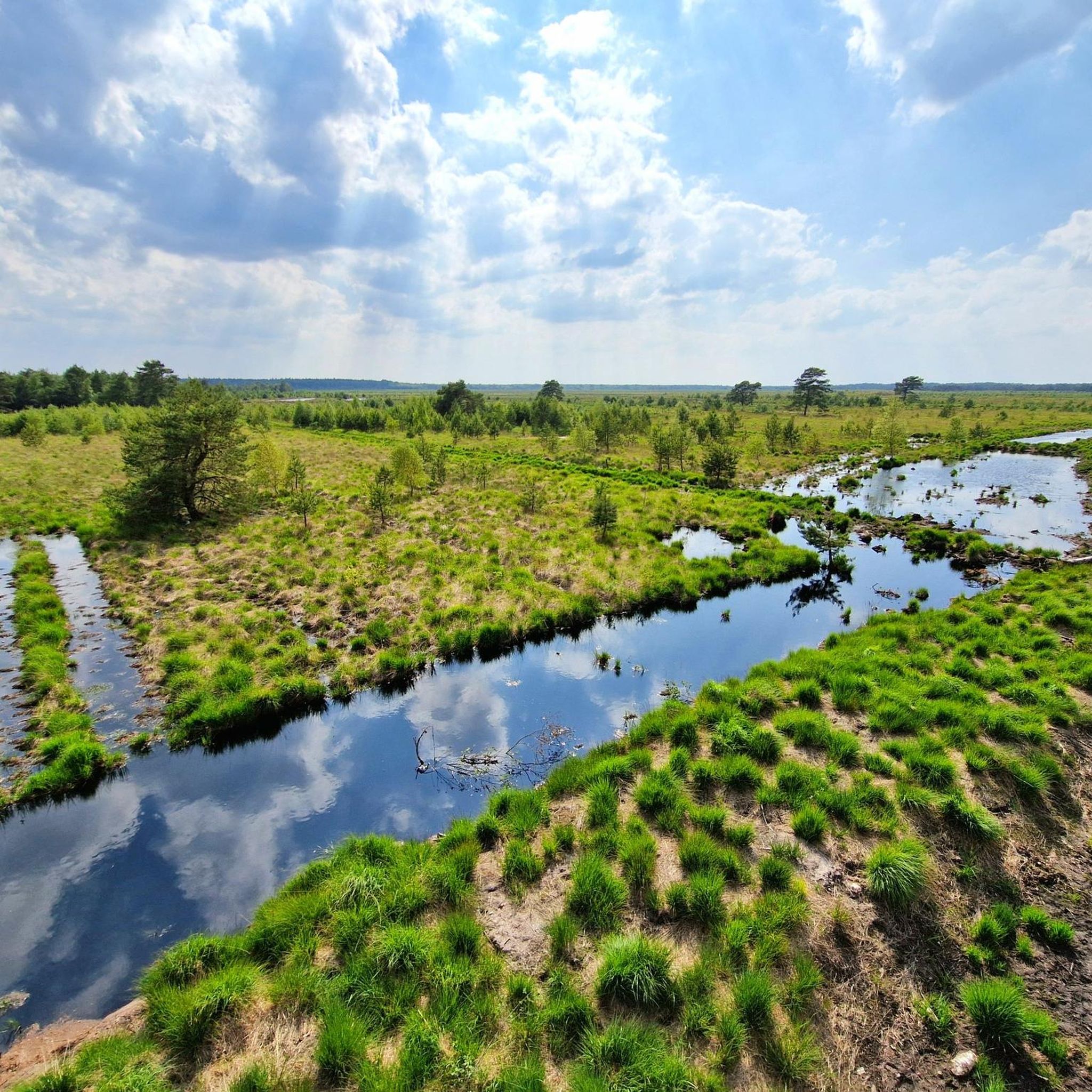
From here you have a wonderful view over the moor.
0
0

In this section, the rewetting of the path also seems to have been "successful". At the moment (January 25) it is actually impassable, unless you have high rubber boots with you.
0
0
From a dam you have a beautiful view of the moor - two boards provide information about the peat cutting (a small lake remains here) and about snakes (there is still a place to rest at the bend in the path)
0
0
The bank has now disappeared.
0
0
Here begins the narrow path to the southern observation tower
2
0
A well-walked path along the moor. Rewetting seems to be working well here.
0
0

Due to the renaturation of the moor, water levels typical for moorland can be seen again.
0
0
Frequently Asked Questions
How many hiking trails are available in Bissendorfer Moor?
Bissendorfer Moor offers a wide variety of hiking opportunities, with over 1000 routes recorded on komoot. These include options for all skill levels, from easy strolls to more challenging treks through the unique moor landscape.
What kind of terrain can I expect when hiking in Bissendorfer Moor?
The terrain in Bissendorfer Moor is primarily characterized by expansive, largely treeless open moorland, which is part of a well-preserved raised bog. You'll find paths through diverse vegetation, including bell heather and cotton grass. Peripheral areas feature pine-birch moor forests and sphagnum quaking meadows. Adjacent areas like the Kananohe nature reserve offer varied scenery with dense forests of beech, birch, and oak, interspersed with meadows and small streams.
What is the best time of year to hike in Bissendorfer Moor?
Bissendorfer Moor is beautiful year-round, but the best time to visit is typically from spring to autumn. In spring, you can witness the awakening of nature and early blooms. Summer offers lush greenery, while autumn brings vibrant colors to the moorland and surrounding forests. Winter hikes are also possible, offering a serene, frosty landscape, though some paths might be wet or icy.
Are there easy hiking options for beginners or casual walkers?
Yes, Bissendorfer Moor is very accessible for beginners and casual walkers. Over 700 easy routes are available. For example, the Start of Reitweg Auter loop from Kananohe is an easy 5.6 km trail that explores varied terrain, and the Bissendorfer Moor – Pond in Bissendorfer Moor loop from Scherenbostel is a shorter 3.0 km route through the core moor area.
Are there any viewpoints or observation points in Bissendorfer Moor?
Yes, Bissendorfer Moor features several observation towers that provide panoramic views of the vast moor landscape and its bog pools. Notable spots include the Bissendorfer Moor Observation Tower and the North Observation Tower. These allow visitors to appreciate the sensitive ecosystem without disturbing it.
What natural features can I see while hiking in Bissendorfer Moor?
Hikers can discover a range of unique natural features. The most prominent is the expansive raised bog landscape with its diverse vegetation, including bell heather and cotton grass. You'll also encounter the distinctive Muswillensee, a bog pond, and former hand-dug peat extraction sites now filled with rainwater. The area is also home to the Basendorfer Moor – Hannoversche Moorgeest Nature Reserve, offering rich biodiversity.
What do other hikers appreciate about Bissendorfer Moor?
The komoot community highly rates Bissendorfer Moor, with an average score of 4.6 stars from over 3400 reviews. Hikers often praise the unique, tranquil moor landscape, the well-maintained trails, and the opportunity to observe diverse wildlife. The observation towers are frequently highlighted for their excellent views.
Are the trails in Bissendorfer Moor suitable for families with children?
Many trails in Bissendorfer Moor are suitable for families, especially the numerous easy routes. The flat terrain and well-marked paths make it enjoyable for children. The observation towers add an exciting element for younger explorers, and information panels along the paths provide educational insights into the Hannoversche Moorgeest region.
Can I bring my dog on the hiking trails in Bissendorfer Moor?
Bissendorfer Moor is a nature reserve, and regulations regarding dogs are in place to protect the sensitive ecosystem and wildlife. Generally, dogs are permitted on designated trails but must be kept on a leash at all times. It's always advisable to check local signage for specific rules in different sections of the moor.
Are there circular hiking routes available in Bissendorfer Moor?
Yes, circular routes are a popular way to explore Bissendorfer Moor. Many trails are designed as loops, allowing you to start and end at the same point. Examples include the View of the Moor – Bissendorfer Moor Path loop from Kiebitzkrug, which offers great views, and the Hiking loop from Kananohe, which is an easy option.
Where can I park my car when visiting Bissendorfer Moor?
There are several designated parking areas around Bissendorfer Moor, often located at the main access points to the trails. These parking spots are typically well-signposted. For specific locations, it's recommended to check the starting points of individual komoot tours, as they often indicate nearby parking facilities.
Is there public transport access to Bissendorfer Moor?
While Bissendorfer Moor is primarily accessed by car, some public transport options may get you to nearby villages like Resse or Bissendorf. From there, you might need to walk or cycle to reach the moor's entry points. For detailed public transport information, it's best to consult local transport schedules for the Wedemark region.
Most popular routes around Bissendorfer Moor
Most popular attractions around Bissendorfer Moor

Get inspired with the komoot mobile app


Explore more
Browse the best Hikes in other regions.
