The best walks and hikes around Schleimündung
4.6
(6290)
29,588
hikers
413
hikes
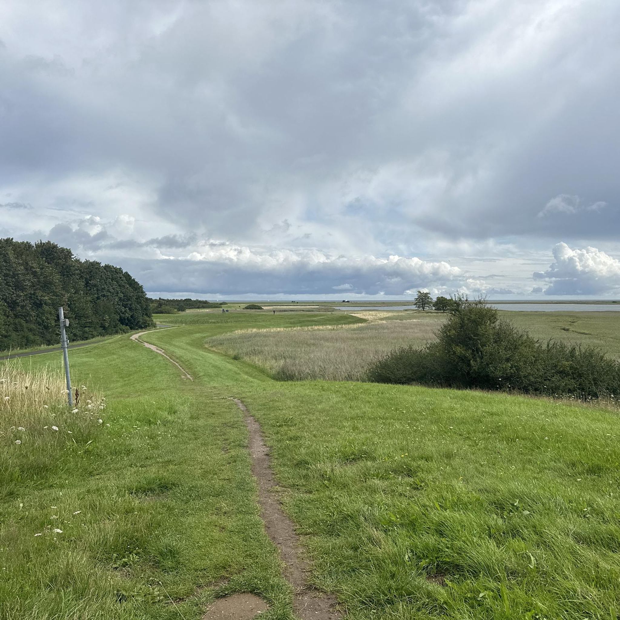
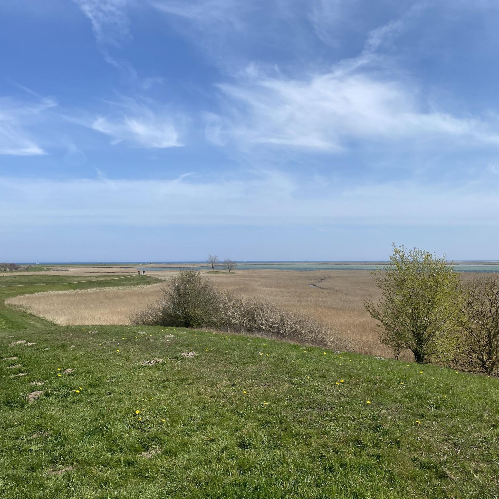
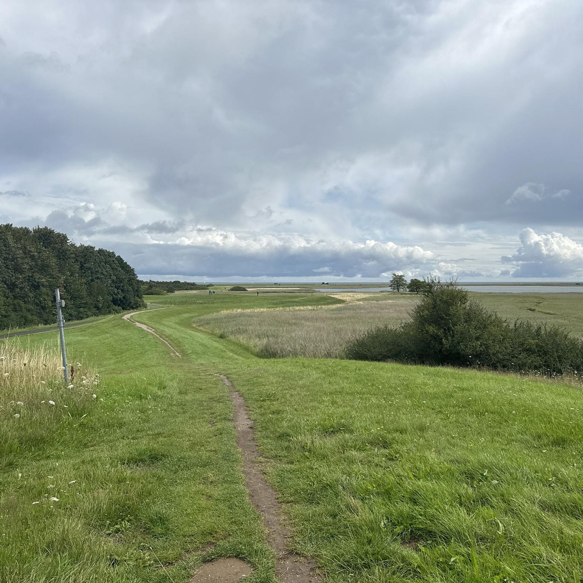
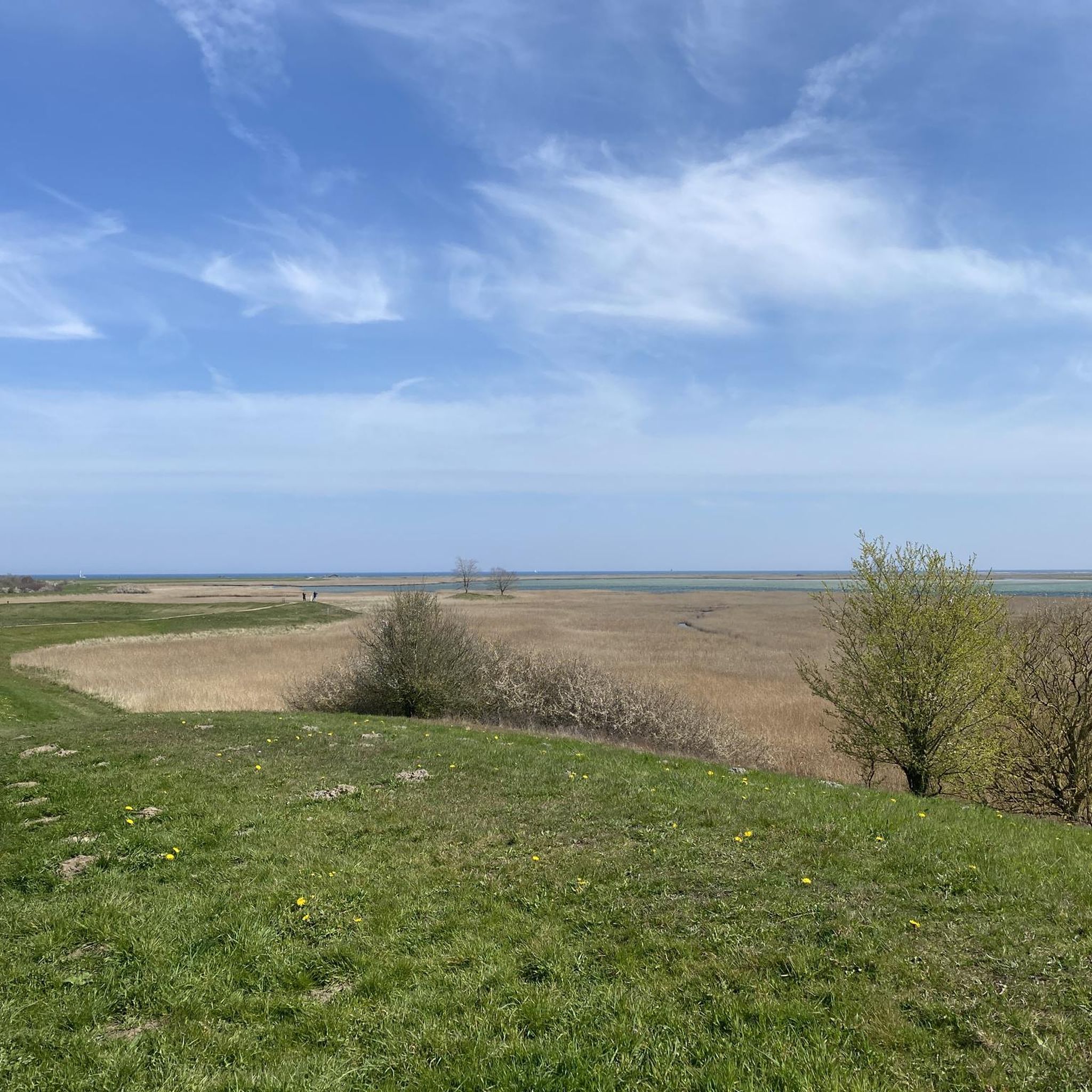
Hiking around Schleimündung offers diverse landscapes along the Baltic Sea coast, centered around the 42-kilometer-long Schlei fjord. The region features a flat coastline with beaches, dunes, and dry grasslands, alongside unique spit hooks and extensive reed beds. An 8-meter high moraine elevation, Hegeberg, provides views of the Schlei Estuary Nature Reserve, a significant area for migratory birds. Gentle hills, lush forests, and distinctive hedgerow landscapes characterize the inland areas.
Best hiking trails around Schleimündung
- The most popular hiking route is…
Last updated: June 26, 2026
4.6
(38)
283
hikers
Easy hike. Great for any fitness level. Easily-accessible paths. Suitable for all skill levels.
5.0
(5)
99
hikers
Easy hike. Great for any fitness level. Easily-accessible paths. Suitable for all skill levels.

Sign up for free
5.0
(5)
93
hikers
Easy hike. Great for any fitness level. Easily-accessible paths. Suitable for all skill levels.
4.6
(98)
616
hikers
Moderate hike. Good fitness required. Easily-accessible paths. Suitable for all skill levels.
4.8
(681)
2,070
hikers
Moderate hike. Good fitness required. Easily-accessible paths. Suitable for all skill levels.
Get access to more routes and recommendations from other explorers.
Sign up for free
Already have an account?
Our route recommendations are based on thousands of hikes, rides, and runs completed by other people on komoot.
Start today with a free account
Your next adventure awaits.
Login or Signup
Tips from the Community

Why is the detour here worthwhile? Because a life without a view of the sea is possible, but not desirable.
0
0

Very nice tour with the R Scooter
0
0

To be precise, there were three minesweeping squadrons…and two fast attack craft squadrons…the so-called Baltic Sea rockers…each squadron had a tender (supply ship). In naval circles, Olpenitz was also affectionately called Olpenizsibirsk…because it was in the middle of nowhere…🙃 Until the end of the 1990s, 50 boats were stationed there…today, the navy unfortunately doesn't even have a fraction of that number…
3
0

A natural hill with some trails and a few uphills. A nice way to pass the time 👍
3
0
Beautiful spot with a wide view of the outer harbor basin and the Baltic Sea😊
3
0

Approximately 85 houses float in the harbor on a total of five piers. The wooden bridges are freely accessible, and the floating houses themselves are private or rental properties.
3
0
This small sandy beach is located in the harbor basin of Port Olpenitz. It's artificially created and planted with beach grass. In summer, it's very busy, with dozens of SUPs frolicking among the bathers.
1
0
From the Schleiufer street, you have a unique view of the floating houses. A total of about 85 of these floating units are located along the five piers.
3
0
Frequently Asked Questions
How many hiking trails are available in Schleimündung?
Schleimündung offers a wide variety of hiking opportunities, with over 400 routes recorded on komoot. These range from easy coastal strolls to more moderate paths, ensuring options for different preferences and fitness levels.
What kind of terrain can I expect when hiking in Schleimündung?
The region is characterized by a naturally formed and diverse beach wall landscape. You'll find a predominantly flat coast featuring beaches, dunes, beach ridges, and dry grasslands. Unique spit hooks are present on the western side. There's also an 8-meter high moraine elevation called Hegeberg, which provides panoramic views of the Schlei Estuary Nature Reserve. Most hikes are considered easy with accessible paths.
Are there any family-friendly hiking options in Schleimündung?
Yes, many of the trails in Schleimündung are suitable for families, often described as 'easy hikes' with accessible paths. Routes like the Ostseeresort Olpenitz – Adventure Mini Golf Olpenitz loop from Olpenitzdorf are relatively short and have minimal elevation change, making them ideal for a family outing.
Can I bring my dog on the hiking trails in Schleimündung?
Many trails in Schleimündung are dog-friendly, allowing you to enjoy the coastal scenery with your canine companion. However, as parts of the area are designated nature reserves, such as the Schlei Estuary Nature Reserve, it's important to keep dogs on a leash to protect local wildlife, especially ground-nesting birds. Always check local signage for specific regulations.
What natural features or landmarks can I see while hiking?
Hikers can explore a rich array of natural features and landmarks. You might encounter the charming Maasholm Harbor, the significant Schlei Estuary Nature Reserve, and the Seabird Conservation Station Oehe-Schleimünde. Coastal paths offer views of the 'Lotseninsel' lighthouse and small stone pillars marking geographical points. The Bird Warden's Hut Maasholm also provides information on local flora and fauna.
Are there any circular hiking routes in the Schleimündung area?
Yes, Schleimündung offers several circular routes perfect for exploring the area. An example is the Floating Houses in Olpenitz – Beach at Schlei Harbor loop from Olpenitzdorf, which provides a pleasant round trip. Many coastal paths are designed as loops, allowing you to start and end at the same point.
How can I reach the hiking trailheads using public transport?
While specific public transport options to every trailhead may vary, the broader Schlei region is generally accessible. For routes starting near towns like Maasholm or Olpenitz, local bus services might connect to larger transport hubs. It's advisable to check local bus schedules for the most up-to-date information on reaching specific starting points.
Where can I find parking near the hiking trails?
Parking is generally available near popular starting points for hikes, especially in areas like Olpenitzdorf or Schönhagen. For instance, routes such as the Floating Houses in Olpenitz loop from Schönhagen typically have designated parking areas nearby. Always look for official parking lots or signs to ensure you're parking legally and safely.
What is the best time of year to go hiking in Schleimündung?
Schleimündung is enjoyable for hiking throughout much of the year. Spring and autumn offer pleasant temperatures and beautiful scenery, with migratory birds being particularly active in the nature reserves. Summer is also popular, though it can be busier. Even in winter, coastal walks can be invigorating, but be prepared for colder weather and potentially strong winds.
What kind of wildlife might I encounter in Schleimündung?
The Schlei Estuary Nature Reserve is a crucial breeding, resting, and wintering area for various Nordic migratory birds. You might spot Arctic terns, oystercatchers, gulls, ducks, and geese. The area is also home to a Galloway herd that helps maintain the landscape through grazing, promoting meadow-breeding bird species.
Are there any moderate or challenging hikes available?
While many trails are easy, Schleimündung also offers moderate options for those seeking a bit more challenge. For example, the Schönhagen Cliffs and Beach – Weidefelder Beach loop from Schönhagen is rated as moderate. Out of over 400 routes, 91 are classified as moderate and 19 as difficult, providing variety for different fitness levels.
What do other hikers enjoy most about hiking in Schleimündung?
The komoot community highly rates hiking in Schleimündung, with an average score of 4.6 stars from over 5,700 reviews. Hikers often praise the diverse coastal landscapes, the peaceful atmosphere of the nature reserves, and the well-maintained paths that offer stunning views of the Schlei estuary and the Baltic Sea.
Are there any places to eat or stay near the hiking trails?
Yes, charming villages like Maasholm, with its picturesque harbor, offer opportunities for refreshments and accommodation. The Olpenitz Baltic Sea Resort also provides amenities. You'll find cafes, pubs, and guesthouses in the surrounding areas, perfect for a break after your hike.
Most popular routes around Schleimündung
Most popular attractions around Schleimündung

Get inspired with the komoot mobile app


Explore more
Browse the best Hikes in other regions.
