Attractions and Places To See around Muñogalindo - Top 13
Best attractions and places to see around Muñogalindo include a mix of historical sites, natural features, and cultural points of interest. Situated in the Valle Amblés and on the slopes of the Sierra de Ávila, the area offers diverse landscapes. Muñogalindo is located approximately 18 kilometers from the city of Ávila, providing access to both local and regional attractions. The region features distinctive granite formations and historical monuments.
Best attractions and places to see around Muñogalindo
- The most popular attractions…
Last updated: August 24, 2026
Pico Zapatero
Highlight • Summit
Translated by Google •
Tip by

Manqueospese Castle
Highlight • Castle
Translated by Google •
Tip by

Sign up now to discover places like this
Get recommendations on the best single tracks, peaks, & plenty of other exciting outdoor places.
Sign up for free
Rollo de Muñotello
Highlight • Monument
Translated by Google •
Tip by

Muñogalindo
Highlight • Settlement
Translated by Google •
Tip by

View of Sotalbo and the Castro de Ulaca
Highlight • Viewpoint
Translated by Google •
Tip by
Sign up for free to discover even more attractions around Muñogalindo.
Sign up for free
Already have an account?
Start today with a free account
Your next adventure awaits.
Login or Signup

Tips from the Community

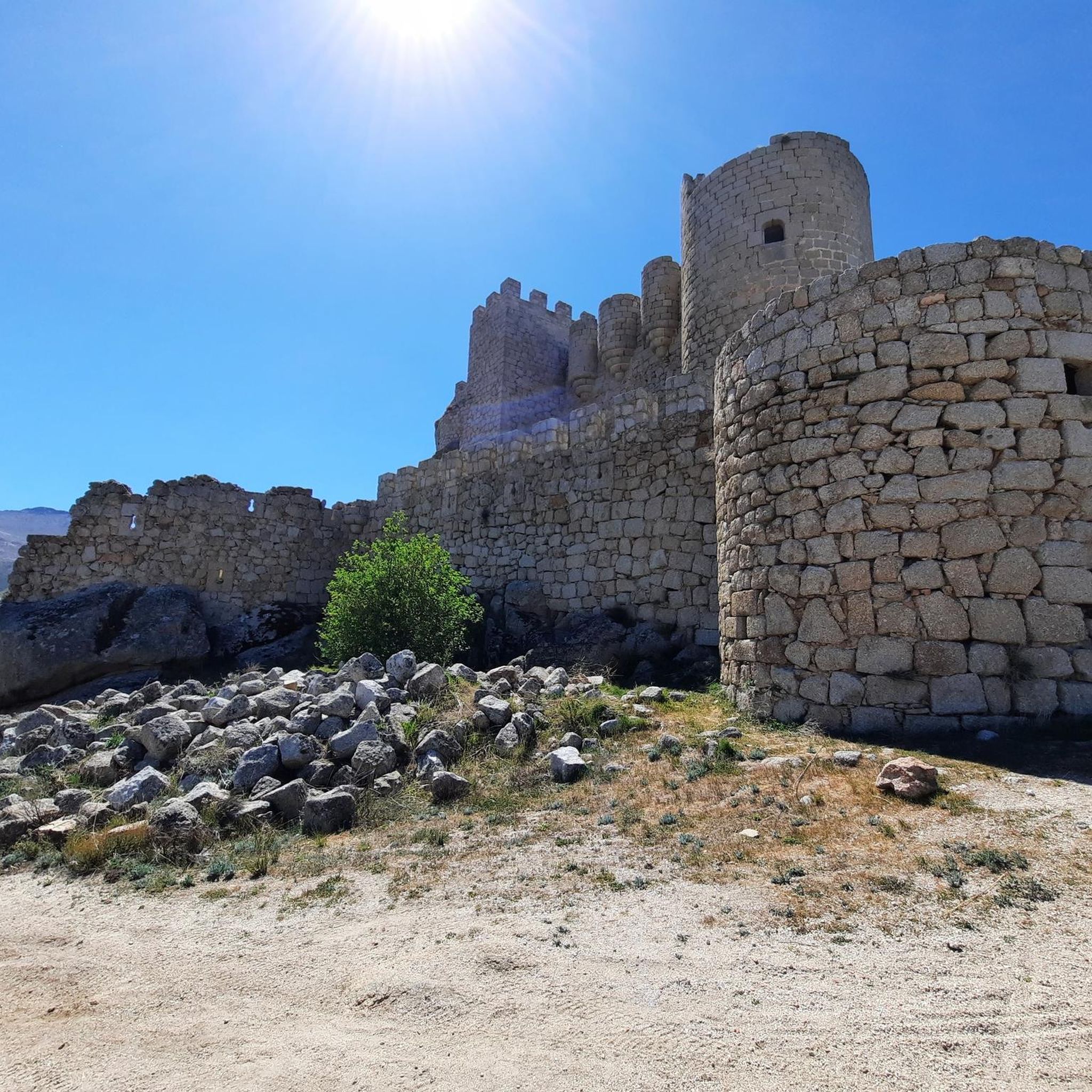
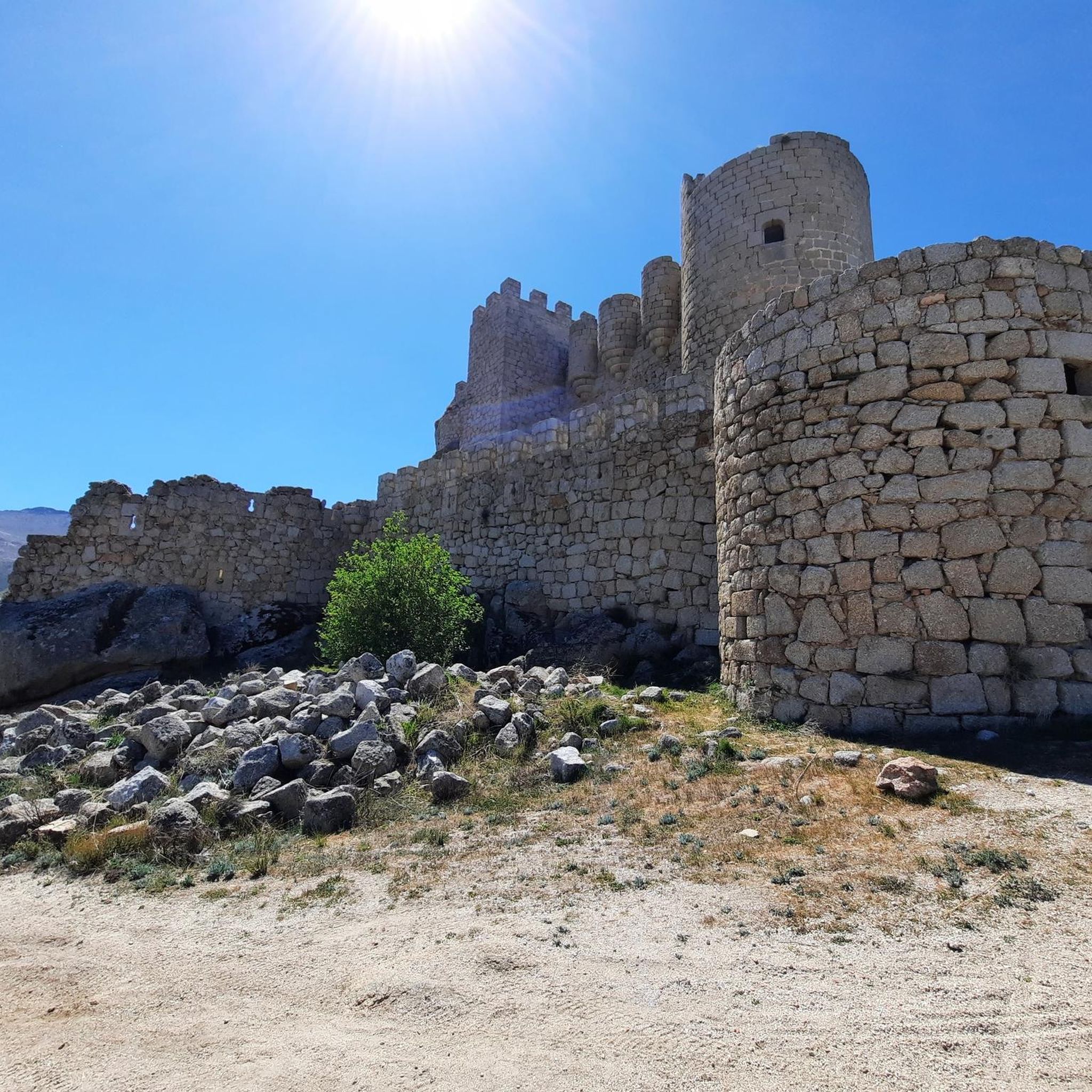
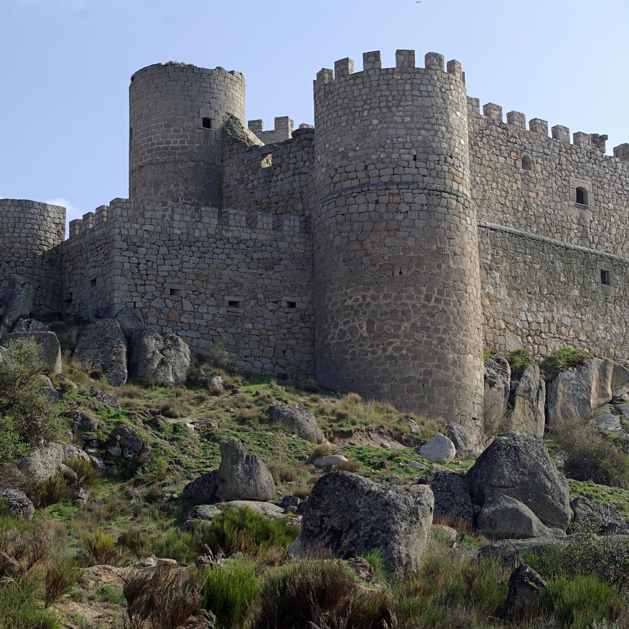
Manqueospese Castle, also known as "Althoughospese," is located in the municipality of Mironcillo, Ávila, at an altitude of 1,360 meters, overlooking the Amblés Valley. This castle is an example of a European mountain fortress, with strong walls adapted to the rocky terrain. Construction of the castle began in the 15th century by the Dávila family and was completed by Esteban Dávila in the 16th century. The castle is surrounded by legends, including stories of unrequited love and rivalries between knights. Its name, "Manqueospese," is said to come from the expression "although it weighs on you," which is related to these legends. From its privileged position, the castle offers stunning views of the Amblés Valley and the walls of Ávila. Although it is currently in ruins, restoration and cleaning work are underway.
5
0

According to legend, the castle would be built by Don Raimundo, to communicate with his beloved Doña Guiomar, locked in the balcony that crowns the door of the Rastro (in Ávila, access through the Dávila house), given the prohibition of her father. for the couple to continue their love affairs. Given the paternal attitude, Don Raimundo exclaimed: "I'll see her manqueospese" or "I'll see her even though she weighs", and it was then that he built his castle, from which he apparently communicated with his beloved Guiomar.
1
0

Impressive castle that is located close to the town of Sotalbo and that has a scene worthy of a movie. The walls and towers create a beautiful image on a hill!
1
0
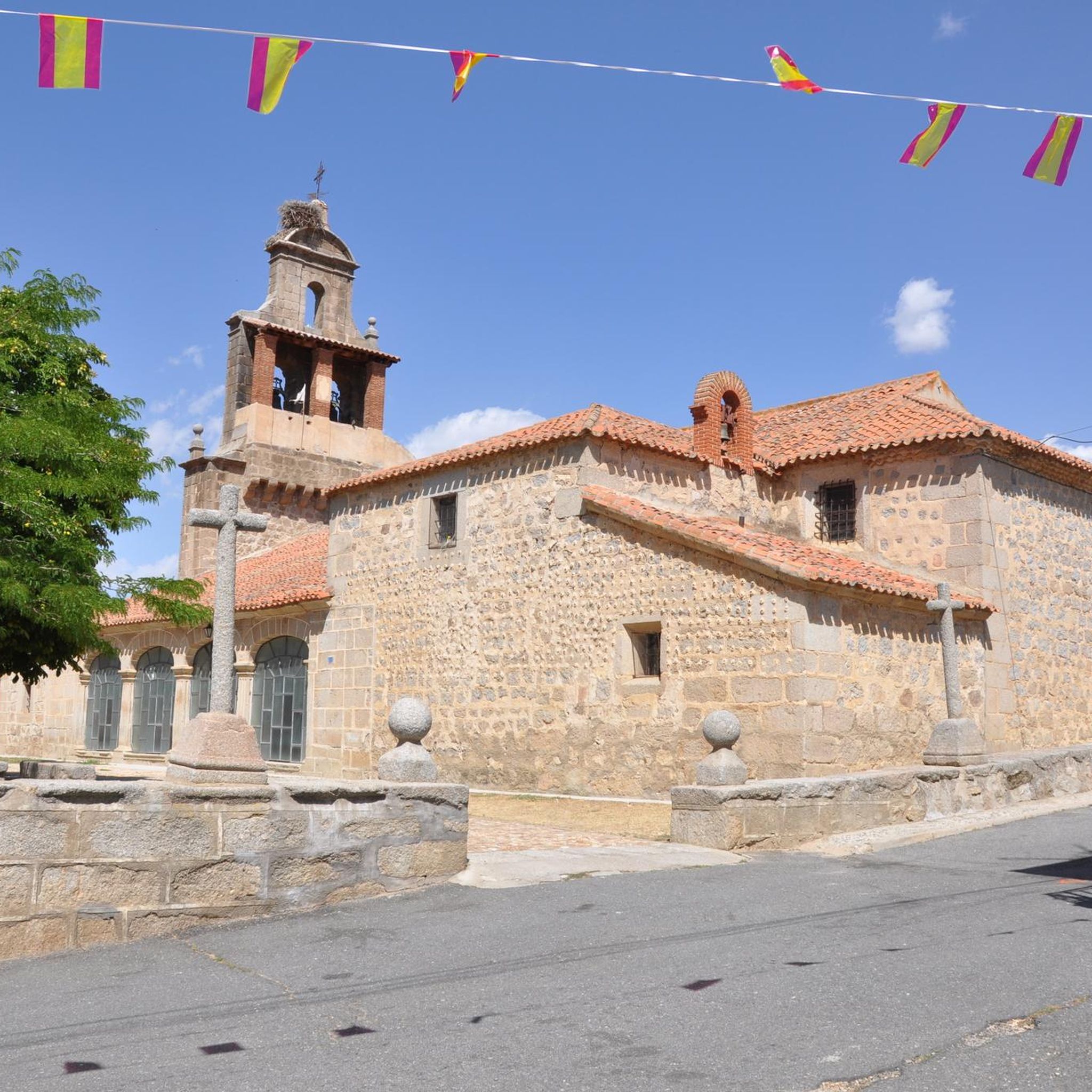
Small town that is located in what is called the Valle de Amblés and that is a few kilometers from its capital, Ávila. From the core, you can begin to see the first forms of the Sierra de Paramera and Gredos.
0
0
From the same road you can see the town that is located higher up the Sierra de la Panamera mountain, Sotalbo. In addition, on the south side and on one of the slopes, there is the Castro de Ulaca, an old castle.
0
0

The Muñotello roll symbolizes the jurisdictional independence obtained by the town with respect to the Villatoro council in 1733, during the reign of Felipe V. The construction is made of carved granite, it is five meters high and represents the sovereignty of the town of Muñotello to administer Justice. The prisoners were tied to the stone pillory during the trial and depending on the sentence they were stoned to death or released.
0
0

The unique granite landscape is the result of the mineral composition, climatic changes and the weathering of the rock surfaces, giving rise to suggestive modeling forms. The most striking process is the slabs, the boats, the corridors and alleys and the granular disintegration, creating an authentic labyrinth of stone sculptures. To the west, at the headwaters of the Adaja River, the white reliefs of La Serrota emerge. The path follows the ridge and collides with the top pyramid of Zapatero in a clear hill where the ascent to the top begins on the southwest face. The ascent is marked with stone milestones. The ice and the amount of snow will determine the technical level of the ascent. First there is a rocky step to a wide and comfortable shoulder, where the final attack begins through a channel that leads to the access passage to the geodesic vertex through a kind of tunnel. The views from the top of the remaining section of the rope are breathtaking between large granite domes and giant speedboats, but it is actually easier than the previous section and almost all descent. The descent of the peak is along the east face, to a pass where the Path of Zapatero climbs from the left from Sotalvo.
2
0
Frequently Asked Questions
What natural features and landscapes can I explore around Muñogalindo?
The area around Muñogalindo offers diverse natural beauty. You can explore the distinctive granite landscape of Pico Zapatero, known for its unique stone sculptures formed by natural weathering. Another excellent spot is Cerro de Gorría, which provides impressive panoramic views of the Sierra de la Paramera, La Serrota, and the Amblés valley. Muñogalindo is also nestled between the flatlands of the Valle Amblés and the oak-covered slopes of the Sierra de Ávila.
What historical sites are there to visit in Muñogalindo?
Muñogalindo boasts several historical points of interest. The Rollo de Muñotello is a significant man-made monument symbolizing the town's jurisdictional independence from 1733. Within the village, you can find the 17th-century Church of San Lucas Evangelista and evidence of an ancient Roman oven. The surrounding region also holds remains from prehistoric Vettones culture, particularly in Peñáguila.
Where can I find the best panoramic views in the Muñogalindo area?
For breathtaking panoramic views, head to Cerro de Gorría. From its geodesic vertex, you can see the Sierra de la Paramera, La Serrota, the Amblés valley to the south, and La Moraña to the north. The ascent to Pico Zapatero also offers impressive vistas of granite domes and the surrounding mountain ranges.
Are there hiking trails available near Muñogalindo?
Yes, there are various running and hiking trails in the vicinity of Muñogalindo. For example, you can find challenging routes like the Pico Zapatero – Molino de Enmedio loop from Sotalbo or the Sotalbo and Manqueospese Castle Loop. You can explore more options and detailed routes in the Running Trails around Muñogalindo guide.
Can I go cycling around Muñogalindo?
Absolutely! The region offers both road cycling and mountain biking opportunities. For road cyclists, routes like the 'Convento de San José – Views of Ávila loop from Muñogalindo' are popular. Mountain bikers can enjoy trails such as the 'Rollo de Muñotello – Villatoro loop from Muñogalindo'. Discover more routes in the Road Cycling Routes around Muñogalindo and MTB Trails around Muñogalindo guides.
Are there any family-friendly attractions in Muñogalindo?
Yes, Muñogalindo offers attractions suitable for families. The Rollo de Muñotello is an interesting historical monument that can be easily visited. Additionally, the Plaza de la Torre and Fuente de Piedra provides a pleasant spot in the village where families can relax and enjoy the local atmosphere.
What unique geological formations can be found near Muñogalindo?
The area is particularly known for the unique granite landscape of Pico Zapatero. Here, you'll find a 'labyrinth of stone sculptures' formed by natural processes like exfoliation, rock slabs, corridors, and granular disintegration. These formations are a result of the mineral composition, climatic changes, and weathering of the rock surfaces.
What is the best time of year to visit Muñogalindo for outdoor activities?
The best time to visit Muñogalindo for outdoor activities generally depends on your preference. The region, situated over 1,100 meters above sea level, experiences harsh winters with low temperatures and snow. For more comfortable hiking and cycling, spring and autumn offer milder weather. Summer can be warm, but the altitude provides some relief compared to lower areas.
Where can I learn more about the local culture and history of Valle Amblés?
To delve deeper into the local culture and history of the Valle Amblés, you can visit the Visitor Center of Valle Amblés. This center is housed in the former doctor's residence in Muñogalindo and serves as an interpretive hub for the landscape and historical context of the region.
What is Muñogalindo like as a settlement?
Muñogalindo is a small town located in the Valle de Amblés, just a few kilometers from Ávila. From the settlement, you can begin to see the first forms of the Sierra de Paramera and Gredos, offering a picturesque setting. It serves as a good base to explore both local attractions and the wider region.
Is it possible to visit the Walls of Ávila from Muñogalindo?
Yes, Muñogalindo is conveniently located approximately 18 kilometers from the city of Ávila. This makes it easy to combine a visit to Muñogalindo with exploring the wider attractions of the province, including the famous Walls of Ávila, a UNESCO World Heritage site. You can find more information about this historical site at worldheritagesite.org.
Most popular attractions around Muñogalindo

Get inspired with the komoot mobile app


Explore more
Still not found the Highlight you’re looking for? See guides of the top attractions in other regions:
