The best road cycling routes around Torre-Cardela
5.0
(1)
74
riders
10
rides
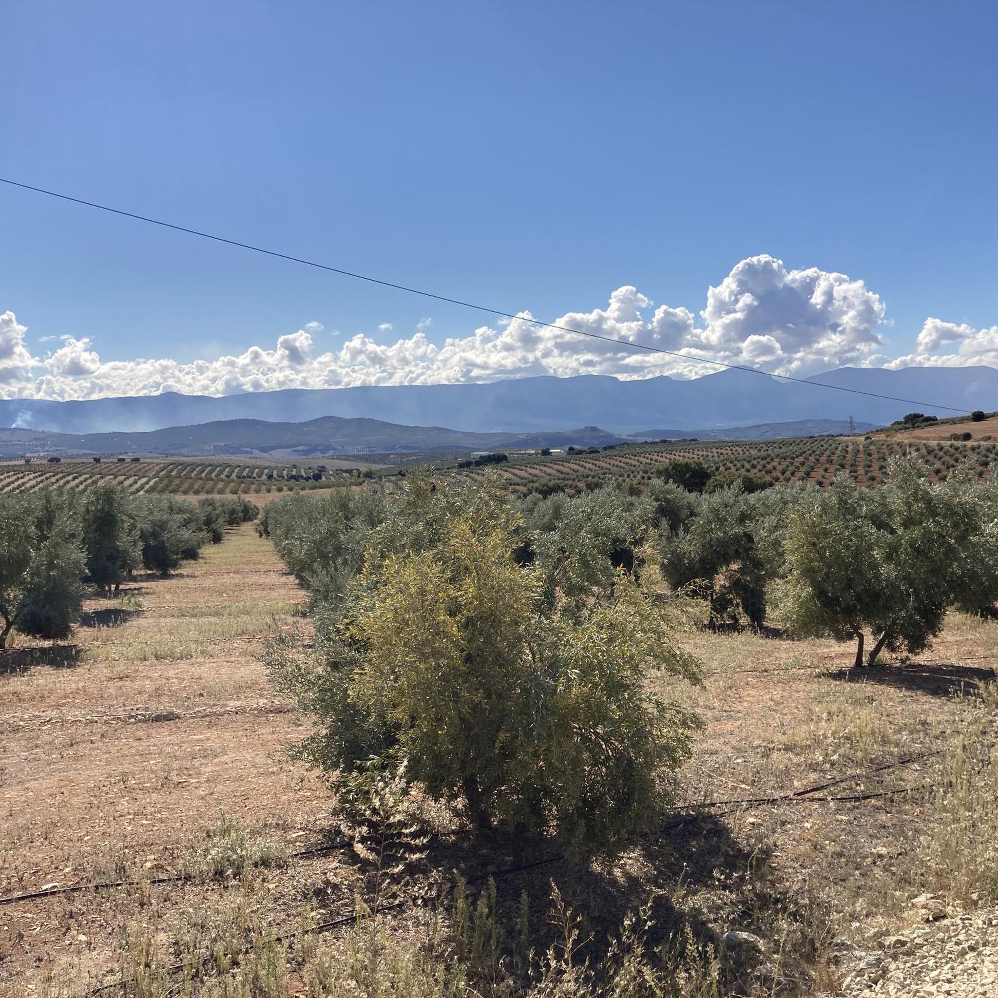
Road cycling around Torre-Cardela is characterized by its elevated position over 1200 meters above sea level, nestled within a small mountain range in Granada, Spain. The region features varied terrain with inclines and descents, offering panoramic views of the Eastern Mountains and the Guadix region. Cyclists will find quiet mountain roads winding through extensive agricultural landscapes, including olive groves and almond trees.
Best road cycling routes around Torre-Cardela
- The most popular road cycling route is Surrounding the Rio Guadahortuna — circular via Alamedilla and Dehesas de Guadix, a 49.6 miles (80 km) trail that takes 3 hours 38 minutes to complete. This difficult route explores river valleys and agricultural areas.
- Another top favourite among local road cyclists is Píñar and Iznalloz Almond Fields Loop, a moderate 34.5 miles (55.5 km) path. This route offers scenic views through extensive almond fields.
- Local road cyclists also love the Roman Dam of Barcinas – View of Chulilla loop from Píñar, a 56.2 miles (90.5 km) trail leading through varied terrain with views of a Roman dam, often completed in about 4 hours 14 minutes.
- Road cycling around Torre-Cardela is defined by elevated terrain, quiet mountain roads, and agricultural landscapes. The network offers options for different ability levels, from moderate loops to challenging climbs.
- The routes in Torre-Cardela are highly rated by the komoot community with an average score of 5.0 stars from a review. More than 75 road cyclists have used komoot to explore Torre-Cardela's varied terrain.
Last updated: May 14, 2026
5.0
(1)
8
riders
Hard road ride. Very good fitness required. Mostly well-paved surfaces and easy to ride.
4
riders
55.5km
02:36
570m
570m
Moderate road ride. Good fitness required. Mostly well-paved surfaces and easy to ride.

Sign up for free
23
riders
90.5km
04:14
1,090m
1,090m
Hard road ride. Very good fitness required. Mostly well-paved surfaces and easy to ride.
7
riders
101km
04:46
1,270m
1,270m
Hard road ride. Very good fitness required. Mostly well-paved surfaces and easy to ride.
4
riders
71.5km
03:41
1,100m
1,100m
Hard road ride. Very good fitness required. Mostly well-paved surfaces and easy to ride.
Get access to more routes and recommendations from other explorers.
Sign up for free
Already have an account?
Our route recommendations are based on thousands of hikes, rides, and runs completed by other people on komoot.
Start today with a free account
Your next adventure awaits.
Login or Signup
Popular around Torre-Cardela
Tips from the Community

The detour isn't worth it - it's steep on both sides and the road is in terrible condition.
0
0

We are at the crossroads between the towns of Olivares, Moclín and Colomera
15
0
Very close to the Cubillas reservoir, we find these facilities dedicated to model airplanes, where hundreds of fans practice this sport with their miniatures.
15
0
This town, joined to two other municipalities such as Cotílfar and Cañatabla in 2015, has its municipal building almost on the outskirts of the town, and like its church, it does not have any important architectural features as it is a relatively recent construction.
18
0
This church, where the image of the patron saint Our Lady of the Rosary is located, is a building that lacks artistic value, although the sentimental value it has for its residents is much greater. The façade and its surroundings are whitewashed and it has a tower where the bell tower is located, also whitewashed like the building.
19
0
This town has a lot of daily activity, which means that it has several grocery stores and bars or cafes, and there is always someone strolling in its streets and squares.
19
0
A town in Granada that has been the union of three municipalities since 2015. These municipalities are Domingo Pérez, Cotílfar and Cañatabla and it is located in the valley of the Cubillas River, which means that its temperature is always several degrees lower than in surrounding towns.
19
0
Frequently Asked Questions
How many road cycling routes are available around Torre-Cardela?
There are over 10 road cycling routes available around Torre-Cardela. These routes offer a variety of experiences, from moderate loops to more challenging climbs, all set against the region's unique mountainous and agricultural landscapes.
What kind of terrain can I expect when road cycling around Torre-Cardela?
Road cycling around Torre-Cardela features elevated terrain, often over 1200 meters above sea level, nestled within a small mountain range. You can expect varied inclines and descents, with quiet mountain roads winding through extensive agricultural landscapes, including olive groves and almond trees. The broader Granada province, where Torre-Cardela is located, is known for challenging climbs and scenic mountain roads.
What scenic views or natural features can I expect on road cycling routes?
Cyclists can enjoy spectacular panoramic views of the Eastern Mountains, the Guadix region, and the southern part of Sierra Mágina. The routes also pass through serene agricultural landscapes with fields of cereals, olive groves, and almond trees, which are particularly picturesque in early spring when almond trees are in blossom. The medieval Torre del Molino also offers expansive vistas.
Are there road cycling routes suitable for beginners or less experienced cyclists?
While many routes in the region feature significant elevation gains, there are options that cater to different fitness levels. For example, the area offers moderate routes like the Píñar and Iznalloz Almond Fields Loop, which is 34.5 miles (55.5 km) long and offers scenic views through extensive almond fields without extreme difficulty.
Are there challenging climbs for experienced road cyclists?
Yes, Torre-Cardela's elevated and mountainous setting provides ample opportunities for challenging climbs. Routes like Surrounding the Rio Guadahortuna — circular via Alamedilla and Dehesas de Guadix (49.6 miles / 80 km with over 900m elevation gain) and Roman Dam of Barcinas – View of Chulilla loop from Píñar (56.2 miles / 90.5 km with over 1000m elevation gain) are rated as difficult and offer significant ascents. The proximity to Sierra Nevada also means access to some of Andalusia's most demanding cycling experiences.
Can I find circular road cycling routes in the area?
Yes, many of the road cycling routes around Torre-Cardela are designed as circular loops, allowing you to start and end your ride in the same location. Examples include the popular Surrounding the Rio Guadahortuna — circular via Alamedilla and Dehesas de Guadix and the Píñar and Iznalloz Almond Fields Loop.
What is the best time of year for road cycling in Torre-Cardela?
The region's elevated position and Mediterranean climate generally make spring and autumn ideal for road cycling, offering pleasant temperatures. Early spring is particularly beautiful when the almond trees are in blossom. Summers can be hot, especially at lower elevations, so early morning rides are recommended during this season. Winters are cooler but often sunny, making cycling possible year-round, though some higher passes might be affected by snow.
Is parking available for cyclists in Torre-Cardela?
While specific designated cycling parking areas are not extensively detailed, Torre-Cardela is a small municipality. Cyclists typically find parking in or around the village center, or at the start points of routes, especially in less populated areas where quiet roads are common. It's advisable to check local parking regulations upon arrival.
Are there places to stop for refreshments or accommodation near the cycling routes?
Torre-Cardela, as a local municipality, offers basic amenities. You can find local cafes and restaurants in the village itself. For more extensive options, nearby towns and villages along the routes will also provide opportunities for refreshments, meals, and accommodation. It's a good idea to plan your stops in advance, especially on longer routes through more rural areas.
What do other road cyclists say about the routes in Torre-Cardela?
The road cycling routes around Torre-Cardela are highly rated by the komoot community, with an average score of 5.0 stars. Over 75 road cyclists have explored the area using komoot, often praising the varied terrain, quiet mountain roads, and the stunning panoramic views of the surrounding mountains and agricultural landscapes.
Are there any historical landmarks or points of interest along the routes?
Yes, the region offers historical points of interest. The medieval Torre del Molino, from which the village gets its name, stands on the Cerro del Molino and provides fantastic views. Some routes, like the Roman Dam of Barcinas – View of Chulilla loop from Píñar, lead past historical structures such as a Roman dam, offering a blend of natural beauty and cultural heritage.
Most popular routes around Torre-Cardela

Get inspired with the komoot mobile app


Explore more
Browse the best Road cycling routes in other regions.
