The best MTB trails around Montitxelvo / Montichelvo
4.1
(82)
932
riders
42
rides
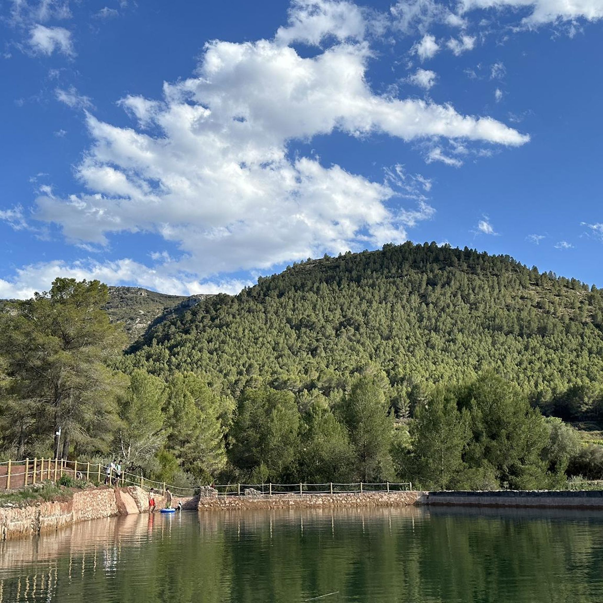
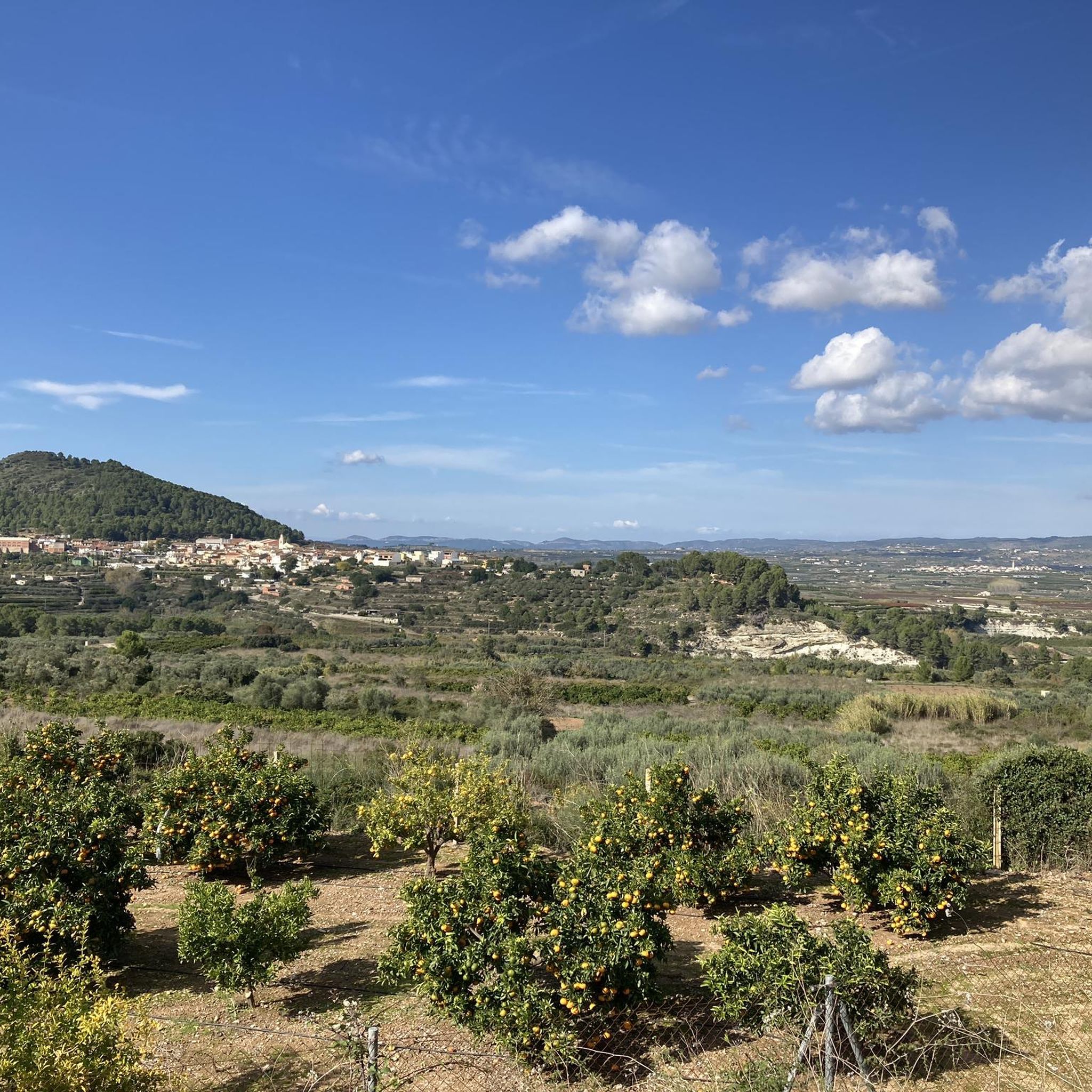
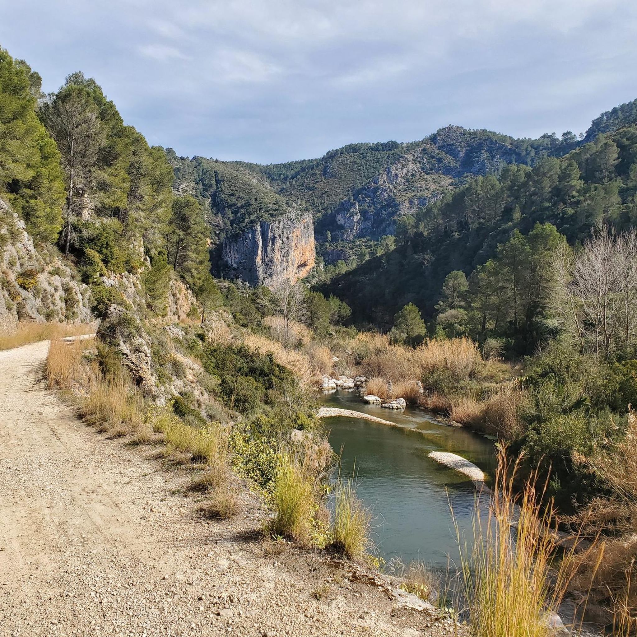
Mountain biking around Montitxelvo / Montichelvo offers diverse natural landscapes and varied terrain in the Vall d'Albaida, Valencia. The area is situated between the Mariola and El Benicadell mountains, providing an ideal setting for outdoor activities. Riders encounter a rich blend of mountains, valleys, and agricultural lands, including picturesque orange groves and vineyards. The region features diverse terrains, from established trails to natural monuments, mountain peaks, and canyons, alongside historical water features.
Best mountain bike trails around Montitxelvo / Montichelvo
- The most popular mountain bike trail is Serra de Quatretonda and El Surar Loop, a 25.5 miles (41.0 km) trail that takes 3 hours 40 minutes to complete. This moderate route explores mountain ranges and natural landscapes.
- Another top favourite among local mountain bikers is Dawn's Way and Safor Loop, a difficult 35.6 miles (57.3 km) path. This challenging route traverses the Safor mountain range with significant elevation gains.
- Local mountain bikers also love the La Bastida Refuge – Cova Negra loop from Llutxent, a 30.8 miles (49.6 km) trail leading through varied terrain, often completed in about 3 hours 40 minutes.
- Mountain biking around Montitxelvo / Montichelvo is defined by mountain ranges, valleys, and agricultural vistas. The network offers options for different ability levels, from moderate to difficult.
- The routes in Montitxelvo / Montichelvo are highly rated by the komoot community with an average score of 4.2 stars from over 70 reviews. More than 900 mountain bikers have used komoot to explore Montitxelvo / Montichelvo's varied terrain.
Last updated: July 8, 2026
4.7
(3)
17
riders
41.0km
03:41
890m
890m
Moderate mountain bike ride. Good fitness required. Suitable for all skill levels.
10
riders
57.3km
05:22
1,490m
1,490m
Hard mountain bike ride. Very good fitness required. Advanced riding skills necessary. Some portions of the route may require you to push your bike.

Sign up for free
4.9
(7)
58
riders
49.2km
03:40
600m
600m
Hard mountain bike ride. Good fitness required. Advanced riding skills necessary. Some portions of the route may require you to push your bike.
4.7
(7)
49
riders
54.9km
04:18
960m
960m
Hard mountain bike ride. Very good fitness required. Suitable for all skill levels.
5.0
(3)
45
riders
21.0km
01:32
340m
340m
Moderate mountain bike ride. Good fitness required. Suitable for all skill levels.
Get access to more routes and recommendations from other explorers.
Sign up for free
Already have an account?
Our route recommendations are based on thousands of hikes, rides, and runs completed by other people on komoot.
Start today with a free account
Your next adventure awaits.
Login or Signup

Tips from the Community

The only crossing over the river. Suitable spot for a picnic. It's not far to Villalonga from here.
2
0
Everything close to the train station. The castle, which is worth seeing, towers above.
2
0
Many tunnels, some very dark. Be sure to bring a light.
1
0


The Monastery of Sant Jeroni de Cotalba is a historic monastery near Alfauir, in the province of Valencia. It was founded in 1388 and was an important Hieronymite monastery until it was expropriated in the 19th century. The monastery combines various architectural styles, including Gothic, Mudéjar, Renaissance and Baroque elements. The cloister, the church, the defensive tower, the water gardens and the olive press are particularly worth seeing. Today the monastery is privately owned but open to visitors. It is one of the best preserved monasteries in the Valencia region and has been declared a Cultural Asset (Bien de Interés Cultural, BIC).
9
0

Beautiful rural house to spend a holiday in the middle of nowhere
0
0

beautiful views of the mountain ranges
18
0
The Hieronymite Monastery of Sant Jeroni de Cotalba was one of the most important monasteries in Valencia in the Middle Ages, belonging to the Hieronymite Order.
15
0
Frequently Asked Questions
How many mountain bike trails are there in Montitxelvo / Montichelvo?
Montitxelvo / Montichelvo offers a wide selection of mountain bike trails, with over 40 routes available. These trails cater to various skill levels, from moderate to difficult.
What kind of terrain can I expect on the mountain bike trails in Montitxelvo / Montichelvo?
The terrain in Montitxelvo / Montichelvo is highly diverse, featuring a rich blend of mountains, valleys, and agricultural lands. You'll encounter everything from established trails to natural monuments, mountain peaks, canyons, and mountain passes. The area is nestled between the Mariola and El Benicadell mountains, offering varied landscapes including picturesque orange groves and vineyards.
Are there mountain bike trails suitable for beginners or families in Montitxelvo / Montichelvo?
Yes, while many routes are moderate to difficult, there are options for less experienced riders. The area features trails suitable for all fitness levels, including 4 routes classified as easy. For example, the Serra de Quatretonda and El Surar Loop is a moderate route that explores natural landscapes, offering a good balance for those looking for a less strenuous ride.
Can I bring my dog on the mountain bike trails in Montitxelvo / Montichelvo?
While the guide does not specify dog-friendly rules for individual trails, many natural areas in the Valencian Community permit dogs on trails, often requiring them to be on a leash. It's always best to check local signage or specific park regulations if you plan to ride with your dog in protected areas.
Are there any circular mountain bike routes in Montitxelvo / Montichelvo?
Yes, many of the mountain bike routes in Montitxelvo / Montichelvo are designed as loops, allowing you to start and finish in the same location. Examples include the challenging Dawn's Way and Safor Loop, which traverses the Safor mountain range, and the La Bastida Refuge – Cova Negra loop from Llutxent, offering varied terrain.
What natural features or landmarks can I see along the mountain bike trails?
The region is rich in natural and historical features. You can encounter historical water infrastructure like the Alcavor de Remigio, an ancient watermill, and a remarkably preserved 15th-century Aqueduct within the Barranc de Collado. The Serpis River also flows nearby. Notable natural monuments include Cim de la Safor (1,013 m), the Toll de l’Estret gorge, and the Gorg del Salt de Planes waterfall.
Are there challenging routes for experienced mountain bikers?
Absolutely. Montitxelvo / Montichelvo is well-suited for experienced mountain bikers, with 27 routes classified as difficult. These routes often feature significant elevation gains and technical sections. A prime example is the Dawn's Way and Safor Loop, a 35.6-mile path traversing the Safor mountain range with substantial climbing.
Where can I find panoramic views while mountain biking?
The area offers several points with excellent panoramic views. From La Creueta Peak, you can enjoy sweeping vistas of Montitxelvo and surrounding towns like Benicolet, Benigánim, Llutxent, Quatretonda, and La Pobla del Duc. Many routes traversing the Mariola and El Benicadell mountains, as well as the Safor mountain range, will also provide stunning viewpoints.
What is the best time of year to go mountain biking in Montitxelvo / Montichelvo?
The Valencian Community generally enjoys a mild Mediterranean climate, making mountain biking enjoyable for much of the year. Spring and autumn typically offer the most pleasant temperatures for riding, avoiding the peak heat of summer and potential cooler, wetter conditions in winter. Always check the local weather forecast before heading out.
Is there parking available near the trailheads in Montitxelvo / Montichelvo?
While specific parking locations for every trailhead are not detailed, Montitxelvo and surrounding towns generally offer public parking. For routes starting directly from the village or nearby, you can usually find suitable parking. It's advisable to check the starting point of your chosen route on Komoot for more precise parking information.
How do other mountain bikers rate the trails in Montitxelvo / Montichelvo?
The mountain bike trails in Montitxelvo / Montichelvo are highly rated by the komoot community, with an average score of 4.2 stars from over 70 reviews. More than 900 mountain bikers have used komoot to explore the varied terrain, often praising the diverse natural landscapes and the range of options for different ability levels.
Are there any routes that follow water features or rivers?
Yes, the region is known for its historical water infrastructure and natural water features. The Serpis River flows nearby, and the Racó del Duc Route (Serpis Greenway) is particularly suitable for mountain bikes, offering opportunities to ride alongside its waters. You can also find features like the Font del Micairent and the Aqueduct within the Barranc de Collado.
What are the typical durations for mountain bike trails in Montitxelvo / Montichelvo?
Trail durations vary significantly based on distance and difficulty. For instance, a moderate route like the Serra de Quatretonda and El Surar Loop (25.5 miles) typically takes around 3 hours 40 minutes. More challenging routes, such as the Dawn's Way and Safor Loop (35.6 miles), can take over 5 hours to complete due to significant elevation gains.
Most popular routes around Montitxelvo / Montichelvo
Most popular attractions around Montitxelvo / Montichelvo

Get inspired with the komoot mobile app


Explore more
Browse the best MTB trails in other regions.
