The best walks and hikes around Luzaide/Valcarlos
4.4
(635)
3,739
hikers
17
hikes
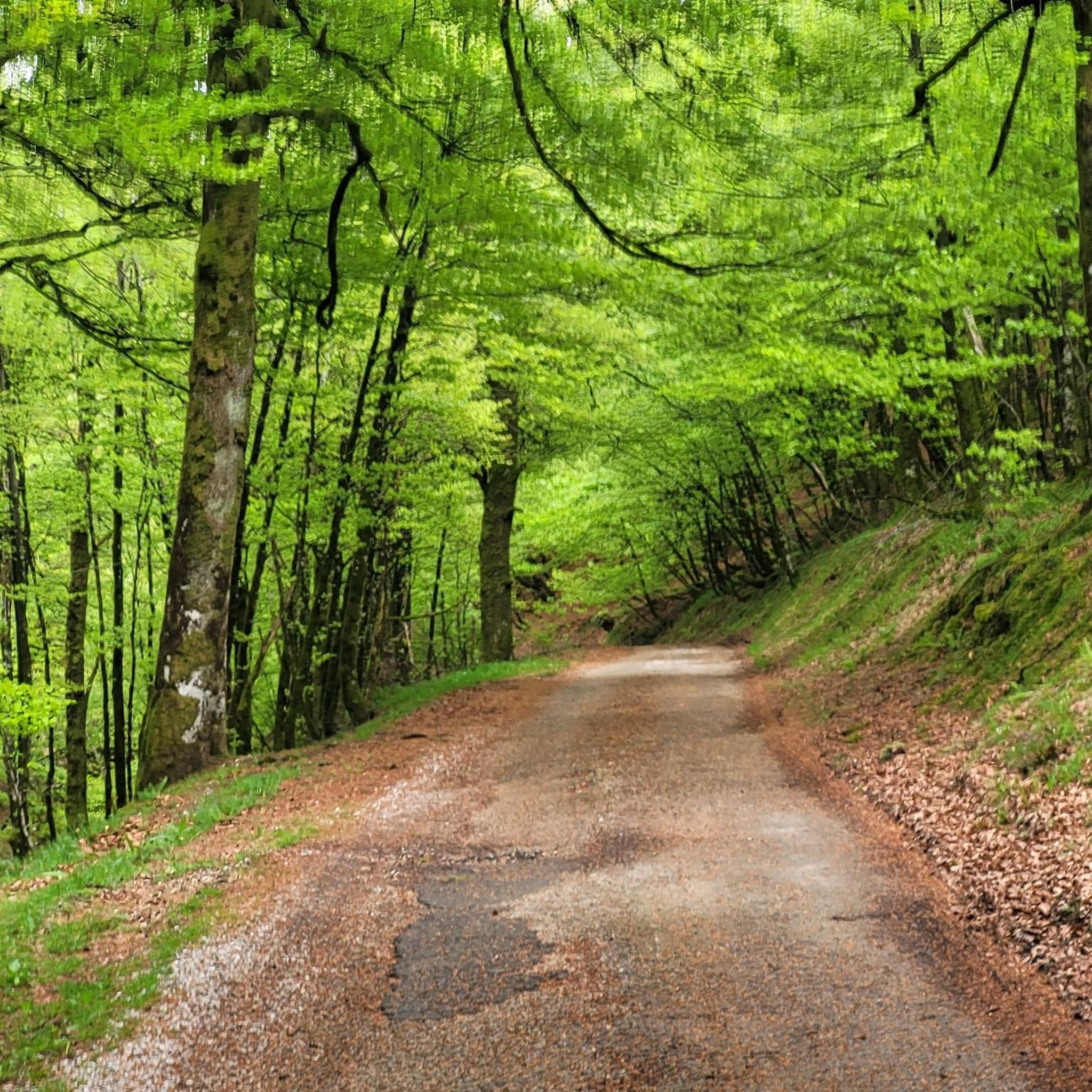
Hiking around Luzaide/Valcarlos offers diverse routes through the unique Pyrenean landscapes of Navarre, situated on the border between Spain and France. The region is characterized by dramatic ravines, rolling mountains, and extensive woodlands primarily composed of beech, oak, and chestnut trees. Fast-flowing streams and waterfalls contribute to the natural features, with the Ibañeta Pass providing a notable elevation at 1,057 meters. This area serves as a significant point on the Camino de Santiago, blending natural beauty with historical routes.
Best hiking trails around Luzaide/Valcarlos
- The most popular hiking route is Mendiaundi and Menditxuri Loop, a 6.4 miles (10.3 km) trail that takes 3 hours 22 minutes to complete. This moderate route offers views of the surrounding Pyrenees.
- Another top favourite among local hikers is GR 10 and Napoleon Route Loop, a difficult 19.6 miles (31.5 km) path. This challenging route features significant elevation gain and panoramic vistas.
- Local hikers also love the Valcarlos Village Center loop from Luzaide, a 9.8 miles (15.7 km) trail leading through varied terrain, often completed in about 5 hours 3 minutes.
- Hiking around Luzaide/Valcarlos is defined by Pyrenean mountain passes, dense woodlands, and historical pilgrimage paths. The network offers options for various ability levels, from easy walks to difficult ascents.
- The routes in Luzaide/Valcarlos are highly rated by the komoot community with an average score of 4.4 stars from over 500 reviews. More than 3000 hikers have used komoot to explore Luzaide/Valcarlos's varied terrain.
Last updated: August 17, 2026
4.0
(9)
13
hikers
10.3km
03:23
380m
380m
Moderate hike. Good fitness required. Mostly accessible paths. Sure-footedness required.
4
hikers
31.5km
10:00
1,190m
1,190m
Hard hike. Very good fitness required. Mostly accessible paths. Sure-footedness required.

Sign up for free
4.3
(4)
13
hikers
13.3km
04:12
560m
560m
Moderate hike. Good fitness required. Easily-accessible paths. Suitable for all skill levels.
5.0
(2)
23
hikers
Moderate hike. Good fitness required. Mostly accessible paths. Sure-footedness required.
4.5
(2)
28
hikers
6.39km
02:04
280m
280m
Moderate hike. Good fitness required. Mostly accessible paths. Sure-footedness required.
Get access to more routes and recommendations from other explorers.
Sign up for free
Already have an account?
Our route recommendations are based on thousands of hikes, rides, and runs completed by other people on komoot.
Start today with a free account
Your next adventure awaits.
Login or Signup

Tips from the Community

The Lepoeder Pass (Col de Lepoeder), standing at roughly 1,430 meters, is the highest point and the ultimate climax of the Route of Napoleon on the Camino de Santiago. Reaching this viewpoint is one of the most physically demanding but deeply rewarding moments of the entire trek from France into Spain. Because it is the highest saddle on the route, it is notoriously windy and exposed to the elements. Even on a sunny day, you will likely want to pull on a windbreaker while you stop to take your photos. This viewpoint is a critical junction. From here, you must choose your path down to Roncesvalles: the steep, direct trail that plunges straight through the beautiful but tough woodland, or the slightly longer, gentler paved route that takes you via the Ibañeta Pass.
1
0
The Lepoeder Pass is a magnificent, unforgettable milestone. The Lepoeder Pass (Col de Lepoeder), standing at roughly 1,430 meters, is the highest point and the ultimate climax of the Route of Napoleon on the Camino de Santiago. Reaching this viewpoint is one of the most physically demanding but deeply rewarding moments of the entire trek from France into Spain. Because it is the highest saddle on the route, it is notoriously windy and exposed to the elements. Even on a sunny day, you will likely want to pull on a windbreaker while you stop to take your photos. This viewpoint is a critical junction. From here, you must choose your path down to Roncesvalles: the steep, direct trail that plunges straight through the beautiful but tough woodland, or the slightly longer, gentler paved route that takes you via the Ibañeta Pass.
1
0
The Ibañeta Chapel is a moving and highly anticipated milestone for anyone walking the Camino de Santiago. After the grueling, steep ascent from the French side of the Pyrenees, crossing the border into Spain, and finally beginning your descent, this small chapel and the large stone cross beside it are a spectacular sight. The First Spanish Waypoint: It serves as the very first visible intermediate destination on the Spanish side of the mountains, signaling that the hardest part of the climb is officially behind you. Once you reach this point, you are almost done! Just a short walk further down the trail lies the day's final stage destination: the mighty and magnificent monastery complex of Roncesvalles.
1
0

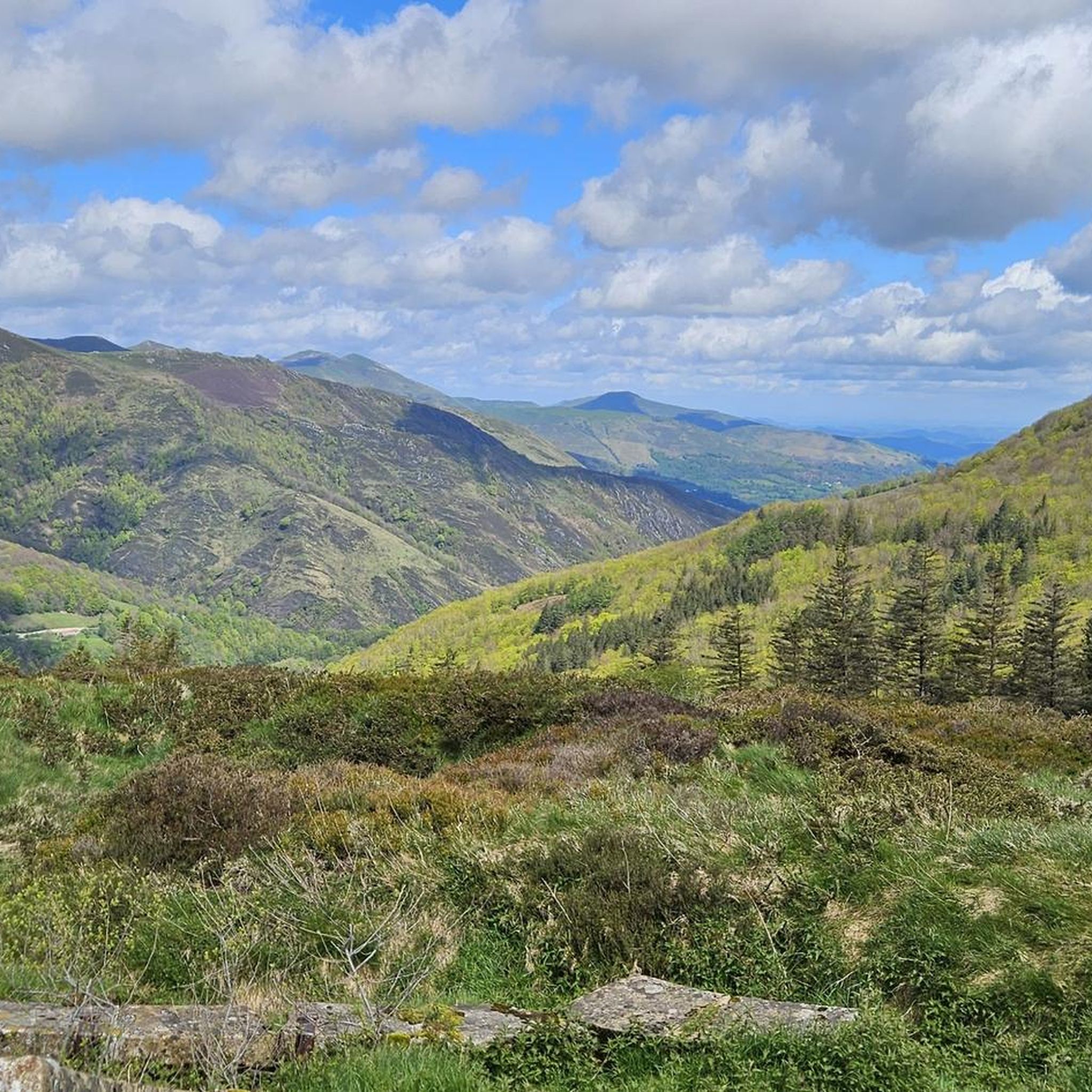
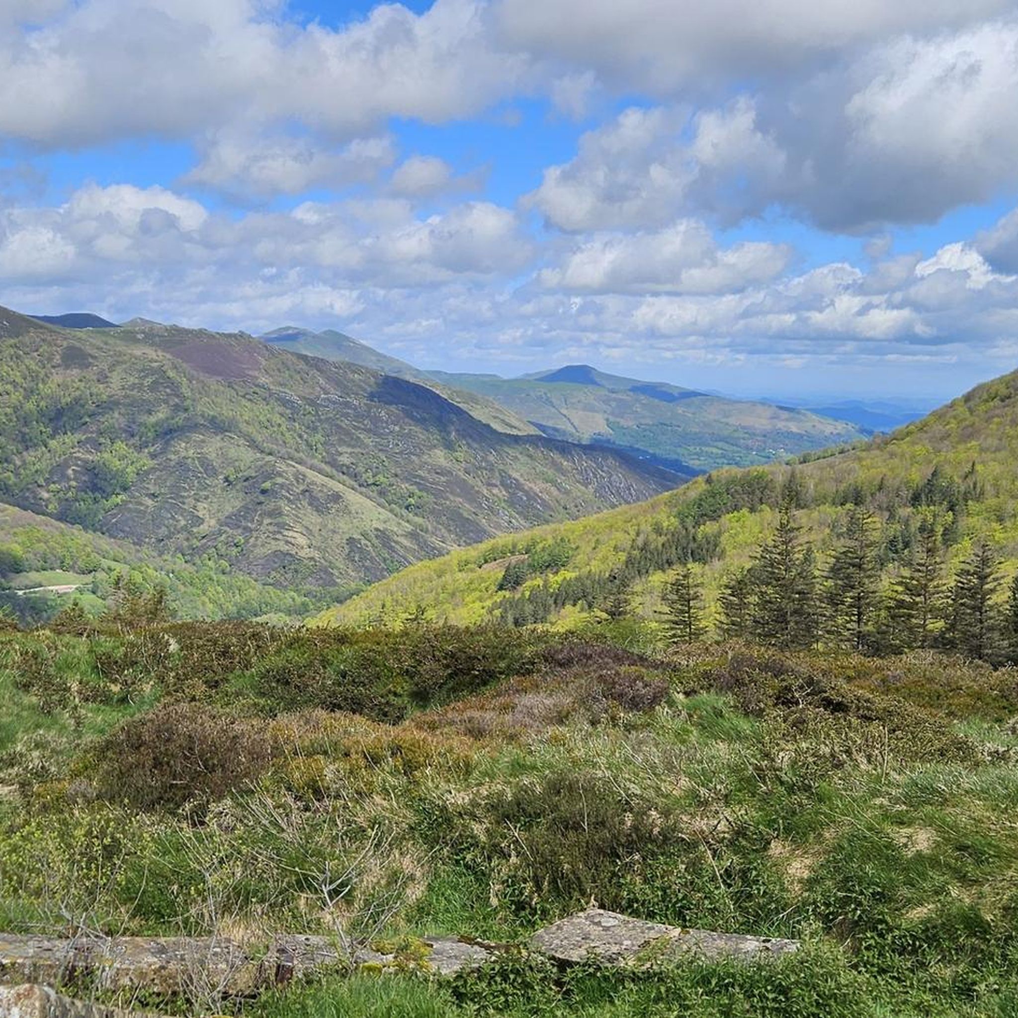
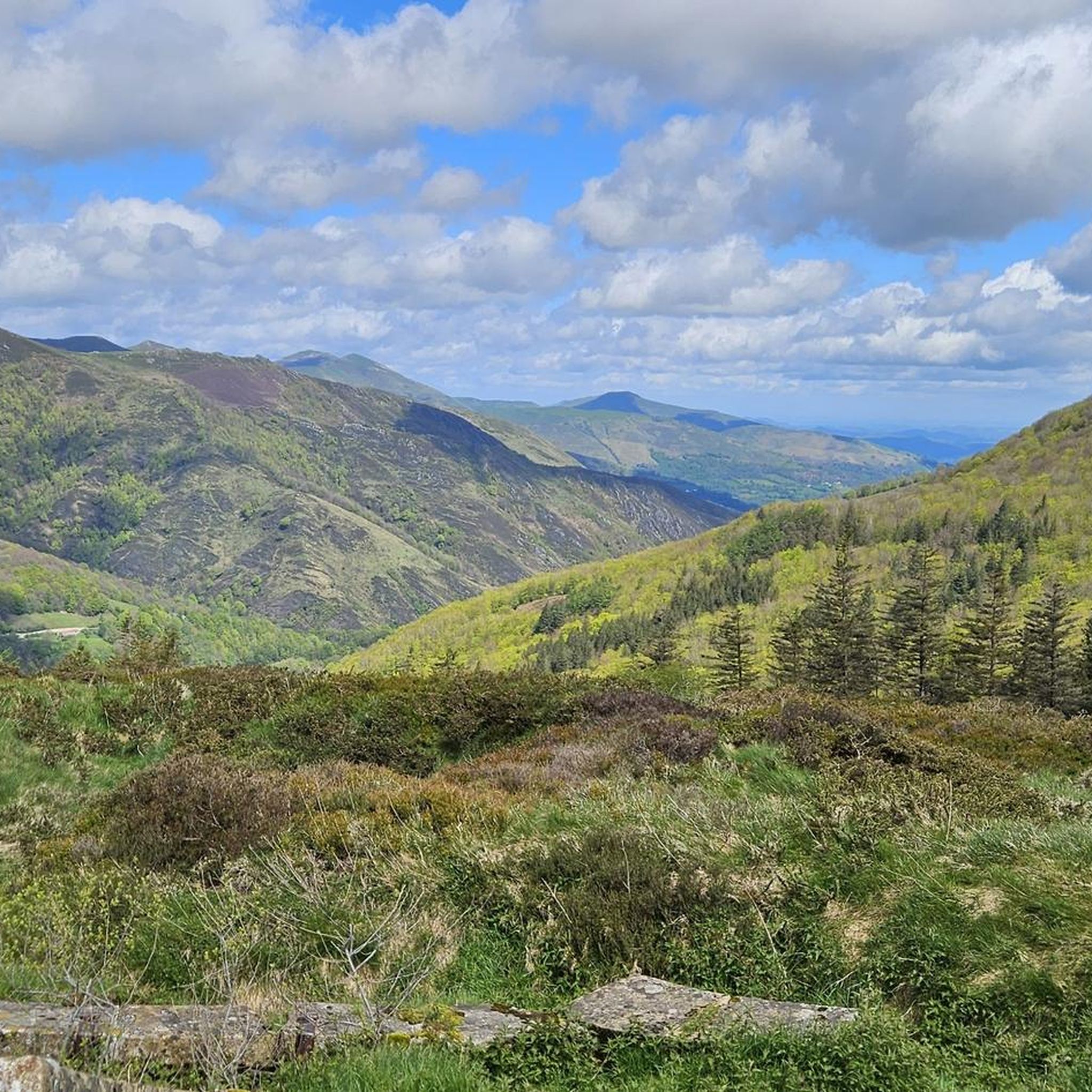
The Pyrenees, when the weather is nice you have a great view.
0
0

This tree reminded me of the four apostles, so the tree is now called
0
0

It is a beautiful border pass between Spain and France, well known for being part of the most traditional route of the Camino de Santiago. Sportingly, the climb on both sides is easy, although on the French side it is much longer as it starts at a lower altitude. The Spanish side is just 6 km from Burguete, the last being the most difficult with an average gradient of 7%. On this side you pass the famous and well-known monastery of Roncesvalles. The French side is 18 km from Arnegui and an average gradient of 4%. The hardest part is 5 km from the summit, with one kilometre at 7%. The landscape on this side is of lush vegetation going up a very closed valley that hardly leaves room for views of the surrounding mountains. The road is very twisty. It is a port with very good asphalt and a lot of traffic in general... so, be careful!
1
0

After a long climb, you finally make it to the Ibeneta Pass and can enjoy the view as a reward. Up here, there is a small chapel and a memorial stone to the knight Roland, who is said to have fallen here.
2
0

Col Burriegeta, also known as Puerto de Ibañeta, is a historic mountain pass in the Pyrenees, located between France and Spain. The pass is best known for its role in the Camino de Santiago, where pilgrims cross the border on their way to Santiago de Compostela1. The pass offers breathtaking views and is home to the modern chapel of San Salvador, which replaced an older chapel, and a monument to Roland, which commemorates the Battle of Roncesvalles in 778. Col Burriegeta is an important passage for both pilgrims and cyclists, who enjoy the challenging climb and the beautiful surroundings.
2
0
Frequently Asked Questions
What kind of terrain and difficulty can I expect on hikes in Luzaide/Valcarlos?
Luzaide/Valcarlos offers a diverse range of terrain, from dramatic ravines and rolling mountains to verdant meadows and dense woodlands of beech, oak, and chestnut trees. You'll find paths suitable for various fitness levels, including easy walks, moderate ascents, and difficult routes with significant elevation gain. The region is characterized by Pyrenean mountain passes and historical pilgrimage paths.
Are there easy hiking options suitable for beginners in Luzaide/Valcarlos?
Yes, Luzaide/Valcarlos has options for beginners and those seeking easier walks. The area offers accessible paths, and out of 14 total tours, 2 are classified as easy. These routes allow you to explore local streams, forests, and meadows without strenuous climbs.
What natural features and landmarks can I see while hiking in Luzaide/Valcarlos?
The region is rich in natural beauty, featuring fast-flowing streams, waterfalls, and extensive forests. Key landmarks include the historic Ibañeta Pass and the Roland Monument, which offers panoramic Pyrenees views. You can also visit the Roncesvalles Collegiate Church, a significant historical and cultural landmark, or explore the charming Saint-Jean-Pied-de-Port Old Town nearby.
Are there family-friendly hiking trails in Luzaide/Valcarlos?
While specific 'family-friendly' designations are not always explicit, the presence of easy, accessible paths suggests that many shorter routes would be suitable for families. These trails often explore local streams and forests, providing a pleasant outdoor experience for all ages.
Can I find circular hiking routes in Luzaide/Valcarlos?
Yes, circular routes are available. For example, the Mendiaundi and Menditxuri Loop is a moderate 6.4-mile trail, and the Valcarlos Village Center loop from Luzaide is a 9.8-mile option through varied terrain.
What is the best time of year to go hiking in Luzaide/Valcarlos?
The region's Pyrenean landscapes are beautiful throughout much of the year. Spring and autumn offer pleasant temperatures and vibrant scenery, with lush greenery in spring and rich colors in autumn. Summer is also popular, though some higher routes might be warm. Winter hiking is possible, but conditions can be challenging, especially at higher elevations, due to snow and ice.
What do other hikers enjoy most about hiking in Luzaide/Valcarlos?
The hiking routes in Luzaide/Valcarlos are highly rated by the komoot community, with an average score of 4.4 stars from over 500 reviews. Hikers frequently praise the unique Pyrenean landscapes, the blend of natural beauty with historical pilgrimage paths like the Camino de Santiago, and the diverse network of trails catering to various ability levels.
Are there any challenging hikes for experienced hikers in Luzaide/Valcarlos?
Yes, experienced hikers will find challenging options. The region offers 3 difficult routes, including the GR 10 and Napoleon Route Loop, a demanding 19.6-mile path with significant elevation gain and panoramic vistas. These routes provide a rigorous experience through the Pyrenees.
Can I hike parts of the Camino de Santiago in Luzaide/Valcarlos?
Absolutely. Luzaide/Valcarlos is a crucial point on the Camino de Santiago. You can experience sections of the Way of St. James, including the challenging 'Camino Alto' from Saint-Jean-Pied-de-Port to Roncesvalles, or the 'Camino del Valle' which passes directly through Luzaide/Valcarlos and the Ibañeta Pass.
Are there places to stay overnight or huts along the trails?
Yes, there are several huts and hostels in the vicinity. Notable options include the Orisson Mountain Hut and Inn, Izandorre Emergency Shelter, and the Roncesvalles Collegiate Hostel. These provide convenient stops for multi-day hikes or longer excursions.
How many hiking trails are available in Luzaide/Valcarlos?
There are 14 hiking trails available in Luzaide/Valcarlos, offering a variety of experiences from easy walks to difficult ascents through the Pyrenean landscape.
Most popular routes around Luzaide/Valcarlos
Most popular attractions around Luzaide/Valcarlos

Get inspired with the komoot mobile app


Explore more
Browse the best Hikes in other regions.
