The best running trails around Palacios Del Sil
64
runners
17
runs
Jogging around Palacios Del Sil offers routes through a mountainous landscape characterized by river valleys, forested slopes, and elevated terrain. The region features numerous hills and peaks, providing challenging ascents and descents for runners. Many running routes traverse natural areas, including those with lakes and open vistas.
Best jogging routes around Palacios Del Sil
- The most popular jogging route is Laguna de San Pedro Mallo – running circular from Matarrosa del Sil by the Cerro de la Laguna, a…
Last updated: May 27, 2026
Hard run. Very good fitness required. Sure-footedness, sturdy shoes and alpine experience required.
10.3km
01:30
460m
460m
This difficult 6.4-mile (10.3 km) trail running route from Fasgar offers challenging terrain and stunning views in the Reserva de la Biosfer

Sign up for free
15.6km
02:55
1,050m
1,050m
This difficult 9.7-mile trail running route in Alto Sil offers spectacular mountain views and visits traditional shepherd's huts.
40
runners
35.6km
05:59
1,880m
1,880m
Hard run. Very good fitness required. Sure-footedness, sturdy shoes and alpine experience required.
9
runners
15.9km
02:27
730m
730m
Hard run. Very good fitness required. Sure-footedness, sturdy shoes and alpine experience required.
Get access to more routes and recommendations from other explorers.
Sign up for free
Already have an account?
Our route recommendations are based on thousands of hikes, rides, and runs completed by other people on komoot.
Start today with a free account
Your next adventure awaits.
Login or Signup
Tips from the Community

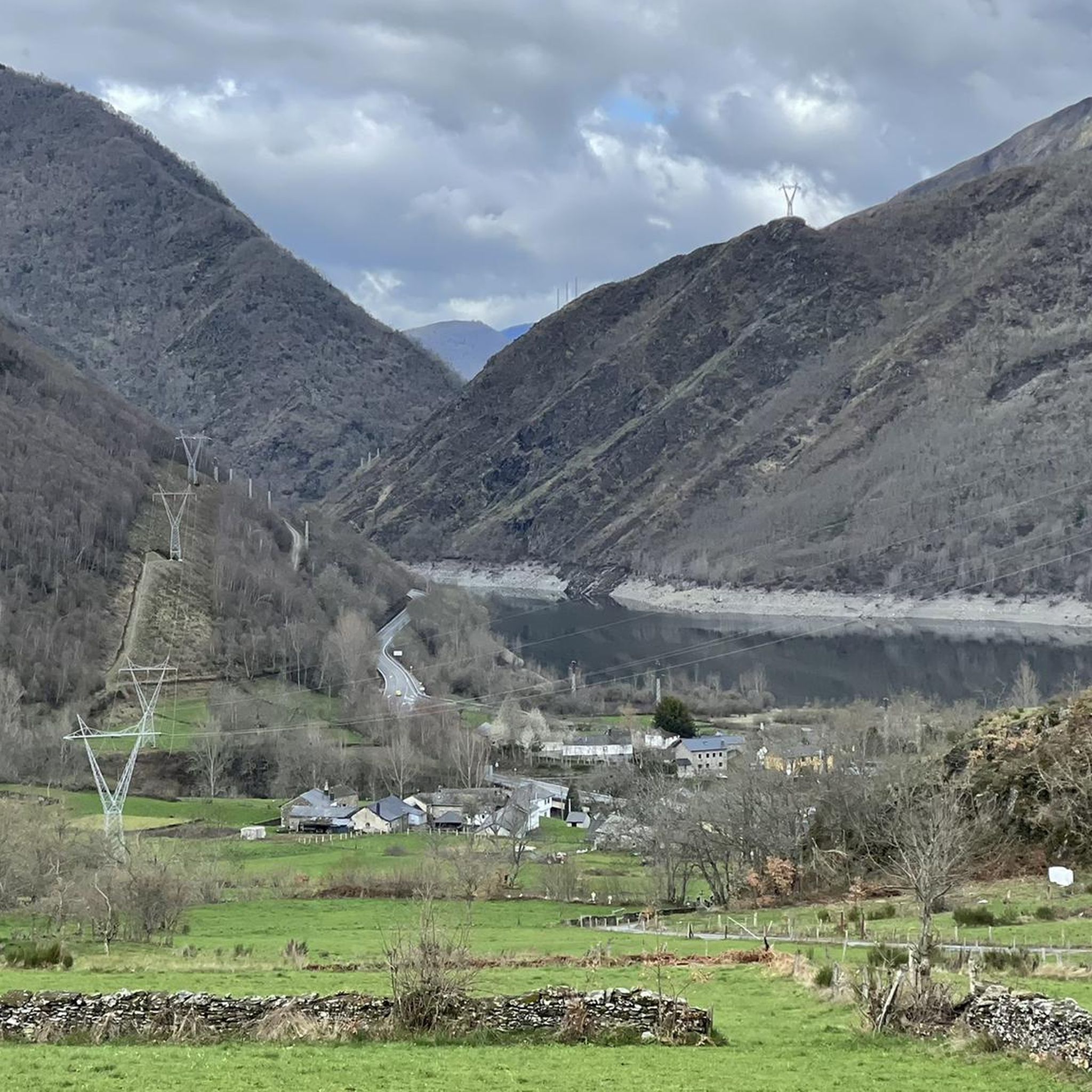
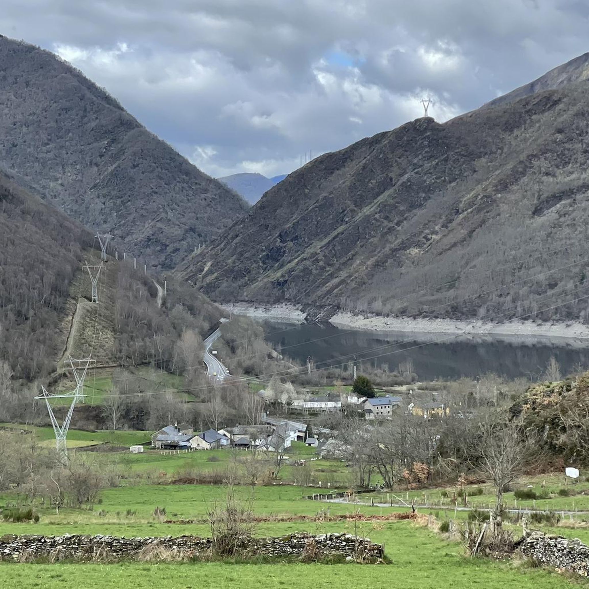
Nice picture that this point of the Forgotten Way offers us near Fasgar in the direction of Campo de Santiago as we will see indicated on the sign.
1
0
From the summit of El Moro de Rabón, we have spectacular views of the surrounding area, as well as the nearby Pico Nevadín and a large part of the Sierra de Gistredo.
4
0
Beautiful path that runs along the crest of the mountain between Miro de Rabón (1,983 m) and Boqueta de Fuentefría (1,895 m). He offers us a postcard stamp.
3
0
Beautiful 360 degree views that we find in the Pico Nevadín, located at 2,077 meters above sea level. On clear days we will have a privileged view of the Catoute and Cernella range, as well as other peaks to the south such as Valdeiglesias and Tambarón.
4
0
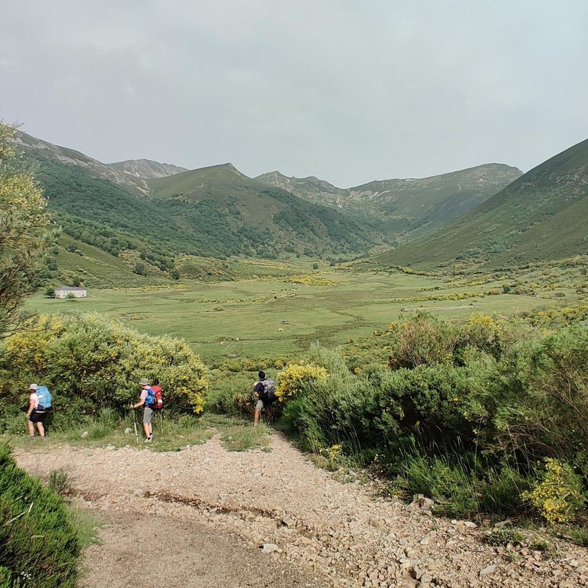
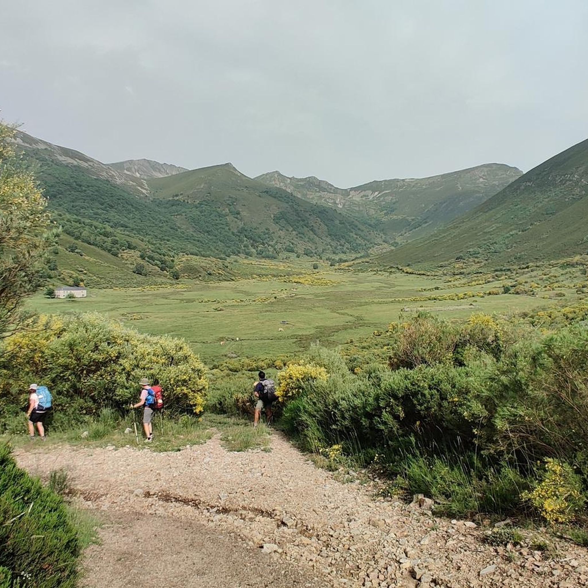
What a spectacle of scenery! The Zarameo braña offers us impressive views of the valley. It is possibly the best preserved in León, and has 22 cabins. Outside of summer, we will be able to recharge water at the source.
4
0
With beautiful views of the Rebentón forest, La Braña de la Seita has 10 cabins. The braña belongs to the residents of Cuevas, which is about 3 kilometers away.
4
0
Beautiful bridge that gives entrance to the braña. We must be attentive because it is somewhat hidden.
4
0
Picturesque forest track next to the Reguerona stream. This path leads to the Braña de la Seita.
4
0
Frequently Asked Questions
How many running routes are available in Palacios Del Sil?
There are 13 dedicated running routes in Palacios Del Sil listed on komoot. The region's mountainous terrain means that most of these, 11 routes, are categorized as difficult, with 2 moderate options.
Are there any easy running routes in Palacios Del Sil suitable for beginners?
The running routes in Palacios Del Sil are primarily designed for experienced runners due to the mountainous terrain and significant elevation changes. There are no routes currently categorized as easy; the available options are either moderate or difficult.
What are some options for long-distance running in Palacios Del Sil?
For those seeking a longer challenge, the Alto de Fasquedo Llamazal loop from Santa Cruz del Sil is a difficult 22.1-mile (35.6 km) route. Another substantial option is El Miro de Rabón y Pico Nevadín – trail running circular desde Rabanal de Arriba, which covers 9.9 miles (16.0 km) with significant elevation gain.
Can I find circular running routes in the Palacios Del Sil area?
Yes, many of the running routes in Palacios Del Sil are circular. For example, the popular Laguna de San Pedro Mallo – running circular from Matarrosa del Sil offers views of the Laguna de San Pedro Mallo. Another circular option is the Camino Olvidado: Fasgar Loop.
What interesting sights can I see along the running routes in Palacios Del Sil?
The routes often traverse natural areas with open vistas and river valleys. You might encounter notable mountain passes like Puerto de Leitariegos or Puerto de Cerredo. The El Miro de Rabón y Pico Nevadín route, for instance, takes you through the Espacio Natural de los Ancares Leoneses y Alto Sil, offering stunning landscapes.
Are there any running routes that pass by waterfalls?
While not directly on a featured running route, the Gualta Waterfall is a notable attraction in the Palacios Del Sil region. You may find routes nearby or plan a visit to this natural landmark as part of your trip.
When is the best time of year for running in Palacios Del Sil?
Given the mountainous terrain, late spring, summer, and early autumn generally offer the most favorable conditions for running in Palacios Del Sil. During these months, the weather is typically milder, and trails are more accessible. Always check local weather forecasts before heading out.
Are there any running routes suitable for winter conditions?
Running in Palacios Del Sil during winter can be challenging due to snow and ice, especially at higher elevations. While some routes might be accessible, it's crucial to be prepared with appropriate gear, check trail conditions beforehand, and consider routes at lower altitudes if available. Many routes feature significant elevation, making them more difficult in winter.
Can I bring my dog on the running trails in Palacios Del Sil?
Generally, dogs are welcome on many trails in natural areas, but it's always best to check local regulations for specific routes or protected areas. When running with your dog, ensure they are well-behaved, kept on a leash where required, and that you carry waste bags. The mountainous terrain can be demanding for both you and your pet.
Is parking available near the running trails in Palacios Del Sil?
While specific parking information isn't always detailed for every trail, many trailheads in rural, mountainous regions like Palacios Del Sil typically have small parking areas or roadside spots available. It's advisable to research the starting point of your chosen route for the most accurate parking details.
How accessible are the running routes by public transport?
Palacios Del Sil is a rural, mountainous region, and public transport options to specific trailheads may be limited. Access is generally easier by car. If relying on public transport, it's recommended to research local bus services to the nearest villages and plan your route accordingly, as some trail starts might require additional walking.
Are there any lesser-known or 'hidden gem' running trails in the area?
While all routes offer unique experiences, the Brañas de la Seita, Zaramedo, and Degollada Loop from Palacios del Sil is a challenging 9.7-mile (15.6 km) route that provides an immersive experience through the region's rugged beauty, perhaps offering a less frequented path compared to the most popular trails.
Most popular routes around Palacios Del Sil
Most popular attractions around Palacios Del Sil

Get inspired with the komoot mobile app


Explore more
Browse the best Running Trails & Routes in other regions.
