The best cycling routes around Campo Lugar
5.0
(1)
53
riders
14
rides
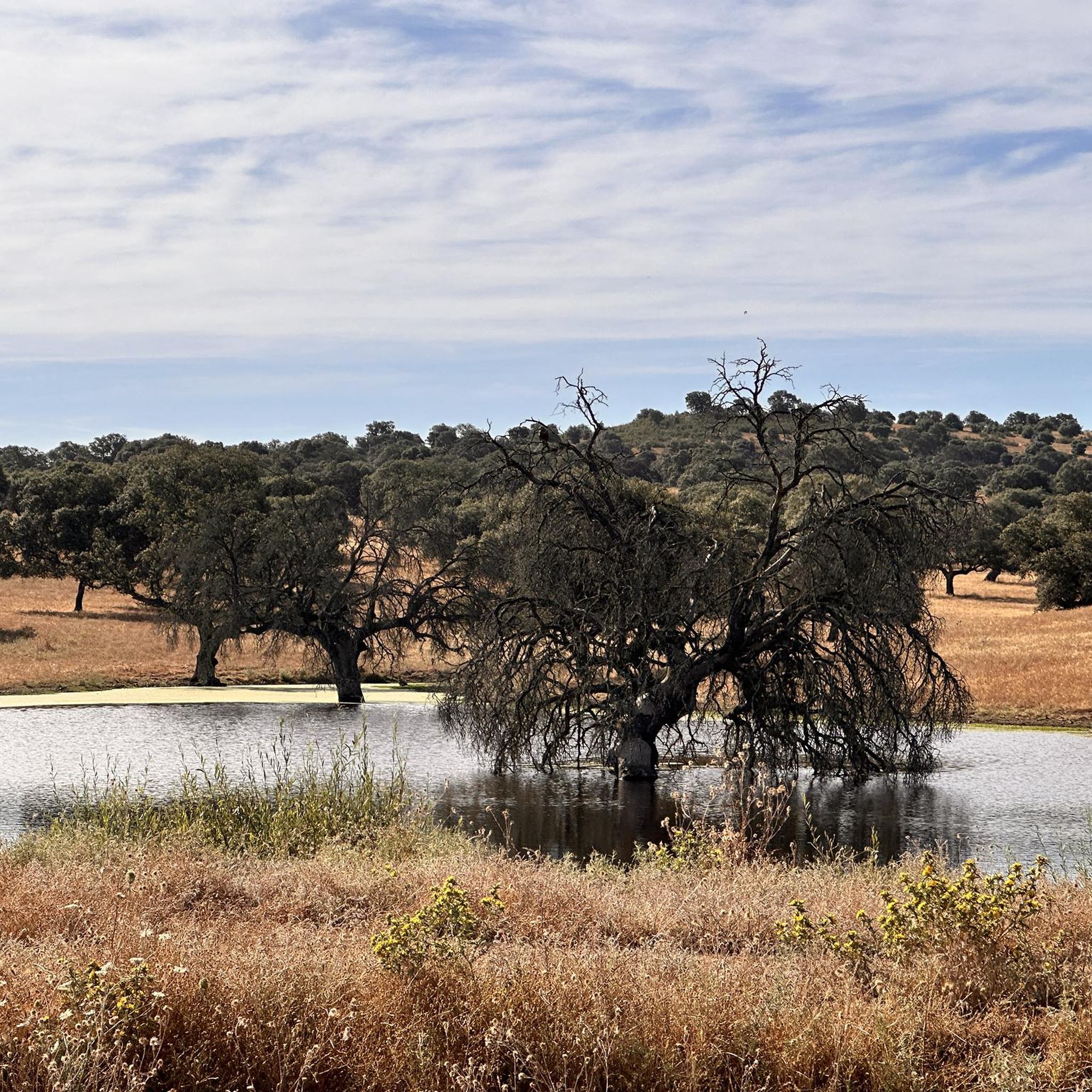
Touring cycling routes around Campo Lugar, located in Extremadura, Spain, traverse a distinct "penillanura" or peneplain, characterized by expansive, relatively flat terrain. This landscape features cultivated plains, rural roads, and several streams, offering broad vistas. The region benefits from its position between the fertile plains of the Guadiana and the drylands of Cáceres, with the Alcollarín Vega contributing to diverse agricultural scenery. The terrain is generally flat to undulating, providing varied cycling experiences.
Best touring cycling routes around Campo Lugar
…Last updated: May 14, 2026
44.3km
03:18
250m
250m
This difficult 27.5-mile touring cycling route from Miajadas explores agricultural fields and the Canal de Orellana in Extremadura.
5.0
(1)
18
riders
48.0km
04:19
470m
470m
Hard bike ride. Very good fitness required. Mostly paved surfaces. Suitable for all skill levels.

Sign up for free
17
riders
83.7km
07:46
1,200m
1,200m
Hard bike ride. Very good fitness required. Mostly paved surfaces. Suitable for all skill levels.
8
riders
47.0km
04:04
440m
440m
Moderate bike ride. Good fitness required. Mostly paved surfaces. Suitable for all skill levels.
5
riders
41.7km
03:35
330m
330m
Moderate bike ride. Good fitness required. Mostly paved surfaces. Suitable for all skill levels.
Get access to more routes and recommendations from other explorers.
Sign up for free
Already have an account?
Our route recommendations are based on thousands of hikes, rides, and runs completed by other people on komoot.
Start today with a free account
Your next adventure awaits.
Login or Signup
Popular around Campo Lugar
Tips from the Community

One of the jewels of Cáceres, the historic center of Montánchez is a must-see. Located on a fortified hill that dominates the slopes of the Tagus and the Guadiana dominated by the magnificent walled castle. Walking up towards the castle, you will be greeted by traditional narrow streets and medieval squares.
0
1

Almoharín is a small town in the south of the province of Cáceres in the region of Montánchez. Surrounded by agricultural fields, the scenic region is known for its fig production. Ride a bike through the city, head to Plaza España and admire the Parochial Church of El Salvador.
0
1
Almoharín is a small town in the south of the province of Cáceres in the region of Montánchez. Surrounded by agricultural fields, the scenic region is known for its fig production. Ride a bike through the city, head to Plaza España and admire the Parochial Church of El Salvador.
1
1
Large gravel roads along the irrigation canal give life to the agricultural fields that surround this area of Miajadas. Walk along the service roads of the canal.
1
1
On the southwestern edge of town, you can find the old silo building that used to house large amounts of grain collected from the local fields. Impressive great agricultural cathedrals.
1
1
The great parish church of Santiago de Miajadas is an impressive monument. The origin of the religious site dates back to 1348 although the church you see today was built later in the Middle Ages.
1
1
Arroyomolinos is a small town in the Montánchez region, founded around the year 1228 by order of King Alfonso IX on a prehistoric settlement. Stop for a coffee along the way and admire the splendid Church of Nuestra Señora de la Consolación.
1
1
One of the jewels of Cáseres, the historic center of Montánchez is a must-see. Located on a fortified hill that dominates the slopes of the Tagus and the Guadiana dominated by the magnificent walled castle. Walking up towards the castle, you will be greeted by traditional narrow streets and medieval squares.
1
1
Frequently Asked Questions
What kind of terrain can I expect when touring cycling around Campo Lugar?
The region around Campo Lugar features a distinct "penillanura," or peneplain, offering expansive, relatively flat to undulating terrain. You'll encounter cultivated plains, rural roads, and streams, providing broad vistas. The landscape is influenced by its position between the fertile plains of the Guadiana and the drylands of Cáceres, with areas like the Alcollarín Vega contributing to diverse agricultural scenery.
How many touring cycling routes are available in Campo Lugar?
There are 14 touring cycling routes around Campo Lugar listed on komoot. These routes cater to various skill levels, with 5 easy, 5 moderate, and 4 difficult options available.
Are there any family-friendly cycling routes in the area?
While specific routes are not explicitly marked as 'family-friendly' in the data, the generally flat to undulating terrain of the 'penillanura' around Campo Lugar means many of the easy and moderate routes could be suitable for families. For example, the Vía Verde Vegas del Guadiana, a dedicated cycle path, is often a good choice for families seeking a safer, flatter experience.
What natural features or landmarks can I see along the cycling routes?
Cyclists can enjoy a variety of natural features and landmarks. You might spot significant birdlife at the Birdwatching viewpoint or observe Stork nests. The area is also known for its traditional drovers' road, the Cañada Real de la Hornilla, offering panoramic views of the peneplain and distant mountain ranges like the Sierra de Montánchez. The Vía Verde Vegas del Guadiana and the Natural Trail Greenway of the Vegas del Guadiana are also notable features.
What is the best time of year to go touring cycling in Campo Lugar?
Autumn and winter are particularly appealing for touring cyclists in Campo Lugar, especially for birdwatching enthusiasts, as large numbers of cranes migrate to Extremadura. While routes are accessible year-round, caution is advised during hot summer days due to the intense heat.
Are there any circular cycling routes around Campo Lugar?
Yes, several routes are designed as loops. Examples include the difficult Almoharín from Miajadas – circular by the Canal de Orellana, the difficult Burdalo River Route loop from Miajadas, and the moderate Silos of Miajadas loop from Miajadas.
What do other touring cyclists say about cycling in Campo Lugar?
The touring cycling routes around Campo Lugar are highly rated by the komoot community, with an average score of 5.0 stars from 1 review. Over 50 touring cyclists have used komoot to explore the varied terrain, often praising the expansive cultivated plains and rural roads that define the area.
Are there any longer, more challenging routes for experienced touring cyclists?
Yes, for experienced cyclists seeking a challenge, the difficult Montánchez Castle – Plaza de España, Montánchez loop from Miajadas is a substantial 83.7 km (52.0 miles) trail that leads through the broader region towards Montánchez Castle, typically taking around 7 hours 46 minutes to complete.
Can I find routes that follow waterways or canals?
Yes, the region's landscape includes several streams like the Alcollarín and Levosilla, and the Canal de Orellana. A notable route that follows a waterway is the difficult Almoharín from Miajadas – circular by the Canal de Orellana, which traverses agricultural landscapes alongside the canal.
What are some of the cultural or historical points of interest near the cycling routes?
While cycling, you might encounter historical elements such as a well-preserved Roman fountain with a semi-circular arch, or the 15th-century Church of Nuestra Señora de los Ángeles, both mentioned in the context of local routes. The nearby settlement of Zorita also offers a glimpse into the local heritage.
Is it possible to cycle on traditional drovers' roads in the area?
Yes, the Cañada Real de la Hornilla, a traditional drovers' road, is a significant feature in the region. While primarily noted for hiking, its expansive views and terrain suggest it could be incorporated into cycling routes for those interested in experiencing this historical path and its surrounding landscapes.
Are there any easy or moderate routes for a more relaxed touring cycling experience?
Absolutely. For a more relaxed ride, you can explore moderate routes such as the Silos of Miajadas loop from Miajadas, which covers 33.6 km (20.9 miles) in about 3 hours 6 minutes, or the Bike loop from Miajadas, a 41.7 km (25.9 miles) route taking approximately 3 hours 35 minutes.
Most popular routes around Campo Lugar
Most popular attractions around Campo Lugar

Get inspired with the komoot mobile app


Explore more
Browse the best Cycling routes in other regions.
