The best MTB trails around Barlovento
4.6
(13)
186
riders
20
rides
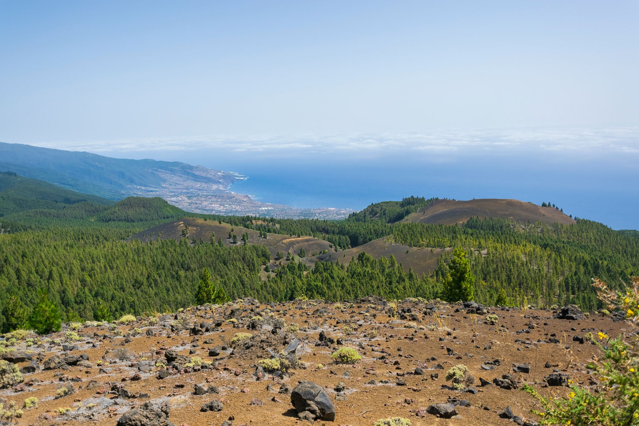
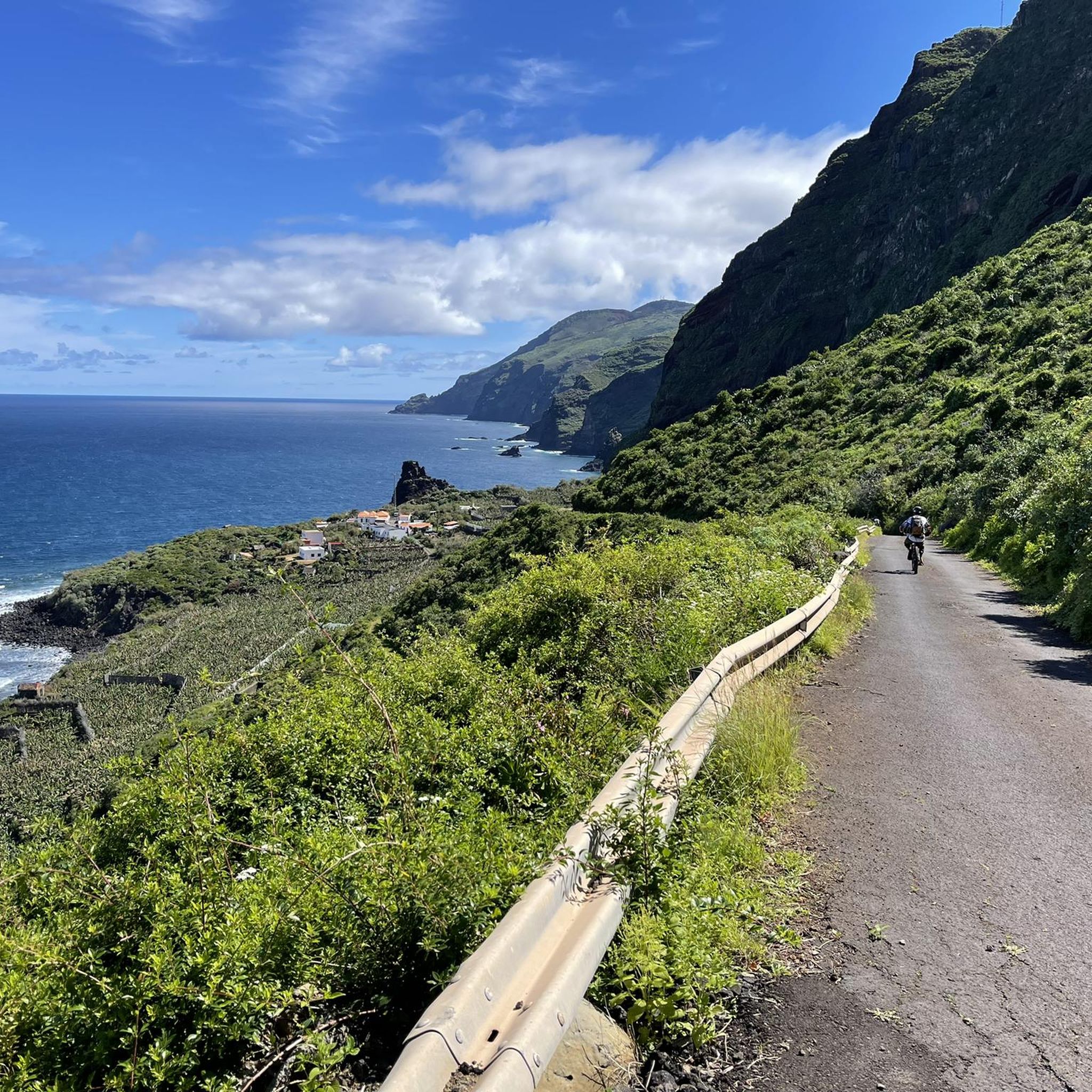
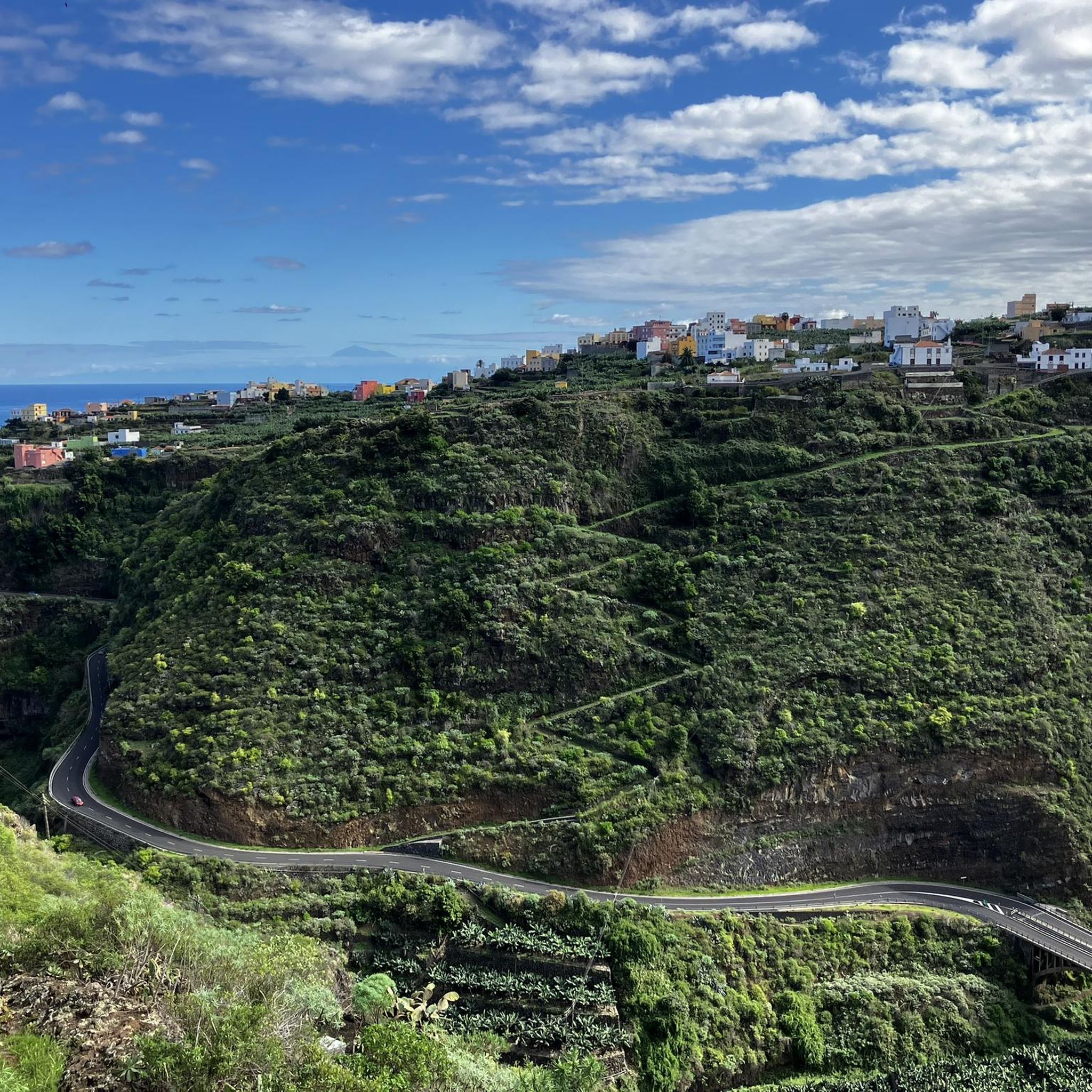
Mountain biking around Barlovento offers diverse and dramatic natural landscapes. The region features a distinctive volcanic topography, characterized by rugged coastlines with impressive cliffs and a network of ravines and hills. Riders can explore intensely green rural landscapes, including ancient laurel forests and areas of pine, providing varied terrain for mountain bike trails.
Best mountain bike trails in Barlovento
- The most popular mountain bike trail is Roque de los Muchachos and Pinar de Garafía Loop, a 25.4 miles (40.8…
Last updated: September 26, 2026
8
riders
40.8km
04:21
1,500m
1,500m
Hard mountain bike ride. Very good fitness required. Advanced riding skills necessary.
1
riders
42.7km
05:49
2,510m
2,510m
Hard mountain bike ride. Very good fitness required. Suitable for all skill levels.

3
riders
53.7km
06:12
2,190m
2,190m
Hard mountain bike ride. Very good fitness required. Advanced riding skills necessary. Some portions of the route may require you to push your bike.
6
riders
45.5km
05:15
1,900m
1,900m
Hard mountain bike ride. Very good fitness required. Advanced riding skills necessary. Some portions of the route may require you to push your bike.
4.0
(1)
9
riders
39.8km
03:40
1,450m
1,450m
Hard mountain bike ride. Very good fitness required. Advanced riding skills necessary. Some portions of the route may require you to push your bike.
Get access to more routes and recommendations from other explorers.
Already have an account?
Our route recommendations are based on thousands of hikes, rides, and runs completed by other people on komoot.
Start today with a free account
Your next adventure awaits.
Other adventures around Barlovento

Tips from the Community

The Roque de los Muchachos Observatory (ORM) boasts an impressive and photogenic telescope array. Over 20 telescopes are set up here, exploring the universe. The ORM is one of the largest observatories in the world. Nowhere else will you feel so close to the stars.
0
0

The many dragon trees are at least as impressive as those in Las Tritias.
0
0

Beautiful view over several dragon trees towards the coast and Gallegos.
1
2

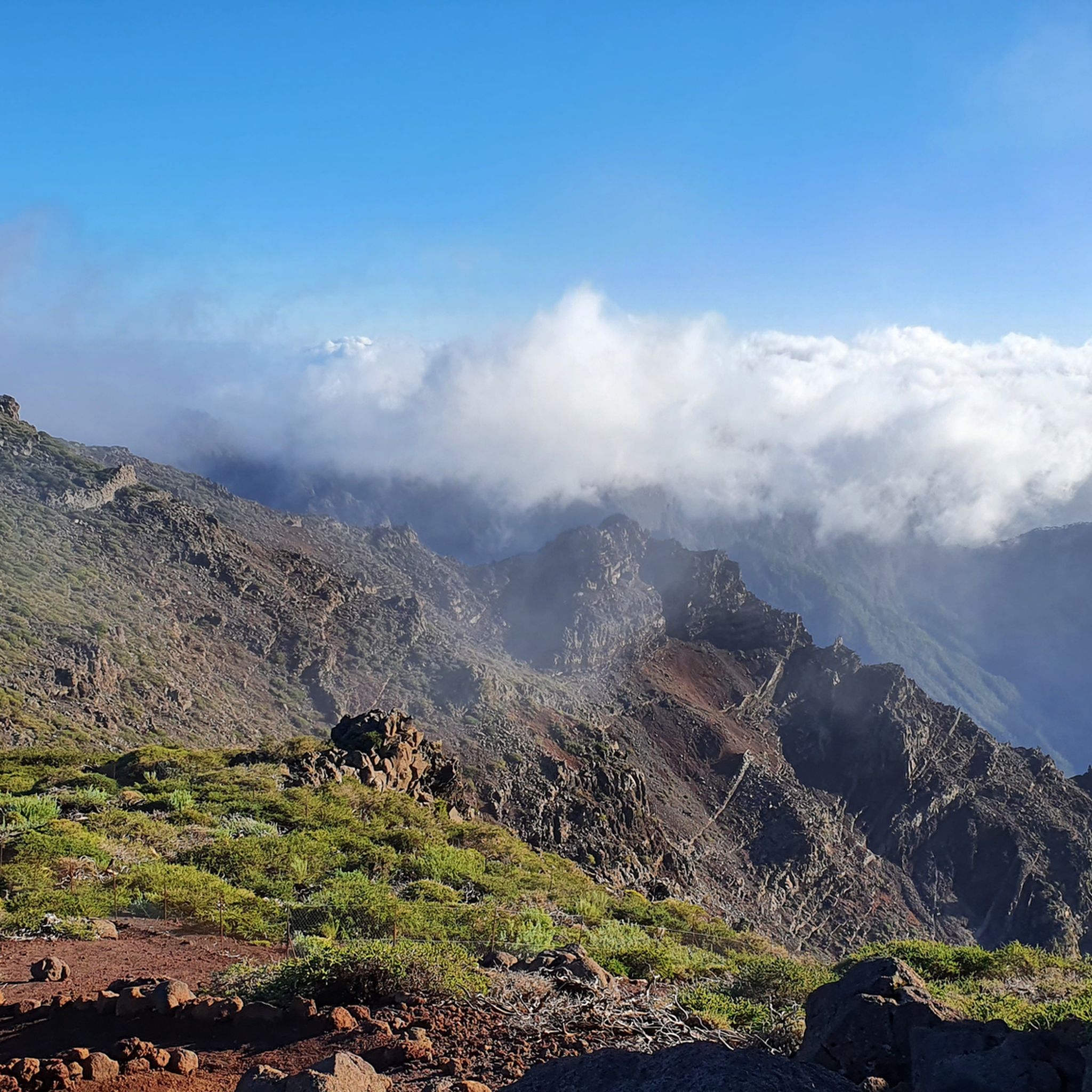
Viewpoint from which you have an excellent and complete panoramic view of the Caldera de Taburiente National Park and the entire peak, the central part of Isla Bonita
0
0

This viewpoint is located on the road that ascends towards Roque de los Muchachos from Santa Cruz de la Plama, very close to the summit on the left. From this location you can enjoy one of the most spectacular views of the Caldera de Taburiente, a huge crater that is one of the most impressive natural symbols of La Palma. You can also access it via the GR 131 but I assure you that you will pray that the end of the ascent arrives soon. The Caldera de Taburiente is a national park and a huge depression that was formed not by a volcanic crater, but by erosion over millions of years. The viewpoint offers an exceptional perspective on this natural space, with its rugged landscape and its walls that rise to almost 2,000 meters high from the caldera floor. The Mirador de los Andenes also provides panoramic views of the sky both day and night, making it a popular spot for astronomy fans. La Palma, and especially the area near Roque de los Muchachos, is known for having one of the cleanest skies and free of light pollution in the world, which makes it an ideal place for observing the stars and other celestial bodies. . https://www.youtube.com/watch?v=7cjv6vqHo5A
0
0
MAGIC stands for Major Atmospheric Gamma-ray Imaging Cherenkov Telescope. It is located at the Roque de los Muchachos Observatory in La Palma (Canary Islands). Upon construction in 2004, MAGIC was a single Cherenkov telescope with a segmented mirror 17 meters in diameter and an area of 240 square meters, capable of detecting flashes of light produced in the atmosphere by cosmic rays. In 2008, a second telescope joined it, a clone of the previous one, nicknamed MAGIC-II.1 Operated alongside the first, it substantially improves its angular resolution and sensitivity. https://magic.mpp.mpg.de/video/20170101-magicbreve.mp4 https://magic.mpp.mpg.de/video/20170101-magicbreve.mp4
0
0

Definitely bring good lights. Road inside the tunnels is full of holes and paddles so you need to navigate them.
1
0
From this point you can detour towards Galga along a fun path. A few meters from the exit you will find a paragliding takeoff area and then prepare to suffer constantly. Excellent views.
1
0
Frequently Asked Questions
How many mountain bike trails are available in Barlovento?
There are 16 mountain bike trails around Barlovento, all of which are rated as difficult, offering challenging routes for experienced riders.
What kind of terrain can I expect on mountain bike trails in Barlovento?
Barlovento's mountain bike trails feature diverse and dramatic natural landscapes. You'll encounter a distinctive volcanic topography, rugged coastlines with impressive cliffs, and intensely green rural areas, including ancient laurel forests and pine woods. The terrain is often sculpted by ravines and hills, providing a comprehensive network of paths.
Are there any family-friendly mountain bike trails in Barlovento?
The mountain bike trails in Barlovento are generally rated as difficult, making them more suitable for experienced riders rather than families with young children. However, the region offers other family-friendly activities, such as the Laguna de Barlovento, which has picnic areas and playgrounds, and is a great starting point for hiking.
What natural features or landmarks can I see while mountain biking in Barlovento?
Barlovento is rich in natural beauty. You can explore ancient laurel forests, dramatic coastlines, and volcanic landscapes. Notable natural features include the serene Laguna de Barlovento, and the impressive Los Tilos Waterfall. For stunning panoramic views, consider visiting the Mirador de La Tosca, which offers vistas of the northern coast and dragon trees.
Are there any waterfalls accessible from the mountain bike trails?
Yes, the Barlovento area is home to several beautiful waterfalls. You can find highlights such as the Colorful Waterfall and Los Tilos Waterfall. Some trails may pass near these, offering scenic detours.
What do other mountain bikers enjoy most about mountain biking in Barlovento?
The mountain bike routes in Barlovento are highly rated by the komoot community, with an average score of 4.7 stars from over 10 reviews. Riders often praise the challenging routes, the intensely green and varied landscapes, and the unique experience of riding through ancient laurel forests and volcanic terrain.
What is the best time of year for mountain biking in Barlovento?
La Palma, including Barlovento, benefits from diverse microclimates. Generally, the island offers good conditions for mountain biking year-round. However, it's always advisable to check local weather forecasts, especially for higher elevations, as conditions can change rapidly.
Are there any long-distance mountain bike trails in Barlovento?
Yes, Barlovento offers several longer routes for endurance riders. For example, the Roque de los Muchachos and Pinar de Garafía Loop is a challenging 40.8 km trail that takes over 4 hours to complete, traversing high-elevation pine forests. Another option is the Pista de Gallegos and Marcos y Cordero Loop, which is 42.7 km long.
Can I find circular mountain bike routes in Barlovento?
Yes, many of the mountain bike trails in Barlovento are designed as loops, allowing you to start and finish in the same location. Examples include the challenging Roque de los Muchachos and Pinar de Garafía Loop and the Roque de los Muchachos and Pista de Gallegos MTB Loop.
Are there any specific permits required for mountain biking in Barlovento?
While general access to trails is usually open, some protected areas or specific routes, especially those within national parks or sensitive ecological zones, might require permits or have restrictions. It's always best to check with local authorities or visitor centers for the most up-to-date information regarding permits before heading out.
Where can I find accommodation suitable for mountain bikers in Barlovento?
Barlovento offers various accommodation options, from rural houses to small hotels. Many establishments cater to outdoor enthusiasts and can provide facilities like secure bike storage. It's recommended to search for accommodation specifically advertising 'bike-friendly' services to ensure your needs are met.
Are there any caves I can explore near the mountain bike trails?
Yes, the Barlovento area features several interesting caves. You might consider exploring highlights such as Cueva del Infierno or Cueva del Morro de las Cebollas. Some trails, like the Through 13 tunnels to the Marcos and Cordero springs, even incorporate tunnel sections, offering a unique experience.
What are some challenging mountain bike routes for advanced riders?
Barlovento is known for its challenging routes. Advanced riders will enjoy trails like the The Cane Trail (GR 131), a difficult 14.8 km path with varied terrain, or the Transvulcania Trail, a 15.3 km route through volcanic landscapes and diverse forests.
Most popular attractions around Barlovento

Get inspired with the komoot mobile app


Explore more
Browse the best MTB trails in other regions.
